Grass Valley is a census-designated place (CDP) in northeastern Pershing County, Nevada, United States. As of the 2010 census the population was 1,161.
| Name: | Grass Valley CDP |
|---|---|
| LSAD Code: | 57 |
| LSAD Description: | CDP (suffix) |
| State: | Nevada |
| County: | Pershing County |
| Elevation: | 4,390 ft (1,338 m) |
| Total Area: | 34.51 sq mi (89.38 km²) |
| Land Area: | 34.51 sq mi (89.38 km²) |
| Water Area: | 0.00 sq mi (0.00 km²) |
| Total Population: | 991 |
| Population Density: | 28.72/sq mi (11.09/km²) |
| Area code: | 775 |
| FIPS code: | 3230220 |
Online Interactive Map
Click on ![]() to view map in "full screen" mode.
to view map in "full screen" mode.
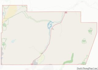
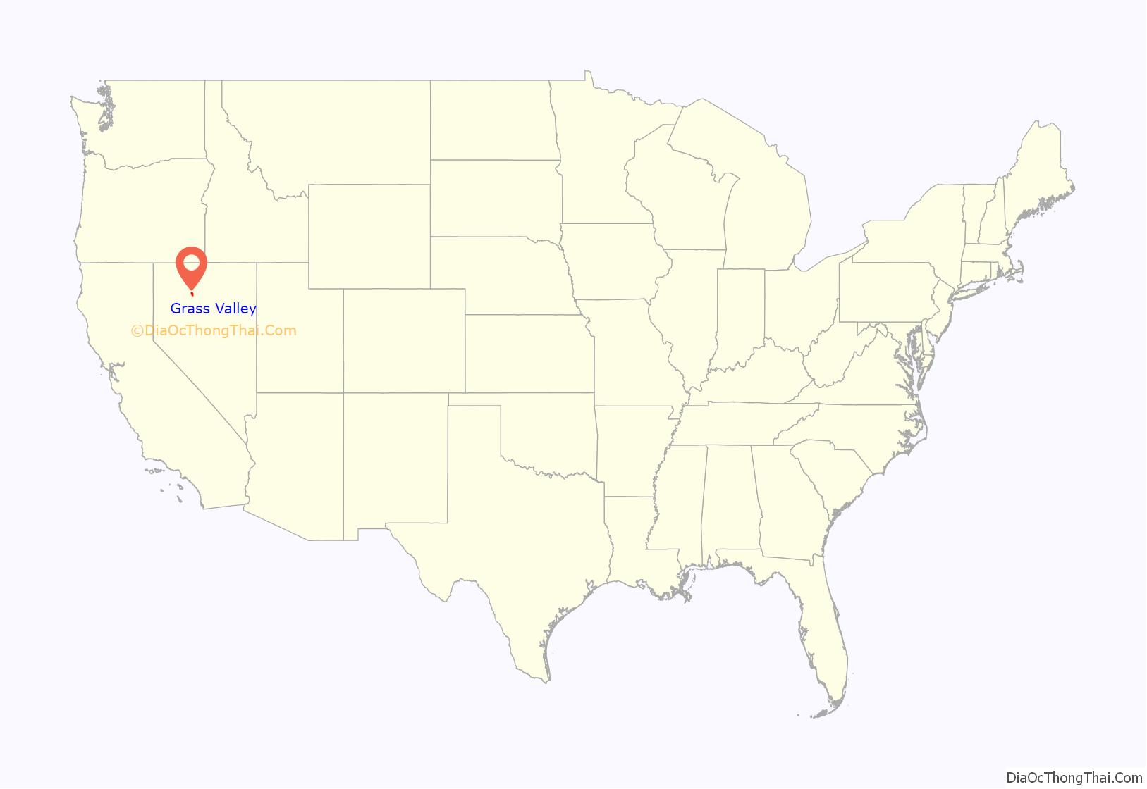
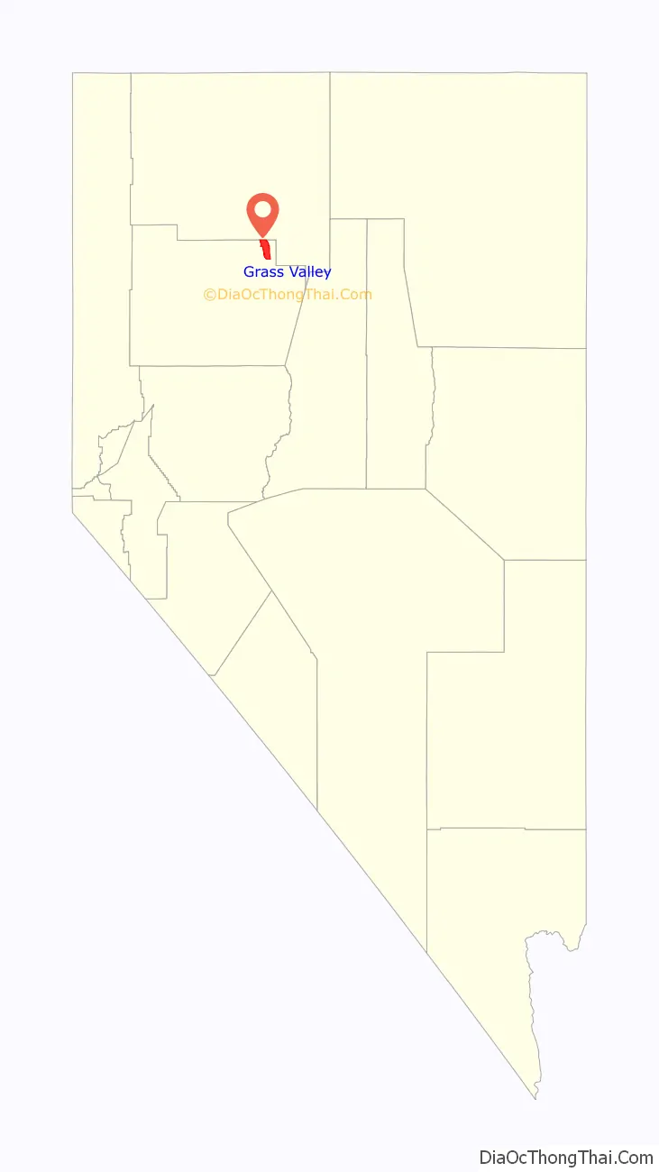
Grass Valley location map. Where is Grass Valley CDP?
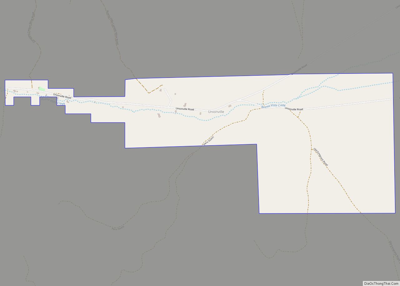
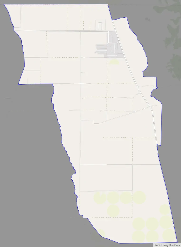
Grass Valley Road Map
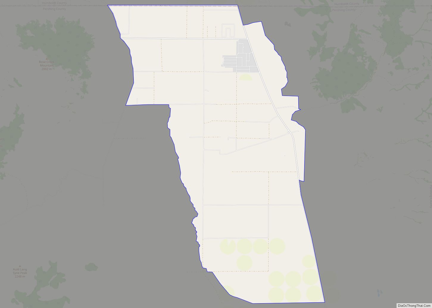
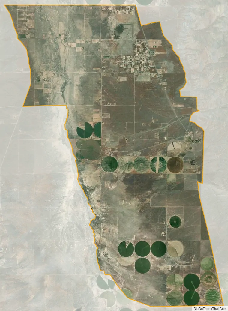
Grass Valley city Satellite Map
Geography
Grass Valley is located 10 miles (16 km) south of Winnemucca. The CDP is named after the valley in which it lies, a 5-mile-wide (8 km) basin between the Sonoma Range to the east and the East Range to the west. Nevada State Route 294 (Grass Valley Road) runs from Grass Valley into Winnemucca.
According to the U.S. Census Bureau, the Grass Valley CDP has an area of 34.5 square miles (89.4 km), all land.
See also
Map of Nevada State and its subdivision: Map of other states:- Alabama
- Alaska
- Arizona
- Arkansas
- California
- Colorado
- Connecticut
- Delaware
- District of Columbia
- Florida
- Georgia
- Hawaii
- Idaho
- Illinois
- Indiana
- Iowa
- Kansas
- Kentucky
- Louisiana
- Maine
- Maryland
- Massachusetts
- Michigan
- Minnesota
- Mississippi
- Missouri
- Montana
- Nebraska
- Nevada
- New Hampshire
- New Jersey
- New Mexico
- New York
- North Carolina
- North Dakota
- Ohio
- Oklahoma
- Oregon
- Pennsylvania
- Rhode Island
- South Carolina
- South Dakota
- Tennessee
- Texas
- Utah
- Vermont
- Virginia
- Washington
- West Virginia
- Wisconsin
- Wyoming