Walker Lake is an unincorporated town and census-designated place in Mineral County, Nevada, United States. As of the 2010 census, the population of Walker Lake was 275.
| Name: | Walker Lake CDP |
|---|---|
| LSAD Code: | 57 |
| LSAD Description: | CDP (suffix) |
| State: | Nevada |
| County: | Mineral County |
| Total Area: | 1.26 sq mi (3.27 km²) |
| Land Area: | 1.26 sq mi (3.27 km²) |
| Water Area: | 0.00 sq mi (0.00 km²) |
| Total Population: | 247 |
| Population Density: | 195.41/sq mi (75.45/km²) |
| ZIP code: | 89415 |
| Area code: | 775 |
| FIPS code: | 3281100 |
| GNISfeature ID: | 0854682 |
Online Interactive Map
Click on ![]() to view map in "full screen" mode.
to view map in "full screen" mode.
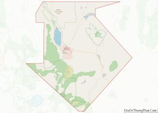
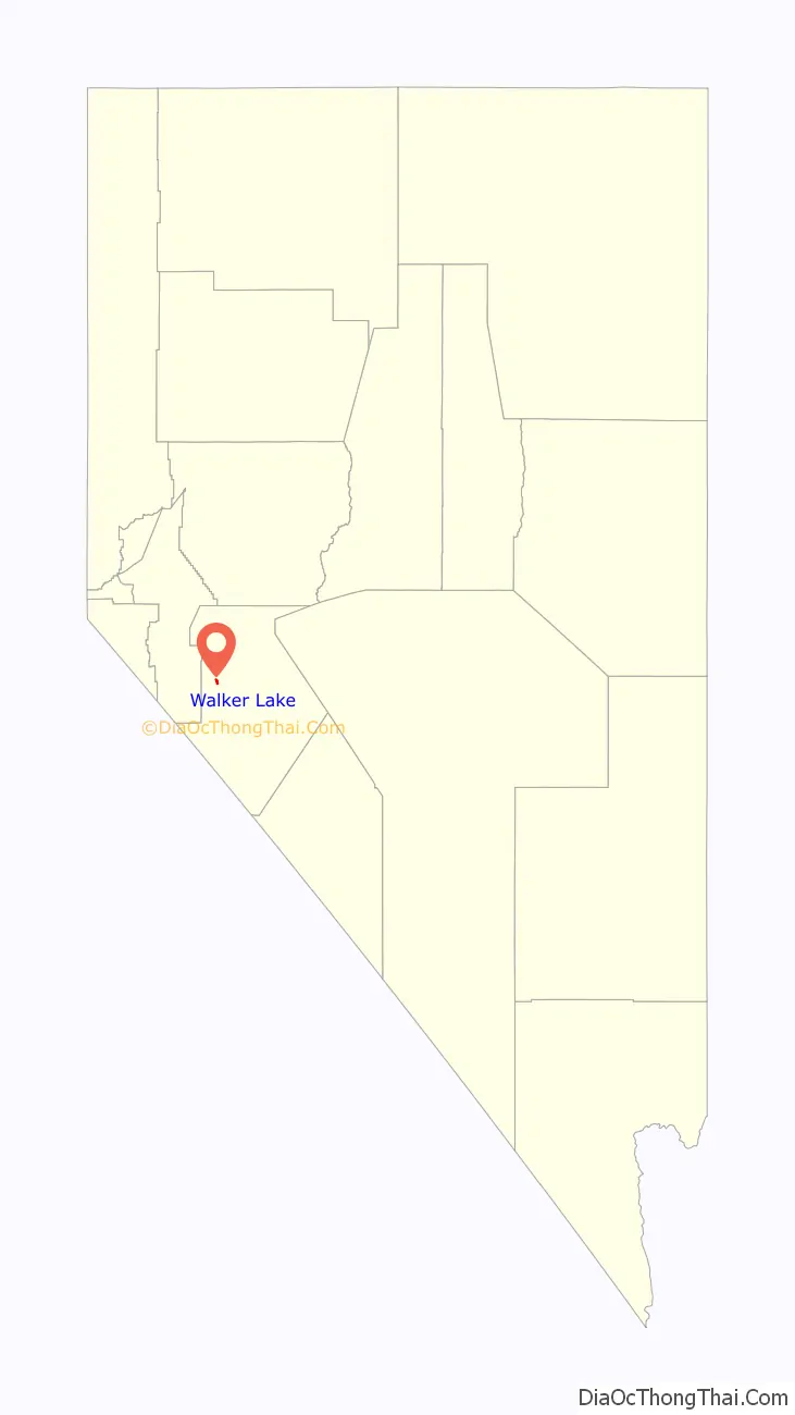
Walker Lake location map. Where is Walker Lake CDP?

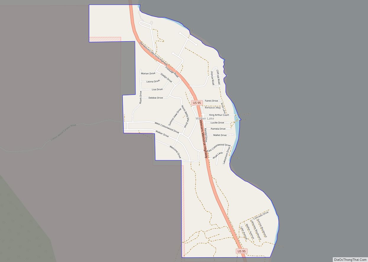
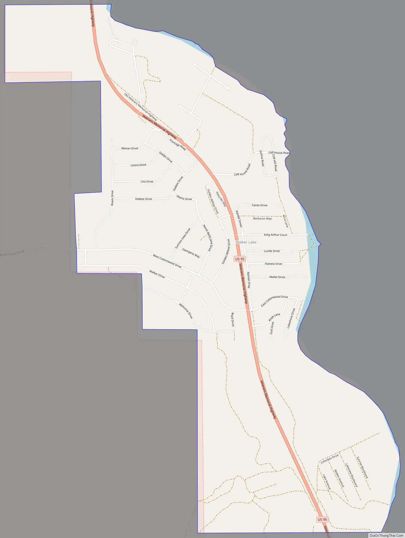
Walker Lake Road Map
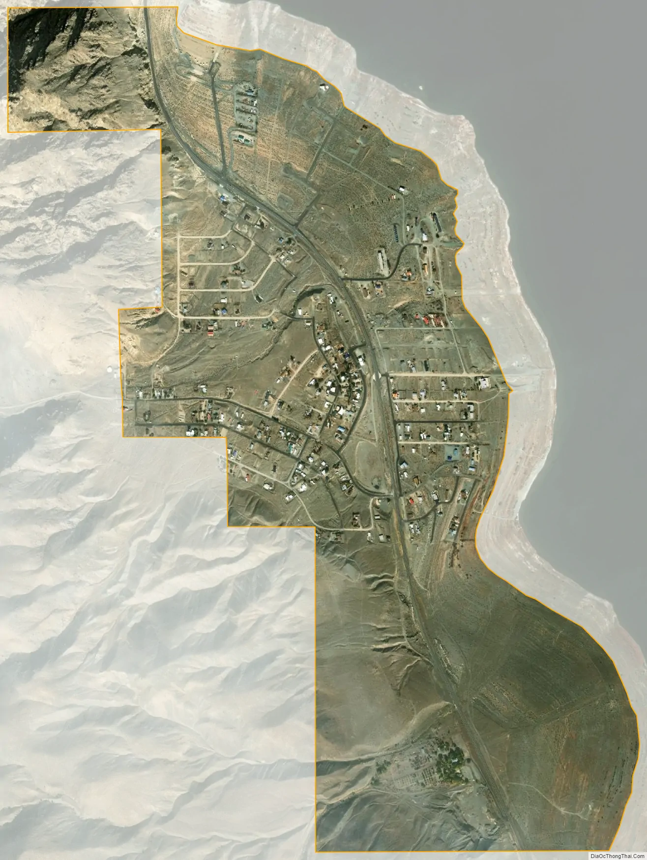
Walker Lake city Satellite Map
Geography
The Walker Lake CDP is located in western Mineral County, Nevada, along the west shore and overlooking Walker Lake. U.S. Route 95 runs through the community; it is 12 miles (19 km) south to Hawthorne and 59 miles (95 km) north to Fallon. Walker Lake State Recreation Area is located immediately north of the CDP.
According to the U.S. Census Bureau, the CDP has an area of 1.4 square miles (3.5 km), all land.
See also
Map of Nevada State and its subdivision: Map of other states:- Alabama
- Alaska
- Arizona
- Arkansas
- California
- Colorado
- Connecticut
- Delaware
- District of Columbia
- Florida
- Georgia
- Hawaii
- Idaho
- Illinois
- Indiana
- Iowa
- Kansas
- Kentucky
- Louisiana
- Maine
- Maryland
- Massachusetts
- Michigan
- Minnesota
- Mississippi
- Missouri
- Montana
- Nebraska
- Nevada
- New Hampshire
- New Jersey
- New Mexico
- New York
- North Carolina
- North Dakota
- Ohio
- Oklahoma
- Oregon
- Pennsylvania
- Rhode Island
- South Carolina
- South Dakota
- Tennessee
- Texas
- Utah
- Vermont
- Virginia
- Washington
- West Virginia
- Wisconsin
- Wyoming