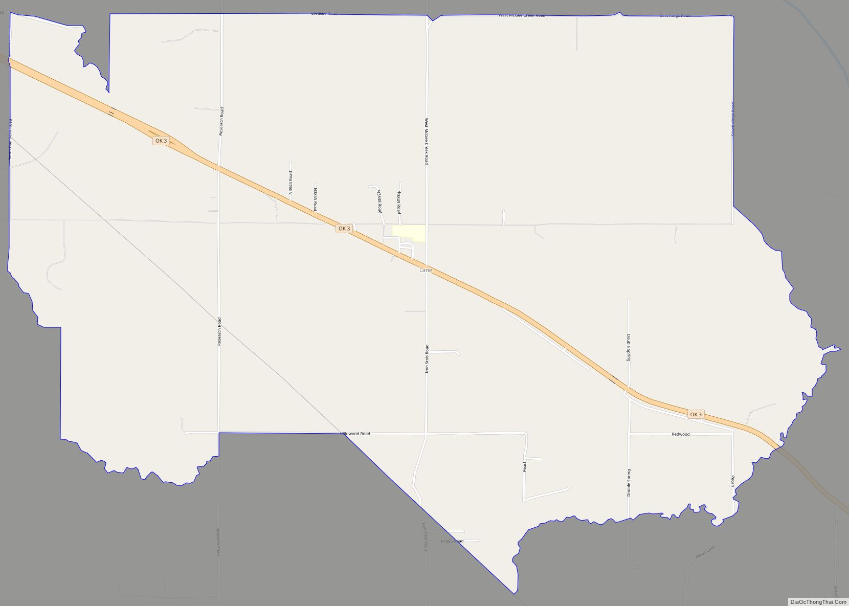
Lane is an unincorporated community and census-designated place in Atoka County, Oklahoma, United States.
A post office was established at Lane, Indian Territory on October 6, 1902. Its name reflects the fact the new post office was located in a building which was at the end of lane bounded by rail fencing. At the time of its founding, Lane was located in Atoka County, Choctaw Nation, a territorial-era government unit.
As of the 2010 census, the CDP had a population of 414.
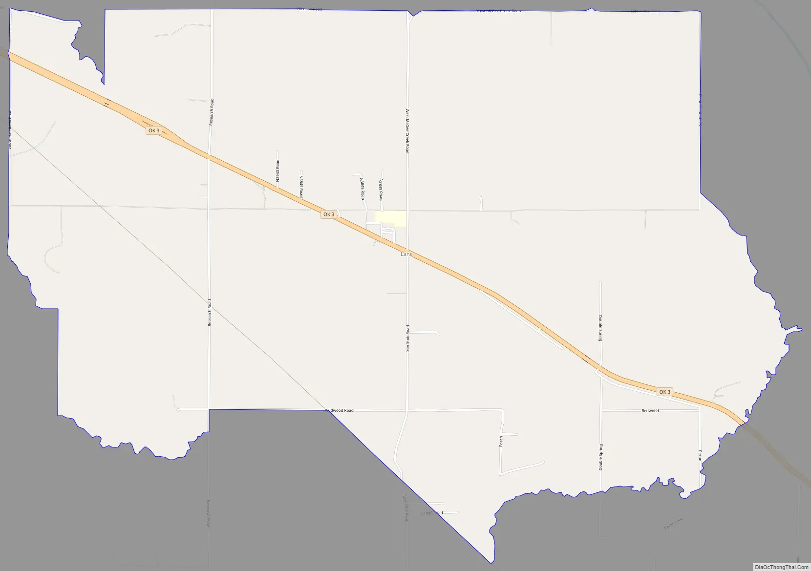
Lane is located along State Highway 3, 10 miles (16 km) southeast of Atoka.
McGee Creek Reservoir, which impounds the waters of McGee Creek, lies northeast of Lane. McGee Creek is a tributary of Muddy Boggy Creek, which flows east of Lane.
The famous rodeo world champion Lane Frost (1963-1989) once lived in Lane, as do his parents. Frost graduated from high school in Atoka.
| Name: | Lane CDP |
|---|---|
| LSAD Code: | 57 |
| LSAD Description: | CDP (suffix) |
| State: | Oklahoma |
| County: | Atoka County |
| Total Area: | 7.99 sq mi (20.69 km²) |
| Land Area: | 7.95 sq mi (20.60 km²) |
| Water Area: | 0.04 sq mi (0.09 km²) |
| Total Population: | 300 |
| Population Density: | 37.73/sq mi (14.57/km²) |
| FIPS code: | 4041400 |
| GNISfeature ID: | 1094499 |
Online Interactive Map
Click on ![]() to view map in "full screen" mode.
to view map in "full screen" mode.
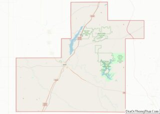
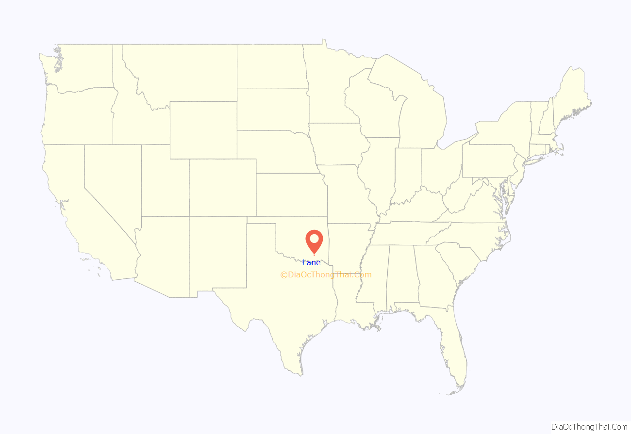
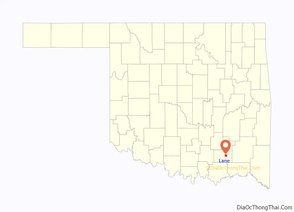
Lane location map. Where is Lane CDP?
Lane Road Map
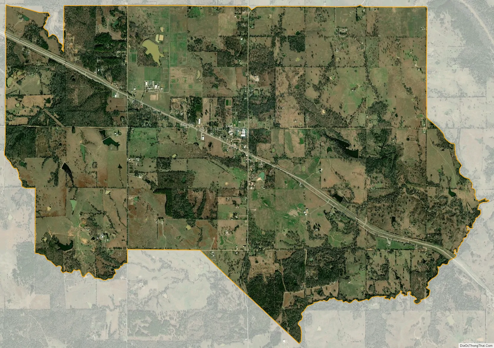
Lane city Satellite Map
See also
Map of Oklahoma State and its subdivision:- Adair
- Alfalfa
- Atoka
- Beaver
- Beckham
- Blaine
- Bryan
- Caddo
- Canadian
- Carter
- Cherokee
- Choctaw
- Cimarron
- Cleveland
- Coal
- Comanche
- Cotton
- Craig
- Creek
- Custer
- Delaware
- Dewey
- Ellis
- Garfield
- Garvin
- Grady
- Grant
- Greer
- Harmon
- Harper
- Haskell
- Hughes
- Jackson
- Jefferson
- Johnston
- Kay
- Kingfisher
- Kiowa
- Latimer
- Le Flore
- Lincoln
- Logan
- Love
- Major
- Marshall
- Mayes
- McClain
- McCurtain
- McIntosh
- Murray
- Muskogee
- Noble
- Nowata
- Okfuskee
- Oklahoma
- Okmulgee
- Osage
- Ottawa
- Pawnee
- Payne
- Pittsburg
- Pontotoc
- Pottawatomie
- Pushmataha
- Roger Mills
- Rogers
- Seminole
- Sequoyah
- Stephens
- Texas
- Tillman
- Tulsa
- Wagoner
- Washington
- Washita
- Woods
- Woodward
- Alabama
- Alaska
- Arizona
- Arkansas
- California
- Colorado
- Connecticut
- Delaware
- District of Columbia
- Florida
- Georgia
- Hawaii
- Idaho
- Illinois
- Indiana
- Iowa
- Kansas
- Kentucky
- Louisiana
- Maine
- Maryland
- Massachusetts
- Michigan
- Minnesota
- Mississippi
- Missouri
- Montana
- Nebraska
- Nevada
- New Hampshire
- New Jersey
- New Mexico
- New York
- North Carolina
- North Dakota
- Ohio
- Oklahoma
- Oregon
- Pennsylvania
- Rhode Island
- South Carolina
- South Dakota
- Tennessee
- Texas
- Utah
- Vermont
- Virginia
- Washington
- West Virginia
- Wisconsin
- Wyoming