Stringtown is a town in Atoka County, Oklahoma, United States. The population was 410 at the 2010 census, an increase of 3.5 percent from the figure of 396 recorded in 2000. It is the second largest town in Atoka County.
The town is notable for the Mack H. Alford Correctional Center, a medium-security prison operated by the Oklahoma Department of Corrections, just outside Stringtown.
| Name: | Stringtown town |
|---|---|
| LSAD Code: | 43 |
| LSAD Description: | town (suffix) |
| State: | Oklahoma |
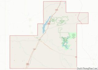
| County: | Atoka County |
| Elevation: | 627 ft (191 m) |
| Total Area: | 5.44 sq mi (14.09 km²) |
| Land Area: | 5.39 sq mi (13.95 km²) |
| Water Area: | 0.05 sq mi (0.14 km²) |
| Total Population: | 419 |
| Population Density: | 77.79/sq mi (30.03/km²) |
| ZIP code: | 74569 |
| Area code: | 580 |
| FIPS code: | 4070850 |
| GNISfeature ID: | 1098585 |
Online Interactive Map
Click on ![]() to view map in "full screen" mode.
to view map in "full screen" mode.
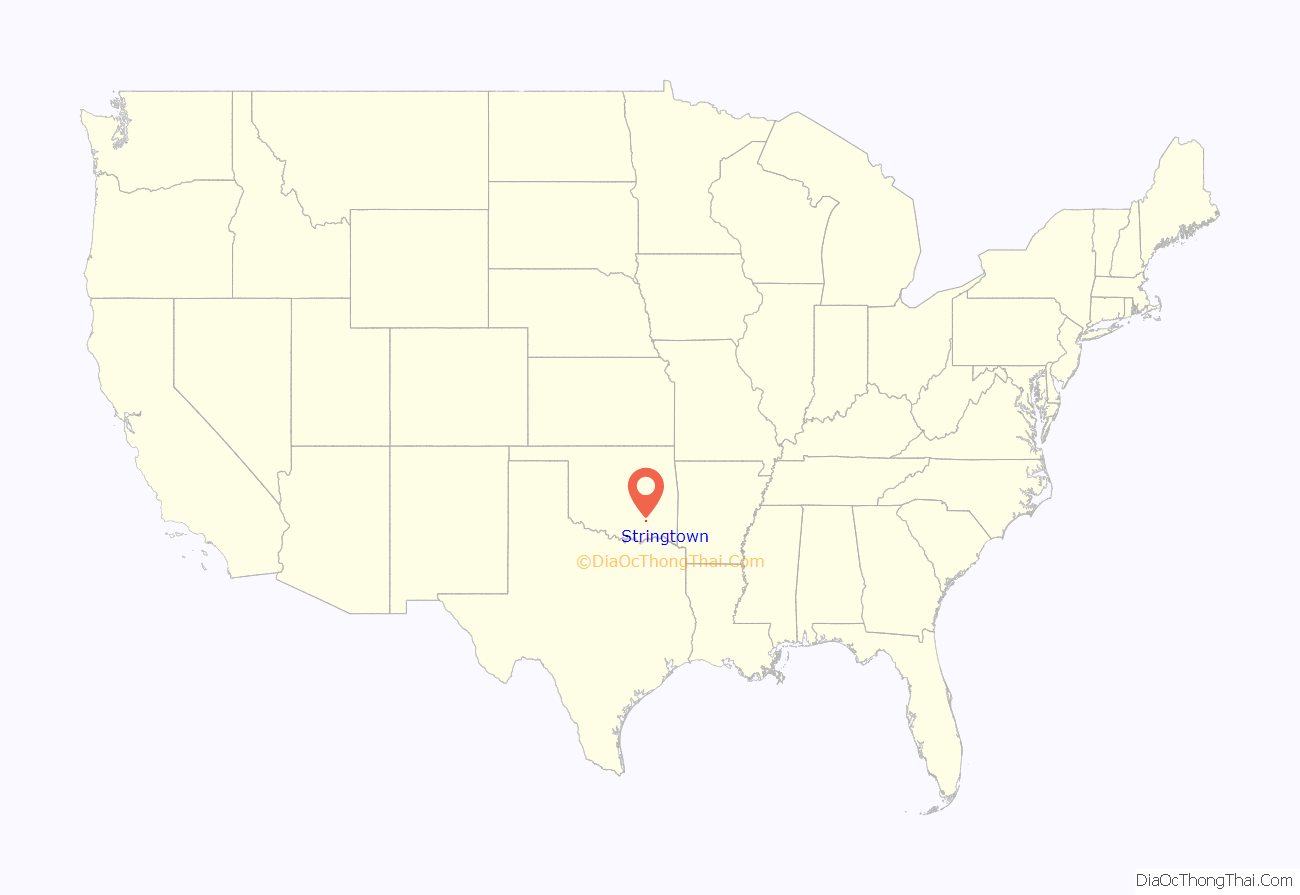
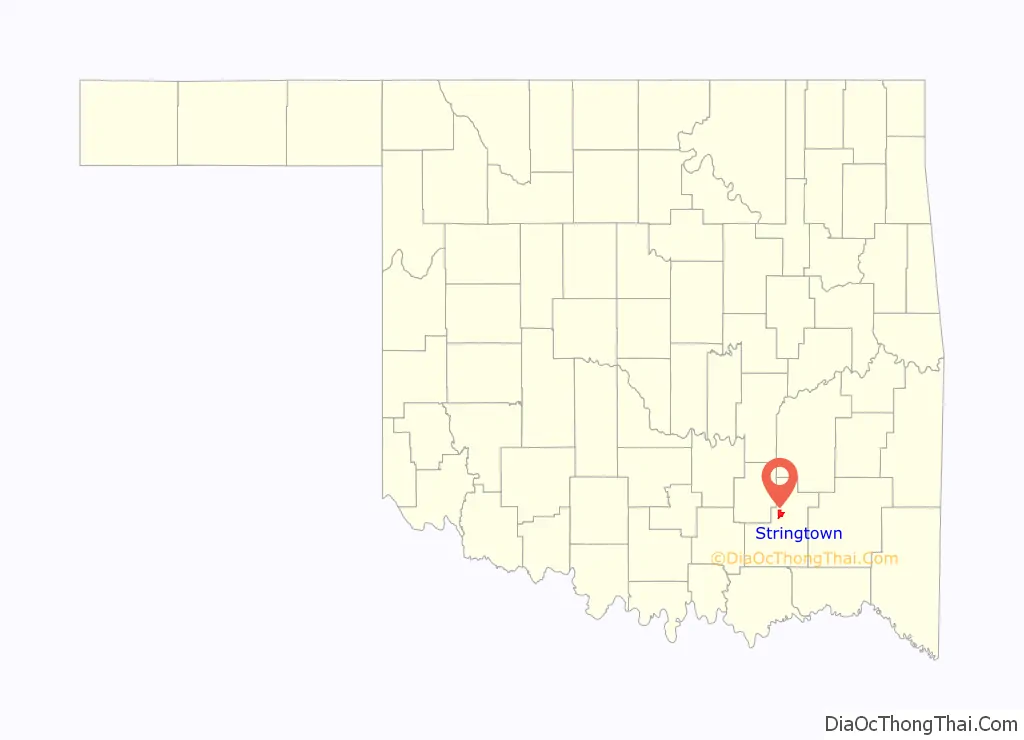
Stringtown location map. Where is Stringtown town?
History
Sources differ as to the origins of the name: one suggests the original name was Springtown for a local sulphur spring but a spelling mistake labeled it Stringtown, while another suggests it got the name because businesses were strung out along the railroad tracks. Once home to a bank, theater, and pub, the town has grown recently, both economically and in population. Companies noticing business opportunities in game hunting. population growth since the 1990 census and the addition of a new café have brought new life to the town. Annually in September, the Good Ole Days Festival celebrates the town’s past with a parade, cookout, and concert.
A post office was established at Stringtown, Indian Territory on August 17, 1874. For a few weeks in July 1877 the official name of the post office was Sulphur Springs, Indian Territory. the present name is a modification of Springtown, the original name of the settlement. At the time of its founding, Stringtown was located in Atoka County, Choctaw Nation, a territorial-era government unit that included parts of today’s Atoka, Coal, Hughes, and Pittsburg counties.
On August 5, 1932, while Bonnie Parker was visiting her mother, Clyde Barrow and two associates were drinking alcohol at a dance in Stringtown (illegal under Prohibition). They were approached by Sheriff C. G. Maxwell and his deputy, at which time Clyde opened fire, killing deputy Eugene C. Moore. That was the first killing of a lawman by what was later known as the Barrow Gang, a total which would eventually amount to nine slain officers.
In the 1940s during World War II, Fritz Johann Hansgirg, the Austrian inventor of magnesium and heavy water processes was interned at the U.S. alien internment camp located in Stringtown.
In the late 1960s, a tornado touched down in the town directly on top of the (then) recently built Community Center, now the Senior Citizens Center. The tornado was only on the ground for a few seconds, but during that time the building was almost destroyed. It was an unusual occurrence for a tornado to touch down in the town itself, given its location between two chains of steep hills.
The nearby Mack Alford State Penitentiary is a large source of employment in the county. It was an internment camp for Japanese Americans arrested as “enemy aliens” and later for German POWs during World War II.
Despite its small size, Stringtown (2010 pop. 410) is the second-largest town in Atoka County, behind Atoka (pop. 3,107) and ahead of Tushka (pop. 312). On January 14, 2014, the Oklahoma Highway Patrol disbanded the Stringtown Police Department for generating too much of the city’s revenue off of writing traffic tickets, a violation of the state “speed trap” law.
The Garside house is one of the biggest historical sites of the town, next to the Bonnie and Clyde monument. The land the Garside house sits on was allotted to Joseph and Sarah Garside and their two children in 1902. In the middle of building the house, a tornado came through the town and tore down the part of the house that had been built. The Garsides had to start over again, but in 1915 they finished a two-story house. The house and land was later purchased by E. H. Colbertson, the first white man to buy land in that area. Approximately four years ago, the house was remodeled and decorated to be a museum.
The Southwest Stone Company, also known as the Rock Crusher, is one of the biggest sources of employment in the county. The crusher moved from Chockee to Stringtown in the early 1900s. Up until that point, Stringtown had not had electricity yet.
The railroad that runs through Stringtown stretches from south Texas, takes several routes in Oklahoma and Kansas, and reaches to the northern parts of Missouri. The part that runs through Stringtown was built in 1872 and is known now as the Union Pacific Railroad.
Stringtown was once home to a sawmill and a cotton gin that had the biggest production rate in the late 1800s. When a fire burnt the town on July 15, 1954, the sawmill and cotton gin burned down, along with half the town, including a café, a jailhouse, a barbershop, a bank, and a hotel. All that was left was Robert’s Store and a few homes. The town never really was rebuilt after this. Today, there is a school, a church, a fire department, City Hall, Dianna’s Store, and a senior citizens center.
A state investigation revealed that 76 percent of the Stringtown’s 2013 budget came from traffic tickets. The investigation found excessive speed trapping, and the police department was disbanded in 2014.
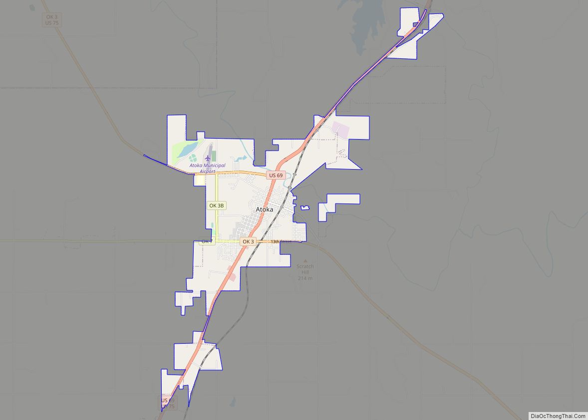
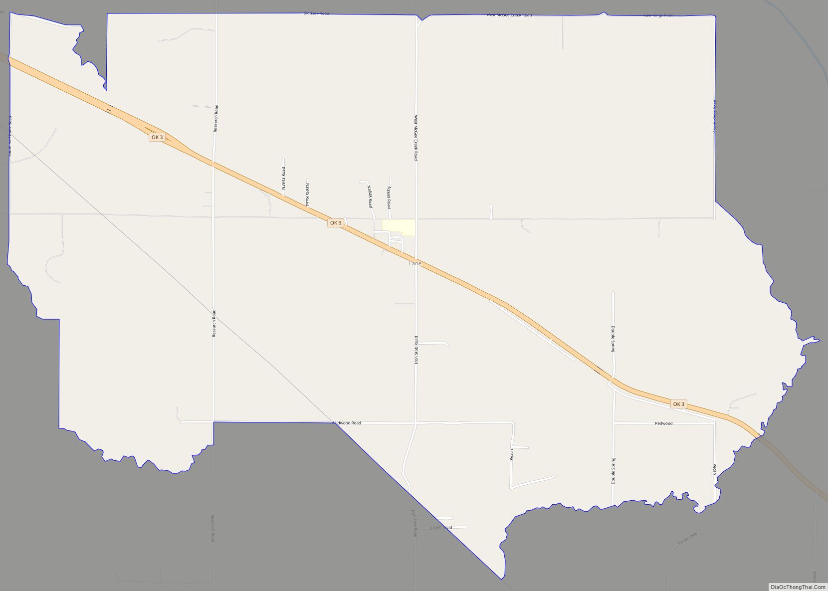
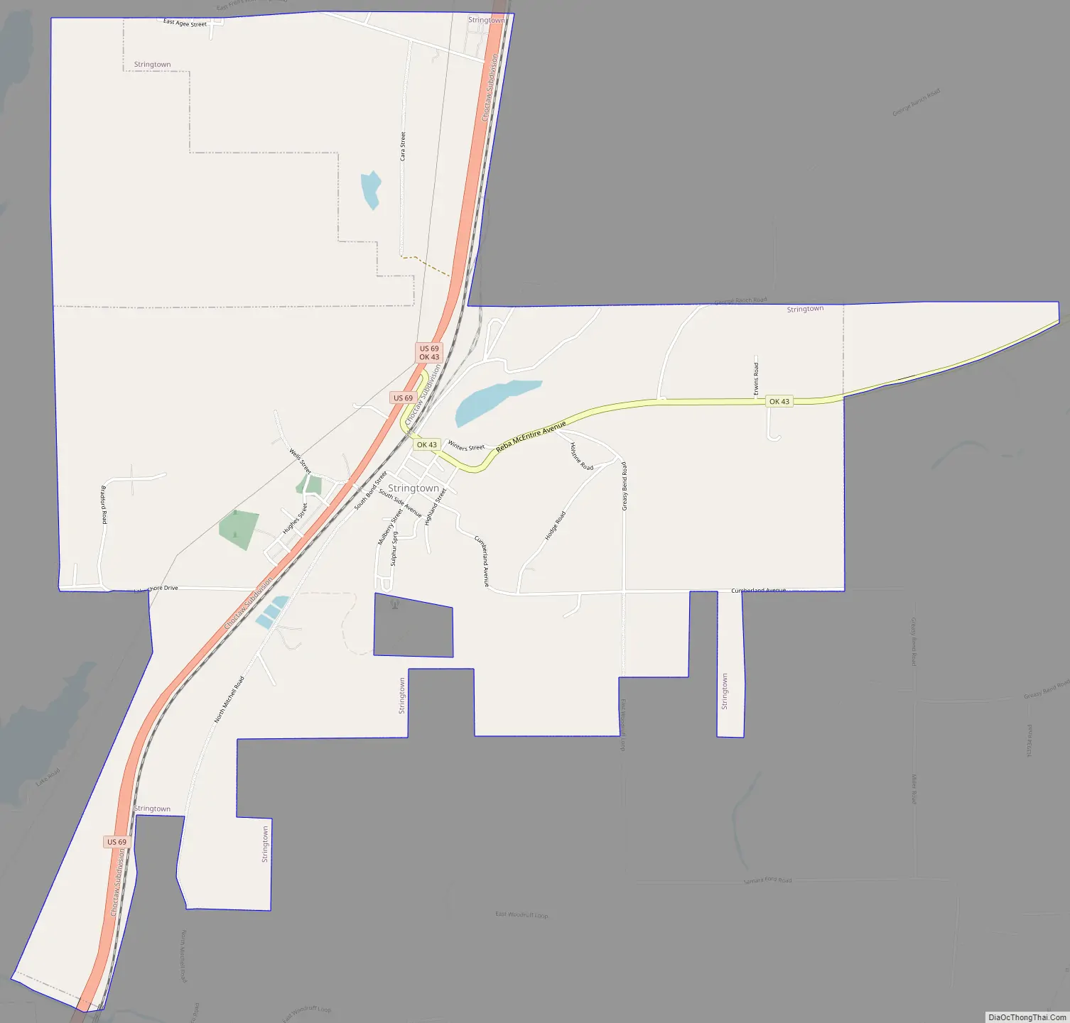
Stringtown Road Map
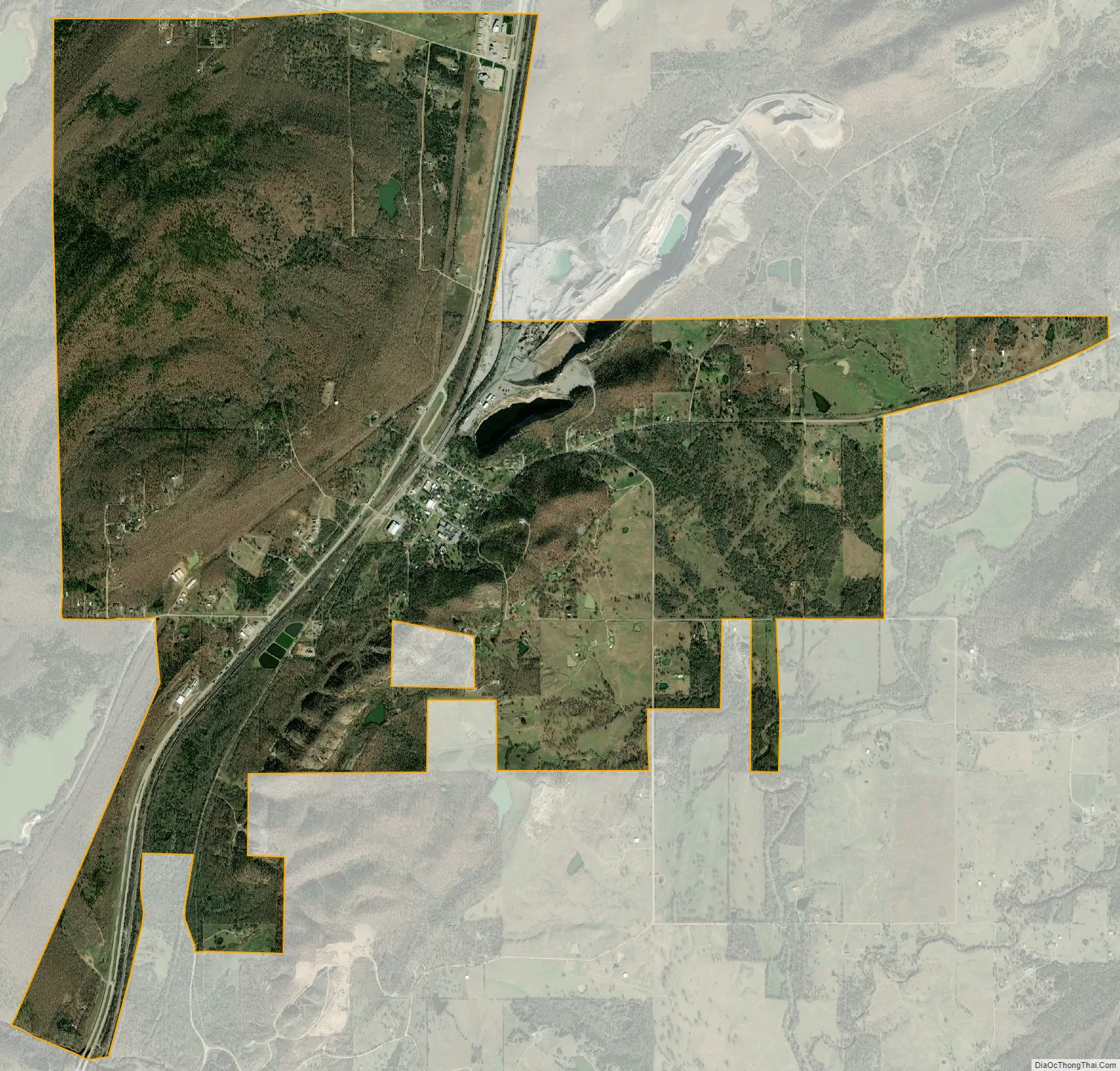
Stringtown city Satellite Map
Geography
Stringtown is located at 34°28′6″N 96°3′10″W / 34.46833°N 96.05278°W / 34.46833; -96.05278 (34.468448, -96.052860).
According to the United States Census Bureau, the town has a total area of 4.7 square miles (12.2 km), of which 4.7 square miles (12.1 km) is land and 0.077 square miles (0.2 km), or 1.24%, is water.
Stringtown is located at the southern intersection of U.S. Highway 69 and State Highway 43.
See also
Map of Oklahoma State and its subdivision:- Adair
- Alfalfa
- Atoka
- Beaver
- Beckham
- Blaine
- Bryan
- Caddo
- Canadian
- Carter
- Cherokee
- Choctaw
- Cimarron
- Cleveland
- Coal
- Comanche
- Cotton
- Craig
- Creek
- Custer
- Delaware
- Dewey
- Ellis
- Garfield
- Garvin
- Grady
- Grant
- Greer
- Harmon
- Harper
- Haskell
- Hughes
- Jackson
- Jefferson
- Johnston
- Kay
- Kingfisher
- Kiowa
- Latimer
- Le Flore
- Lincoln
- Logan
- Love
- Major
- Marshall
- Mayes
- McClain
- McCurtain
- McIntosh
- Murray
- Muskogee
- Noble
- Nowata
- Okfuskee
- Oklahoma
- Okmulgee
- Osage
- Ottawa
- Pawnee
- Payne
- Pittsburg
- Pontotoc
- Pottawatomie
- Pushmataha
- Roger Mills
- Rogers
- Seminole
- Sequoyah
- Stephens
- Texas
- Tillman
- Tulsa
- Wagoner
- Washington
- Washita
- Woods
- Woodward
- Alabama
- Alaska
- Arizona
- Arkansas
- California
- Colorado
- Connecticut
- Delaware
- District of Columbia
- Florida
- Georgia
- Hawaii
- Idaho
- Illinois
- Indiana
- Iowa
- Kansas
- Kentucky
- Louisiana
- Maine
- Maryland
- Massachusetts
- Michigan
- Minnesota
- Mississippi
- Missouri
- Montana
- Nebraska
- Nevada
- New Hampshire
- New Jersey
- New Mexico
- New York
- North Carolina
- North Dakota
- Ohio
- Oklahoma
- Oregon
- Pennsylvania
- Rhode Island
- South Carolina
- South Dakota
- Tennessee
- Texas
- Utah
- Vermont
- Virginia
- Washington
- West Virginia
- Wisconsin
- Wyoming