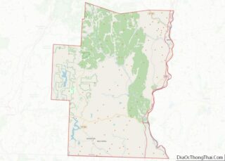
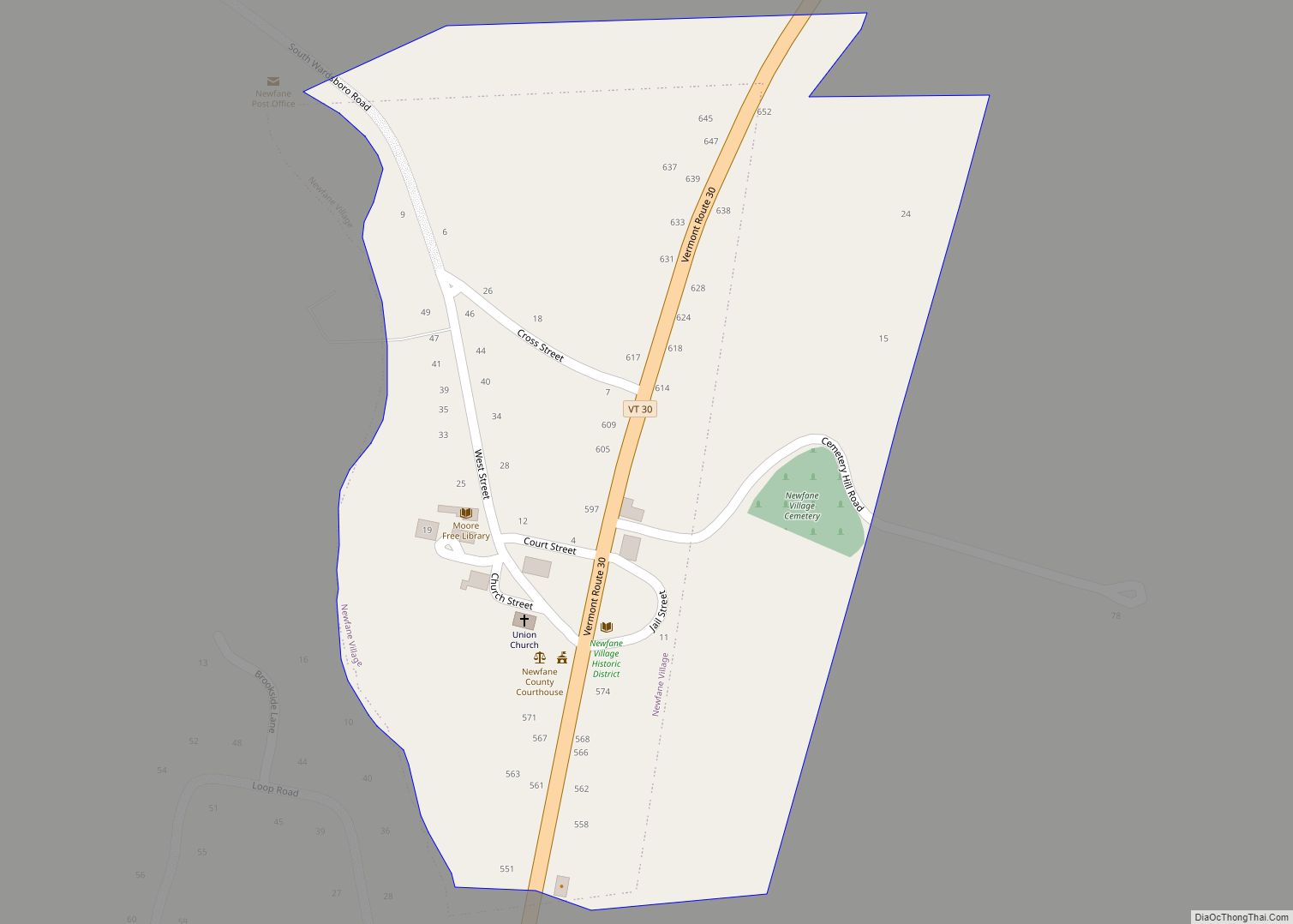
Newfane is the shire town (county seat) of Windham County, Vermont, United States. The population was 1,645 at the 2020 census. The town includes the villages of Newfane, Williamsville, and South Newfane.
| Name: | Newfane village |
|---|---|
| LSAD Code: | 47 |
| LSAD Description: | village (suffix) |
| State: | Vermont |
| County: | Windham County |
| Elevation: | 1,004 ft (306 m) |
| Total Area: | 40.4 sq mi (104.6 km²) |
| Land Area: | 40.2 sq mi (104.2 km²) |
| Water Area: | 0.1 sq mi (0.4 km²) |
| Total Population: | 1,645 |
| Population Density: | 15.8/sq mi (6.1/km²) |
| ZIP code: | 05345 |
| Area code: | 802 |
| FIPS code: | 5048325 |
| GNISfeature ID: | 1462159 |
Online Interactive Map
Click on ![]() to view map in "full screen" mode.
to view map in "full screen" mode.
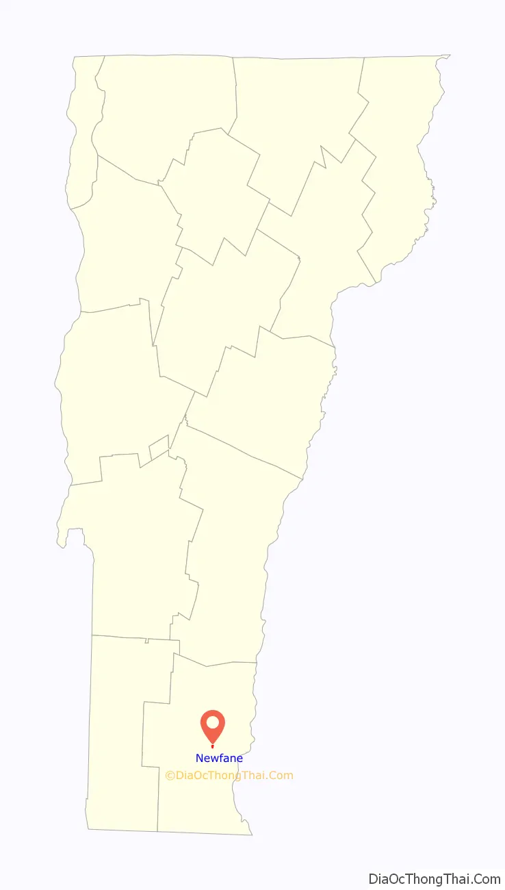
Newfane location map. Where is Newfane village?

History
One of the New Hampshire grants, the town was chartered on June 19, 1753, by Governor Benning Wentworth, who named it Fane after John Fane, the 7th Earl of Westmoreland. But hostilities during the French and Indian War prevented its settlement. Because a first town meeting was not held within the required five years, the charter was deemed null and void. So Wentworth issued an entirely new charter on November 3, 1761, as New Fane. The town was settled in 1766 by families from Worcester County, Massachusetts. Newfane became the shire town of the county before 1812. A village was built atop Newfane Hill, including the county buildings. But because of winter travel difficulties, it was relocated to the flatland below in 1825, until 1882 called Fayetteville after the Marquis de Lafayette.
The town has a diversified terrain, with both high hills and deep valleys. Farmers found good soil for cultivation on the intervales, and for grazing livestock on the uplands. Various streams provided water power for mills, and by 1859 industries included manufacturers of both leather and linseed oil, two flour mills, two lumber mills, and a large carriage factory. As a result, Newfane became prosperous during the 19th century, when it built the Federal, Greek Revival and Victorian architecture that today makes it a tourist destination.
Bird’s-eye view in 1909
Courthouse, built in 1825
Scene in Williamsville
Newfane Road Map
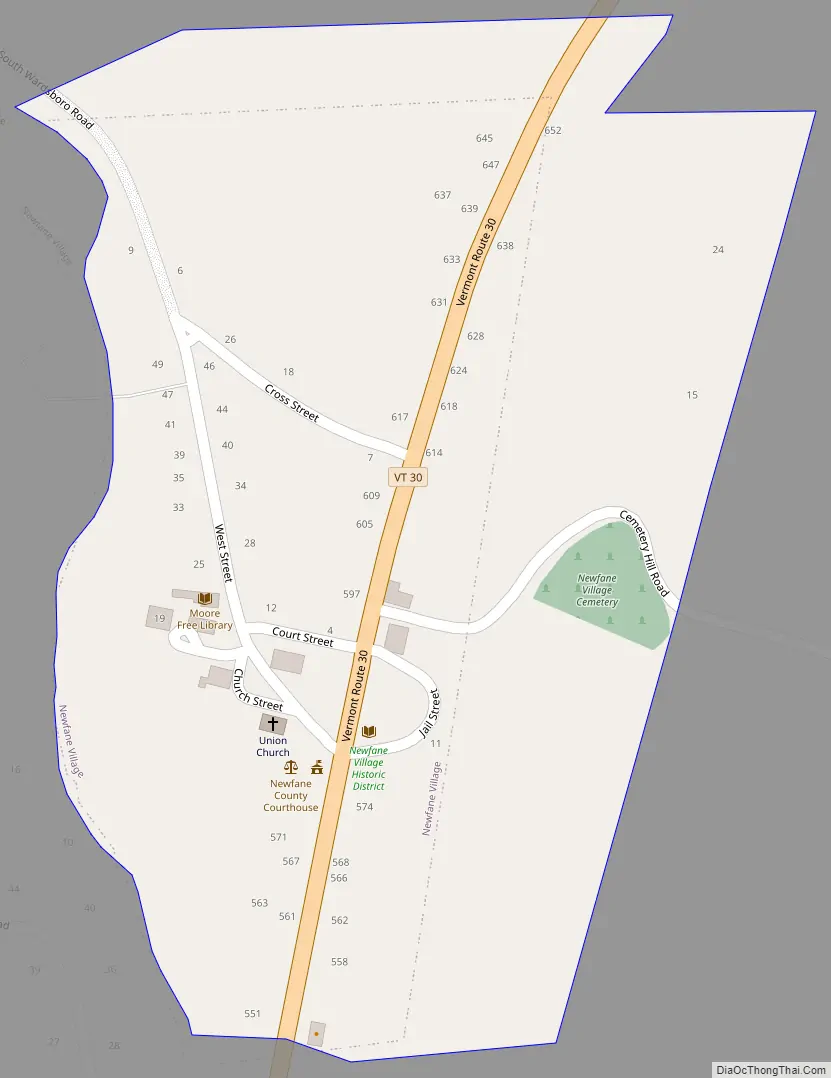
Newfane city Satellite Map

Geography
According to the United States Census Bureau, the town has a total area of 40.4 square miles (104.6 km), of which 40.2 square miles (104.2 km) is land and 0.1 square mile (0.4 km) (0.35%) is water. The West and Rock rivers flow through the town.
Newfane is crossed by Vermont Route 30.
The West River in Newfane yielded the largest gold nugget ever found in New England, at 6.5oz.
See also
Map of Vermont State and its subdivision: Map of other states:- Alabama
- Alaska
- Arizona
- Arkansas
- California
- Colorado
- Connecticut
- Delaware
- District of Columbia
- Florida
- Georgia
- Hawaii
- Idaho
- Illinois
- Indiana
- Iowa
- Kansas
- Kentucky
- Louisiana
- Maine
- Maryland
- Massachusetts
- Michigan
- Minnesota
- Mississippi
- Missouri
- Montana
- Nebraska
- Nevada
- New Hampshire
- New Jersey
- New Mexico
- New York
- North Carolina
- North Dakota
- Ohio
- Oklahoma
- Oregon
- Pennsylvania
- Rhode Island
- South Carolina
- South Dakota
- Tennessee
- Texas
- Utah
- Vermont
- Virginia
- Washington
- West Virginia
- Wisconsin
- Wyoming