Biloxi (/bɪˈlʌksi/ bih-LUK-see; French: [bilusi]) is a city in and one of two county seats of Harrison County, Mississippi, United States. Adjacent to the co-seat of Gulfport, Biloxi lies along the Gulf Coast in southern Mississippi. The population was 49,449 at the 2020 census, making it the state’s fourth-largest city. It is a principal city of the Gulfport–Biloxi metropolitan area, home to 416,259 residents in 2020. The area’s first European settlers were French colonists.
The beachfront of Biloxi lies directly on the Mississippi Sound, with barrier islands scattered off the coast and into the Gulf of Mexico. Keesler Air Force Base lies within the city and is home to the 81st Training Wing and the 403d Wing of the U.S. Air Force Reserve.
| Name: | Biloxi city |
|---|---|
| LSAD Code: | 25 |
| LSAD Description: | city (suffix) |
| State: | Mississippi |
| County: | Harrison County |
| Incorporated: | in 1838 as a township |
| Elevation: | 20 ft (6 m) |
| Land Area: | 42.94 sq mi (111.20 km²) |
| Water Area: | 24.77 sq mi (64.16 km²) |
| Population Density: | 1,151.69/sq mi (444.67/km²) |
| Area code: | 228 |
| FIPS code: | 2806220 |
| GNISfeature ID: | 0667173 |
| Website: | www.biloxi.ms.us |
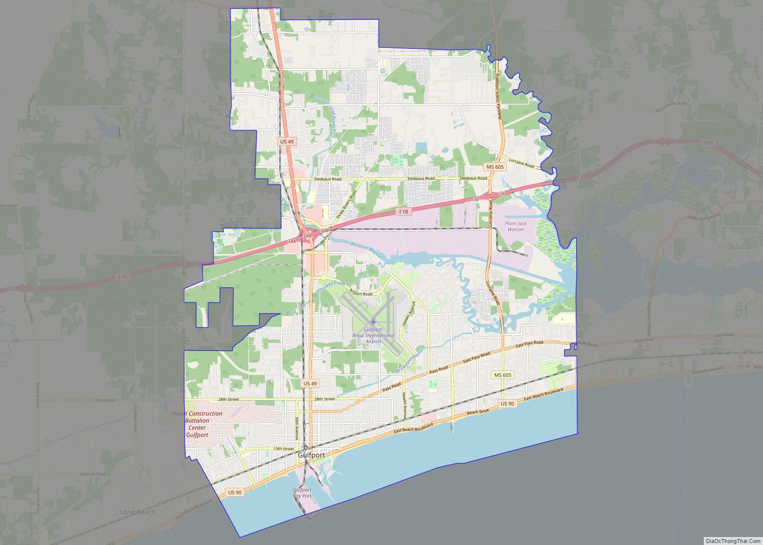
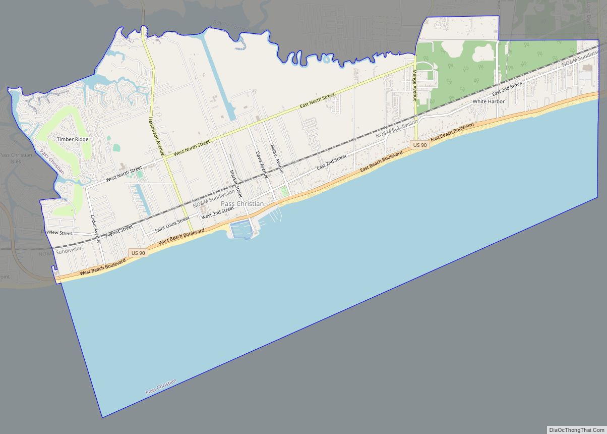
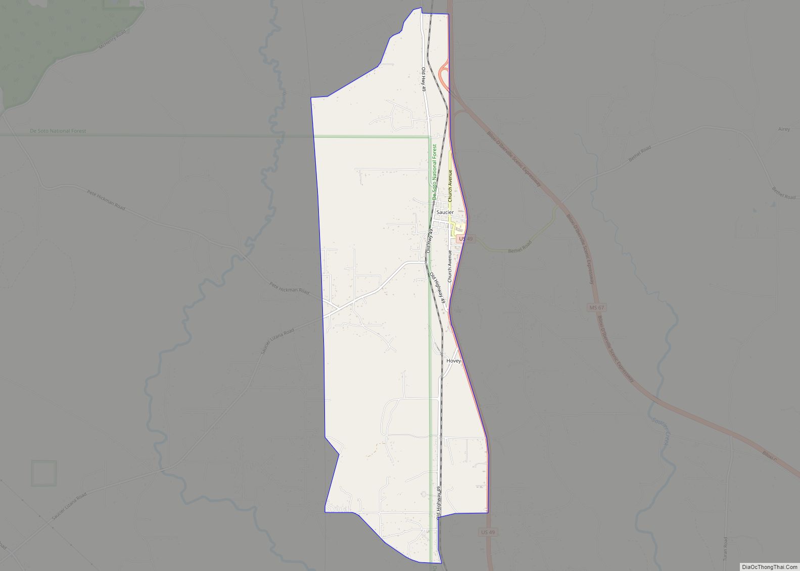
Online Interactive Map
Click on ![]() to view map in "full screen" mode.
to view map in "full screen" mode.
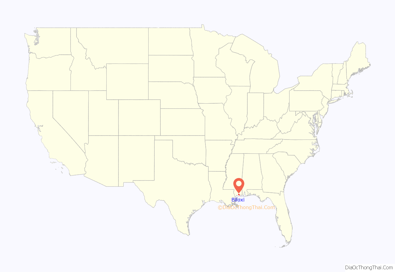
Biloxi location map. Where is Biloxi city?
History
Colonial era
In 1699 French colonists formed the first, permanent, European settlement in French Louisiana, at Fort Maurepas, now in Ocean Springs, Mississippi, and referred to as “Old Biloxi”. They were under the direction of Pierre Le Moyne d’Iberville. La Louisiane was separated from Spanish Florida at the Perdido River near Pensacola (this was founded by the Spanish 1559 and again in 1698).
The name of Biloxi in French was Bilocci, a transliteration of the term for the local Native American tribe in their language. Labeled along with “Fort Maurepas” on maps dated circa year 1710/1725, the name was sometimes used in English as “Fort Bilocci”.
In 1720, the area of today’s city of Biloxi was settled for the first time around Fort Louis. In this year the administrative capital of French Louisiana was moved to Biloxi (or Bilocci) from Mobile (or La Mobile). French Louisiana, part of New France, was known in French as La Louisiane in colonial times. In modern times it is called La Louisiane française to distinguish it from the modern state of Louisiana.
Due to fears of tides and hurricanes, colonial governor Bienville moved the capital of French Louisiana in 1722 from Biloxi to a new inland harbor town named La Nouvelle-Orléans (New Orleans), built for this purpose in 1718–1720.
In 1763, following Britain’s victory in the Seven Years’ War/French and Indian War, France had to cede their colonies east of the Mississippi River, except for New Orleans, to Great Britain, as part of the Treaty of Paris. At the same time, the French colony west of the Mississippi, plus New Orleans, was ceded to Spain as part of the Treaty of Fontainebleau.
Subsequent history
British rule lasted from 1763 to 1779, followed by Spanish rule from 1779 to 1810. Despite this, the character of Biloxi remained mostly French, as their descendants made up the majority of the population. In 1811, the US traded with Spain to take over Biloxi and related area, making it part of their Mississippi Territory. Mississippi, and Biloxi with it, was admitted as a state to the union in 1817.
Biloxi began to grow. In the antebellum period of the 19th century, it became known as a summer resort, because of its proximity to the breezes and beaches of the coast. It also had the advantages of proximity to New Orleans and ease of access via water. Summer homes were built by wealthy slave-owners and commercial figures. Hotels and rental cottages were developed to serve those who could not afford their own homes.
The Biloxi Lighthouse was built in Baltimore, Maryland, and shipped south, where it was completed at the site in May 1848. (It is one of two surviving lighthouses on the Mississippi Gulf Coast, which at one time had twelve.)
In the early stages of the Civil War, Ship Island was captured by Union forces, enabling them to take control of Biloxi. No major battles were fought in the area, and Biloxi did not suffer direct damage from the war. Some local Union sentiment could be discerned following the war’s conclusion.
In the postbellum period, Biloxi again emerged as a vacation spot. Its popularity as a destination increased with railroad access. In 1881, the first cannery was built in the town to process seafood, leading to others soon joining the location. This stimulated development in the city, and it attracted new immigrants from Europe and different ethnic groups who worked in the seafood factories. They processed shrimp and other local seafood. These changes gave Biloxi a more heterogeneous population.
During World War II, the United States Army Air Forces built Keesler Field, now Keesler Air Force Base, which became a major basic training site and site for aircraft maintenance. The Biloxi economy boomed as a result, attracting new residents and businesses. By 1958, the first Jewish synagogue had been built in the town.
Biloxi’s casino history dates to a period in the 1940s. At the time, open, if technically illegal, gambling took place in a casino within the Broadwater Beach Resort. Open gambling ended during the 1950s. The Mississippi Gulf Coast became known as the “Poor Man’s Riviera”, and was frequented by Southern families interested in fishing expeditions during the summer. Commercially, Biloxi was dominated by shrimp boats and oyster luggers.
In 1959 Biloxi was the site of “Mississippi’s first public assault on racial barriers in its 15-year civil rights struggle”. Gilbert R. Mason, a black physician in Biloxi, went swimming at a local beach with seven black friends. They were ordered to leave by a city policeman, who told them that “Negroes don’t come to the sand beach.” Mason reacted by leading a series of protests, known as the Biloxi Wade-Ins. The protests were followed in 1960 by the worst racial riot in Mississippi history, during which ten people died. Ultimately, the protests led to the desegregation of the beaches of Biloxi.
In the early 1960s, the Gulf Coast again emerged as a prime alternative to Florida as a southern vacation destination among Northerners, with Biloxi a favored destination. Biloxi hotels upgraded their amenities and hired chefs from France and Switzerland in an effort to provide some of the best seafood cuisine in the country. Edgewater Mall was built in 1963.
With the introduction of legal gambling in Mississippi in the 1990s, Biloxi was again transformed. It became an important center in the resort casino industry. The new hotels and gambling complexes brought millions of dollars in tourism revenue to the city. The more famous casino complexes were the Beau Rivage casino resort, the Hard Rock Hotel and Casino, Casino Magic, Grand Casino, Isle of Capri Casino Resort Biloxi, Boomtown Casino, President Casino Broadwater Resort, and Imperial Palace. Like Tunica County in the northern part of the state, Biloxi and the surrounding Gulf Coast region were considered a leading gambling center in the Southern United States.
To celebrate the area’s tricentennial in 1998/99, the city’s tourism promotion agency invited the nationally syndicated Travel World Radio Show to broadcast live from Biloxi, with co-host Willem Bagchus in attendance.
By the early 21st century, Biloxi’s economy was based on the seafood industry, tourism, and gaming.
Hurricanes
Scores of hurricanes have hit the Mississippi Gulf Coast, but the most destructive, as measured by storm surge levels in the Biloxi Lighthouse, occurred in 1855, 1906, 1909, 1947, 1969 (Hurricane Camille), and 2005 (Hurricane Katrina)
On August 29, 2005, Hurricane Katrina hit the Mississippi Gulf Coast with high winds, heavy rains and a 30-foot (9.1 m) storm surge, causing massive damage to the area. Katrina came ashore during the high tide of 6:56 am, +2.3 feet more. Commenting on the power of the storm and the damage, Mayor A. J. Holloway said, “This is our tsunami.” Mississippi Governor Haley Barbour was quoted as saying the destruction of the Mississippi coastline by Hurricane Katrina looked like an American Hiroshima.
On the morning of August 31, 2005, in an interview on MSNBC, Governor Barbour stated that 90% of the buildings along the coast in Biloxi and neighboring Gulfport had been destroyed by the hurricane. Several of the “floating” casinos were torn off their supports and thrown inland, contributing to the damage.
Many churches were destroyed or severely damaged, including St. Michael’s Catholic Church, which was gutted by the storm surge, breaking the entry doors and stained-glass windows along the first floor; however, the interior was later removed, and the structure was still solid enough to allow repairing the church.
Hurricane Katrina damaged over 40 Mississippi libraries beyond repair, breaking windows and flooding several feet in the Biloxi Public Library, requiring a total rebuild.
Hurricane-force winds persisted for 17 hours and tore the branches off many coastal oak trees, but the tree trunks survived the 30-foot (9.1 m) flood and many have since regrown smaller branches. Some reconstructed homes still have their antebellum appearance, and miles inland, with less flooding, shopping centers have reopened.
Harrison County Coroner Gary T. Hargrove told the mayor and City Council that Hurricane Katrina had claimed 53 victims in Biloxi, as of January 30, 2006. Of the 53 confirmed fatalities in Biloxi, a figure that includes one unidentified male, Hargrove said the average age was 58, with the youngest being 22 and the oldest 90; 14 were female and 39 were male.
Biloxi is the site of a well-known memorial to Katrina victims. The memorial was created by a team of local artists (Elizabeth Veglia and Aaron Kramer), an architect (Dennis Cowart), a contractor (Roy Anderson Corporation), and city liaison (Nathan Sullivan), with assistance from the crew and volunteers of Extreme Makeover: Home Edition.
Many casinos were damaged or destroyed by Hurricane Katrina. Of the casinos that were located in Biloxi, eight have reopened since Katrina. They are the Grand Biloxi Casino Hotel Spa (formerly known as Grand Casino Biloxi), the Hard Rock Hotel & Casino, the Golden Nugget, the Palace Casino Resort, the IP Casino Resort Spa (formerly known as Imperial Palace), Treasure Bay Casino, Boomtown Casino, and the Beau Rivage, which reopened on the first anniversary of Hurricane Katrina.
Multiple plans have been laid out to rebuild the waterfront areas of Biloxi, and the federal government has recently announced that it is considering giving up to 17,000 Mississippi coast homeowners the option to sell their properties so that a vast hurricane-protection zone can be implemented. Meanwhile, the city of Biloxi is rapidly implementing plans to allow the redevelopment of commercial properties south of Highway 90.
Hurricane Katrina pushed houses inland along the Mississippi Gulf Coast, including at Biloxi.
Casino barges floated ashore in Biloxi during Hurricane Katrina’s storm surge.
U.S. Navy personnel perform a search and rescue mission in Biloxi after Hurricane Katrina.
Biloxi beach during cleanup of storm debris
Front view of Beauvoir in Biloxi, 7 months after Hurricane Katrina
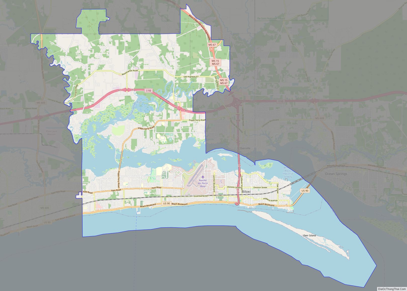
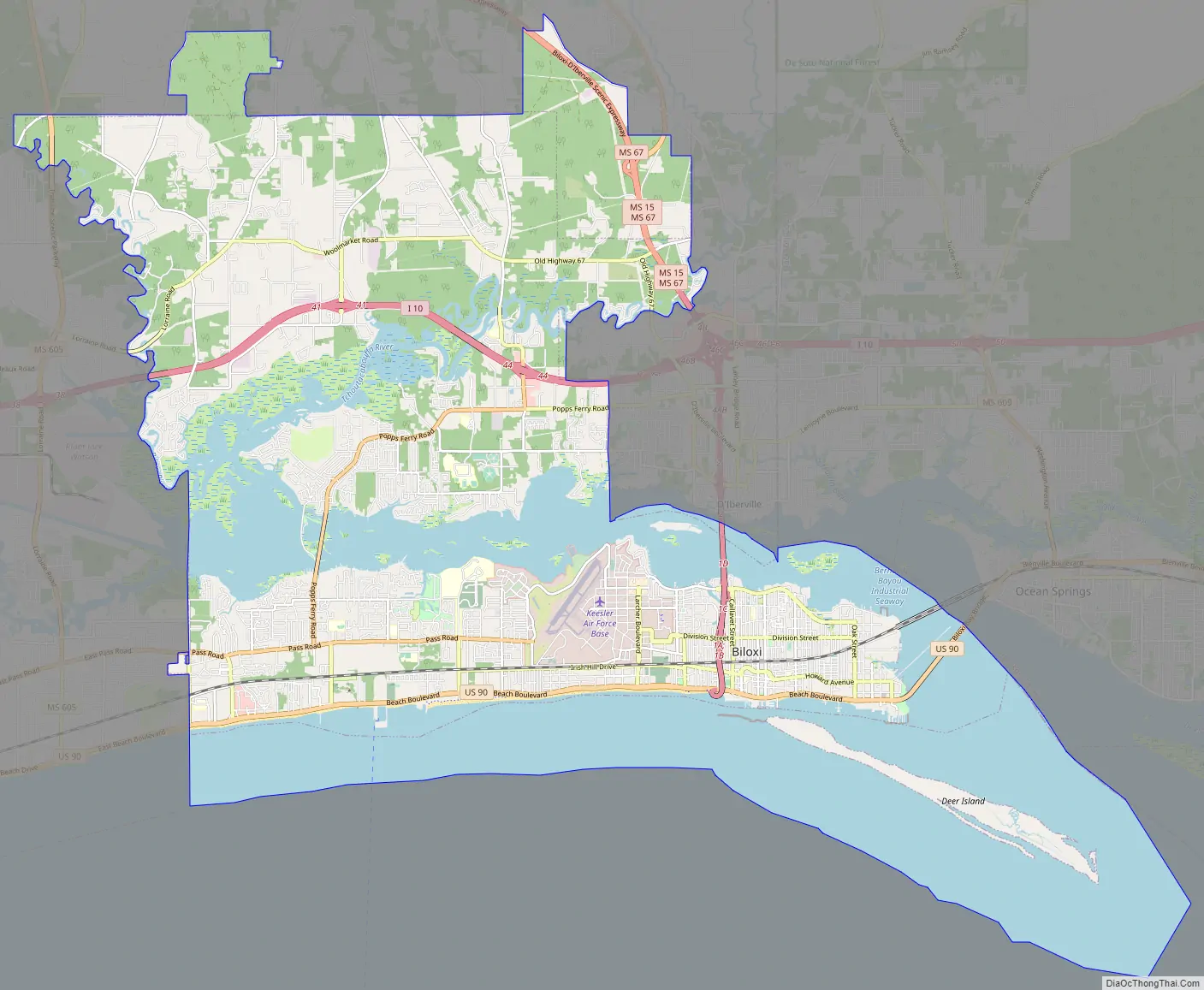
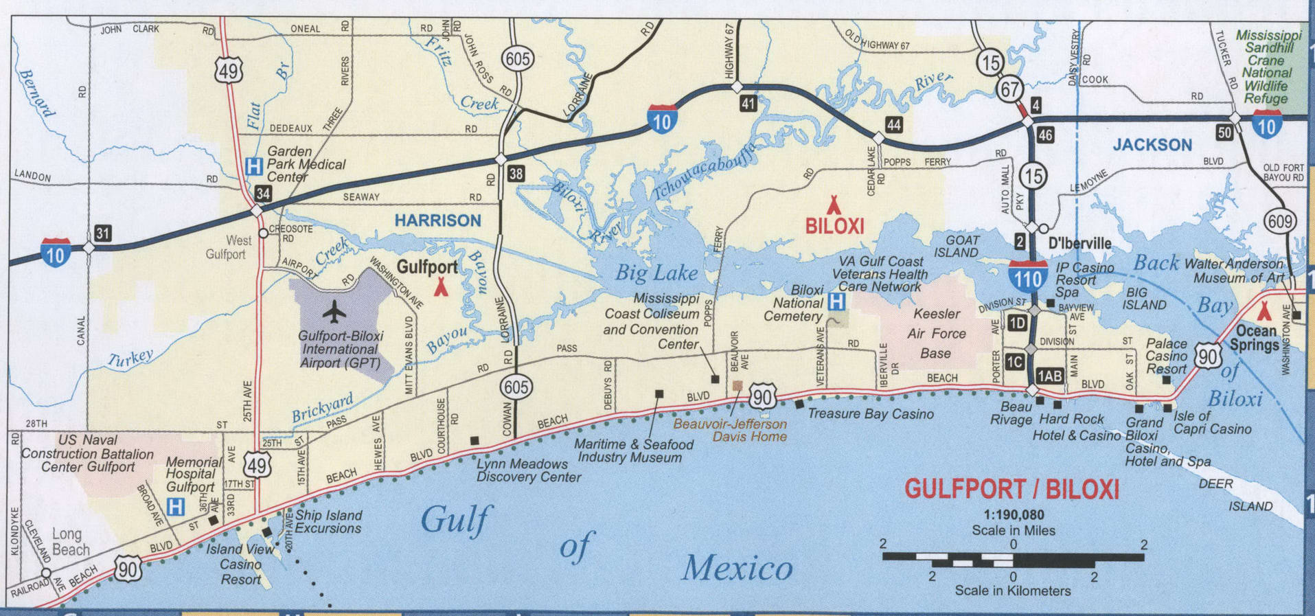
Biloxi Road Map
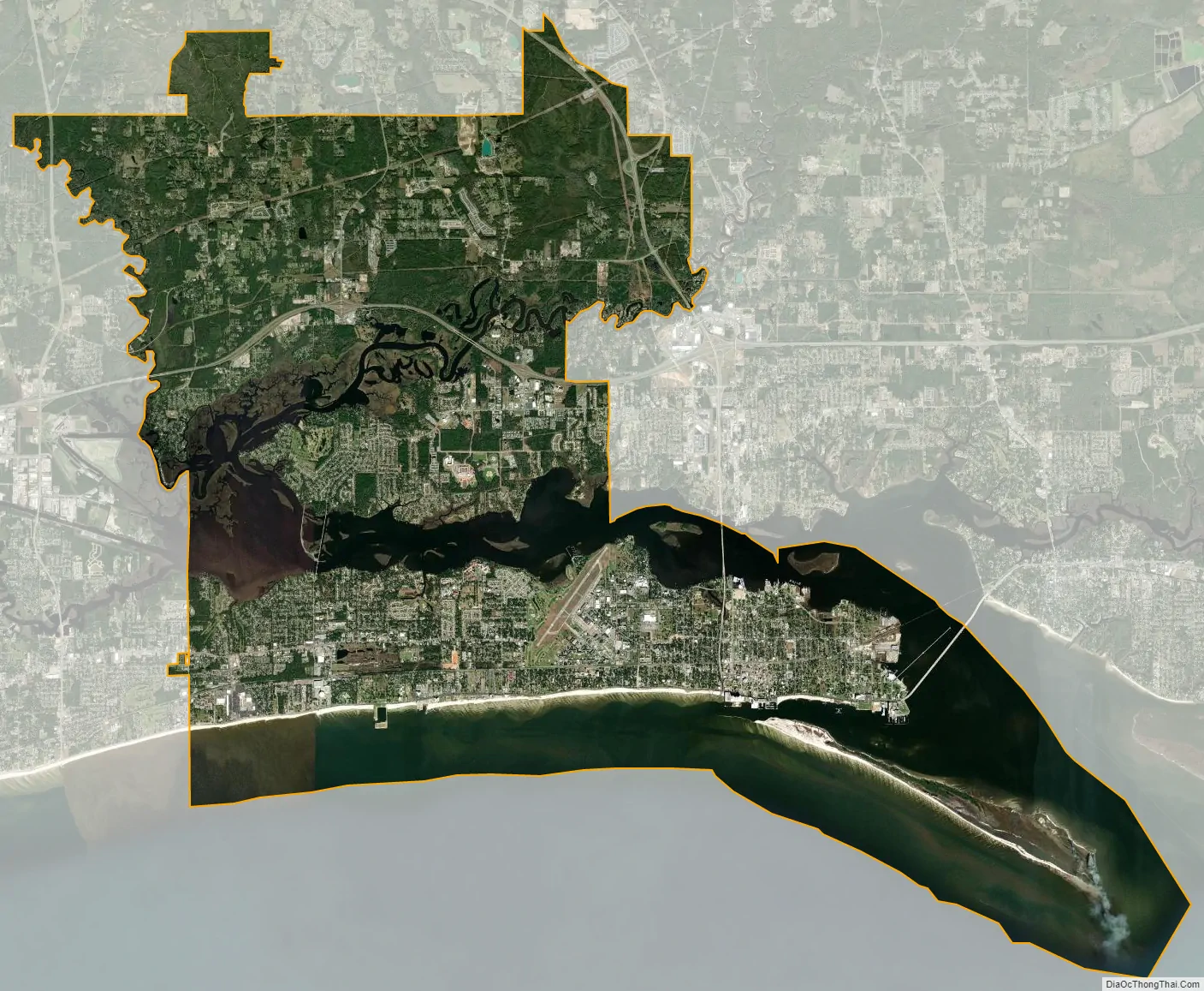
Biloxi city Satellite Map
Geography
Biloxi is located in southeastern Harrison County, bordered to the south by Mississippi Sound (part of the Gulf of Mexico) and to the northeast partially by Biloxi Bay, which forms part of the Jackson County line. To the northeast, across Biloxi Bay, are the Jackson County city of Ocean Springs and the unincorporated community of St. Martin. The Back Bay of Biloxi continues west from the Jackson County line, crossing the city of Biloxi to Big Lake on the city’s western boundary, where the Biloxi and Tchoutacabouffa rivers join. The Tchoutacbouffa flows from east to west across the city and forms part of the city’s eastern boundary. Biloxi is bordered to the north and east by the city of D’Iberville and to the west by the city of Gulfport.
According to the United States Census Bureau, Biloxi has a total area of 46.7 square miles (120.9 km), of which 38.2 square miles (99.0 km) are land and 8.5 square miles (21.9 km), or 18.14%, are water.
Biloxi has a humid subtropical climate (Köppen: Cfa) that is heavily influenced by the Gulf of Mexico. Winter days are mild and wet. Snow is extremely rare in Biloxi. Summers are hot and humid, bearing the brunt of tropical storms during the late summer to fall. Biloxi’s record low of 10 °F (−12.2 °C) was recorded on January 24, 1963, and the record high of 104 °F (40 °C) was recorded on August 29, 2000.
See also
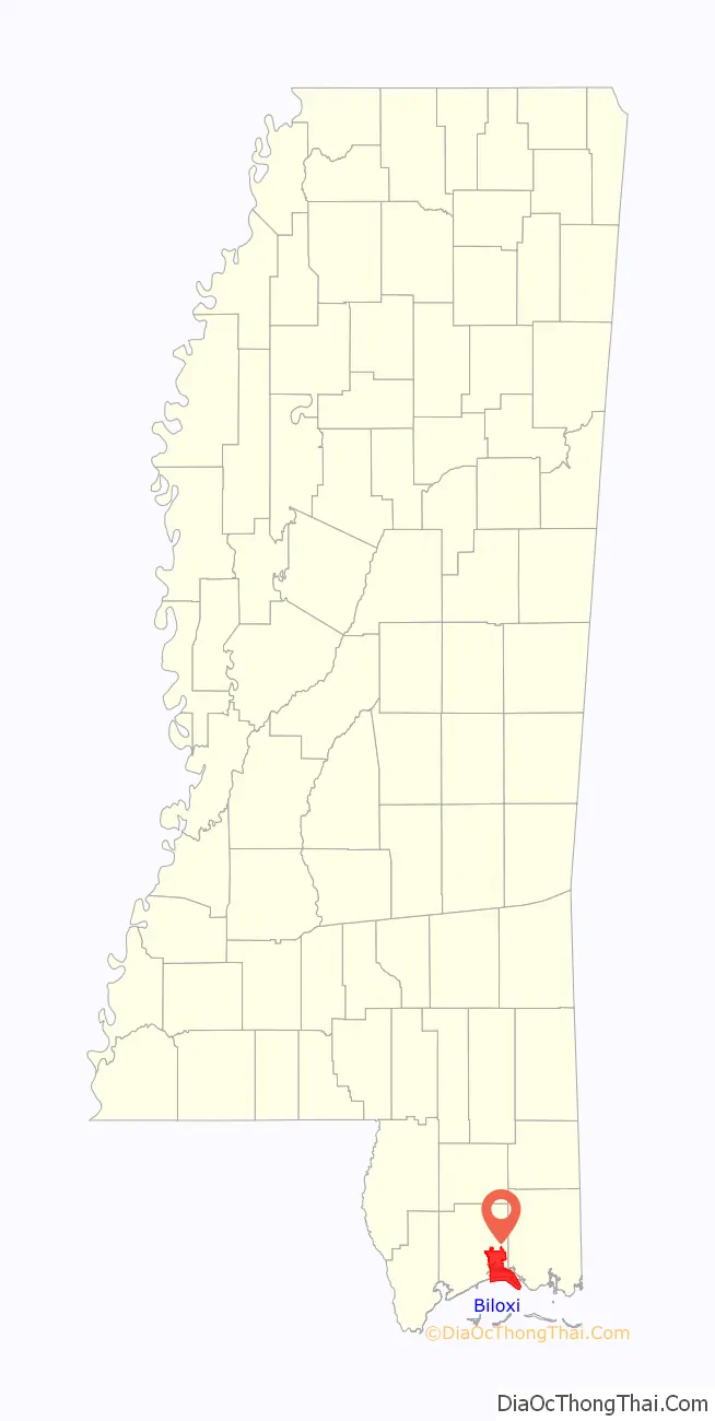
Map of Mississippi State and its subdivision:- Adams
- Alcorn
- Amite
- Attala
- Benton
- Bolivar
- Calhoun
- Carroll
- Chickasaw
- Choctaw
- Claiborne
- Clarke
- Clay
- Coahoma
- Copiah
- Covington
- Desoto
- Forrest
- Franklin
- George
- Greene
- Grenada
- Hancock
- Harrison
- Hinds
- Holmes
- Humphreys
- Issaquena
- Itawamba
- Jackson
- Jasper
- Jefferson
- Jefferson Davis
- Jones
- Kemper
- Lafayette
- Lamar
- Lauderdale
- Lawrence
- Leake
- Lee
- Leflore
- Lincoln
- Lowndes
- Madison
- Marion
- Marshall
- Monroe
- Montgomery
- Neshoba
- Newton
- Noxubee
- Oktibbeha
- Panola
- Pearl River
- Perry
- Pike
- Pontotoc
- Prentiss
- Quitman
- Rankin
- Scott
- Sharkey
- Simpson
- Smith
- Stone
- Sunflower
- Tallahatchie
- Tate
- Tippah
- Tishomingo
- Tunica
- Union
- Walthall
- Warren
- Washington
- Wayne
- Webster
- Wilkinson
- Winston
- Yalobusha
- Yazoo
- Alabama
- Alaska
- Arizona
- Arkansas
- California
- Colorado
- Connecticut
- Delaware
- District of Columbia
- Florida
- Georgia
- Hawaii
- Idaho
- Illinois
- Indiana
- Iowa
- Kansas
- Kentucky
- Louisiana
- Maine
- Maryland
- Massachusetts
- Michigan
- Minnesota
- Mississippi
- Missouri
- Montana
- Nebraska
- Nevada
- New Hampshire
- New Jersey
- New Mexico
- New York
- North Carolina
- North Dakota
- Ohio
- Oklahoma
- Oregon
- Pennsylvania
- Rhode Island
- South Carolina
- South Dakota
- Tennessee
- Texas
- Utah
- Vermont
- Virginia
- Washington
- West Virginia
- Wisconsin
- Wyoming