Gilliam County is one of the 36 counties in the U.S. state of Oregon. As of the 2020 census, the population was 1,995, making it the third-least populous county in Oregon. The county seat is Condon. The county was established in 1885 and is named for Cornelius Gilliam, a colonel who commanded the forces of the provisional government of Oregon after the Whitman Massacre.
| Name: | Gilliam County |
|---|---|
| FIPS code: | 41-021 |
| State: | Oregon |
| Founded: | February 25, 1885 |
| Named for: | Cornelius Gilliam |
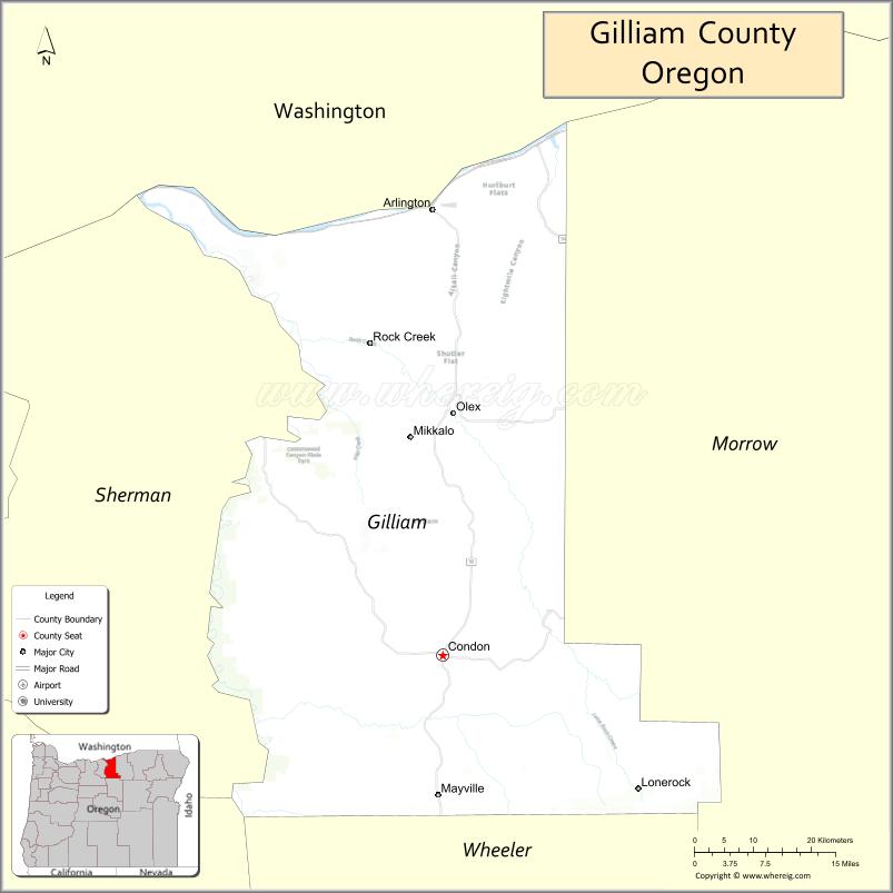
| Seat: | Condon |
| Largest city: | Condon |
| Total Area: | 1,223 sq mi (3,170 km²) |
| Land Area: | 1,205 sq mi (3,120 km²) |
| Total Population: | 1,995 |
| Population Density: | 1.6/sq mi (0.6/km²) |
| Website: | www.co.gilliam.or.us |
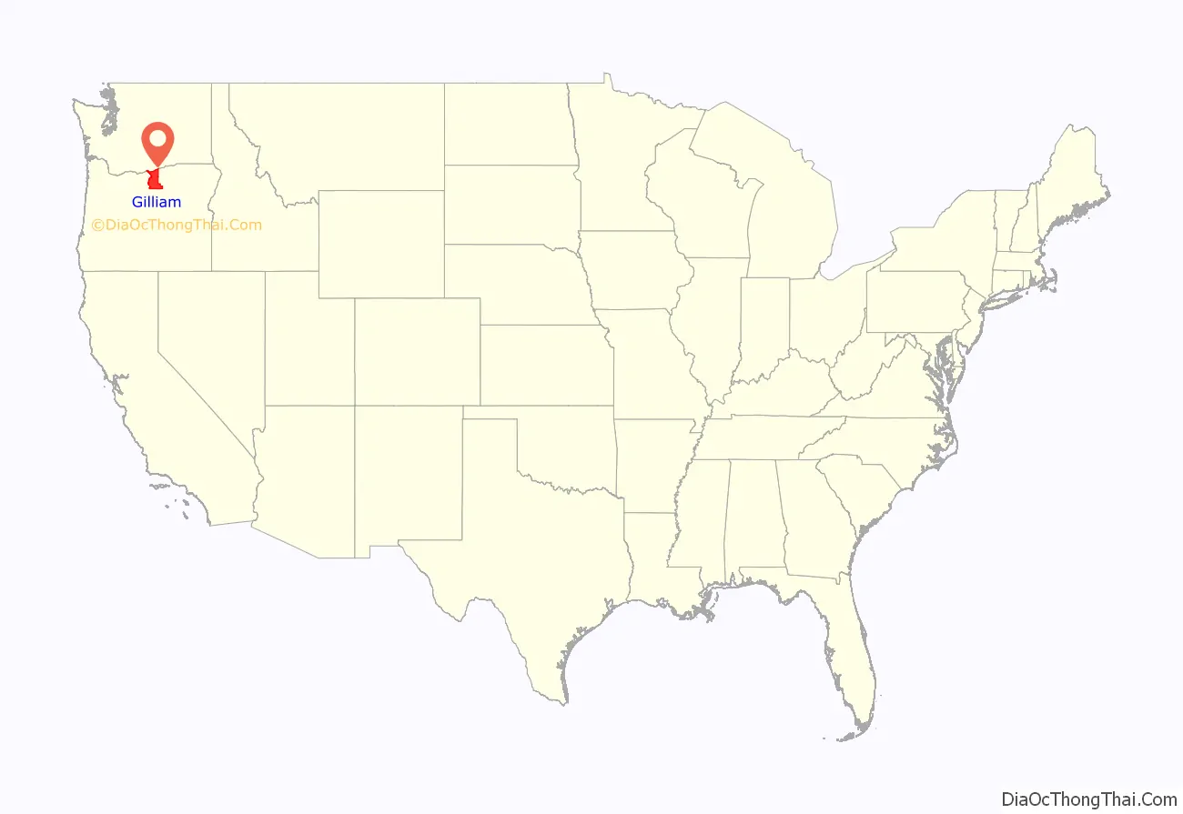
Gilliam County location map. Where is Gilliam County?
History
The Oregon Legislative Assembly created Gilliam County on February 25, 1885, from the eastern third of Wasco County after residents complained that they were too far from their county seat in The Dalles. The first Gilliam county seat was at Alkali, now Arlington. The question of a permanent county seat was placed on general election ballots in 1886, 1888, and again in 1890, when voters chose to move the county seat to Condon, known to early settlers as “Summit Springs.” Once the question of the location of the county seat was settled, voters in Gilliam County proved reluctant to provide a courthouse in Condon. The county government operated out of a two-room house until 1903, when the county court appropriated money to construct a courthouse. This courthouse burned down in 1954 and was replaced the following year with the current courthouse.
The Shepherds Flat Wind Farm, an 845 megawatt (MW) wind farm, began construction near Arlington in 2009, shortly after approval by state regulators. The wind farm was being built by Caithness Energy using General Electric (GE) 2.5 MW wind turbines, and it will supply electricity to Southern California Edison. In April, 2011, Google announced they had invested $100 million in the project. The wind farm was estimated to have an economic impact of $16 million annually for Oregon.
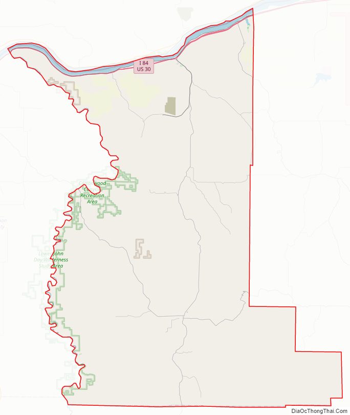
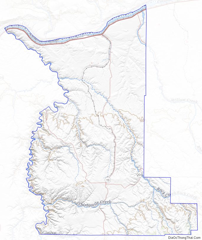
Gilliam County Road Map
Geography
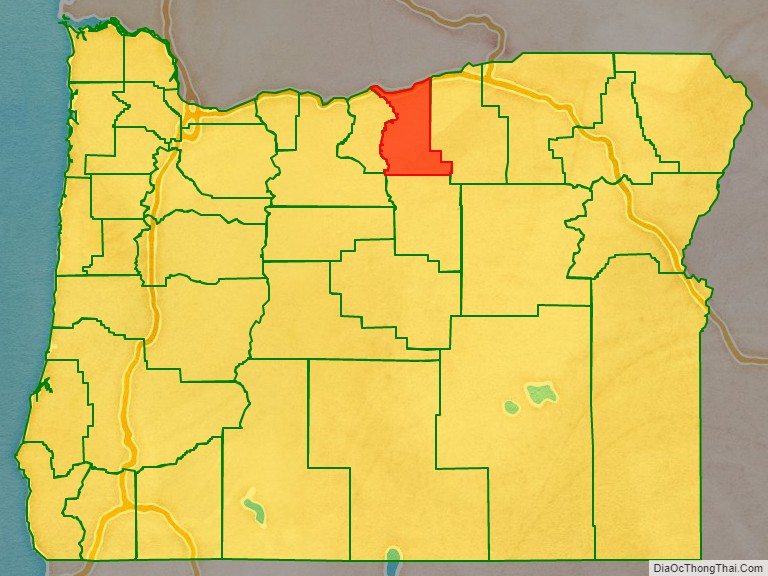
Gilliam County is located in the central northern part of Oregon, east of the Cascade Range. While its southern and eastern borders are defined by its neighboring counties, its western border is defined by the John Day River and its northern border is defined by the Columbia River. Most of the county is mostly flat, but contains various canyons created by streams from the Blue Mountains.
According to the United States Census Bureau, the county has a total area of 1,223 square miles (3,170 km), of which 1,205 square miles (3,120 km) is land and 18 square miles (47 km) (1.5%) is water.
Adjacent counties
- Klickitat County, Washington – north
- Morrow County – east
- Wheeler County – south
- Wasco County – southwest
- Sherman County – west
Gilliam County Topographic Map
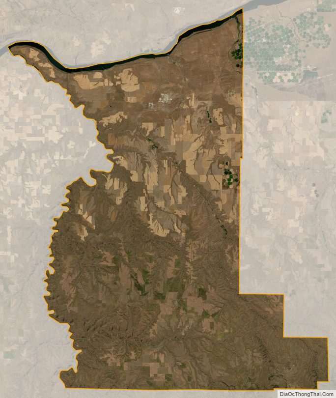
Gilliam County Satellite Map
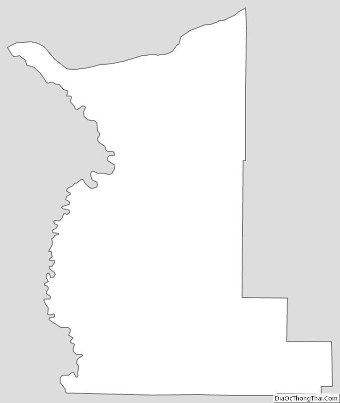
Gilliam County Outline Map
See also
Map of Oregon State and its subdivision: Map of other states:- Alabama
- Alaska
- Arizona
- Arkansas
- California
- Colorado
- Connecticut
- Delaware
- District of Columbia
- Florida
- Georgia
- Hawaii
- Idaho
- Illinois
- Indiana
- Iowa
- Kansas
- Kentucky
- Louisiana
- Maine
- Maryland
- Massachusetts
- Michigan
- Minnesota
- Mississippi
- Missouri
- Montana
- Nebraska
- Nevada
- New Hampshire
- New Jersey
- New Mexico
- New York
- North Carolina
- North Dakota
- Ohio
- Oklahoma
- Oregon
- Pennsylvania
- Rhode Island
- South Carolina
- South Dakota
- Tennessee
- Texas
- Utah
- Vermont
- Virginia
- Washington
- West Virginia
- Wisconsin
- Wyoming