Angoon (sometimes formerly spelled Angun, Tlingit: Aangóon) is a city on Admiralty Island in Hoonah-Angoon Census Area, Alaska, United States. At the 2000 census the population was 572; by the 2010 census the population had declined to 459. The name in Tlingit, Aangóon, means roughly “isthmus town.”
| Name: | Angoon city |
|---|---|
| LSAD Code: | 25 |
| LSAD Description: | city (suffix) |
| State: | Alaska |
| County: | Hoonah-Angoon Census Area |
| Incorporated: | May 7, 1963 |
| Elevation: | 23 ft (7 m) |
| Total Area: | 38.97 sq mi (100.93 km²) |
| Land Area: | 24.53 sq mi (63.54 km²) |
| Water Area: | 14.44 sq mi (37.39 km²) |
| Total Population: | 357 |
| Population Density: | 14.55/sq mi (5.62/km²) |
| ZIP code: | 99820 |
| Area code: | 907 |
| FIPS code: | 0203440 |
| GNISfeature ID: | 1420113 |
Online Interactive Map
Click on ![]() to view map in "full screen" mode.
to view map in "full screen" mode.
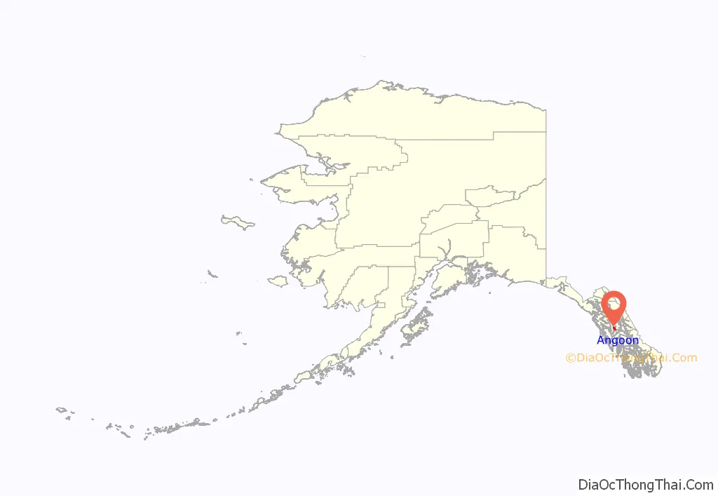
Angoon location map. Where is Angoon city?
History
Admiralty Island has long been the home of the Kootznoowoo Tlingit group, or Xootsnoowú Ḵwáan in Tlingit. Kootznoowoo means “fortress of brown bears”, literally xoots-noow-ú “brown.bear-fortress-possessive”. Angoon has a less-rainy climate than most of southeastern Alaska and was valued by the Tlingit for that reason.
During the Russian period in Alaska, from the 18th century to the mid-19th century, maritime fur trading was a major economic activity in the area.
In 1878, after the 1867 Alaska Purchase, the North West Trading Company established a trading post and whaling station on nearby Killisnoo Island and employed Angoon villagers to hunt whales. Whaling, a school, and a Russian Orthodox church attracted many Tlingits to neighboring Killisnoo.
In October 1882 of the village was destroyed in the Angoon Bombardment by US Naval forces under the command Commander Edgar C. Merriman and the USRC Thomas Corwin under the command of Michael A. Healy. The Tlingit villagers had taken white hostages and property and demanded two hundred blankets in compensation from the North West Trading Company following the accidental death of a Tlingit shaman who died in a whaling bomb accident while working on the whaler. The hostages were released upon the arrival of the naval expedition to Angoon, however Merriman demanded four hundred blankets in tribute and upon the Tlingit delivery of just eighty one blankets, Merriman’s forces destroyed the village.
After a short time, the North West Trading Company switched to herring processing. During this time, many Tlingits moved to Killisnoo for employment at the fish plant. In 1928, Killisnoo was destroyed by fire and many Tlingits returned to Angoon.
In 1973, Angoon won a U.S. $90,000 settlement from the United States government for the 1882 bombardment.
Angoon Road Map
Angoon city Satellite Map
Geography
Angoon is located on the west side of Admiralty Island at 57°29′49″N 134°34′25″W / 57.49694°N 134.57361°W / 57.49694; -134.57361 (57.496891, -134.573579). It is the largest permanent settlement on Admiralty Island and is sited on an isthmus at the mouth of Kootznahoo Inlet on the west side of the island. It is 60 miles (97 km) southwest of Juneau. The only other community on the island is Cube Cove, to the north.
According to the United States Census Bureau, the city has a total area of 38.8 square miles (100.4 km), of which 24.4 square miles (63.2 km) are land and 14.4 square miles (37.2 km), or 37.04%, are water.
Climate
The climate is either an oceanic climate (Köppen climate classification: Cfb), when utilising the −3 °C or 26.6 °F isotherm or a warm-summer humid continental climate (Köppen climate classification: Dfb), when utilising the 0 °C or 32 °F isotherm. Its climate moderately tempered by the Alaska Current is only slightly more extreme than the north of Scotland.
See also
Map of Alaska State and its subdivision:- Aleutians East
- Aleutians West
- Anchorage
- Bethel
- Bristol Bay
- Denali
- Dillingham
- Fairbanks North Star
- Haines
- Juneau
- Kenai Peninsula
- Ketchikan Gateway
- Kodiak Island
- Lake and Peninsula
- Matanuska-Susitna
- Nome
- North Slope
- Northwest Arctic
- Prince of Wales-Outer Ketchi
- Sitka
- Skagway-Yakutat-Angoon
- Southeast Fairbanks
- Valdez-Cordova
- Wade Hampton
- Wrangell-Petersburg
- Yukon-Koyukuk
- Alabama
- Alaska
- Arizona
- Arkansas
- California
- Colorado
- Connecticut
- Delaware
- District of Columbia
- Florida
- Georgia
- Hawaii
- Idaho
- Illinois
- Indiana
- Iowa
- Kansas
- Kentucky
- Louisiana
- Maine
- Maryland
- Massachusetts
- Michigan
- Minnesota
- Mississippi
- Missouri
- Montana
- Nebraska
- Nevada
- New Hampshire
- New Jersey
- New Mexico
- New York
- North Carolina
- North Dakota
- Ohio
- Oklahoma
- Oregon
- Pennsylvania
- Rhode Island
- South Carolina
- South Dakota
- Tennessee
- Texas
- Utah
- Vermont
- Virginia
- Washington
- West Virginia
- Wisconsin
- Wyoming


