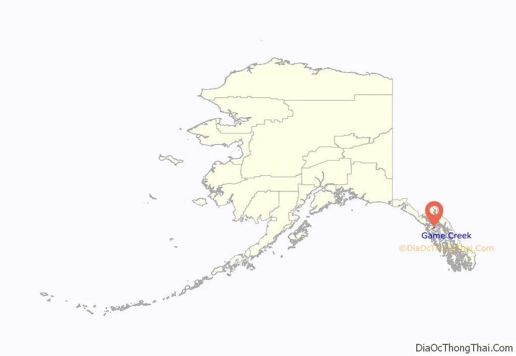
Game Creek (Lingít: Xutshéeni) is a census-designated place (CDP) on Chichagof Island in Hoonah-Angoon Census Area, Alaska, United States. The population was 18 at the 2010 census, down from 35 at the 2000 census.
| Name: | Game Creek CDP |
|---|---|
| LSAD Code: | 57 |
| LSAD Description: | CDP (suffix) |
| State: | Alaska |
| County: | Hoonah-Angoon Census Area |
| Elevation: | 548 ft (167 m) |
| Total Area: | 5.95 sq mi (15.42 km²) |
| Land Area: | 5.89 sq mi (15.26 km²) |
| Water Area: | 0.06 sq mi (0.16 km²) |
| Total Population: | 23 |
| Population Density: | 3.90/sq mi (1.51/km²) |
| Area code: | 907 |
| FIPS code: | 0227700 |
| GNISfeature ID: | 1866948 |
Online Interactive Map
Click on ![]() to view map in "full screen" mode.
to view map in "full screen" mode.
Game Creek location map. Where is Game Creek CDP?
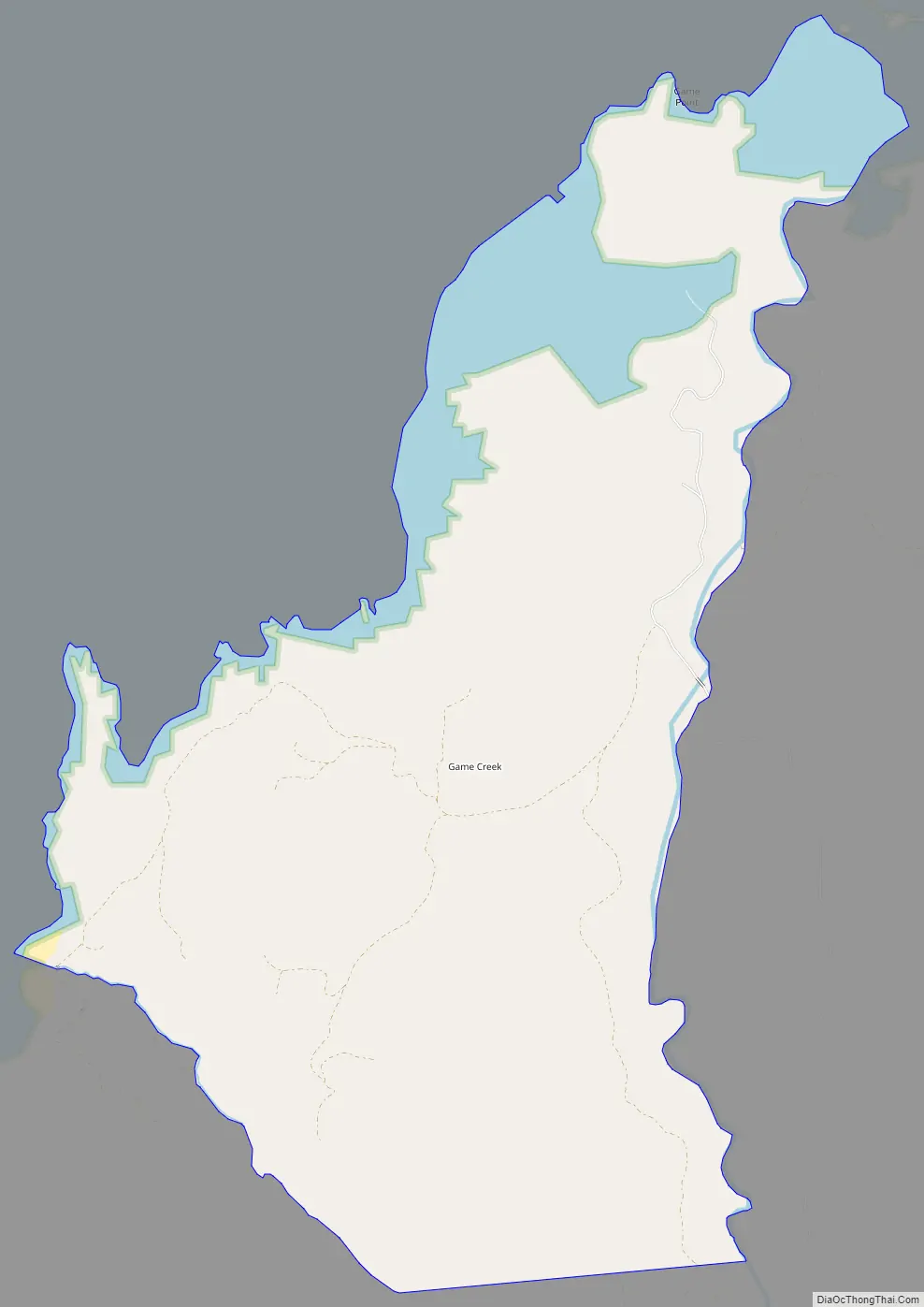
Game Creek Road Map
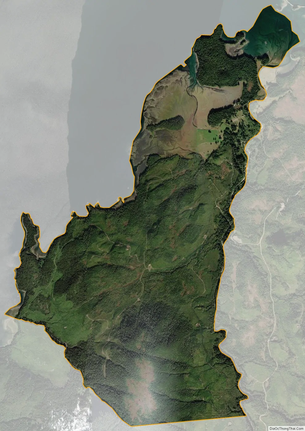
Game Creek city Satellite Map
Geography
Game Creek is located on the northern side of Chichagof Island at 58°3′31″N 135°30′47″W / 58.05861°N 135.51306°W / 58.05861; -135.51306 (58.058694, -135.513082). It lies just southwest of the community of Whitestone Logging Camp and the city of Hoonah. The CDP limits follow the shoreline of Port Frederick on the northwest as far south as Burnt Point. Game Creek, the waterway, forms the eastern edge of the CDP as far north as its mouth in Port Frederick, and the southern limit extends from Burnt Point to Game Creek across an intervening 2,760-foot (840 m) summit.
According to the United States Census Bureau, the CDP has a total area of 5.95 square miles (15.42 km), of which 5.89 square miles (15.26 km) are land and 0.062 square miles (0.16 km), or 1.03%, are water.
See also
Map of Alaska State and its subdivision:- Aleutians East
- Aleutians West
- Anchorage
- Bethel
- Bristol Bay
- Denali
- Dillingham
- Fairbanks North Star
- Haines
- Juneau
- Kenai Peninsula
- Ketchikan Gateway
- Kodiak Island
- Lake and Peninsula
- Matanuska-Susitna
- Nome
- North Slope
- Northwest Arctic
- Prince of Wales-Outer Ketchi
- Sitka
- Skagway-Yakutat-Angoon
- Southeast Fairbanks
- Valdez-Cordova
- Wade Hampton
- Wrangell-Petersburg
- Yukon-Koyukuk
- Alabama
- Alaska
- Arizona
- Arkansas
- California
- Colorado
- Connecticut
- Delaware
- District of Columbia
- Florida
- Georgia
- Hawaii
- Idaho
- Illinois
- Indiana
- Iowa
- Kansas
- Kentucky
- Louisiana
- Maine
- Maryland
- Massachusetts
- Michigan
- Minnesota
- Mississippi
- Missouri
- Montana
- Nebraska
- Nevada
- New Hampshire
- New Jersey
- New Mexico
- New York
- North Carolina
- North Dakota
- Ohio
- Oklahoma
- Oregon
- Pennsylvania
- Rhode Island
- South Carolina
- South Dakota
- Tennessee
- Texas
- Utah
- Vermont
- Virginia
- Washington
- West Virginia
- Wisconsin
- Wyoming