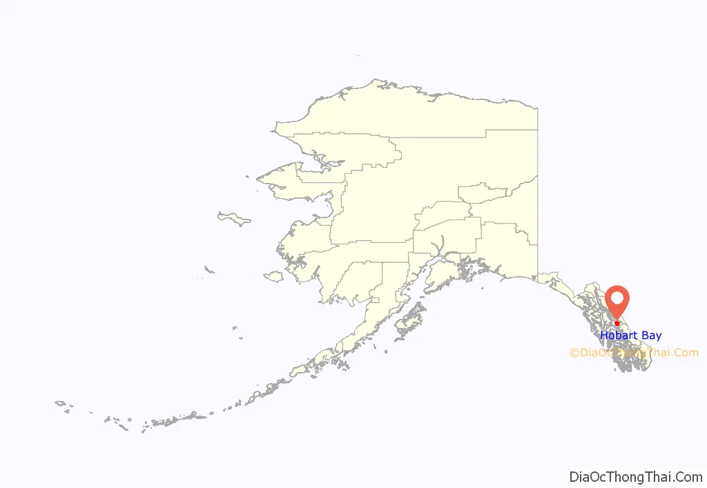
Hobart Bay is a census-designated place that was located in Hoonah-Angoon Census Area, Alaska during the 2010 United States Census, but is now part of Petersburg Borough. As of the 2010 Census, the population of the CDP was one, down from three in 2000.
The bay was named in 1889 by Lieutenant Commander Mansfield of the United States Navy. The site was first settled as a logging camp. The population has declined in recent years. Nevertheless, on January 3, 2013, Hobart Bay and a sizable portion of the Hoonah-Angoon Census Area around it were incorporated into the new Petersburg Borough, which has the city of Petersburg as its economic center and is composed primarily of land from the former Petersburg Census Area.
| Name: | Hobart Bay CDP |
|---|---|
| LSAD Code: | 57 |
| LSAD Description: | CDP (suffix) |
| State: | Alaska |
| County: | Hoonah-Angoon Census Area |
| Elevation: | 1,184 ft (361 m) |
| Total Area: | 129.00 sq mi (334.10 km²) |
| Land Area: | 119.43 sq mi (309.31 km²) |
| Water Area: | 9.57 sq mi (24.79 km²) |
| Total Population: | 1 |
| Population Density: | 0.01/sq mi (0.00/km²) |
| Area code: | 907 |
| FIPS code: | 0232550 |
| GNISfeature ID: | 1866951 |
Online Interactive Map
Click on ![]() to view map in "full screen" mode.
to view map in "full screen" mode.
Hobart Bay location map. Where is Hobart Bay CDP?
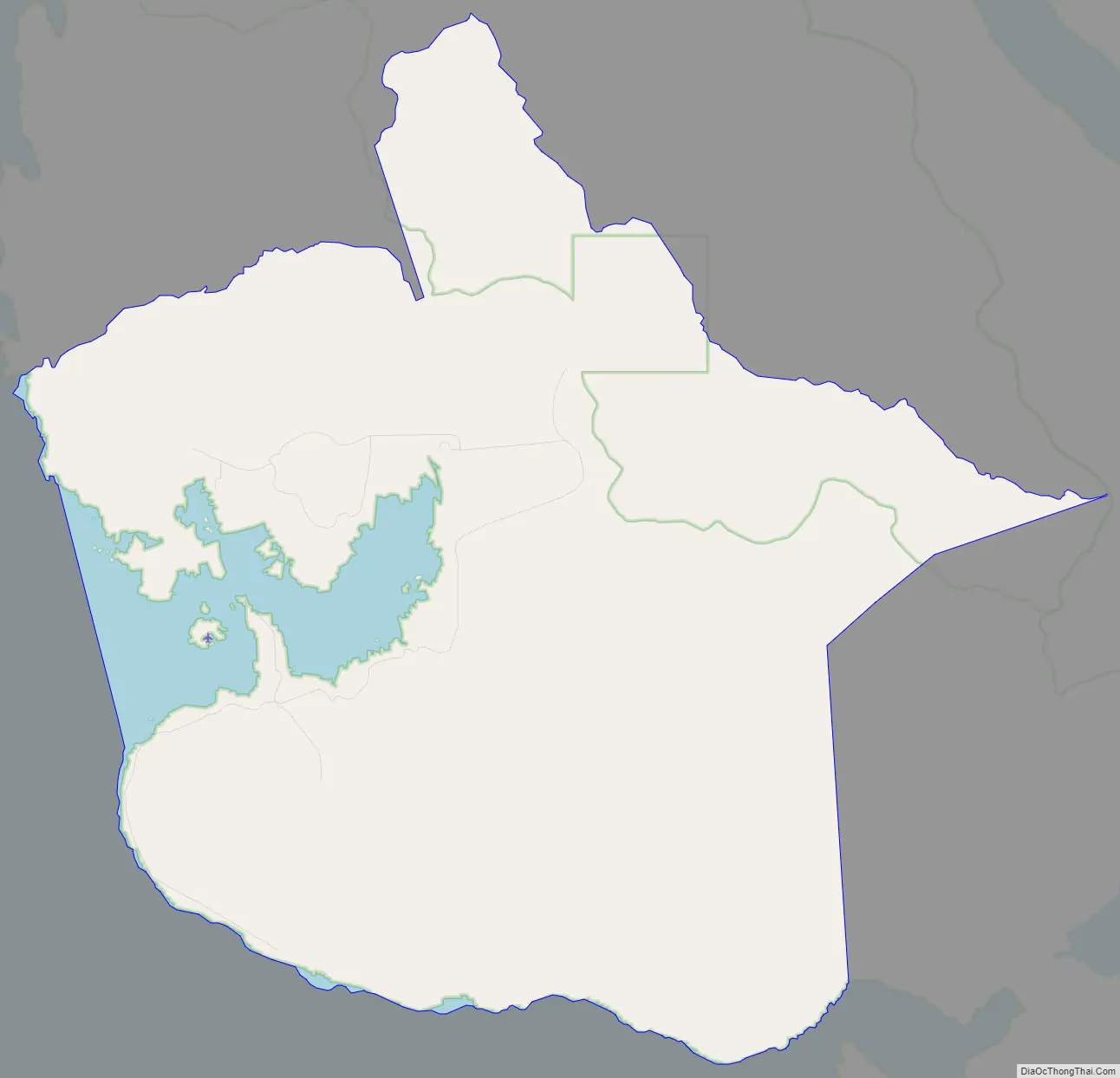
Hobart Bay Road Map
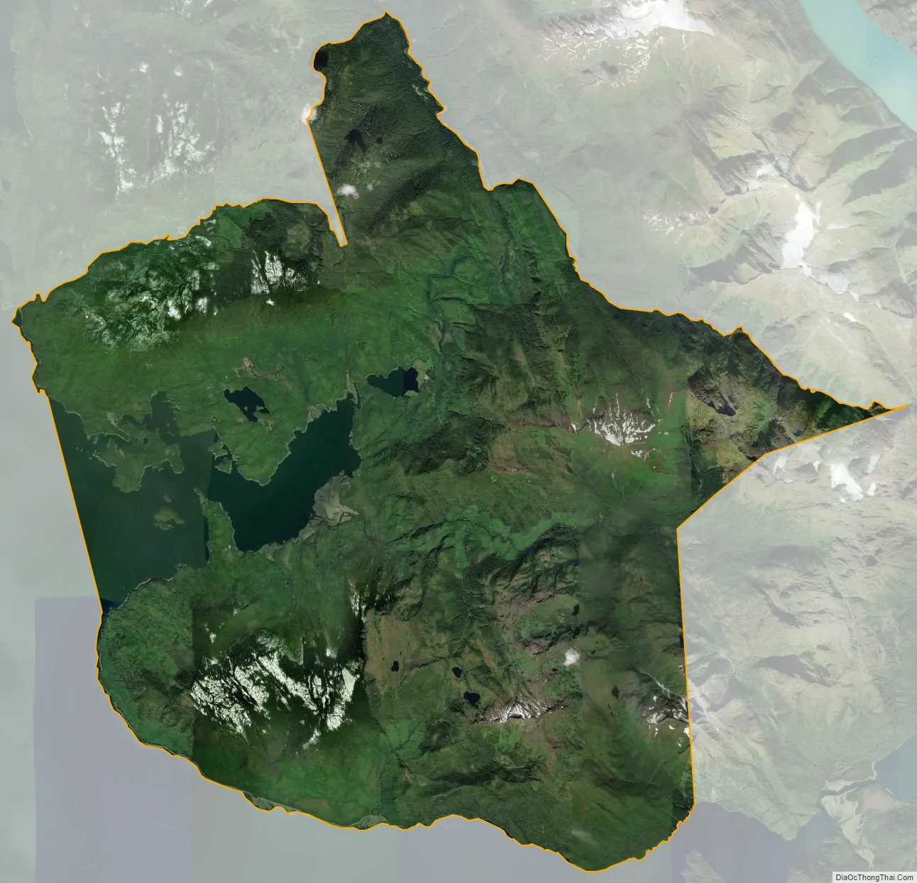
Hobart Bay city Satellite Map
Geography
Hobart Bay is located at 57°27’11” North, 133°23’36” West (57.453007, -133.393308).
According to the United States Census Bureau, the CDP has a total area of 129.8 square miles (336 km), of which, 117.4 square miles (304 km) of it is land and 12.4 square miles (32 km) of it is water. The total area is 9.54% water.
See also
Map of Alaska State and its subdivision:- Aleutians East
- Aleutians West
- Anchorage
- Bethel
- Bristol Bay
- Denali
- Dillingham
- Fairbanks North Star
- Haines
- Juneau
- Kenai Peninsula
- Ketchikan Gateway
- Kodiak Island
- Lake and Peninsula
- Matanuska-Susitna
- Nome
- North Slope
- Northwest Arctic
- Prince of Wales-Outer Ketchi
- Sitka
- Skagway-Yakutat-Angoon
- Southeast Fairbanks
- Valdez-Cordova
- Wade Hampton
- Wrangell-Petersburg
- Yukon-Koyukuk
- Alabama
- Alaska
- Arizona
- Arkansas
- California
- Colorado
- Connecticut
- Delaware
- District of Columbia
- Florida
- Georgia
- Hawaii
- Idaho
- Illinois
- Indiana
- Iowa
- Kansas
- Kentucky
- Louisiana
- Maine
- Maryland
- Massachusetts
- Michigan
- Minnesota
- Mississippi
- Missouri
- Montana
- Nebraska
- Nevada
- New Hampshire
- New Jersey
- New Mexico
- New York
- North Carolina
- North Dakota
- Ohio
- Oklahoma
- Oregon
- Pennsylvania
- Rhode Island
- South Carolina
- South Dakota
- Tennessee
- Texas
- Utah
- Vermont
- Virginia
- Washington
- West Virginia
- Wisconsin
- Wyoming