Hoonah (Tlingit: Xunaa or Gaaw Yat’aḵ Aan) is a largely Tlingit community on Chichagof Island, located in Alaska‘s panhandle in the southeast region of the state. It is 30 miles (48 km) west of Juneau, across the Alaskan Inside Passage. Hoonah is the only first-class city on Chichagof Island, the 109th-largest island in the world and the 5th-largest island in the U.S. At the 2020 census the population was 931, up from 760 in 2010. In the summer the population can swell to over 1,300 depending on fishing, boating, hiking and hunting conditions.
“Hoonah” became the official spelling in 1901, with establishment of the Hoonah branch of the United States Post Office. “Hoonah” is the approximate pronunciation of the Tlingit name Xunaa, which means “lee of the north wind”, i.e., protected from the north wind.
| Name: | Hoonah city |
|---|---|
| LSAD Code: | 25 |
| LSAD Description: | city (suffix) |
| State: | Alaska |
| County: | Hoonah-Angoon Census Area |
| Incorporated: | June 8, 1946 |
| Elevation: | 52 ft (16 m) |
| Total Area: | 7.13 sq mi (18.47 km²) |
| Land Area: | 5.87 sq mi (15.20 km²) |
| Water Area: | 1.26 sq mi (3.28 km²) |
| Total Population: | 931 |
| Population Density: | 130/sq mi (50/km²) |
| ZIP code: | 99829 |
| Area code: | 907 |
| FIPS code: | 0233360 |
| GNISfeature ID: | 1403488 |
| Website: | www.cityofhoonah.org |
Online Interactive Map
Click on ![]() to view map in "full screen" mode.
to view map in "full screen" mode.
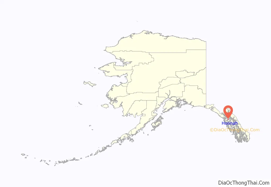
Hoonah location map. Where is Hoonah city?
History
The clans comprising the Huna Tlingit originally settled what is now Glacier Bay National Park as well as Icy Strait, Cross Sound, and the outer coast north to Sea Otter Creek. Two catastrophic events forced the Tlingit from their homeland; rapid glacial advance in Glacier Bay and a landslide-induced tsunami in Lituya Bay along the outer coast. Tlingit oral tradition recounts these events as well as the clans’ ultimate resettlement in Xunaa.
A partial timeline of modern Hoonah history is below:
- 1750s – Xunaa was settled by clans fleeing glacial advance in Glacier Bay.
- 1880 – The North West Trading Company built the first store in Hoonah.
- 1881 – The Presbyterian Home Mission and school was built.
- 1887 – 450 to 500 people were wintering in the village.
- 1901 – Hoonah post office was opened.
- 1912 – The Hoonah Packing Co. built a large cannery north of town. The cannery was shut down after decades of use and is now a tourist attraction at Icy Strait Point.
- 1934, 1936 – Hoonah Indian Association was constituted as a federally recognized tribe, authorized to act on behalf of the Huna Tlingit.
- 1944 – A fire destroyed much of Hoonah, including many priceless Tlingit cultural objects. The United States federal government assisted in rebuilding Hoonah.
- 1953 – Last year that Icy Strait Salmon Company operated as a full-fledged canning operation. From this point until 1999 the property functioned as a maintenance and support facility for the seine boat fishing fleet.
- 1964 – First graduating class from Hoonah High School, in May.
- 2001 – Groundbreaking ceremony for Icy Strait Point, at abandoned Hoonah Packing Company site.
- 2004 – Celebrity MV Mercury makes inaugural call at Icy Strait Point.
- 2007 – ZipRider! The world’s largest zipline opens at Icy Strait Point.
- 2010 – Alaska State Troopers assisted Hoonah police in a 2-day manhunt for a man who was reported to be armed in a wooded area in the city. He was later apprehended without incident.
- 2010 – A fire and subsequent series of explosions destroyed the Icy Strait Lumber Mill. No criminal activity was suspected in the fire.
- 2010 – Two police officers from the city were shot and killed in an ambush on Front Street. The suspect subsequently barricaded himself inside his own home on August 29, 2010. State, local and federal law enforcement officers and SWAT personnel from agencies throughout Alaska responded in the wake of the shooting. The suspect, John Marvin, was taken into custody the next day.
The town of Hoonah is featured on the Discovery Channel show Alaskan Bush People.
Education and schools
Sheldon Jackson established the first school house and teacher’s residence in November 1881. The school was initially overseen by Mr. and Mrs. Walter B. Styles of New York until their transfer to Sitka in 1882. The Reverend and Mrs. John McFarland assumed responsibility for the school in 1884, and by 1885 219 Tlingit students were enrolled: 69 boys, 76 girls and 74 adults. A territorial school and government school were built in 1923. In 1932 the government school was demolished and replaced by a Bureau of Indian Affairs school.
Hoonah City Schools currently serves the needs of Hoonah’s elementary and secondary students. Six graduating seniors made up the Hoonah City Schools class of 2015.
Hoonah Packing Company
The Hoonah Packing Company (“HPC”), built in 1912, was one of eight canneries operating in the area during the early twentieth century, representing Hoonah’s major industry at the time. HPC was sold several times until coming to be owned by Wards Cove Packing, which also owned Hoonah Trading. The cannery ceased operating in 1954, but continued to see use by commercial fishermen for storing and repairing their boats and gear.
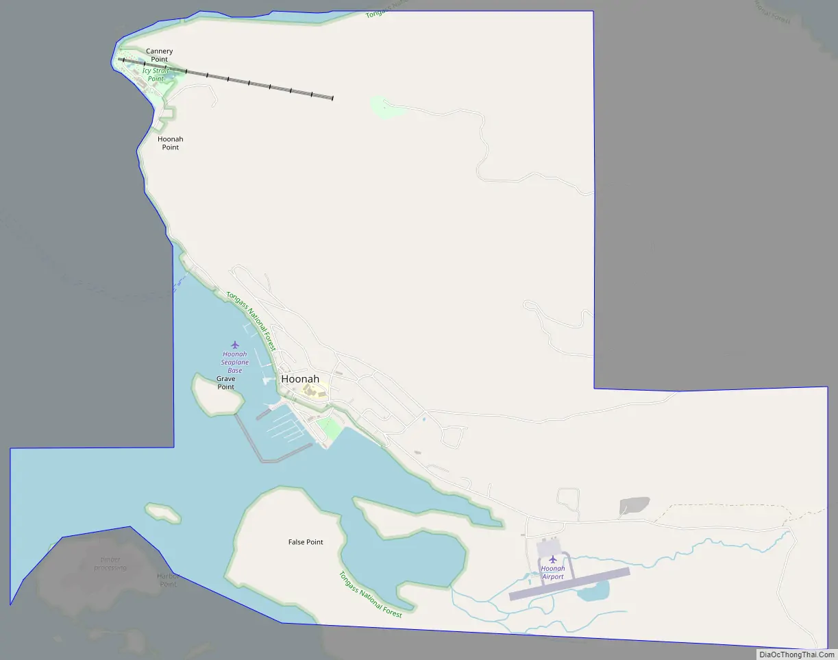
Hoonah Road Map
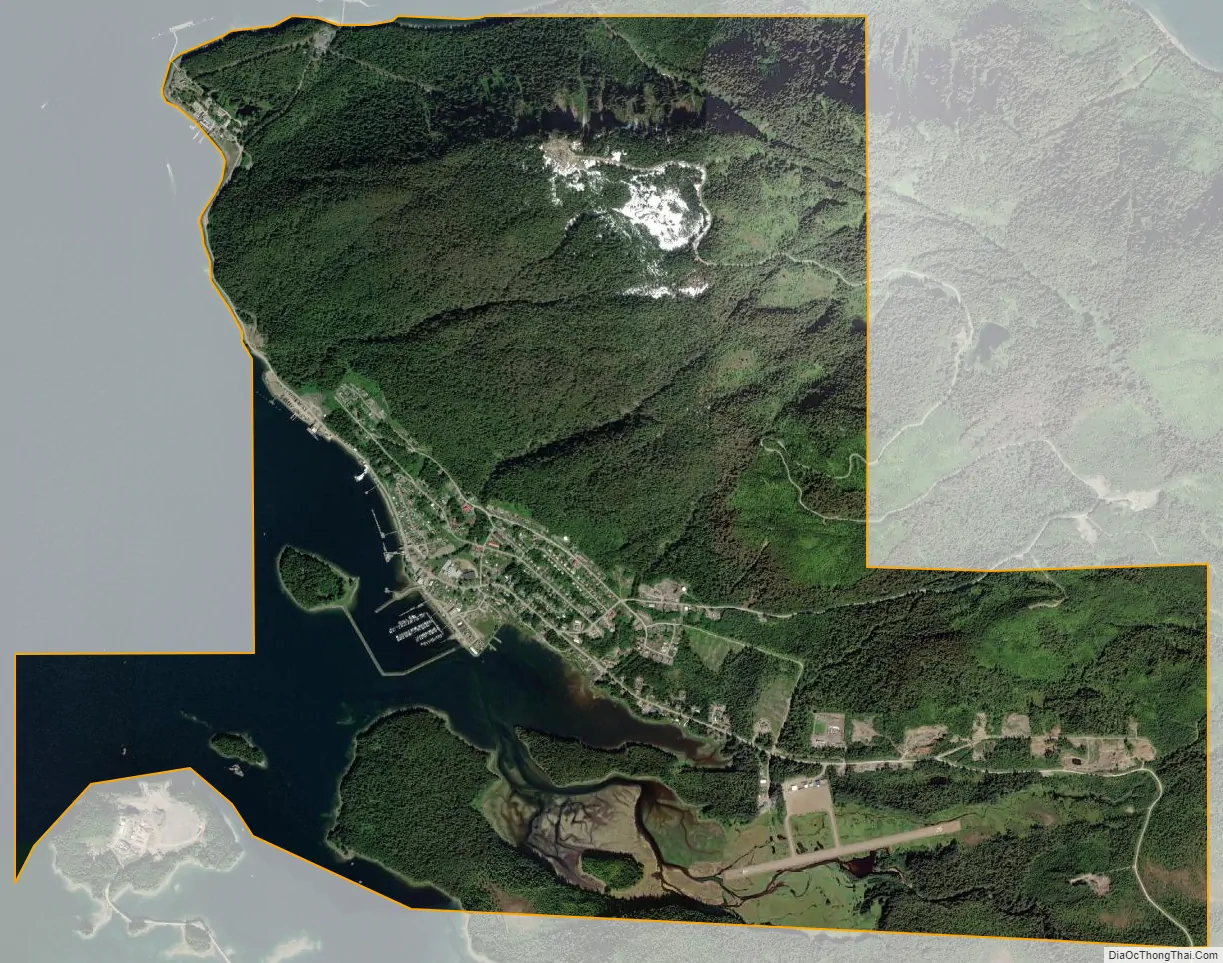
Hoonah city Satellite Map
Geography
Hoonah is on the north shore of Chichagof Island, on Icy Strait, at 58°6′34″N 135°26′11″W / 58.10944°N 135.43639°W / 58.10944; -135.43639 (58.109435, -135.436349). The communities of Whitestone Logging Camp (which was being dismantled in early 2011) and Game Creek just south of the city limits. The port at Hoonah is called Port Frederick. Other incorporated communities nearby on Chichagof Island include Tenakee Springs to the south and Pelican to the west. A study began in 2009 regarding the feasibility of a road from Hoonah to Pelican and possibly connecting to Tenakee Springs to allow an energy corridor to hot spring thermal energy sources in the region for Hoonah, to lower heating and energy costs. Most Tenakee residents expressed opposition to the road, while Pelican has generally supported the idea. The road would save the Alaska Department of Transportation ferry costs in summer snow-free months, by connecting these areas to Hoonah.
According to the United States Census Bureau, the city of Hoonah has a total area of 7.3 square miles (18.9 km), of which 6.0 square miles (15.6 km) are land and 1.3 square miles (3.3 km), or 17.59%, are water.
Tongass National Forest borders the area and has an unpaved road system of over 300 miles (480 km). Recreation areas include Game Creek, Kennel Creek, and Freshwater Bay which has a small boat harbor, all to the east; and Whitestone boat landing and False Bay recreation area to the southeast. These areas are inaccessible in winter due to deep snow.
See also
Map of Alaska State and its subdivision:- Aleutians East
- Aleutians West
- Anchorage
- Bethel
- Bristol Bay
- Denali
- Dillingham
- Fairbanks North Star
- Haines
- Juneau
- Kenai Peninsula
- Ketchikan Gateway
- Kodiak Island
- Lake and Peninsula
- Matanuska-Susitna
- Nome
- North Slope
- Northwest Arctic
- Prince of Wales-Outer Ketchi
- Sitka
- Skagway-Yakutat-Angoon
- Southeast Fairbanks
- Valdez-Cordova
- Wade Hampton
- Wrangell-Petersburg
- Yukon-Koyukuk
- Alabama
- Alaska
- Arizona
- Arkansas
- California
- Colorado
- Connecticut
- Delaware
- District of Columbia
- Florida
- Georgia
- Hawaii
- Idaho
- Illinois
- Indiana
- Iowa
- Kansas
- Kentucky
- Louisiana
- Maine
- Maryland
- Massachusetts
- Michigan
- Minnesota
- Mississippi
- Missouri
- Montana
- Nebraska
- Nevada
- New Hampshire
- New Jersey
- New Mexico
- New York
- North Carolina
- North Dakota
- Ohio
- Oklahoma
- Oregon
- Pennsylvania
- Rhode Island
- South Carolina
- South Dakota
- Tennessee
- Texas
- Utah
- Vermont
- Virginia
- Washington
- West Virginia
- Wisconsin
- Wyoming