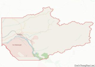
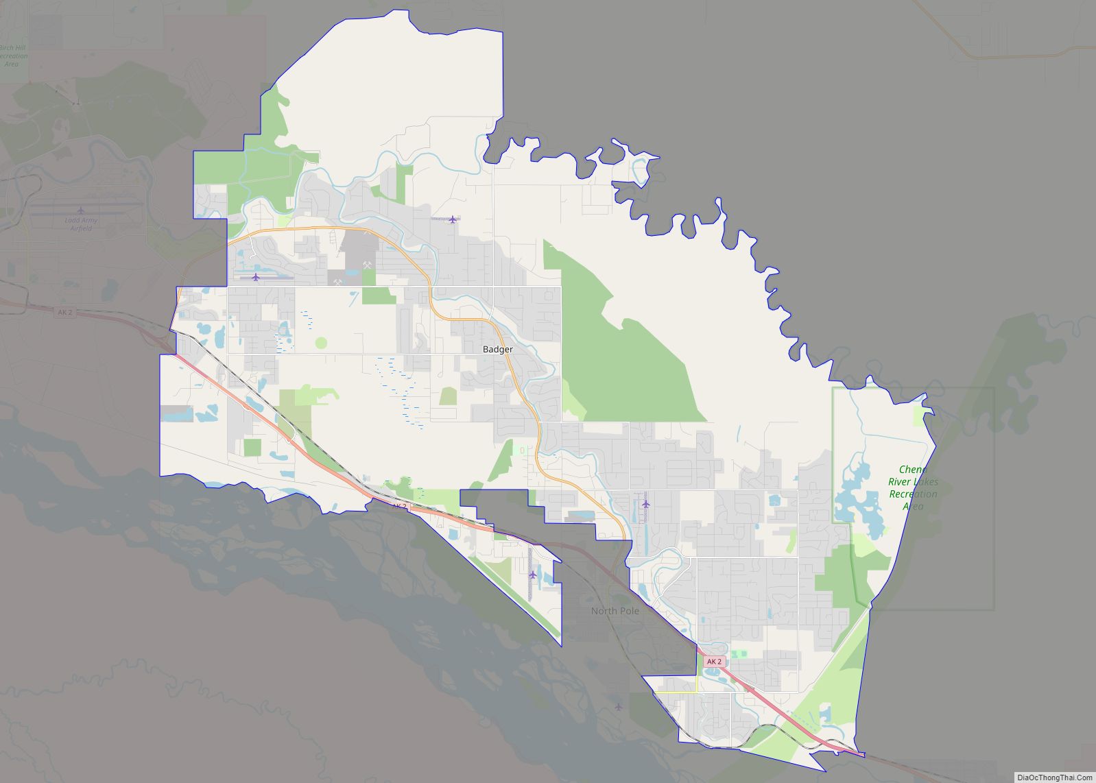
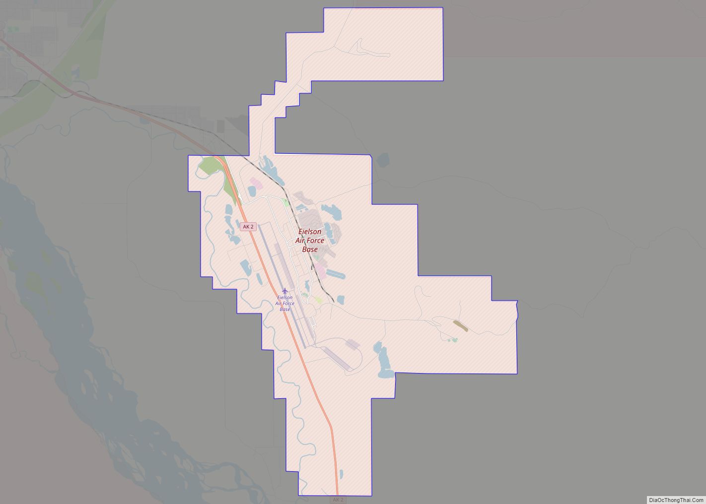
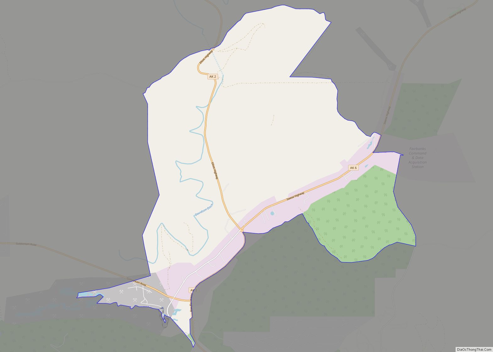
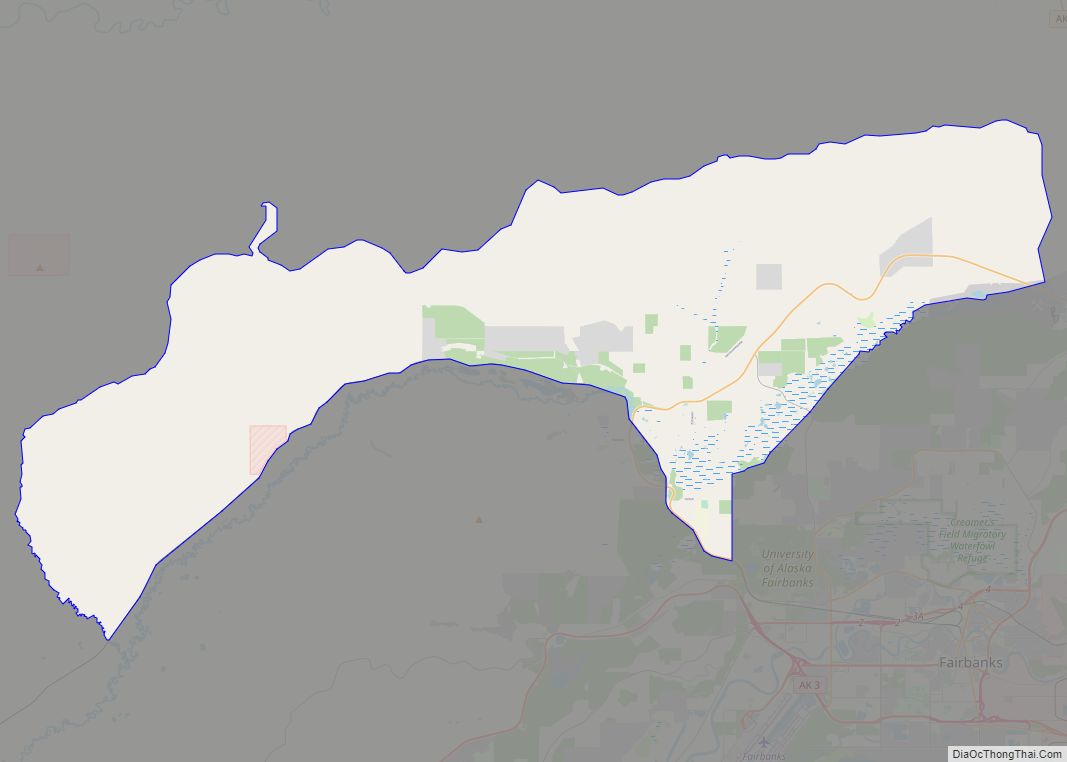
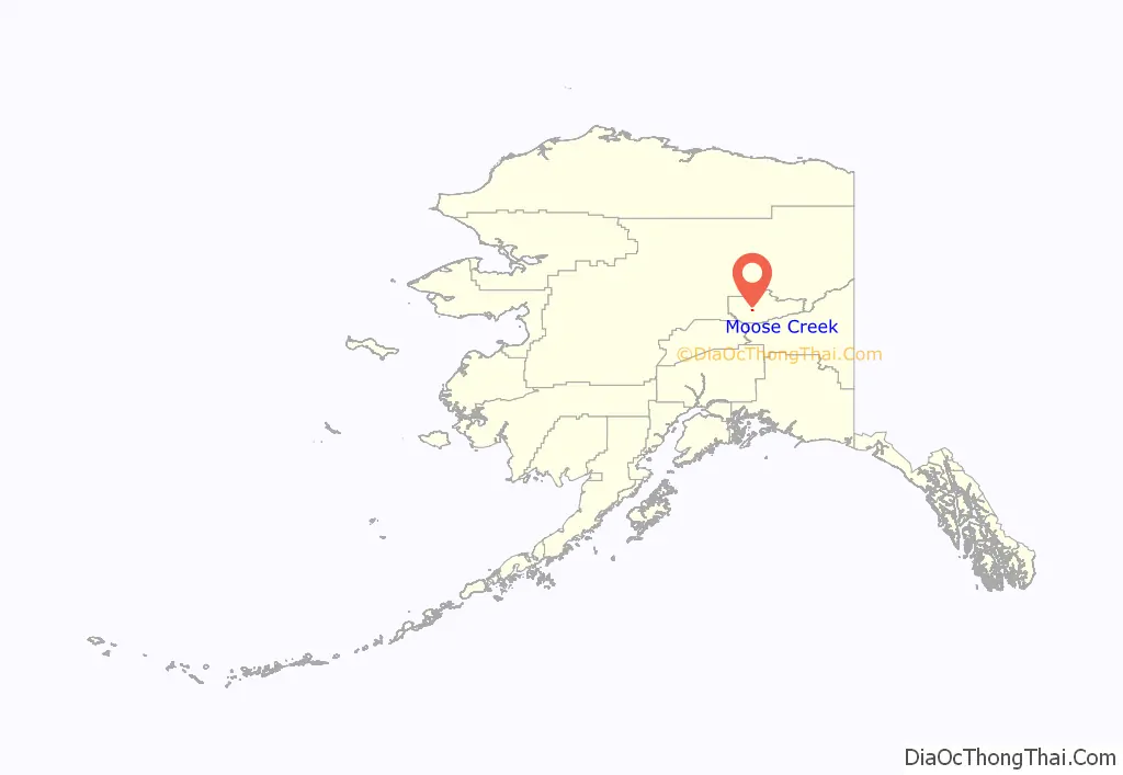
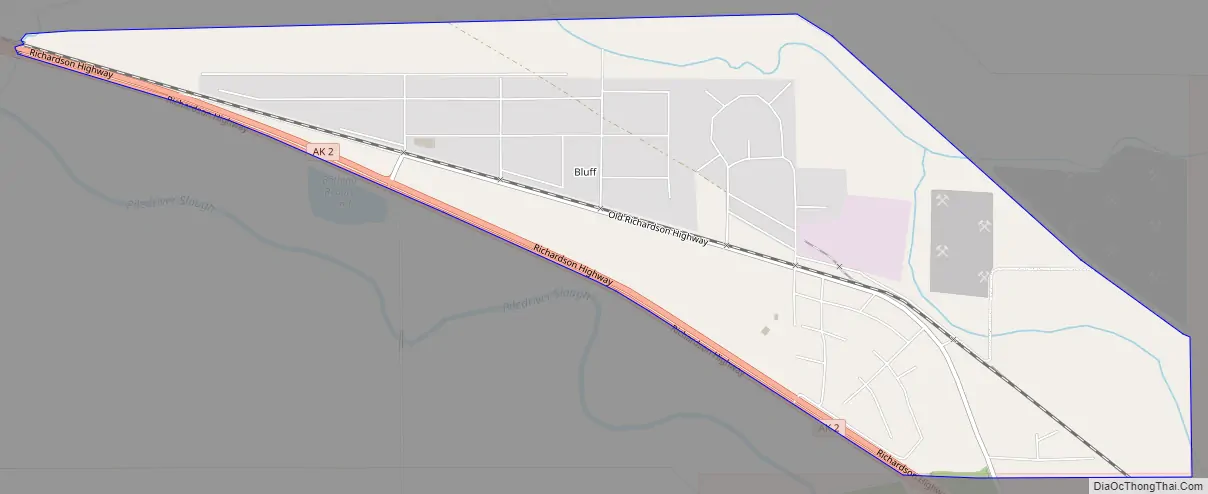
Moose Creek is a census-designated place (CDP) in Fairbanks North Star Borough in the U.S. state of Alaska. As of the 2010 census, the population of the CDP was 747, up from 542 in 2000. It is part of the ‘Fairbanks, Alaska Metropolitan Statistical Area’. Moose Creek is located south of Fairbanks, Alaska along the Richardson Highway. Moose Creek is bordered by Eielson Air Force Base to the south, the Tanana River to the west, and the Chena River Flood Control Project to the north.
| Name: | Moose Creek CDP |
|---|---|
| LSAD Code: | 57 |
| LSAD Description: | CDP (suffix) |
| State: | Alaska |
| County: | Fairbanks North Star Borough |
| Elevation: | 522 ft (159 m) |
| Total Area: | 1.65 sq mi (4.27 km²) |
| Land Area: | 1.54 sq mi (3.99 km²) |
| Water Area: | 0.11 sq mi (0.28 km²) |
| Total Population: | 534 |
| Population Density: | 346.53/sq mi (133.77/km²) |
| ZIP code: | 99705 |
| Area code: | 907 |
| FIPS code: | 0250080 |
| GNISfeature ID: | 1406548 |
Online Interactive Map
Click on ![]() to view map in "full screen" mode.
to view map in "full screen" mode.
Moose Creek location map. Where is Moose Creek CDP?
Moose Creek Road Map
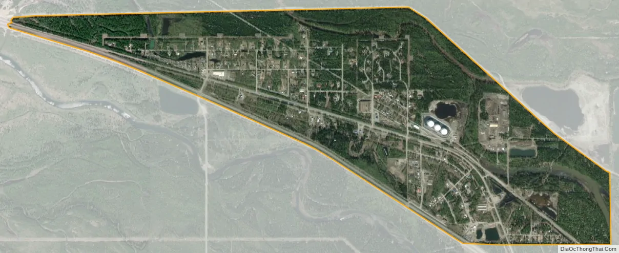
Moose Creek city Satellite Map
Geography
Moose Creek is located at 64°42′45″N 147°9′40″W / 64.71250°N 147.16111°W / 64.71250; -147.16111 (64.712474, -147.161128).
According to the United States Census Bureau, the CDP has a total area of 1.7 square miles (4.4 km), of which, 1.6 square miles (4.1 km) of it is land and 0.1 square miles (0.26 km) of it (6.51%) is water. It is located beside the Moose Creek Bluff, which is a medium size hill with a rocky cliff facing the Richardson Highway.
See also
Map of Alaska State and its subdivision:- Aleutians East
- Aleutians West
- Anchorage
- Bethel
- Bristol Bay
- Denali
- Dillingham
- Fairbanks North Star
- Haines
- Juneau
- Kenai Peninsula
- Ketchikan Gateway
- Kodiak Island
- Lake and Peninsula
- Matanuska-Susitna
- Nome
- North Slope
- Northwest Arctic
- Prince of Wales-Outer Ketchi
- Sitka
- Skagway-Yakutat-Angoon
- Southeast Fairbanks
- Valdez-Cordova
- Wade Hampton
- Wrangell-Petersburg
- Yukon-Koyukuk
- Alabama
- Alaska
- Arizona
- Arkansas
- California
- Colorado
- Connecticut
- Delaware
- District of Columbia
- Florida
- Georgia
- Hawaii
- Idaho
- Illinois
- Indiana
- Iowa
- Kansas
- Kentucky
- Louisiana
- Maine
- Maryland
- Massachusetts
- Michigan
- Minnesota
- Mississippi
- Missouri
- Montana
- Nebraska
- Nevada
- New Hampshire
- New Jersey
- New Mexico
- New York
- North Carolina
- North Dakota
- Ohio
- Oklahoma
- Oregon
- Pennsylvania
- Rhode Island
- South Carolina
- South Dakota
- Tennessee
- Texas
- Utah
- Vermont
- Virginia
- Washington
- West Virginia
- Wisconsin
- Wyoming