Claypool (Western Apache: Goshtłʼish Tú) is a census-designated place (CDP) in Gila County, Arizona, United States. The population was 1,538 at the 2010 census, down from 1,794 at the 2000 census. It was named after W. D. Claypool, a member of both the State House of Representatives and State Senate in the 1910s and 1920s.
| Name: | Claypool CDP |
|---|---|
| LSAD Code: | 57 |
| LSAD Description: | CDP (suffix) |
| State: | Arizona |
| County: | Gila County |
| Elevation: | 3,327 ft (1,014 m) |
| Total Area: | 1.27 sq mi (3.29 km²) |
| Land Area: | 1.27 sq mi (3.29 km²) |
| Water Area: | 0.00 sq mi (0.00 km²) |
| Total Population: | 1,395 |
| Population Density: | 1,096.70/sq mi (423.60/km²) |
| ZIP code: | 85532 |
| Area code: | 928 |
| FIPS code: | 0413960 |
| GNISfeature ID: | 27695 |
Online Interactive Map
Click on ![]() to view map in "full screen" mode.
to view map in "full screen" mode.
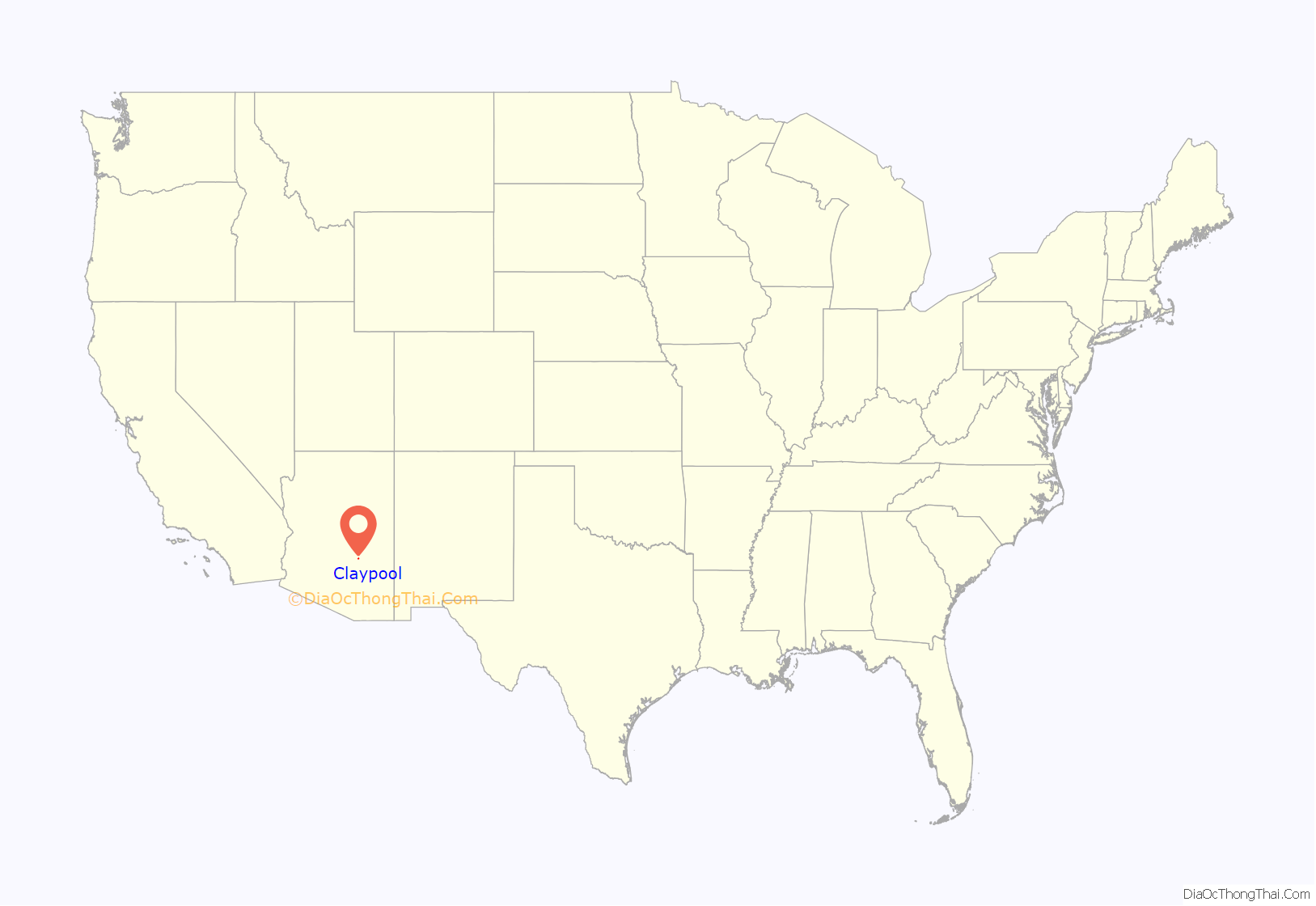
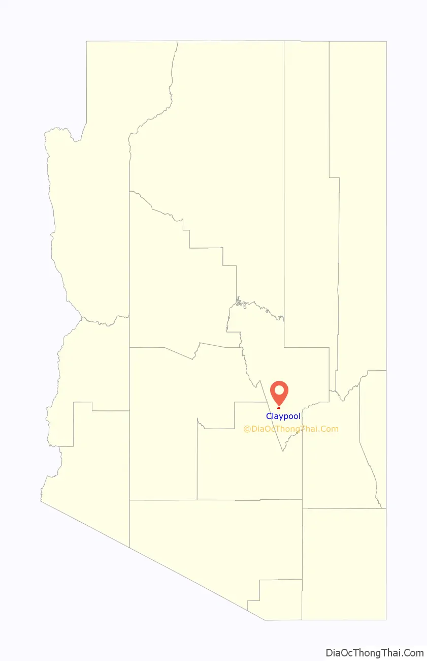
Claypool location map. Where is Claypool CDP?
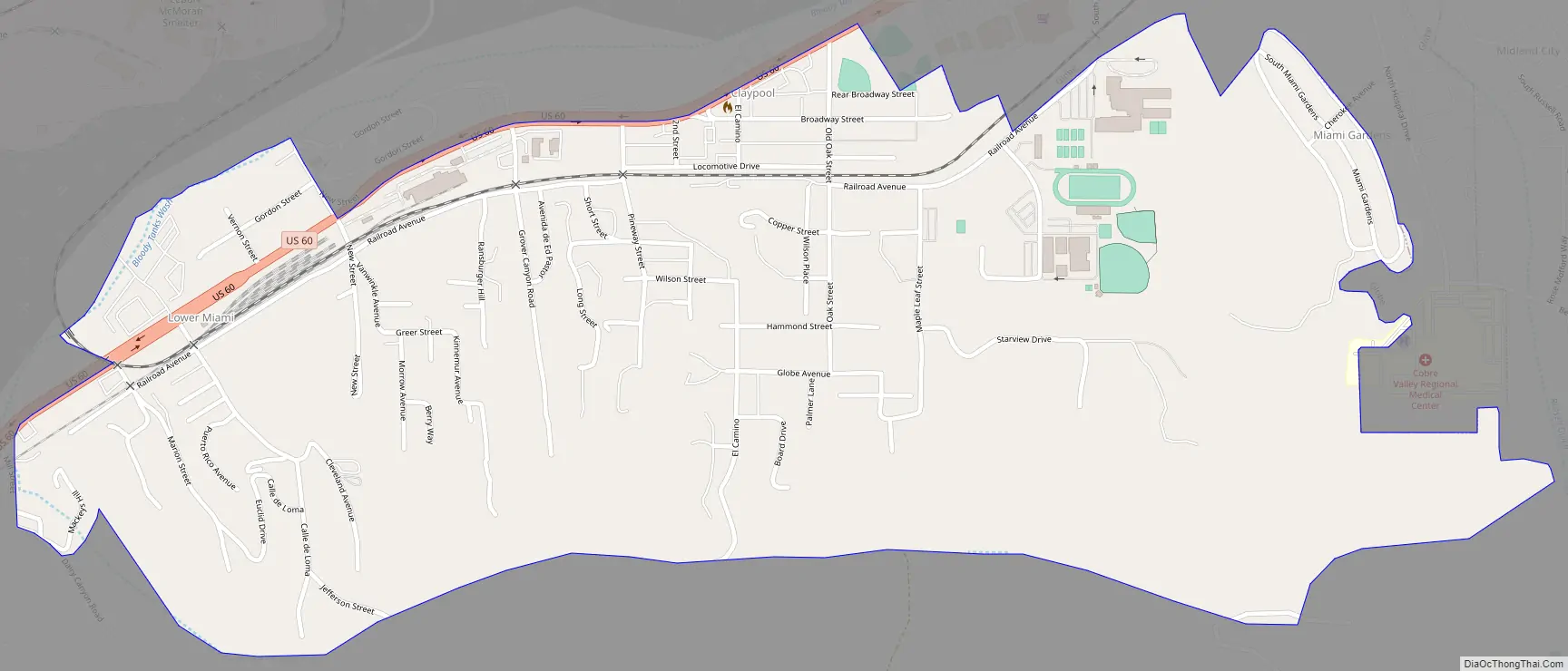
Claypool Road Map
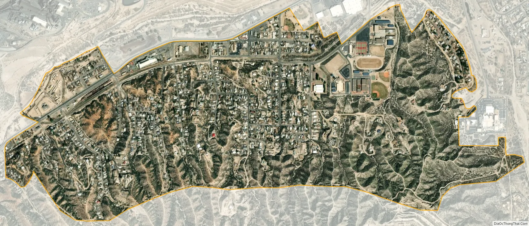
Claypool city Satellite Map
Geography
Claypool is located in southern Gila County at 33°24′31″N 110°50′51″W / 33.40861°N 110.84750°W / 33.40861; -110.84750 (33.408626, -110.847532), between Miami to the west and Globe, the county seat, to the east. U.S. Route 60 runs along the northern edge of the community.
According to the United States Census Bureau, the CDP has a total area of 1.17 square miles (3.04 km), all land.
Climate
According to the Köppen Climate Classification system, Claypool has a warm-summer Mediterranean climate, abbreviated “Csa” on climate maps.
See also
Map of Arizona State and its subdivision: Map of other states:- Alabama
- Alaska
- Arizona
- Arkansas
- California
- Colorado
- Connecticut
- Delaware
- District of Columbia
- Florida
- Georgia
- Hawaii
- Idaho
- Illinois
- Indiana
- Iowa
- Kansas
- Kentucky
- Louisiana
- Maine
- Maryland
- Massachusetts
- Michigan
- Minnesota
- Mississippi
- Missouri
- Montana
- Nebraska
- Nevada
- New Hampshire
- New Jersey
- New Mexico
- New York
- North Carolina
- North Dakota
- Ohio
- Oklahoma
- Oregon
- Pennsylvania
- Rhode Island
- South Carolina
- South Dakota
- Tennessee
- Texas
- Utah
- Vermont
- Virginia
- Washington
- West Virginia
- Wisconsin
- Wyoming


