| Name: | Hayden town |
|---|---|
| LSAD Code: | 43 |
| LSAD Description: | town (suffix) |
| State: | Arizona |
| County: | Gila County, Pinal County |
| Elevation: | 2,044 ft (623 m) |
| Total Area: | 1.27 sq mi (3.30 km²) |
| Land Area: | 1.26 sq mi (3.28 km²) |
| Water Area: | 0.01 sq mi (0.02 km²) |
| Total Population: | 512 |
| Population Density: | 404.74/sq mi (156.23/km²) |
| ZIP code: | 85135 |
| Area code: | 520 |
| FIPS code: | 0432020 |
| GNISfeature ID: | 5646 |
| Website: | www.townofhaydenaz.gov |
Online Interactive Map
Click on ![]() to view map in "full screen" mode.
to view map in "full screen" mode.
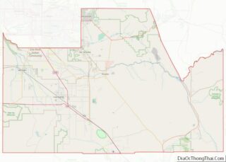
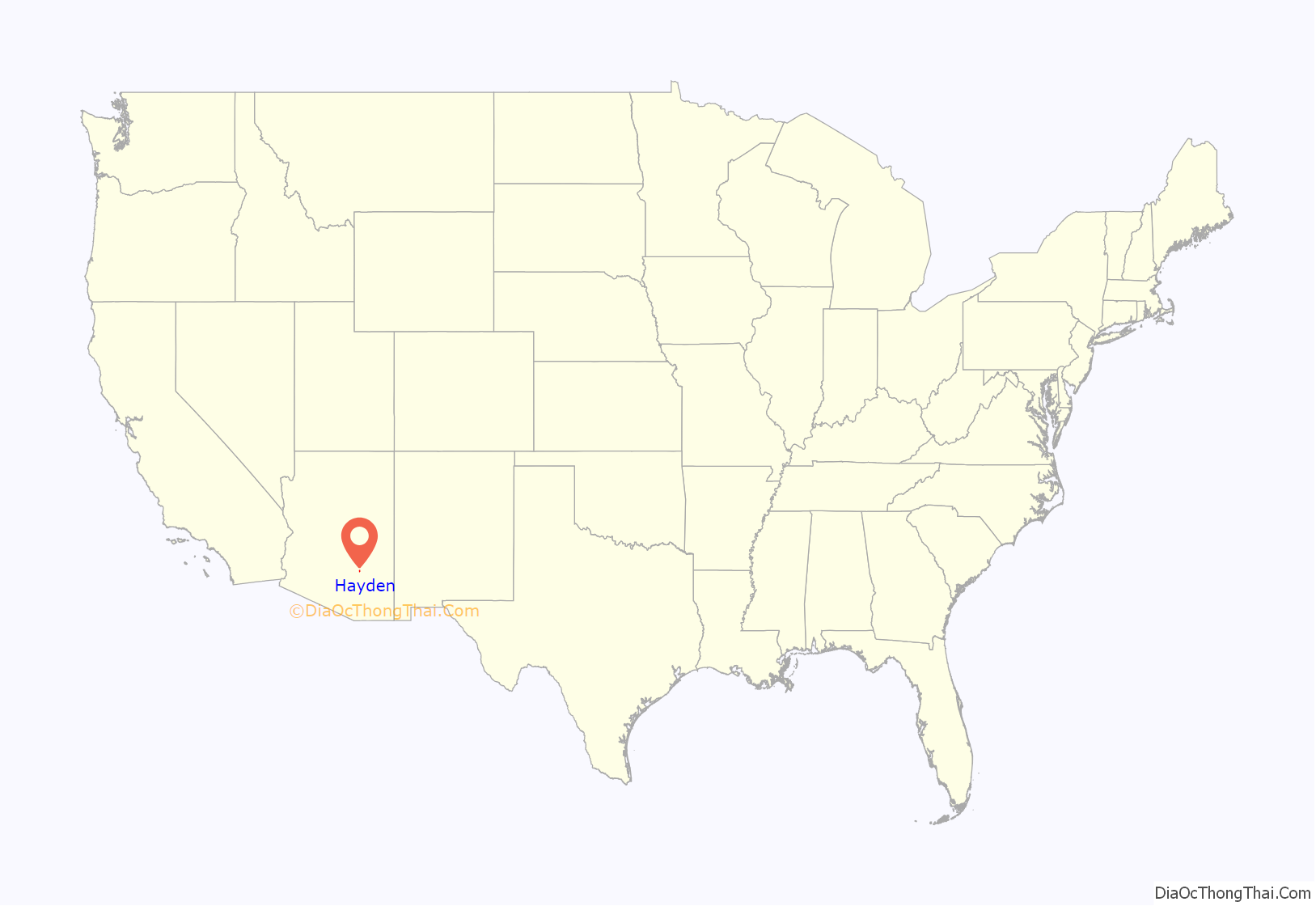
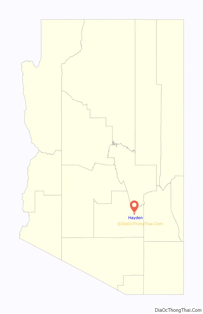
Hayden location map. Where is Hayden town?
History
Hayden was founded in 1909 and owned by the Kennecott Copper Corp. In 1912, the company built a 1,000 ft (300 m) smelter named the “Hayden Smelter”. It was the tallest smelter chimney in Arizona. The mine is now owned by the American Smelting and Refining Company. The town is now in the process of becoming a ghost town.
One of the main reasons the people are abandoning the town is that the crime rate is much higher in Hayden than the Arizona average crime rate. It is also much higher than the national average crime rate in the rest of the United States.
Pollution is another factor which has contributed to the abandonment of the town by its residents. The illegal amounts of lead, arsenic and eight other dangerous compounds released by the smelter were so huge that in 2011, the U.S. Environmental Protection Agency (EPA) took action against the smelter.
Hayden’s economy began to decline as the mine veins became depleted. The crime rate rose and residents began to move out. There were also political scandals. Businesses closed, and churches, schools and houses were abandoned or burned. The Valley National Bank abandoned its building, and it now occupied by the Hayden Police Department. According to the mayor, Bob Smith, Hayden has more police cars than police officers.
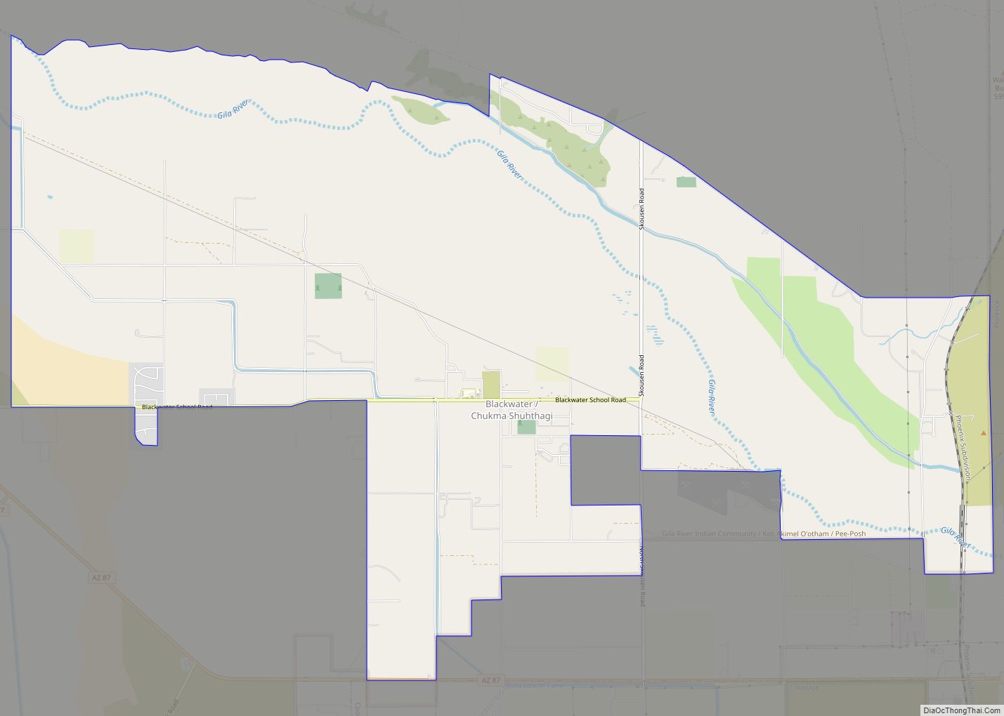
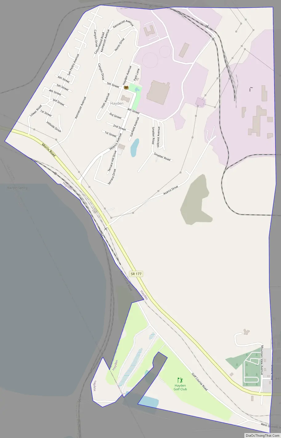
Hayden Road Map
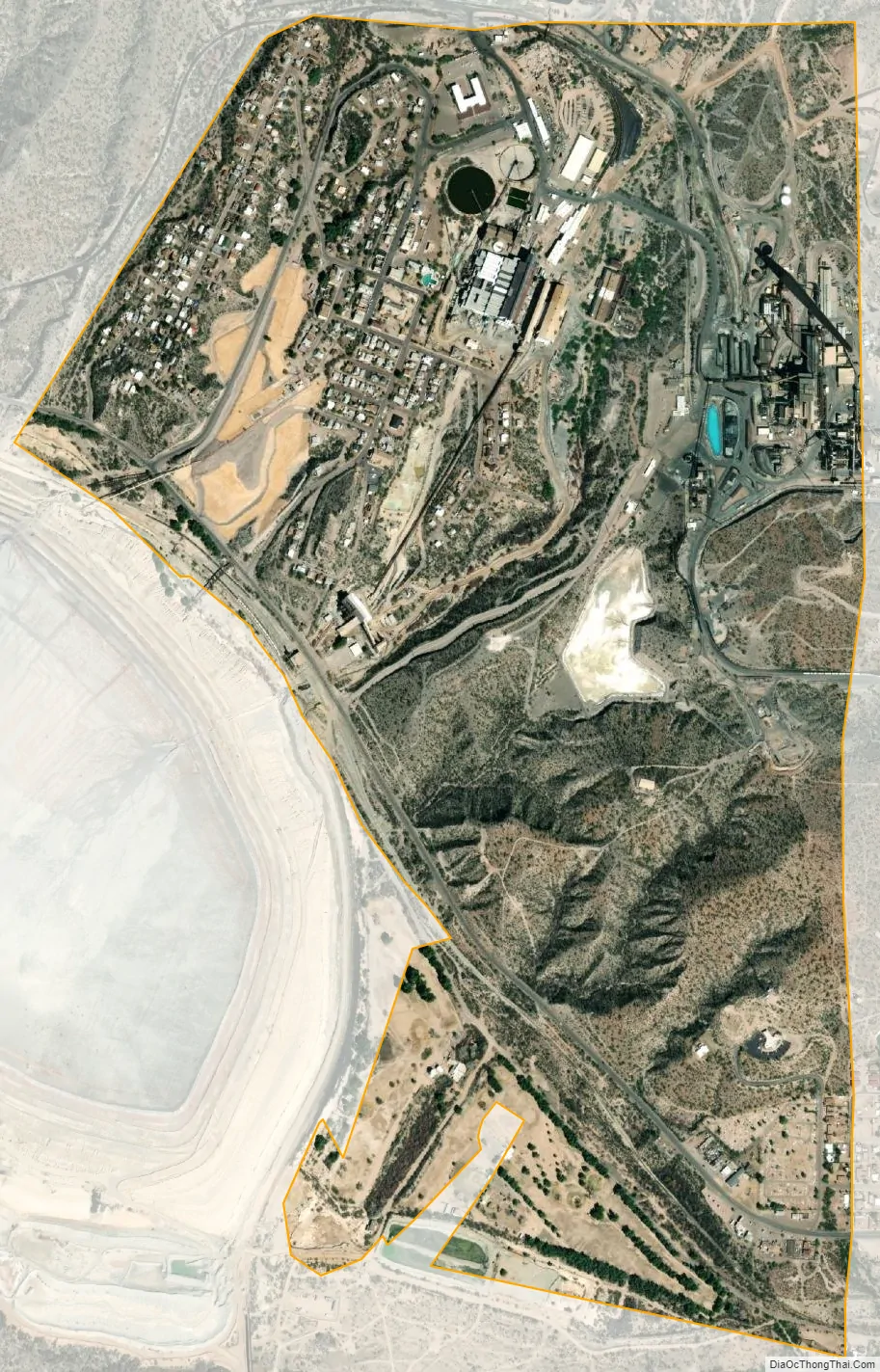
Hayden city Satellite Map
Geography
Hayden is adjacent to Winkelman.
According to the United States Census Bureau, the town has a total area of 1.3 square miles (3.4 km), all land.
See also
Map of Arizona State and its subdivision: Map of other states:- Alabama
- Alaska
- Arizona
- Arkansas
- California
- Colorado
- Connecticut
- Delaware
- District of Columbia
- Florida
- Georgia
- Hawaii
- Idaho
- Illinois
- Indiana
- Iowa
- Kansas
- Kentucky
- Louisiana
- Maine
- Maryland
- Massachusetts
- Michigan
- Minnesota
- Mississippi
- Missouri
- Montana
- Nebraska
- Nevada
- New Hampshire
- New Jersey
- New Mexico
- New York
- North Carolina
- North Dakota
- Ohio
- Oklahoma
- Oregon
- Pennsylvania
- Rhode Island
- South Carolina
- South Dakota
- Tennessee
- Texas
- Utah
- Vermont
- Virginia
- Washington
- West Virginia
- Wisconsin
- Wyoming