Apache Junction (Western Apache: Hagosgeed) is a city in Pinal and Maricopa counties in the state of Arizona. As of the 2020 census, the population was 38,499, most of whom lived in Pinal County. It is named for the junction of the Apache Trail and Old West Highway. The area where Apache Junction is located used to be known as Youngberg. Superstition Mountain, the westernmost peak of the Superstition Mountains, is to the east.
| Name: | Apache Junction city |
|---|---|
| LSAD Code: | 25 |
| LSAD Description: | city (suffix) |
| State: | Arizona |
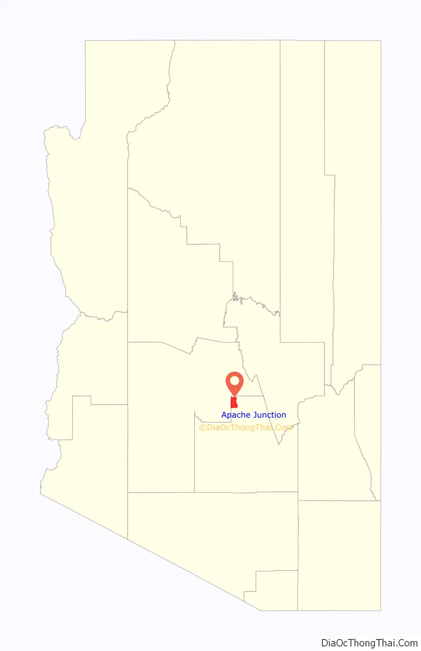
| County: | Maricopa County, Pinal County |
| Incorporated: | November 24, 1978 (1978-11-24) |
| Elevation: | 1,700 ft (500 m) |
| Total Area: | 35.08 sq mi (90.86 km²) |
| Land Area: | 35.07 sq mi (90.83 km²) |
| Water Area: | 0.01 sq mi (0.03 km²) |
| Total Population: | 38,499 |
| Population Density: | 1,097.81/sq mi (423.86/km²) |
| ZIP code: | 85119–85120 |
| Area code: | 480 |
| FIPS code: | 0402830 |
| GNISfeature ID: | 2409718 |
| Website: | www.ajcity.net |
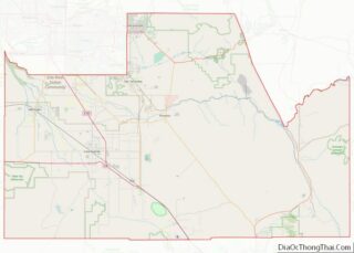
Online Interactive Map
Click on ![]() to view map in "full screen" mode.
to view map in "full screen" mode.
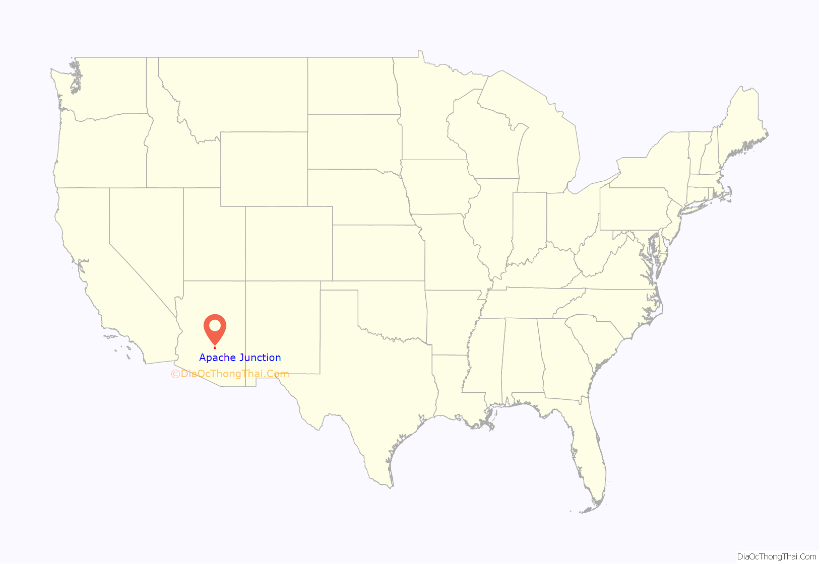
Apache Junction location map. Where is Apache Junction city?
History
Apache Junction arose at an intersection on an unpaved stagecoach trail to the nearby Superstition Mountains. The location became a historical landmark, part of a scenic byway that was opened to the public in 1922 and is currently part of a 120-mile-long (190 km) “circle trail” that begins and ends in Apache Junction. The O’odham Jeweḍ, Akimel O’odham (Upper Pima), and Hohokam people all have tribal ties to the area.
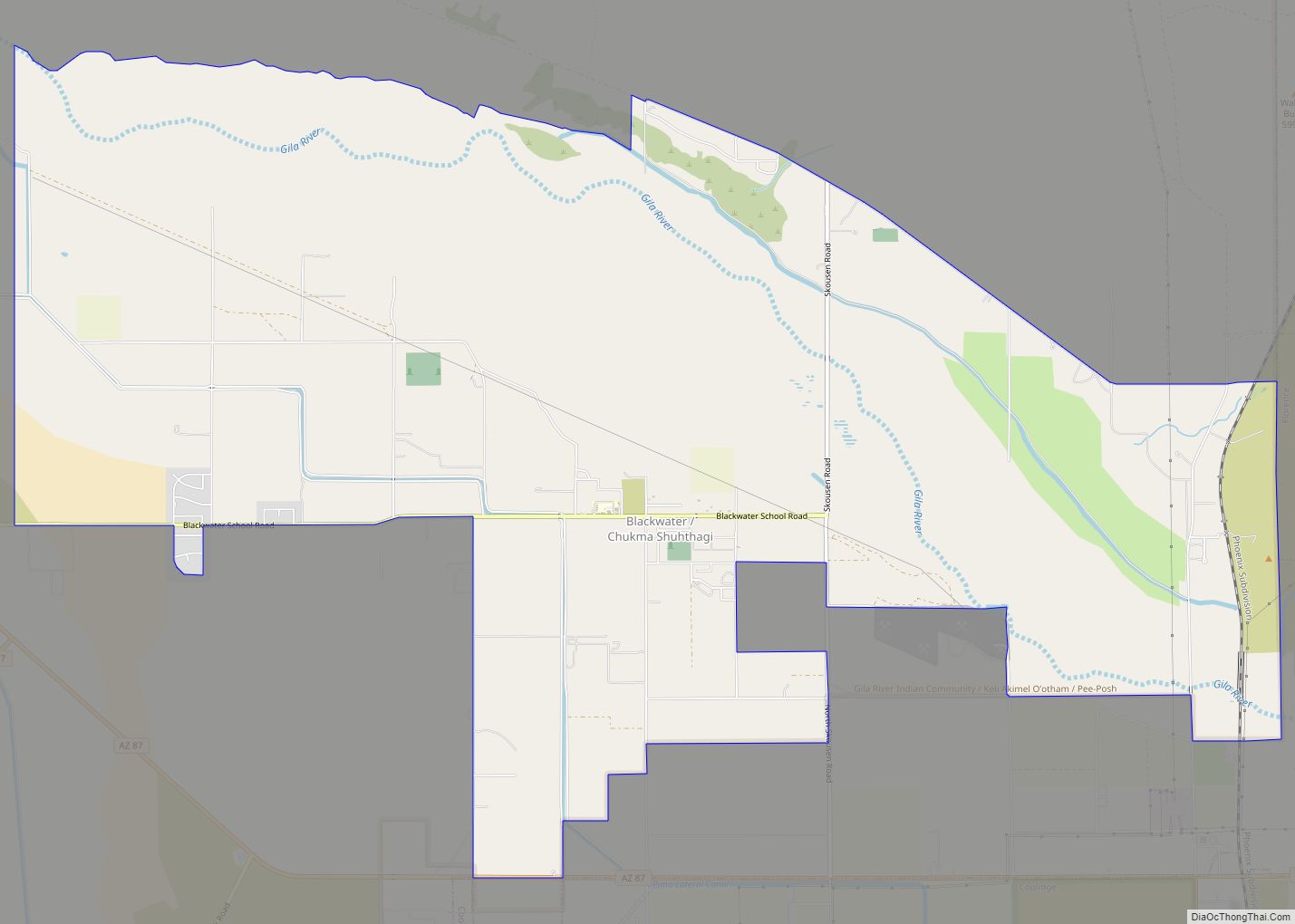
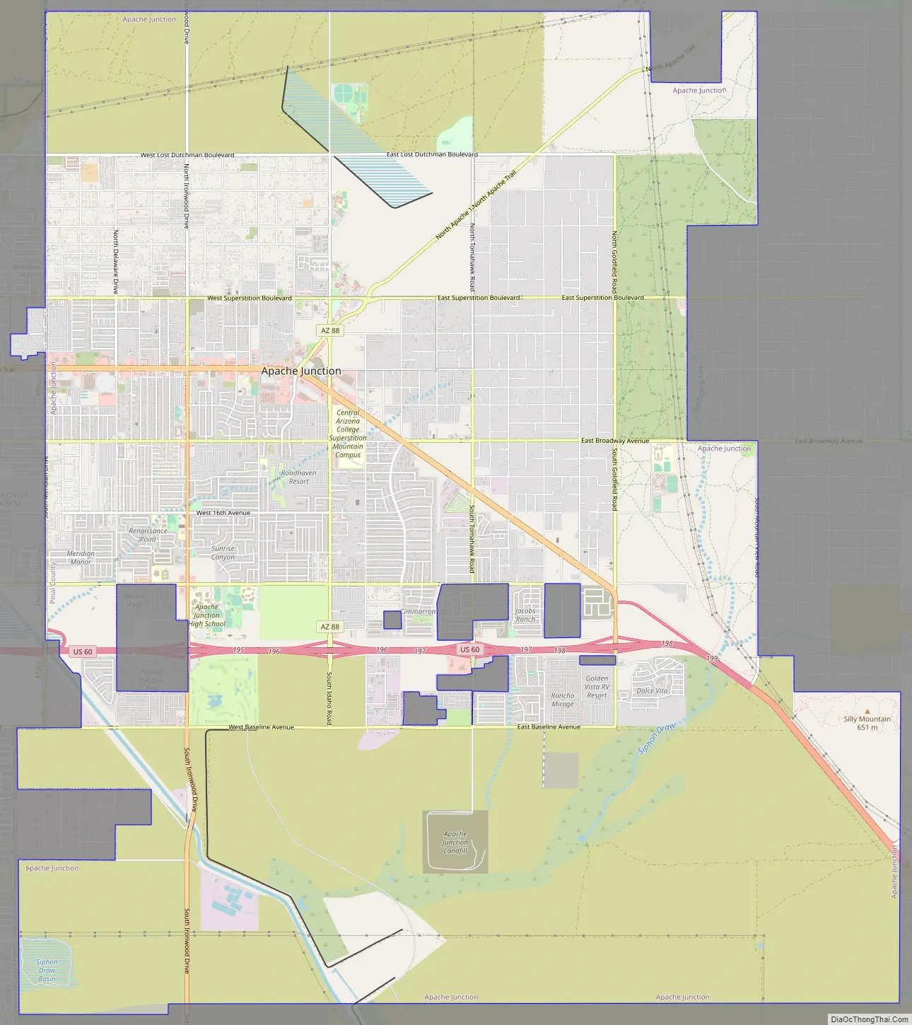
Apache Junction Road Map
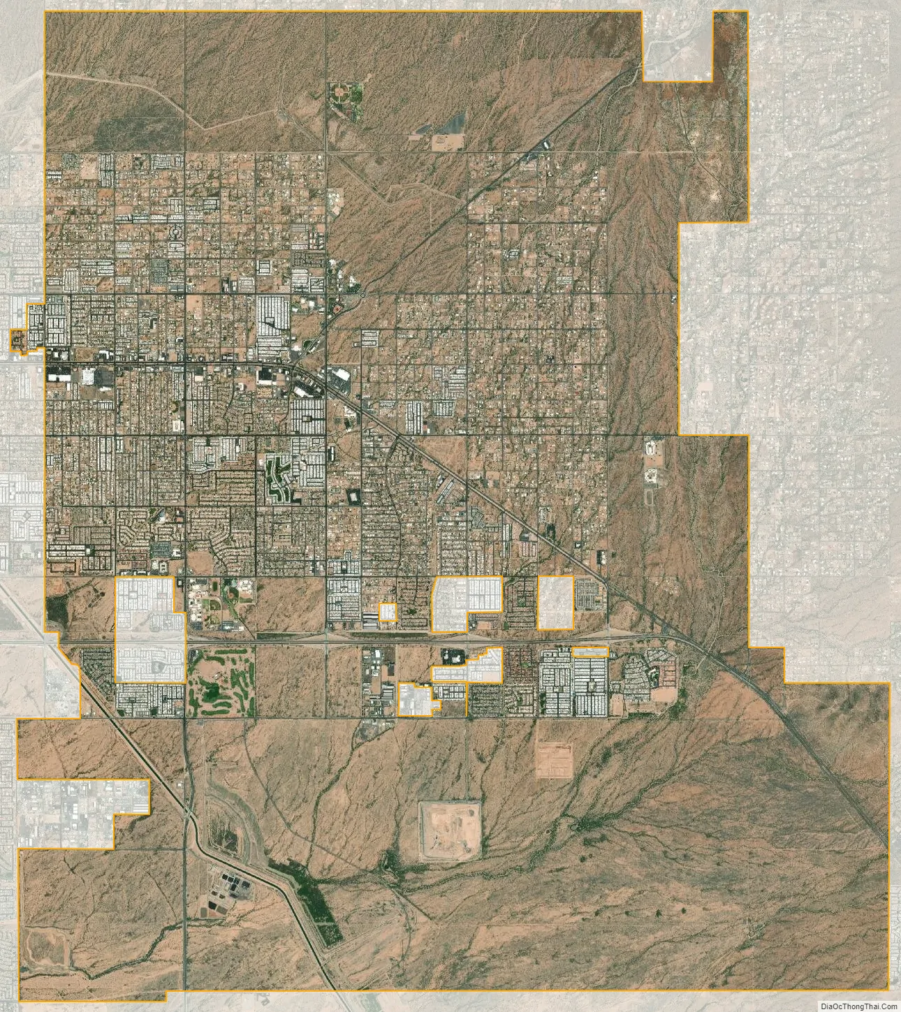
Apache Junction city Satellite Map
Geography
Apache Junction is in northern Pinal County at 33°24′54″N 111°32′46″W / 33.415035°N 111.546025°W / 33.415035; -111.546025. A small portion of the city limits comprising the El Dorado Mobile Estates Resort and Senior Cottages of Apache Junction extends west into Maricopa County. The city is bordered to the west partly by the city of Mesa and to the southeast by unincorporated Gold Canyon. Downtown Phoenix is 33 miles (53 km) to the west via U.S. Route 60, which also leads east 54 miles (87 km) to Globe. Arizona State Route 88, following the route of the old Apache Trail, leads northeast from Apache Junction through the Superstition Mountains 45 miles (72 km) to State Route 188 at Theodore Roosevelt Lake.
Apache Junction is located in the east part of the Phoenix-Mesa-Chandler Metropolitan Area.
According to the United States Census Bureau, the city has an area of 35.1 square miles (91 km), of which 0.01 square miles (0.03 km), or 0.03%, were listed as water.
The town is bounded to the east by the Superstition Mountains (a federal wilderness area and home of the Lost Dutchman’s Gold Mine) and to the north by the Goldfield Mountains with the Bulldog Recreation Area. Goldfield Ghost Town, a tourist location preserved from former prospecting days, lies near the western face of Superstition Mountain just off Highway 88 (Apache Trail). It is located just southwest of the site of the ghost town of Goldfield.
In October 2021, Apache Junction annexed ten square miles south of the city’s previous southern boundary.
See also
Map of Arizona State and its subdivision: Map of other states:- Alabama
- Alaska
- Arizona
- Arkansas
- California
- Colorado
- Connecticut
- Delaware
- District of Columbia
- Florida
- Georgia
- Hawaii
- Idaho
- Illinois
- Indiana
- Iowa
- Kansas
- Kentucky
- Louisiana
- Maine
- Maryland
- Massachusetts
- Michigan
- Minnesota
- Mississippi
- Missouri
- Montana
- Nebraska
- Nevada
- New Hampshire
- New Jersey
- New Mexico
- New York
- North Carolina
- North Dakota
- Ohio
- Oklahoma
- Oregon
- Pennsylvania
- Rhode Island
- South Carolina
- South Dakota
- Tennessee
- Texas
- Utah
- Vermont
- Virginia
- Washington
- West Virginia
- Wisconsin
- Wyoming