Pinal is a census-designated place (CDP) in Gila County, Arizona, United States. The population was 439 at the 2010 census.
| Name: | Pinal CDP |
|---|---|
| LSAD Code: | 57 |
| LSAD Description: | CDP (suffix) |
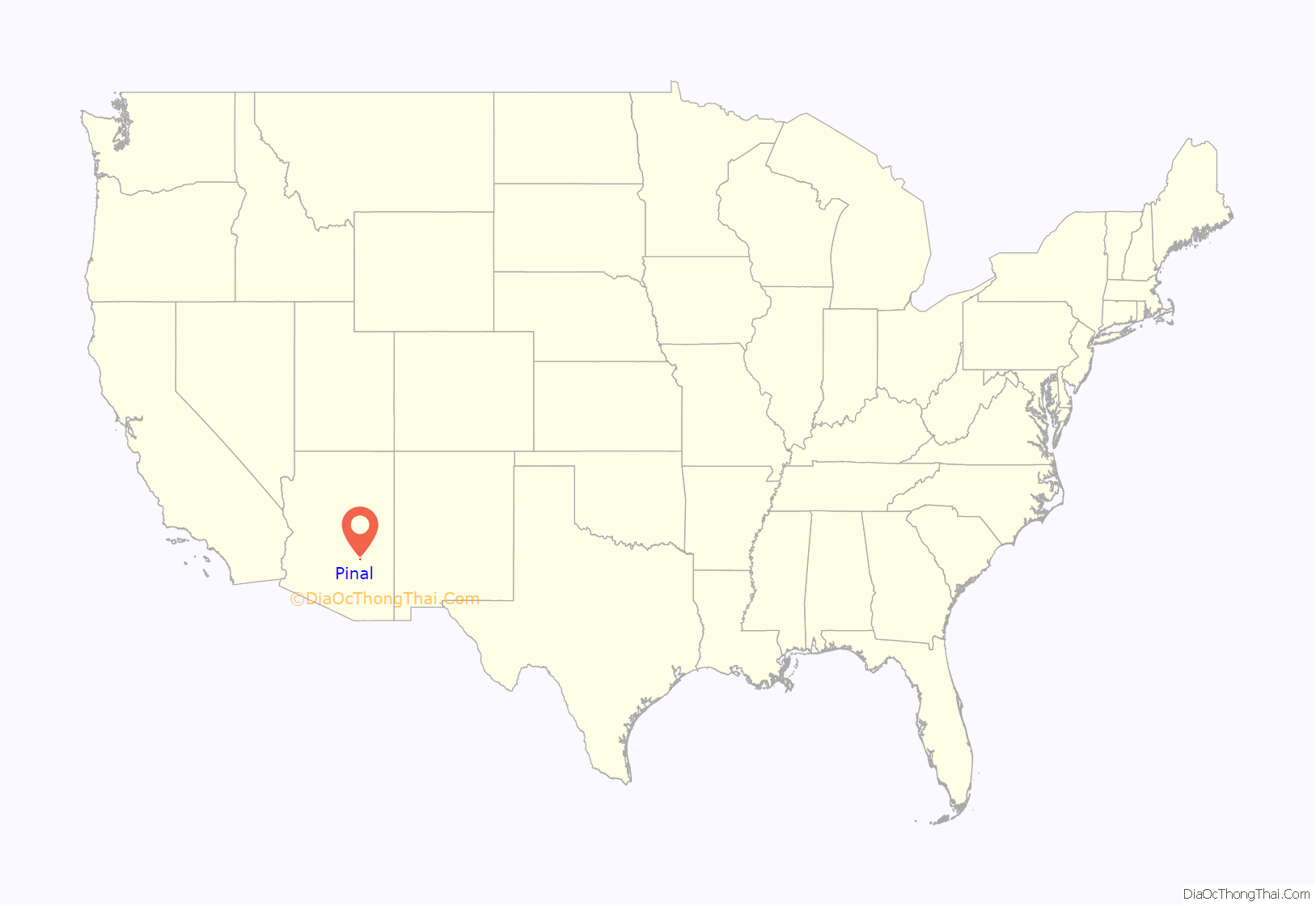
| State: | Arizona |
| County: | Gila County |
| Elevation: | 3,800 ft (1,200 m) |
| Total Area: | 0.42 sq mi (1.08 km²) |
| Land Area: | 0.42 sq mi (1.08 km²) |
| Water Area: | 0.00 sq mi (0.00 km²) |
| Total Population: | 456 |
| Population Density: | 1,093.53/sq mi (421.94/km²) |
| ZIP code: | 85501 |
| Area code: | 928 |
| FIPS code: | 0455630 |
| GNISfeature ID: | 32906 |
Online Interactive Map
Click on ![]() to view map in "full screen" mode.
to view map in "full screen" mode.
Pinal location map. Where is Pinal CDP?
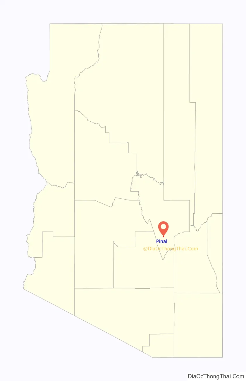
Pinal Road Map
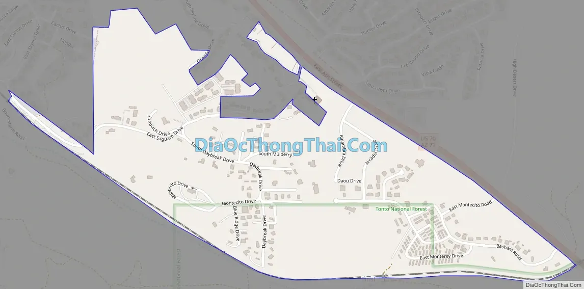
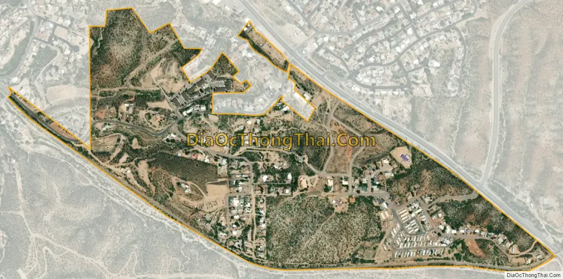
Pinal city Satellite Map
Geography
The CDP is located in southern Gila County southeast of the center of Globe, the county seat. The CDP is bordered by the Globe city limits to the north, east, and south. U.S. Route 70 forms the northeast edge of the CDP; downtown Globe is 2.5 miles (4.0 km) to the northwest, and Peridot is 18 miles (29 km) to the southeast. According to the United States Census Bureau, the Pinal CDP has a total area of 0.44 square miles (1.14 km), all land.
See also
Map of Arizona State and its subdivision: Map of other states:- Alabama
- Alaska
- Arizona
- Arkansas
- California
- Colorado
- Connecticut
- Delaware
- District of Columbia
- Florida
- Georgia
- Hawaii
- Idaho
- Illinois
- Indiana
- Iowa
- Kansas
- Kentucky
- Louisiana
- Maine
- Maryland
- Massachusetts
- Michigan
- Minnesota
- Mississippi
- Missouri
- Montana
- Nebraska
- Nevada
- New Hampshire
- New Jersey
- New Mexico
- New York
- North Carolina
- North Dakota
- Ohio
- Oklahoma
- Oregon
- Pennsylvania
- Rhode Island
- South Carolina
- South Dakota
- Tennessee
- Texas
- Utah
- Vermont
- Virginia
- Washington
- West Virginia
- Wisconsin
- Wyoming


