West Hartford is a town in Hartford County, Connecticut, United States, 5 miles (8.0 km) west of downtown Hartford. The town is part of the Capitol Planning Region. The population was 64,083 at the 2020 census.
The town’s popular downtown area is colloquially known as “West Hartford Center,” or simply “The Center,” and is centered on Farmington Avenue and South/North Main Street. West Hartford Center has been the community’s main hub since the late 17th century.
Incorporated as a town in 1854, West Hartford was previously a parish of Hartford, founded in 1672. Among the southernmost of the communities in the Hartford-Springfield Knowledge Corridor metropolitan region, West Hartford is home to University of Hartford and the University of Saint Joseph.
West Hartford is home to regular events which draw large crowds from neighboring towns, including the Elizabeth Park Concert Series. The town also hosts the annual Celebrate West Hartford event, which includes fairground rides, food vendors, and stalls by local businesses.
| Name: | West Hartford CDP |
|---|---|
| LSAD Code: | 57 |
| LSAD Description: | CDP (suffix) |
| State: | Connecticut |
| County: | Hartford County |
| Incorporated: | May 3, 1854 |
| Elevation: | 164 ft (50 m) |
| Total Area: | 22.3 sq mi (57.7 km²) |
| Land Area: | 21.9 sq mi (56.6 km²) |
| Water Area: | 0.4 sq mi (1.1 km²) |
| Total Population: | 64,083 |
| Population Density: | 2,900/sq mi (1,100/km²) |
| Area code: | 860/959 |
| FIPS code: | 0982660 |
| GNISfeature ID: | 0213529 |
| Website: | www.westhartfordct.gov |
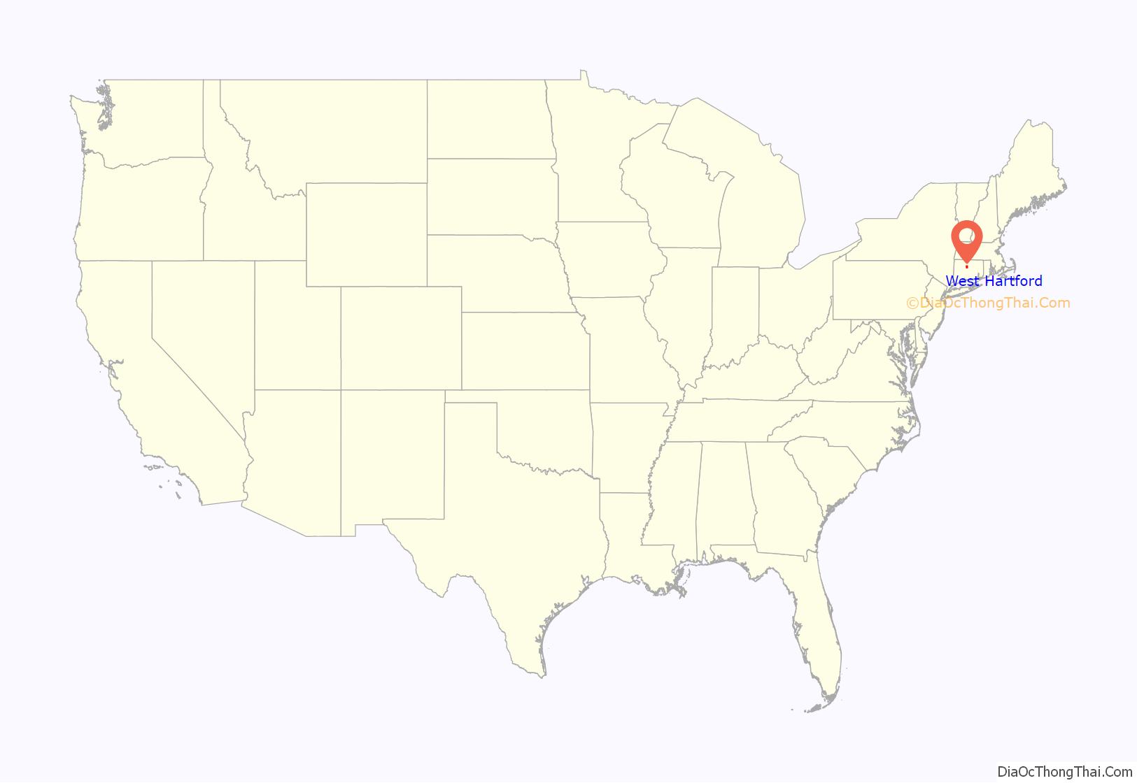
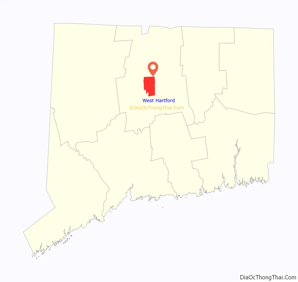
Online Interactive Map
Click on ![]() to view map in "full screen" mode.
to view map in "full screen" mode.
West Hartford location map. Where is West Hartford CDP?
History
According to archaeological evidence, the Wampanoag people used West Hartford as one of their winter camps. Fishing and hunting along the Connecticut River, the area of West Hartford offered the Wampanoag people a refuge from the cold winter wind and the river’s severe spring flooding. In 1636 Reverend Thomas Hooker led a group of followers from what is now Cambridge, Massachusetts to the “Great River” and established Hartford, Connecticut and the Connecticut Colony. As the colony grew, additional land was needed. In 1672 the Proprietors of Hartford ordered that a Division be created to the West. A total of “72 Long Lots” were laid out between today’s Quaker Lane in the East and Mountain Road in the West. The northern boundary was Bloomfield, and the Southern, present day New Britain Avenue. (The western boundary was extended in 1830 to include part of Farmington). In the 1670s, the area was referred to as the “West Division” of Hartford. This remained the official name until 1806 when Connecticut General Assembly started referring to it as “the Society of West Hartford.”
It is believed that the first homesteader to West Hartford was Stephen Hosmer whose father was in Hooker’s first group of Hartford settlers and who later owned 300 acres (1,200,000 m) just north of the present day Center. In 1679, Stephen Hosmer’s father sent him to establish a sawmill on the property. Young Hosmer would eventually go back to live in Hartford, but in his 1693 estate inventory, 310 acres (1,300,000 m) in West Hartford along with a house and a sawmill are listed. For nearly a century the property would be handed down throughout the family. Evidence still remains of the Town’s first industry, as Stephen Hosmer’s mill pond and dam can still be found today on the westernmost side of North Main Street.
By the time of the American Revolution, the once rugged wilderness had been largely clear and a new agricultural-based community had developed with a population of just over 1,000 residents and 3,000 sheep. At its core was the parish meeting house. The First Congregational Meeting House was built around 1712. Now in its 5th building, the church stands proudly at what is now the southeast corner of Main Street and Farmington Avenue. As the focus of early religious, political, and social life, the meeting house helped to provide this area with a name, a title that it still holds today—”The Center.”
Evidence in the Hartford Courant and in the 1790s census show that some of the more prosperous households relied on laborers and slaves for fieldwork and domestic help. The Sarah Whitman Hooker House was one such residence and still stands on New Britain Avenue. Evidence shows that the Hookers owned several slaves. One such slave, Bristow, bought his freedom from Thomas Hart Hooker in April 1775 as Hooker set off to fight in the Revolutionary War. Bristow continued to live with the family after Thomas Hart Hooker was killed in the war. Bristow became an agricultural expert and left his property to the Hookers’ two children when he died. He is the only known African American to be buried in West Hartford’s Old Center Burial Yard. West Hartford’s Bristow Middle School is named in his honor.
Coming of industry
One of the first major industries to arise centered on the pottery and brick works. Extending from Hartford to Berlin is a sizable deposit of fine clay. In 1770, Ebenezer Faxon came from Massachusetts and settled in what would become the Elmwood section of West Hartford. There he established a pottery on South Road (what is today New Britain Avenue) which took advantage of the local geological landscape. It was Seth Goodwin, however, who helped to establish a pottery dynasty. Goodwin started his pottery works around 1798. For over a hundred years, the Goodwin name would be associated with West Hartford pottery. Producing utilitarian items such as jugs for the gin manufactured in local distilleries, to terra cotta designs and fine china, the Goodwin Company employed up to 75 people in its heyday. The Goodwin Brothers Pottery Company (as it came to be known) burned for the third time in 1908 and never recovered.
In 1879 Edwin Arnold established the Trout Brook Ice & Feed Company. Ice from Trout Brook, a stream that runs through the middle of West Hartford, was harvested in the winter, sawn into blocks, and placed into a series of ice houses through an escalator system. Insulated in sawdust, the blocks of ice were used as refrigeration locally and shipped as far away as New York City. By the late 19th century, the New York, New Haven & Hartford Railroad ran through part of Elmwood in the southeast corner of town. A variety of companies cropped up in this area including Whitlock Coil Pipe Company in 1891, and later Royal Typewriter, Wiremold, Abbot Ball, Colt’s Manufacturing and Uncle Bill’s Silver Grippers (producer of tweezers). The largest of West Hartford manufacturers was Pratt & Whitney (now Pratt & Whitney Measurement Systems, which later lent its name to Pratt & Whitney, the aerospace corporation headquartered in East Hartford). In 1940 it built a plant on 20 acres (81,000 m) and at the height of World War II it employed over 7,000 people. It would stand until 1991, when Pratt & Whitney Measurement Systems was acquired and operations were relocated to Plainville.
A new town
In 1792 a committee of residents was appointed to ask permission from Hartford to secede, and were denied. Five years later they petitioned again and again were denied. In the spring of 1854, the Connecticut General Assembly was meeting in New Haven (co-capitol with Hartford at the time). Most likely taking advantage of the distance from Hartford, a petition dated March 21 was delivered to the General Assembly by delegates from West Hartford. Signed by 153 residents, the petition claimed that residences were “subjected to many inconveniences on account of their present connection with the town and city of Hartford and that their convenience and prosperity would be essentially promoted by being set off as a separate town.” On April 26, about 100 residents from West Hartford presented their own case against secession. After review and an opportunity for Hartford to make an argument for keeping West Hartford, the General Assembly voted on May 3 for West Hartford’s independence.
The 1854 vote was not however the end of the debate. In 1895 wealthy residents from the “East Side” of West Hartford petitioned Hartford for annexation. Their call was rebuffed by other West Hartford residents. Then in 1923 and 1924 Hartford wanted to annex West Hartford back so that it could achieve a “Greater Hartford Plan.” Town residents rallied in opposition and the plan was defeated by a vote of 2,100 to 6137.
Emergence as a streetcar suburb
It is transportation that has had the biggest impact on West Hartford and its evolution from sleepy crossroads to modern suburb. In the late 18th and early 19th century three turnpikes ran through West Hartford. Around these roads, taverns, blacksmith and wheelwright shops, general stores and many other places of businesses sprang up. Early maps provide a sense of how important these byways were in the development of commerce and industry. Then came the trolleys—starting in 1845, Fred Brace began running a horse-drawn omnibus from his home on the corner of Farmington Avenue and Dale Street into downtown Hartford. Even more significant were the horse-drawn trolley lines and later electric trolleys that in 1889 began to weave their way from the inner city of Hartford to the countryside of West Hartford. Trolley lines opened up a land that had been inaccessible to many, and made it possible for professionals and their families to settle along Prospect Avenue, then north of Farmington Avenue.
By the 1880s, Hartford began to experience an economic boom. As such Hartford’s business leaders began building their mansions along Prospect Avenue. Prospect Hill, situated on a one-mile-long (1.6 km) ridge boasting impressive views of the burgeoning city, became the area’s most prestigious address. Homes are characteristic of the architectural styles popular in that period are represented, particularly Late 19th and 20th Century Revivals. Many homes in the area on the National Register of Historic Places, including the Connecticut Governor’s Residence, built in 1908. Prospect Avenue is adjacent to Elizabeth Park, designed by acclaimed landscape architect Frederick Law Olmsted in 1896 and named for the wife of Charles M. Pond, who bequeathed the land to the City of Hartford. In 1900, the Hartford Golf Club opened its links on the other side of Asylum Avenue just west of Prospect Avenue, adding to the area’s ideal suburban sensibility.
In 1895, Wood, Harmon and Company created one of the town’s first subdivisions on property known as Stanley Farm, a tract sloping upward from the trolley line that then ran along Farmington Avenue, across from Reservoir No. 1. Called Buena Vista, it was promoted it “Hartford’s New and Handsome Suburb.” Their literature highlighted “splendid suburban electric car service” and proximity to Reservoir No. 1.
Other developments followed including “Elmhurst” in Elmwood (1901), and Sunset Farm (1917). One of the most exclusive of these early developments was West Hill. Located on the former estate of Cornelius Vanderbilt, son of the famous financier and transportation magnet, it was the brainchild of Horace R. Grant. Designed by some of Hartford’s best architects in the 1920s, West Hill is significant historically because it is an excellent example of a planned real estate development of the early 1920s that proceeded under specific design restrictions to achieve outstanding success as a well-crafted and prestigious neighborhood. The architecture is characteristic of the Colonial Revival and Tudor Revival styles popular in the period. It was declared a National Historic District in 1996.
The automobile
By the 1920s and 1930s the impact of the automobile was felt in West Hartford as the town became more accessible to Hartford’s middle and working class citizens. Between 1910 and 1930 the population of West Hartford grew from 4,808 to 24,941 residents. Then with the end of the Great Depression, World War II, and the exodus from urban centers, West Hartford witnessed a tremendous influx of people as its population swelled from 33,776 in 1940 to 62,382 people by 1960. This era ushered in major housing developments and retail spaces throughout the community.
In the 1950s, the primary avenues—Albany, Asylum and Farmington—became important arteries for commuters, and the access made West Hartford attractive to middle-class families. During the decade, the town built one new elementary school each year to accommodate the growing population. In the 1960s, construction began on Interstate 84, completed in 1969. The interstate had many ramifications on the community, the most visible was that it bisected the town, isolating the more industrial and ethnically diverse neighborhood of Elmwood with a physical barrier from the rest of West Hartford. Furthermore, The interstate allowed for increased accessibility as the population increased with the Baby Boom and development, and recalibrated the traditional retail sites.
Subsequent residential development continued on through the late 1970s, particularly in the town’s northern, western and far southwestern fringes, as evidenced by the many large colonial, ranch, and split level-style homes in these areas. In 1971, the Bishops Corner development was inaugurated. Housing tenants such as Lord & Taylor, F.W. Woolworth, and Doubleday Book Shop drew shoppers from across the region; the Center with its largely independently owned stores, were negatively impacted by the new retail traffic patterns.
Towards the town’s southwest fringe lies Westfarms Mall. Opened in 1974 with original anchors JC Penney, G. Fox & Co., and Sage-Allen, the mall further recalibrated retail in West Hartford. It became well known for its lavish ceilings and waterfall-style fountain. Sitting astride I-84, conveniently connected to the town’s main internal arteries, and comprising more than 1,300,000 square feet (120,000 m) of stores and restaurants, it is the third largest indoor mall in Connecticut.
Heist
In 1983, a robbery was committed by a militant Puerto Rican group called “Los Macheteros” where they robbed a Wells Fargo depot situated in West Hartford, netting $7 million. At the time, it was the largest heist in US history.
Blue Back Square
Opening in 2007, Blue Back Square is a pioneer mixed-use development in the Center that blends retail and residential living space on a large scale. The five-building complex contains 220,000 square feet (20,000 m) of ground floor retail space and 120 luxury space. Medical office space encompasses 137,000 square feet (12,700 m), and other professional offices total another 62,500 square feet (5,810 m) square feet. A six-screen movie theatre as well as two 500-space parking garages were also built. Named after Noah Webster’s popular spelling book, Blue-Back Speller, the development has significantly altered the Center and furthered West Hartford’s status as a regional dining and shopping destination.
West Hartford Road Map
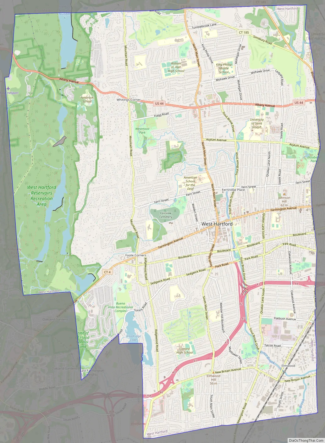
West Hartford city Satellite Map

Geography
According to the United States Census Bureau, the town has a total area of 22.3 square miles (57.7 km), of which 21.9 square miles (56.6 km) is land and 0.42 square miles (1.1 km), or 1.91%, is water.
The west side of West Hartford is flanked by the Metacomet Ridge, a mountainous trap rock ridgeline that stretches from Long Island Sound to nearly the Vermont border. Notable features of the Metacomet Ridge in West Hartford include Talcott Mountain and a number of highland water reservoirs belonging to the Metropolitan District, which maintains watershed and recreation resources on the property. The 51-mile-long (82 km) Metacomet Trail traverses the ridge. The town’s web site indicates that the highest point in town is 778 feet (237 m) above sea level on Talcott (Avon) Mountain. The altitude at Town Hall is 120 feet (37 m).
West Hartford is adjacent to and west of Hartford, the state capital, and borders Bloomfield, Newington, New Britain, Farmington, and Avon. West Hartford is approximately 100 miles (160 km) southwest of Boston and 120 miles (190 km) northeast of New York City. Interstate 84 runs through West Hartford.
See also
Map of Connecticut State and its subdivision: Map of other states:- Alabama
- Alaska
- Arizona
- Arkansas
- California
- Colorado
- Connecticut
- Delaware
- District of Columbia
- Florida
- Georgia
- Hawaii
- Idaho
- Illinois
- Indiana
- Iowa
- Kansas
- Kentucky
- Louisiana
- Maine
- Maryland
- Massachusetts
- Michigan
- Minnesota
- Mississippi
- Missouri
- Montana
- Nebraska
- Nevada
- New Hampshire
- New Jersey
- New Mexico
- New York
- North Carolina
- North Dakota
- Ohio
- Oklahoma
- Oregon
- Pennsylvania
- Rhode Island
- South Carolina
- South Dakota
- Tennessee
- Texas
- Utah
- Vermont
- Virginia
- Washington
- West Virginia
- Wisconsin
- Wyoming


