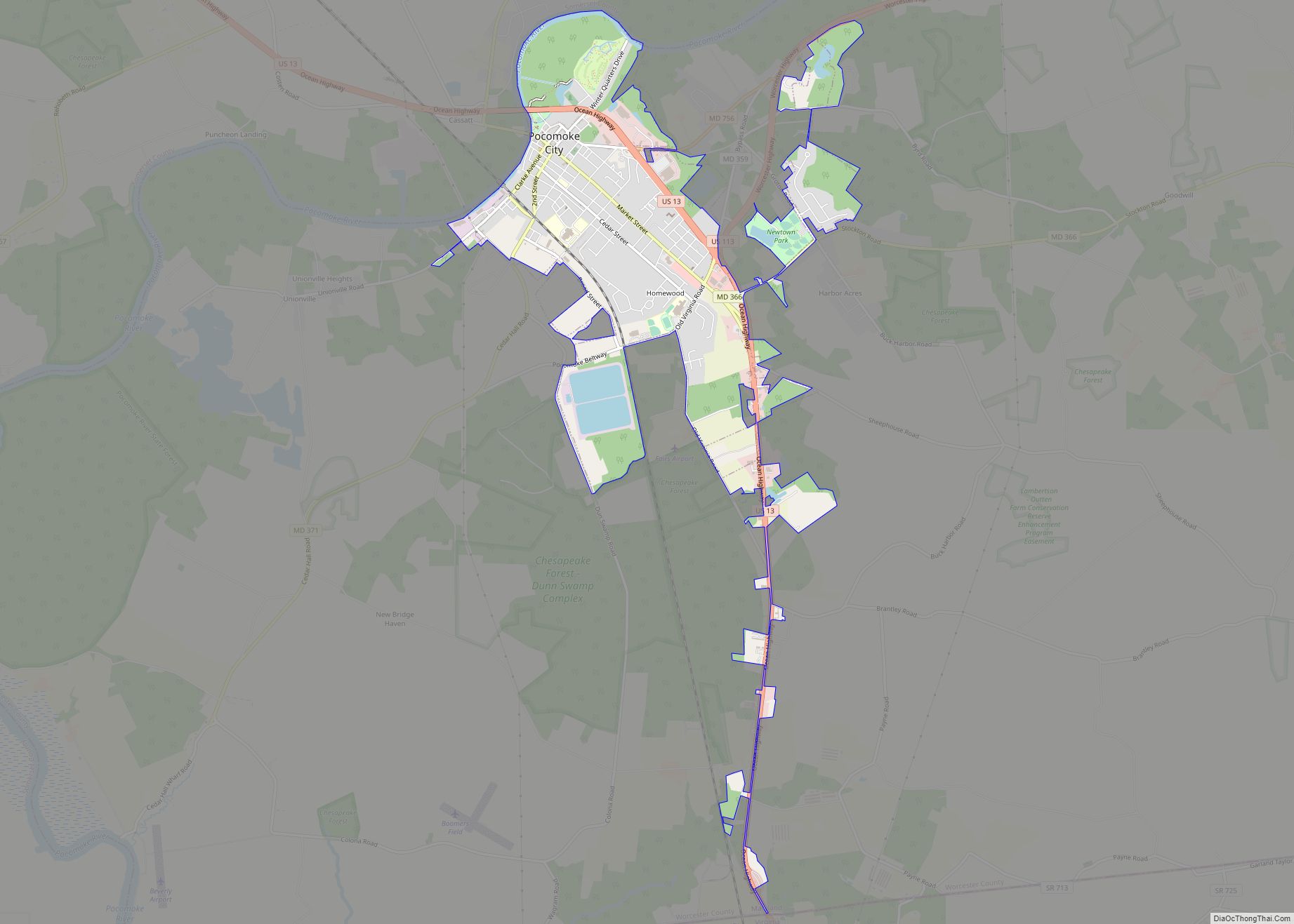
Pocomoke City, dubbed “the friendliest town on the Eastern Shore”, is a city in Worcester County, Maryland, United States. Although renamed in a burst of civic enthusiasm in 1878, the city is regularly referred to by its inhabitants simply as Pocomoke /ˈpoʊkoʊmoʊk/. The population was 4,184 at the 2010 census. It is part of the Salisbury, Maryland-Delaware Metropolitan Statistical Area. Pocomoke City is a center for commerce on the lower shore, home to an industrial park currently playing host to defense contractors, aerospace engineering, and plastics fabrication. Pocomoke City is located near the Wallops Island Flight Facility in Wallops Island, Virginia.
| Name: | Pocomoke City city |
|---|---|
| LSAD Code: | 25 |
| LSAD Description: | city (suffix) |
| State: | Maryland |
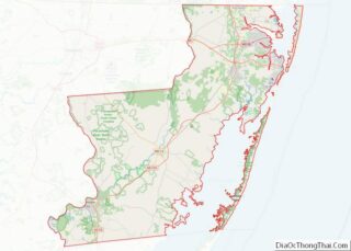
| County: | Worcester County |
| Incorporated: | 1878 |
| Elevation: | 7 ft (2 m) |
| Total Area: | 4.04 sq mi (10.45 km²) |
| Land Area: | 3.79 sq mi (9.81 km²) |
| Water Area: | 0.25 sq mi (0.64 km²) |
| Total Population: | 4,295 |
| Population Density: | 1,133.84/sq mi (437.81/km²) |
| ZIP code: | 21851 |
| Area code: | 410, 443 |
| FIPS code: | 2462475 |
| GNISfeature ID: | 0591031 |
| Website: | www.cityofpocomoke.com |
Online Interactive Map
Click on ![]() to view map in "full screen" mode.
to view map in "full screen" mode.
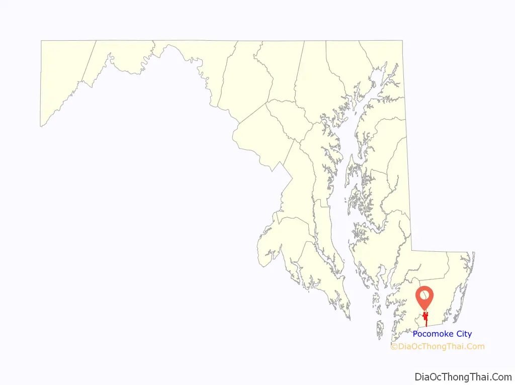
Pocomoke City location map. Where is Pocomoke City city?

History
Beginning in the late seventeenth century, a small settlement called Stevens Landing (sometimes Stevens Ferry) grew at the ferry landing on the south bank of the Pocomoke River. The town was incorporated as Newtown (or New Town) in 1865, but was reincorporated in 1878 as Pocomoke City, after the American Indian name of the river, meaning “black water.”
Stevens Landing, and then Newtown, remained a modest river crossing until the construction through the town in the 1880s of the trunk railroad line along the Delmarva Peninsula from Wilmington, Delaware, to Cape Charles on the Eastern Shore of Virginia. The line eventually became part of the Pennsylvania Railroad. In addition to agriculture, industry such as lumber milling and shipbuilding and, in the twentieth century, factories making barrels and baskets for truck crops, and the canning of those crops, aided the town’s growth.
In 1922, the business district of Pocomoke City was destroyed in a large fire; on one side of town this continued up to the church on third Street, known as St. Mary’s Episcopal Church, but the downtown was quickly rebuilt. While truck farming declined during the 1900s, the poultry industry rose to take its place. NASA, the U.S. Navy, and the Coast Guard helped with continued growth by bringing jobs to the area.
Pocomoke City was named an All-America City by the National Municipal League, and for the years 1984–85, Pocomoke City was one of the nine Finalist Communities.
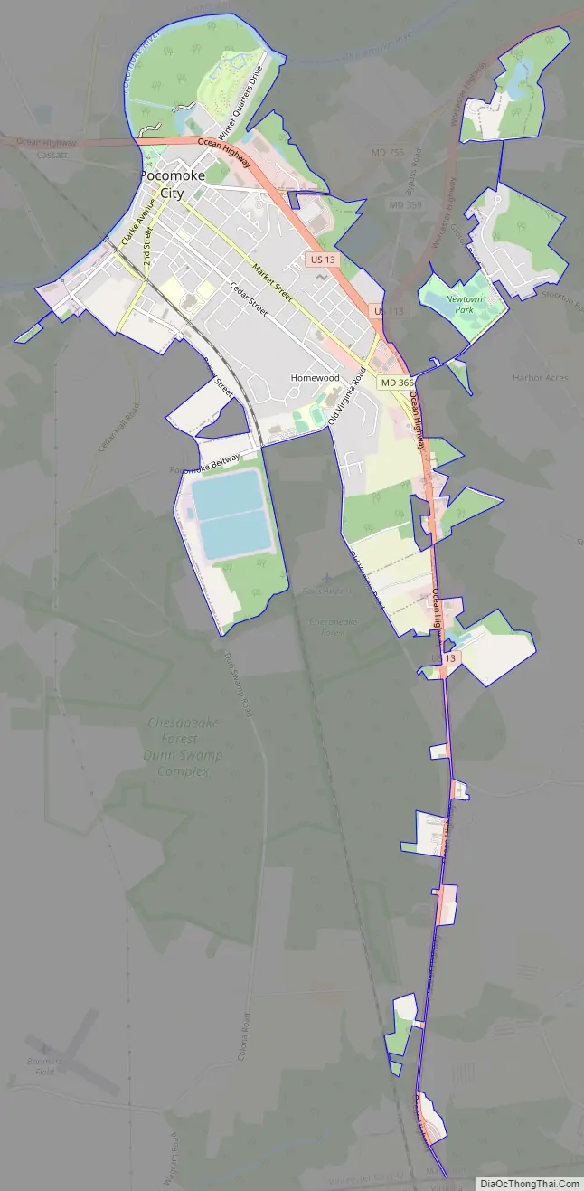
Pocomoke City Road Map
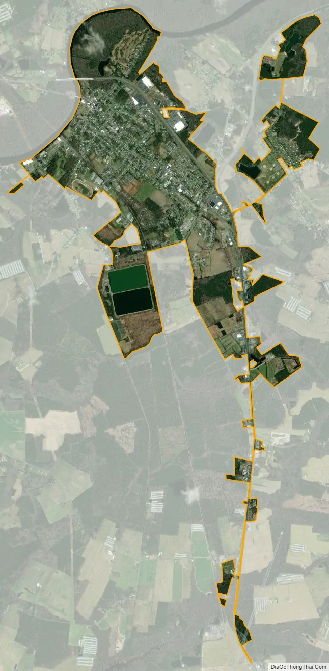
Pocomoke City city Satellite Map
Geography
Pocomoke City is located at 38°4′8″N 75°33′42″W / 38.06889°N 75.56167°W / 38.06889; -75.56167 (38.068904, -75.561718).
According to the United States Census Bureau, the city has a total area of 3.94 square miles (10.20 km), of which 3.69 square miles (9.56 km) is land and 0.25 square miles (0.65 km) is water.
Climate
Its climate is characterized by hot and humid stretches of weather in summer, but they are often broken up by cold fronts from the north offering several days of mild temperatures. Both spring and fall are pleasant with cool to mild temperatures and lower humidity. Winters are relatively mild compared to areas to the north and northwest, but cold spells send temperatures well below freezing. Due to the impact of the Atlantic Ocean nearby, average snowfall amounts only range from 5 to 10 inches (130 to 250 mm); however, this varies considerably from year to year and occasional nor’easters can produce significant snowfalls over one foot (30 cm). The Blizzard of 2018, for example, produced 10 to 15 inches (250 to 380 mm) of snow, temperatures in teens, and winds gusting over 40 mph (64 km/h). Tropical storms occasionally impact the region during summer and fall.
The Köppen climate classification subtype for this climate is “Cfa” (Humid Subtropical Climate).
See also
Map of Maryland State and its subdivision: Map of other states:- Alabama
- Alaska
- Arizona
- Arkansas
- California
- Colorado
- Connecticut
- Delaware
- District of Columbia
- Florida
- Georgia
- Hawaii
- Idaho
- Illinois
- Indiana
- Iowa
- Kansas
- Kentucky
- Louisiana
- Maine
- Maryland
- Massachusetts
- Michigan
- Minnesota
- Mississippi
- Missouri
- Montana
- Nebraska
- Nevada
- New Hampshire
- New Jersey
- New Mexico
- New York
- North Carolina
- North Dakota
- Ohio
- Oklahoma
- Oregon
- Pennsylvania
- Rhode Island
- South Carolina
- South Dakota
- Tennessee
- Texas
- Utah
- Vermont
- Virginia
- Washington
- West Virginia
- Wisconsin
- Wyoming