| Name: | Baltimore city |
|---|---|
| LSAD Code: | 25 |
| LSAD Description: | city (suffix) |
| State: | Maryland |
| County: | Baltimore city |
| FIPS code: | 2404000 |
When it comes to getting around Baltimore, public transportation is the way to go. The city is served by the Maryland Transit Administration (MTA), which operates light rail, subway, and bus systems. If you’re looking to explore the city further, there are plenty of bike-share programs and taxi services available as well.
If you’re looking for a place to visit, Baltimore is an excellent choice. With its beautiful harbors and seaports, friendly people, and plenty of things to do and explore, it’s easy to see why it’s nicknamed the “Charm City.” Before you plan your trip, take a look at this Baltimore map to get an idea of what you should see and do.
When you think of Baltimore, the first thing that probably comes to mind must be its picturesque harbors and seaports. With its friendly people living there, it’s no wonder why the city is nicknamed the “Charm City”. Baltimore is the most populous city in Maryland, and it’s a thriving city with a lot of history and diversity. Check out the Oriole Park at Camden Yards stadium, historic neighborhoods like Little Italy and Highlandtown, and the funky Fells Point. Plus, the city is full of amazing food and drink, including crab cakes and other seafood.
When it comes to getting around the city, public transportation is the way to go. The city is served by the Maryland Transit Administration (MTA), which operates light rail, subway, and bus systems. There are also plenty of bike-share programs and taxi services available.
If you’re planning your next trip, Baltimore is an excellent choice. Check out this Baltimore map for major routes/highways, landmarks, things to do, and an interactive map of the city. With its beautiful harbors and seaports, friendly people, and plenty of things to do and explore, there’s no doubt why Baltimore is the “Charm City.”
Online Interactive Map
Click on ![]() to view map in "full screen" mode.
to view map in "full screen" mode.
This map is an interactive tool that you can use to plan your visit to Baltimore. It has details about attractions, things to do, transportation, and more. You can zoom, pan, and explore all the neighborhoods, landmarks, and businesses that Baltimore has to offer. It’s not only for sightseeing, but you can also view Baltimore’s intriguing topography like the Piedmont Plateau and the Atlantic coastal plain.
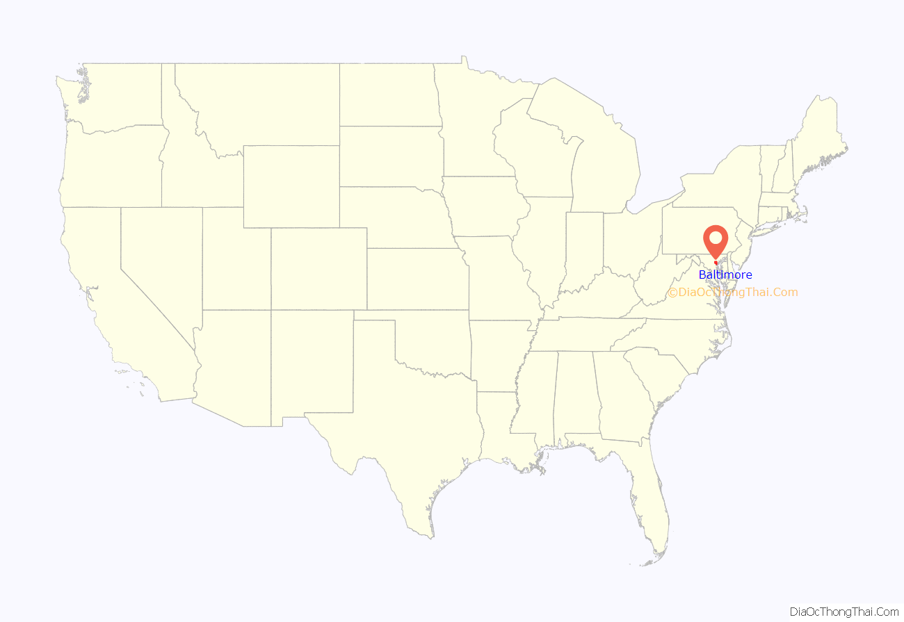
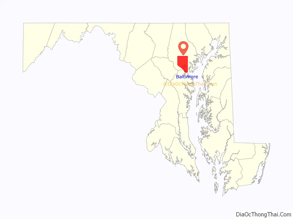
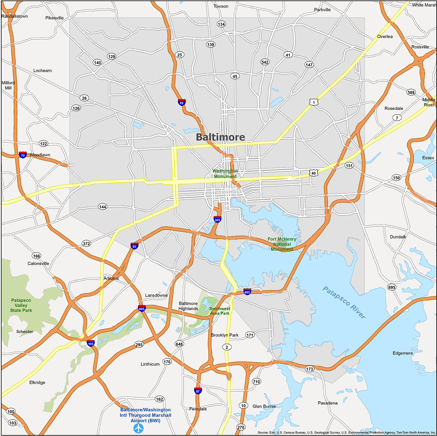
Baltimore location map. Where is Baltimore city?
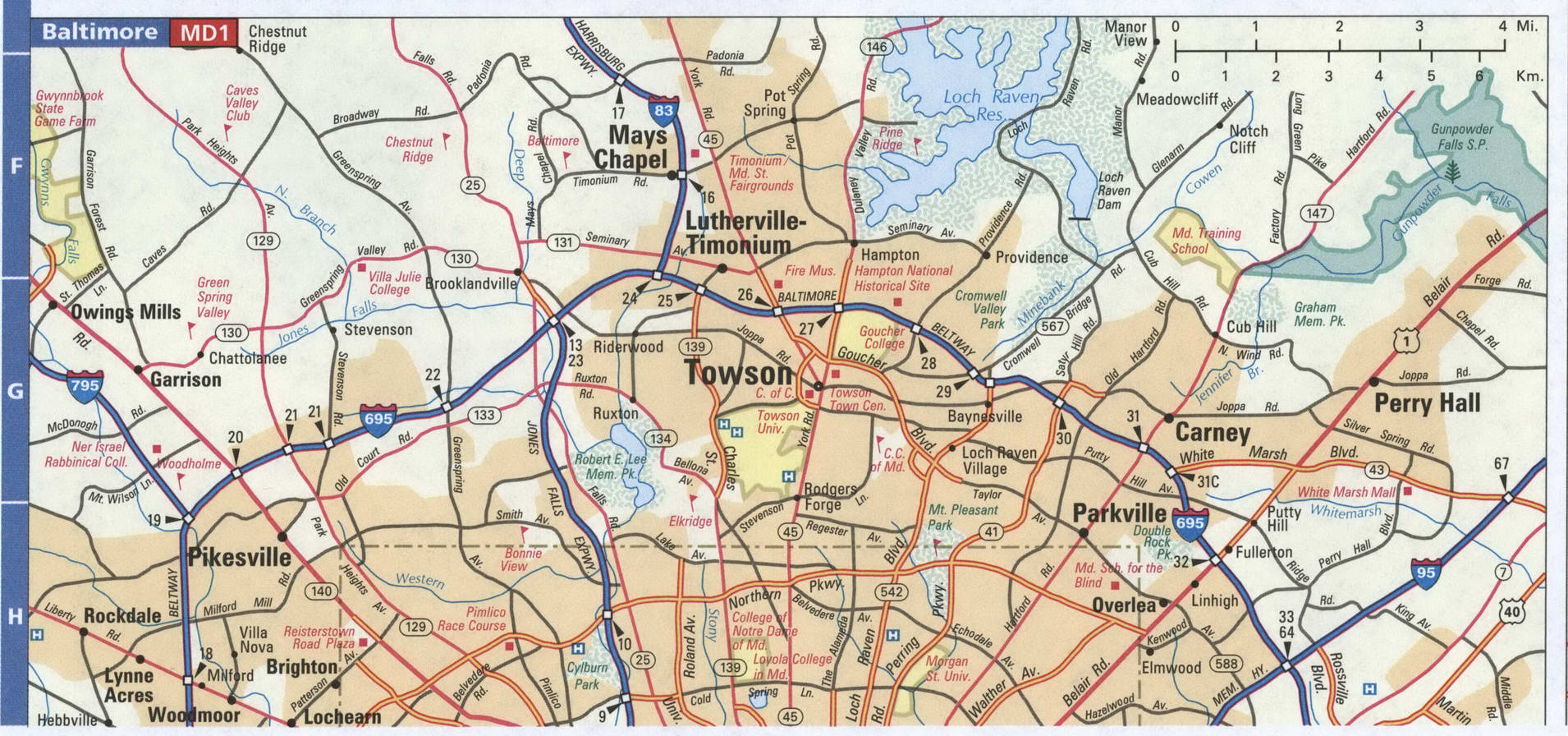
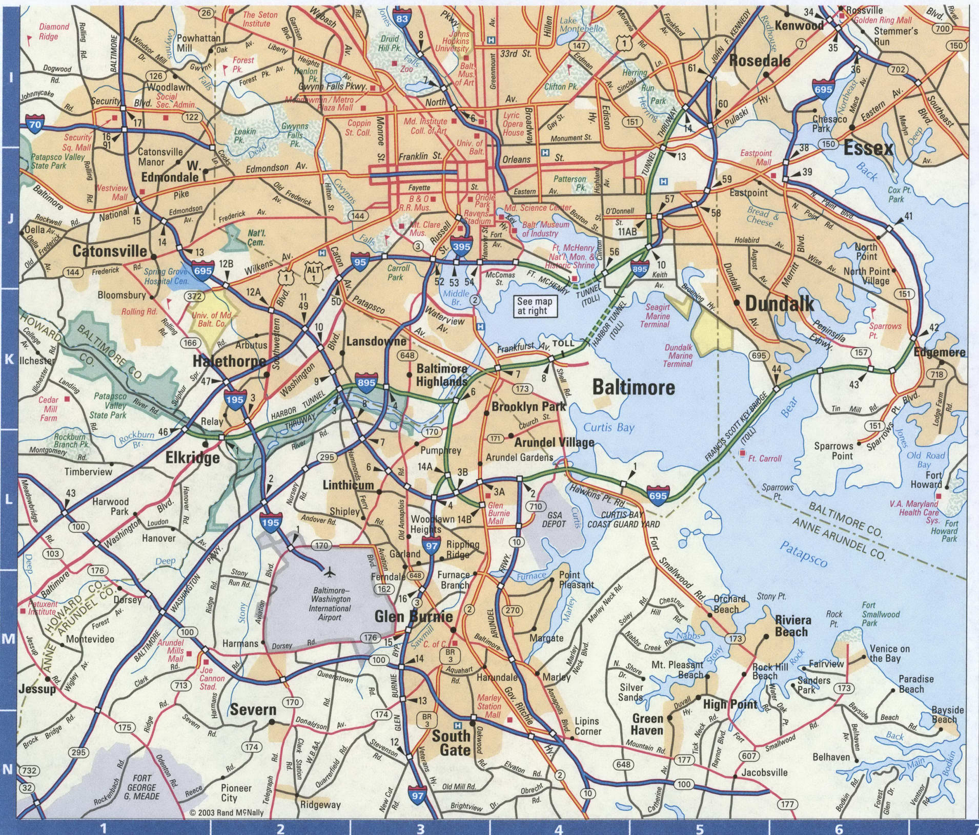
Baltimore Road Map
It’s easy to get lost in a big city like Baltimore, so it’s a good idea to print a map of Baltimore to help you navigate around. Baltimore is one of the largest and most diverse cities in the US, and this map is a great starting point for your next adventure. It makes it easy to use for someone who might be visiting or moving to Baltimore, but also makes it easy to travel through the state with major highways like I-95, I-70, I-83, I-395, I-695, I-895 and US Highways 1, 2, 25, 26, 40, 41, 45, 129, 134, 139, 140, 144, 147, 150, 151, 173, 295, 372, 395, 542, 648, Pulaski Hwy, Perring Pky, and University Pky. Other major roads include 29th St, 31st St, 33rd St, Annapolis Rd, Baltimore National Pike, Baltimore St, Bellona Ave, Broadway, Curtis Ave, Druid Hill Ave, Eastern Ave, Falls Rd, Falls Road Ter, Fayette St, Forrest St, Fulton Ave, Greene St, Hanover St, Harford Ave, Hillen Rd, Hilton St, Lafayette Ave, Lanvale St, Lee St, Liberty Heights Ave, Loch Raven Blvd, Lombard St, Martin Luther King Jr Blvd, Maryland Ave, Monument St, Moravia Rd, Orleans St, Pennington Ave, Pennsylvania Ave, President St, Reisterstown Rd, Russell St, SSouthwestern Blvd, Swann Dr, The Alameda, Washington Blvd, and York Rd.
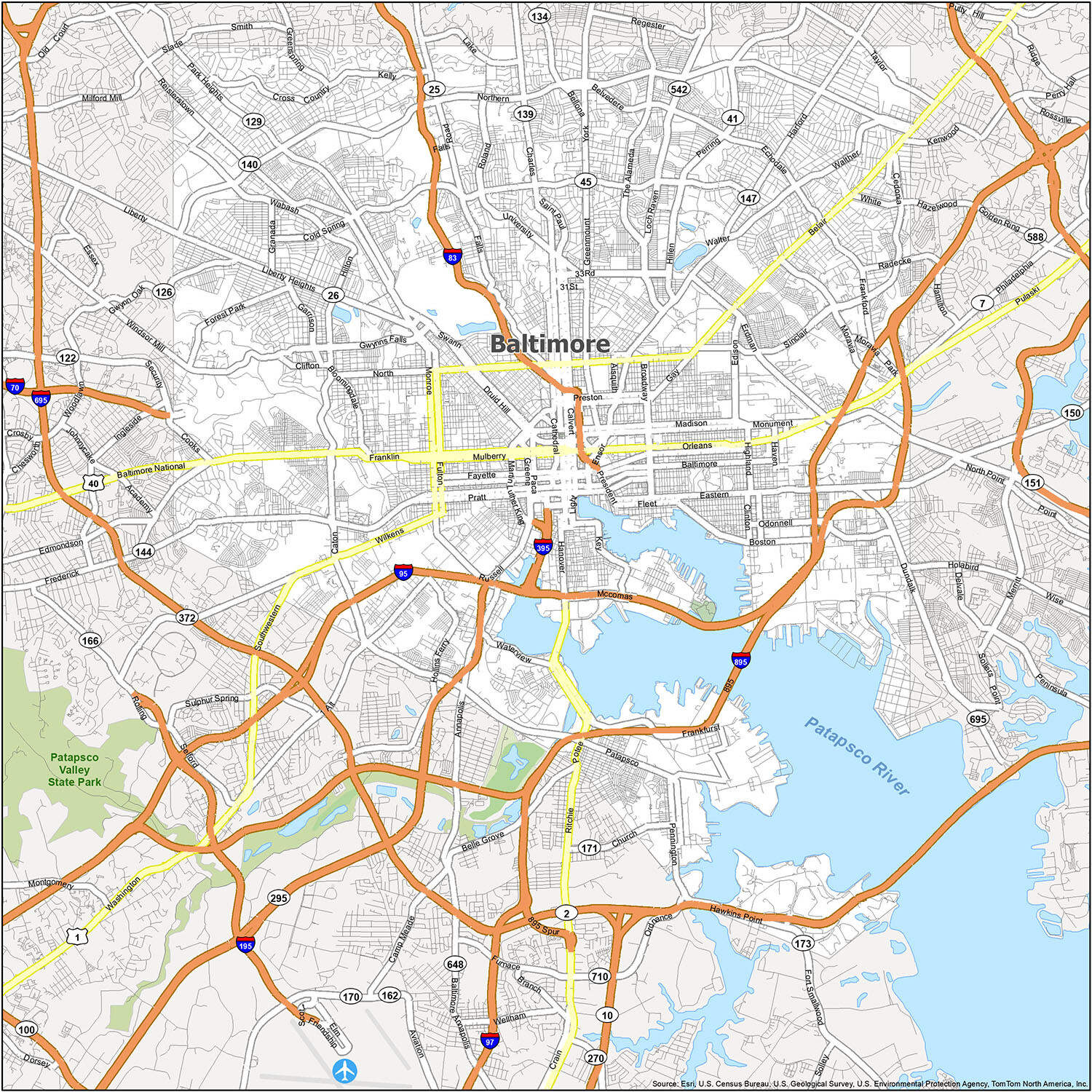
Baltimore, Maryland is a city of unique neighborhoods, rich culture, and vibrant history. From the cobblestone streets of Fells Point to the bustling Inner Harbor, each neighborhood is distinct in its own way. Explore the city with this map to find out where the different neighborhoods are located and what they have to offer.
Baltimore/Washington International Thurgood Marshall Airport (BWI) is the main airport serving the city of Baltimore. The city of Baltimore is home to a variety of neighborhoods, including Arbutus, Baltimore Highlands, Brooklyn Park, Catonsville, Dundalk, Edgemere, Elkridge, Essex, Ferndale, Glen Burnie, Ilchester, Lansdowne, Linthicum, Lochearn, Middle River, Milford Mill, Overlea, Parkville, Pasadena, Perry Hall, Pikesville, Randallstown, Riviera Beach, Rosedale, Rossville, Towson, White Marsh, and Woodlawn.
Discover Baltimore’s unique neighborhoods and cultural attractions with this map of the city. You’ll be able to explore the different areas of Baltimore and get a better understanding of the city’s rich history and culture. So what are you waiting for? Start exploring Baltimore today!
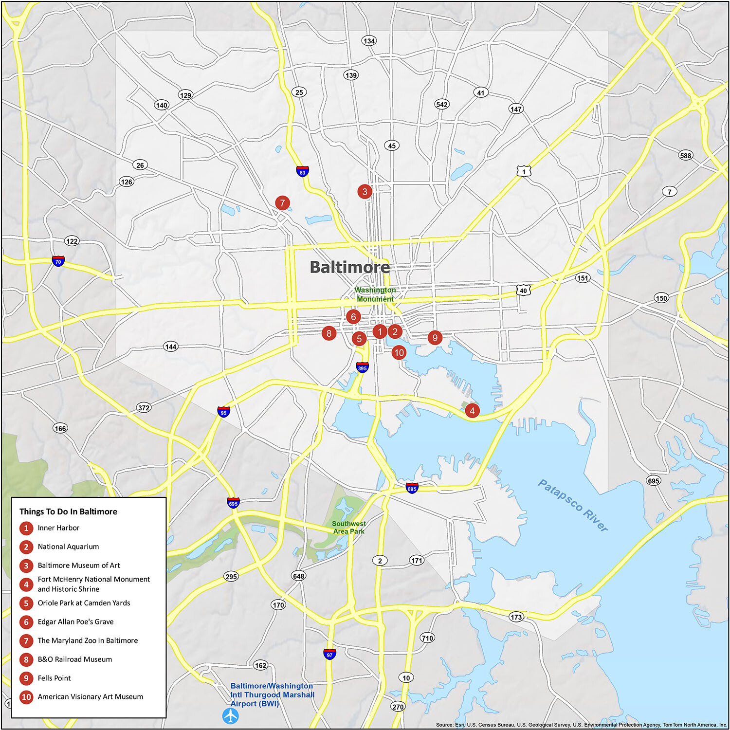
10 things to do in Baltimore city
Baltimore, Maryland is a vibrant city with plenty of things to see and do. From the waterfront to the Inner Harbor and Fort McHenry National Monument & Historic Shrine, there’s something for everyone to enjoy in the city. With the help of the Baltimore Maryland map, you can explore all the great attractions the city has to offer. From the Inner Harbor to the National Aquarium, Baltimore Museum of Art, Oriole Park at Camden Yards, Edgar Allan Poe’s Grave, The Maryland Zoo in Baltimore, B&O Railroad Museum, Fells Point and the American Visionary Art Museum, there are plenty of places to explore in Baltimore.
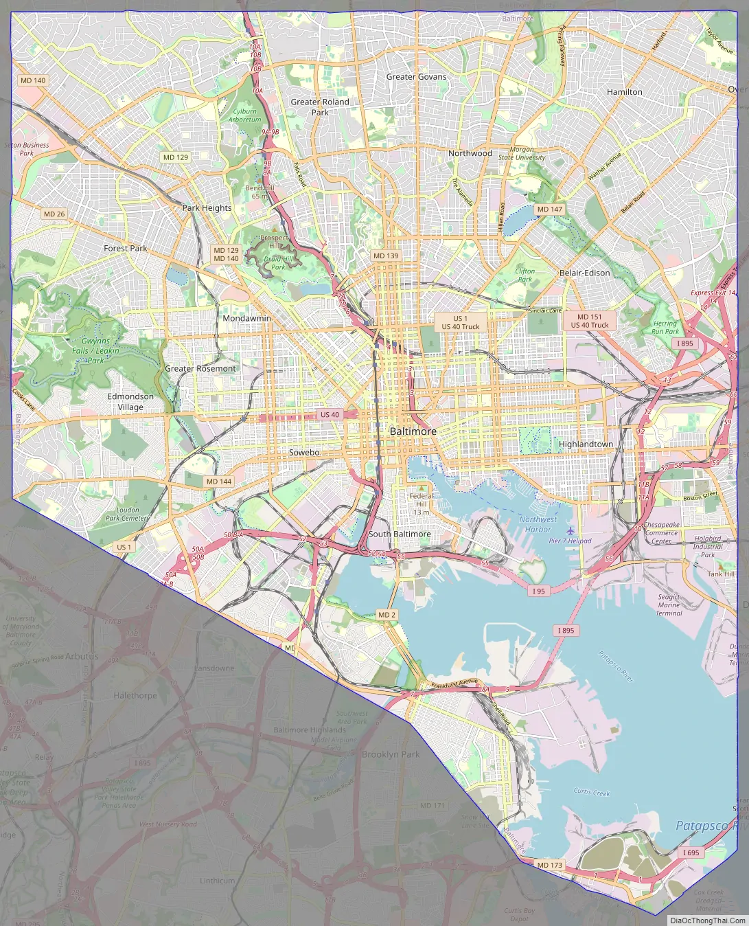
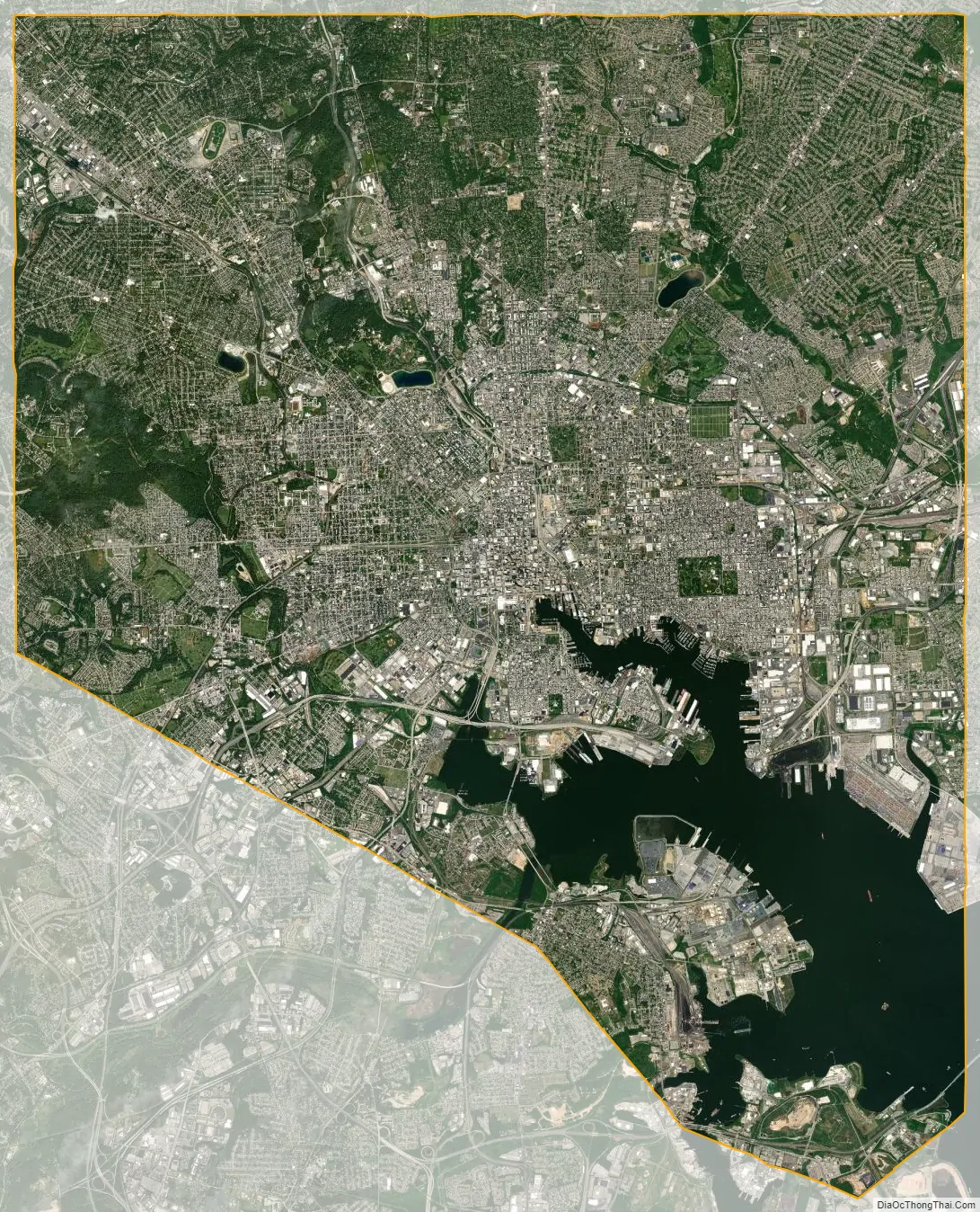
Baltimore city Satellite Map
See also
Map of Maryland State and its subdivision: Map of other states:- Alabama
- Alaska
- Arizona
- Arkansas
- California
- Colorado
- Connecticut
- Delaware
- District of Columbia
- Florida
- Georgia
- Hawaii
- Idaho
- Illinois
- Indiana
- Iowa
- Kansas
- Kentucky
- Louisiana
- Maine
- Maryland
- Massachusetts
- Michigan
- Minnesota
- Mississippi
- Missouri
- Montana
- Nebraska
- Nevada
- New Hampshire
- New Jersey
- New Mexico
- New York
- North Carolina
- North Dakota
- Ohio
- Oklahoma
- Oregon
- Pennsylvania
- Rhode Island
- South Carolina
- South Dakota
- Tennessee
- Texas
- Utah
- Vermont
- Virginia
- Washington
- West Virginia
- Wisconsin
- Wyoming