Clear Spring is a town in Washington County, Maryland, United States. The population was 358 at the 2010 census.
| Name: | Clear Spring town |
|---|---|
| LSAD Code: | 43 |
| LSAD Description: | town (suffix) |
| State: | Maryland |
| County: | Washington County |
| Incorporated: | 1836 |
| Elevation: | 571 ft (174 m) |
| Total Area: | 0.12 sq mi (0.30 km²) |
| Land Area: | 0.12 sq mi (0.30 km²) |
| Water Area: | 0.00 sq mi (0.00 km²) |
| Total Population: | 372 |
| Population Density: | 3,234.78/sq mi (1,250.41/km²) |
| ZIP code: | 21722 |
| Area code: | 301, 240 |
| FIPS code: | 2417600 |
| GNISfeature ID: | 0589986 |
| Website: | www.clearspringmd.gov |
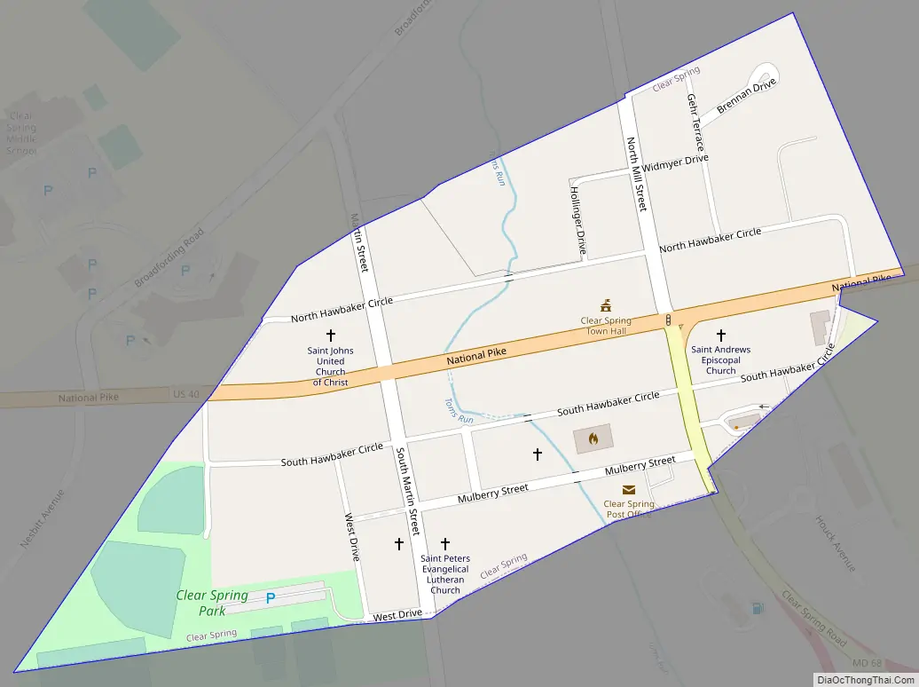
Online Interactive Map
Click on ![]() to view map in "full screen" mode.
to view map in "full screen" mode.
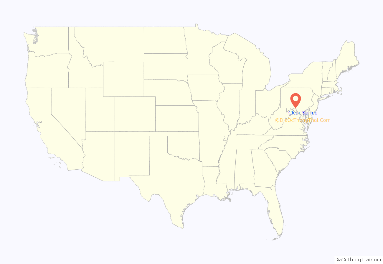
Clear Spring location map. Where is Clear Spring town?
History
The Joseph Fiery House, Wilson School, Rufus Wilson Complex, and Plumb Grove are listed on the National Register of Historic Places.
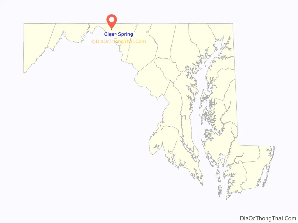
Clear Spring Road Map
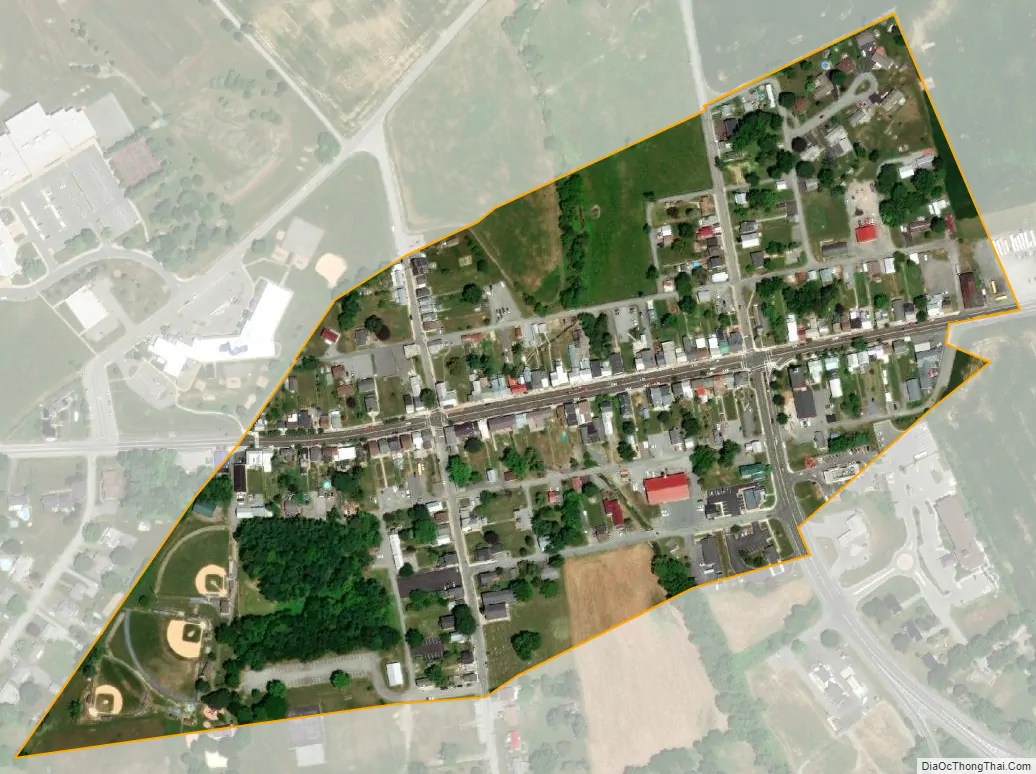
Clear Spring city Satellite Map
Geography
Clear Spring is located at 39°39′22″N 77°55′51″W / 39.65611°N 77.93083°W / 39.65611; -77.93083 (39.656011, -77.930828).
According to the United States Census Bureau, the town has a total area of 0.11 square miles (0.28 km), all land.
The town is situated at the eastern base of Fairview Mountain. The area is underlain by Conococheague limestone. The spring after which the town is named is the only local source of ground water, from which the local run, Tom’s Run, receives its volume.
See also
Map of Maryland State and its subdivision: Map of other states:- Alabama
- Alaska
- Arizona
- Arkansas
- California
- Colorado
- Connecticut
- Delaware
- District of Columbia
- Florida
- Georgia
- Hawaii
- Idaho
- Illinois
- Indiana
- Iowa
- Kansas
- Kentucky
- Louisiana
- Maine
- Maryland
- Massachusetts
- Michigan
- Minnesota
- Mississippi
- Missouri
- Montana
- Nebraska
- Nevada
- New Hampshire
- New Jersey
- New Mexico
- New York
- North Carolina
- North Dakota
- Ohio
- Oklahoma
- Oregon
- Pennsylvania
- Rhode Island
- South Carolina
- South Dakota
- Tennessee
- Texas
- Utah
- Vermont
- Virginia
- Washington
- West Virginia
- Wisconsin
- Wyoming


