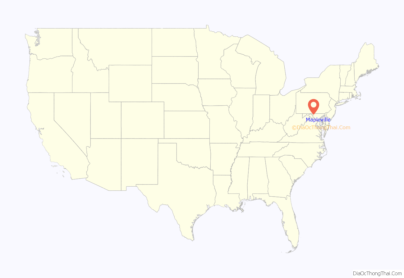
Mapleville is an unincorporated community and census-designated place in eastern Washington County, Maryland, United States. Its population was 243 as of the 2020 census. It is officially a part of the Hagerstown Metropolitan Area.
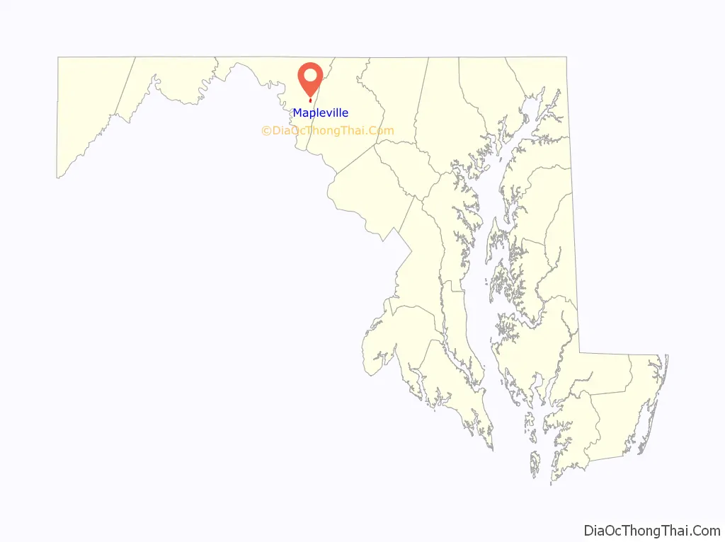
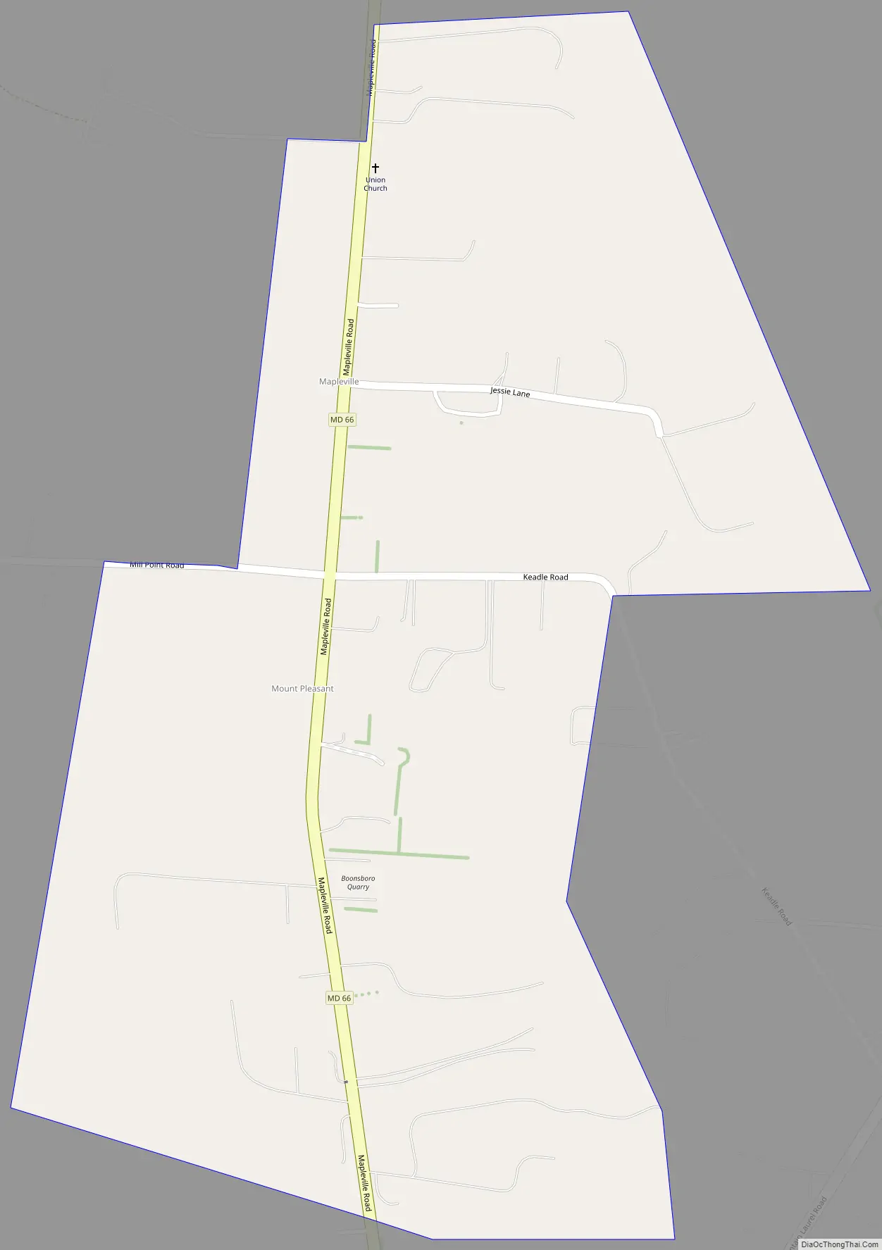
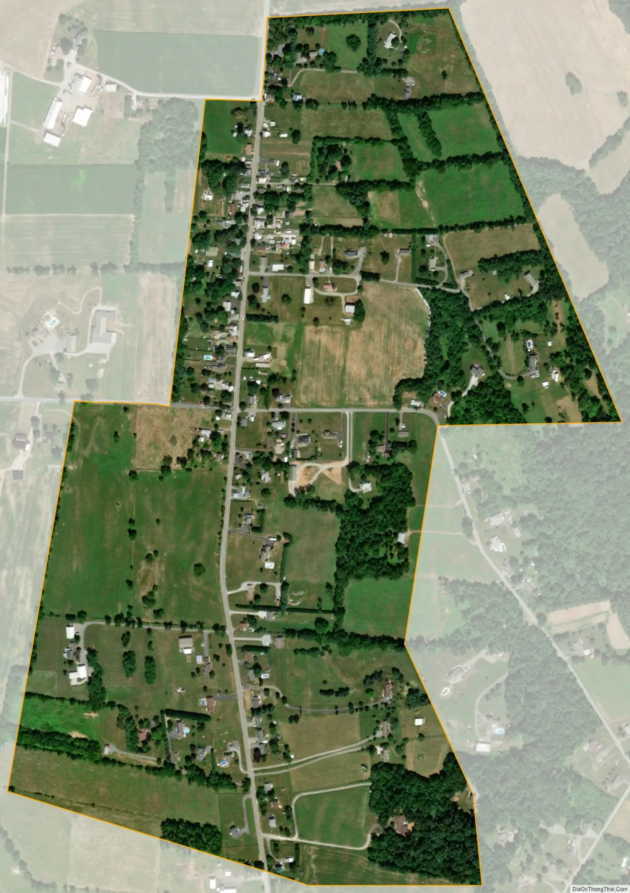
Mapleville lies along MD Route 66, known locally as the Mapleville Road, north of Boonsboro and just south of the community of San Mar. Route 66 links the towns of Boonsboro and Smithsburg, and provides local residents with access to nearby U.S. Route 40 and Interstate 70, making the main road along which the community is settled well-traveled. Short Hill, a lesser arm of the Blue Ridge’s South Mountain, lies directly to the east of Mapleville; Greenbrier State Park & Lake are located between the hill and the range’s principal ridge.
| Name: | Mapleville CDP |
|---|---|
| LSAD Code: | 57 |
| LSAD Description: | CDP (suffix) |
| State: | Maryland |
| County: | Washington County |
| Elevation: | 610 ft (190 m) |
| Total Area: | 0.40 sq mi (1.04 km²) |
| Land Area: | 0.40 sq mi (1.04 km²) |
| Water Area: | 0.00 sq mi (0.00 km²) |
| Total Population: | 243 |
| Population Density: | 602.98/sq mi (232.55/km²) |
| Area code: | 301, 240 |
| FIPS code: | 2450375 |
| GNISfeature ID: | 590735 |
Online Interactive Map
Click on ![]() to view map in "full screen" mode.
to view map in "full screen" mode.
Mapleville location map. Where is Mapleville CDP?
Mapleville Road Map
Mapleville city Satellite Map
Geography
According to the U.S. Census Bureau, the community has an area of 0.403 square miles (1.04 km), all land.
See also
Map of Maryland State and its subdivision: Map of other states:- Alabama
- Alaska
- Arizona
- Arkansas
- California
- Colorado
- Connecticut
- Delaware
- District of Columbia
- Florida
- Georgia
- Hawaii
- Idaho
- Illinois
- Indiana
- Iowa
- Kansas
- Kentucky
- Louisiana
- Maine
- Maryland
- Massachusetts
- Michigan
- Minnesota
- Mississippi
- Missouri
- Montana
- Nebraska
- Nevada
- New Hampshire
- New Jersey
- New Mexico
- New York
- North Carolina
- North Dakota
- Ohio
- Oklahoma
- Oregon
- Pennsylvania
- Rhode Island
- South Carolina
- South Dakota
- Tennessee
- Texas
- Utah
- Vermont
- Virginia
- Washington
- West Virginia
- Wisconsin
- Wyoming


