Paramount-Long Meadow is a census-designated place (CDP) in Washington County, Maryland, United States. The population was 2,722 at the 2000 census.
| Name: | Paramount-Long Meadow CDP |
|---|---|
| LSAD Code: | 57 |
| LSAD Description: | CDP (suffix) |
| State: | Maryland |
| County: | Washington County |
| Total Area: | 2.18 sq mi (5.65 km²) |
| Land Area: | 2.18 sq mi (5.65 km²) |
| Water Area: | 0.00 sq mi (0.00 km²) |
| Total Population: | 2,658 |
| Population Density: | 1,218.15/sq mi (470.33/km²) |
| ZIP code: | 21742 |
| Area code: | 240 and 301 |
| FIPS code: | 2459787 |
Online Interactive Map
Click on ![]() to view map in "full screen" mode.
to view map in "full screen" mode.
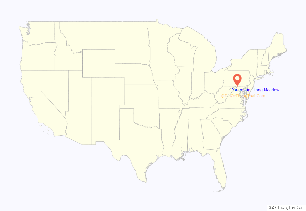
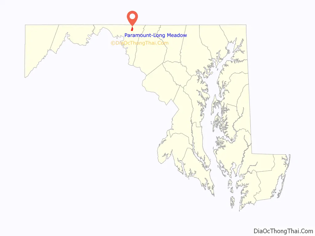
Paramount-Long Meadow location map. Where is Paramount-Long Meadow CDP?
History
The region of Washington County Maryland known today as Long Meadow was originally a large mostly level area covering close to twenty square-miles of agriculturally desirable land west of Antietam Creek. One of the earliest transportation routes through the colony passed near this region, crossing the upper branches of Antietam Creek before turning southwest. This was a route preferred by many of the early German and Swiss immigrant settlers to the Hagerstown area from central Pennsylvania. The name Long Meadow derives from a land grant issued to Thomas Cresap (Sr.) in 1739. Cresap’s Long Meadow property would be transferred to investor Daniel Dulaney of Annapolis in 1746 and enlarged from 550 acres to 2131 acres. “Long Meadow” and the region surrounding it would remain mostly agricultural until the mid-20th century. In 1958 the name was revived with the opening of the region’s first purpose-built shopping area, “Long Meadow Shopping Center” between Northern Avenue and Potomac Avenue / Leitersburg Pike.
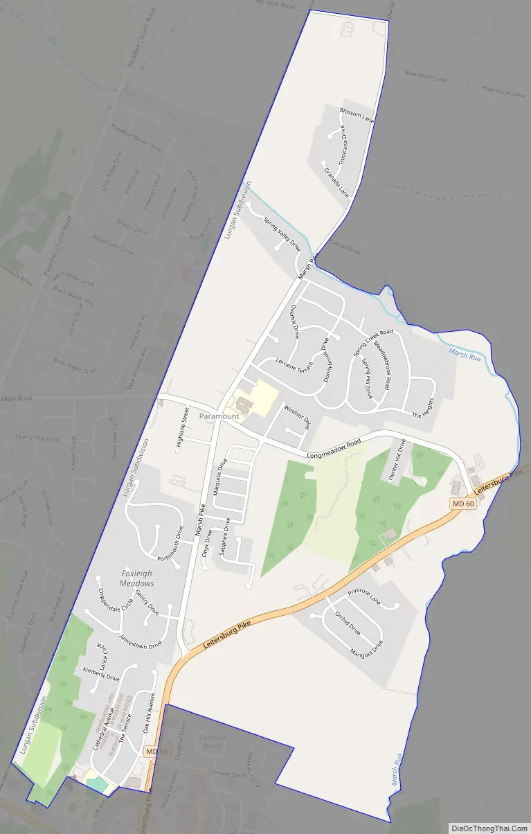
Paramount-Long Meadow Road Map
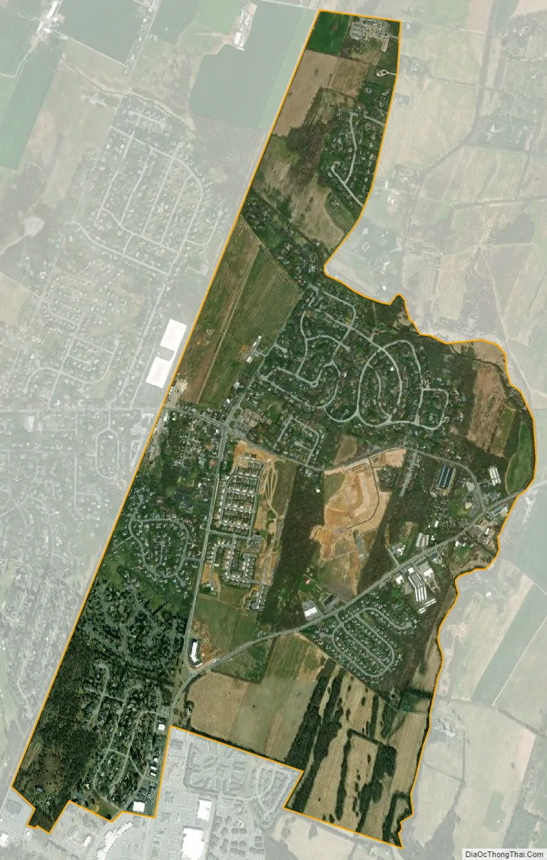
Paramount-Long Meadow city Satellite Map
Geography
Paramount-Long Meadow is located at 39°40′58″N 77°41′50″W / 39.68278°N 77.69722°W / 39.68278; -77.69722 (39.682795, −77.697175).
According to the United States Census Bureau, the CDP has a total area of 2.8 square miles (7.3 km), all land.
See also
Map of Maryland State and its subdivision: Map of other states:- Alabama
- Alaska
- Arizona
- Arkansas
- California
- Colorado
- Connecticut
- Delaware
- District of Columbia
- Florida
- Georgia
- Hawaii
- Idaho
- Illinois
- Indiana
- Iowa
- Kansas
- Kentucky
- Louisiana
- Maine
- Maryland
- Massachusetts
- Michigan
- Minnesota
- Mississippi
- Missouri
- Montana
- Nebraska
- Nevada
- New Hampshire
- New Jersey
- New Mexico
- New York
- North Carolina
- North Dakota
- Ohio
- Oklahoma
- Oregon
- Pennsylvania
- Rhode Island
- South Carolina
- South Dakota
- Tennessee
- Texas
- Utah
- Vermont
- Virginia
- Washington
- West Virginia
- Wisconsin
- Wyoming


