Calais /ˈkælɪs/ is a city in Washington County, Maine, United States. As of the 2020 census, it had a population of 3,079, making Calais the third least-populous city in Maine (after Hallowell and Eastport). The city has three Canada–US border crossings (also known as ports of entry) over the St. Croix River connecting to St. Stephen, New Brunswick, Canada.
Calais has been a city of commerce and is recognized as the primary shopping center of eastern Washington County and of Charlotte County, New Brunswick. Retail, service, and construction businesses are the primary components of the Calais economy.
| Name: | Calais city |
|---|---|
| LSAD Code: | 25 |
| LSAD Description: | city (suffix) |
| State: | Maine |
| County: | Washington County |
| Incorporated: | June 16, 1809 |
| Elevation: | 43 ft (13 m) |
| Total Area: | 40.11 sq mi (103.88 km²) |
| Land Area: | 34.32 sq mi (88.90 km²) |
| Water Area: | 5.79 sq mi (14.98 km²) |
| Total Population: | 3,079 |
| Population Density: | 89.71/sq mi (34.64/km²) |
| ZIP code: | 04619 |
| Area code: | 207 |
| FIPS code: | 2309585 |
| GNISfeature ID: | 0563341 |
| Website: | www.calaismaine.org |
Online Interactive Map
Click on ![]() to view map in "full screen" mode.
to view map in "full screen" mode.
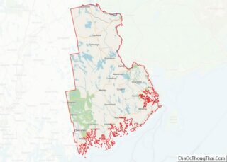
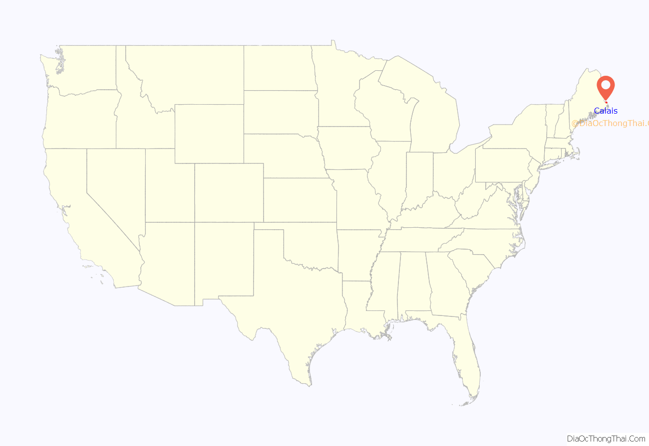
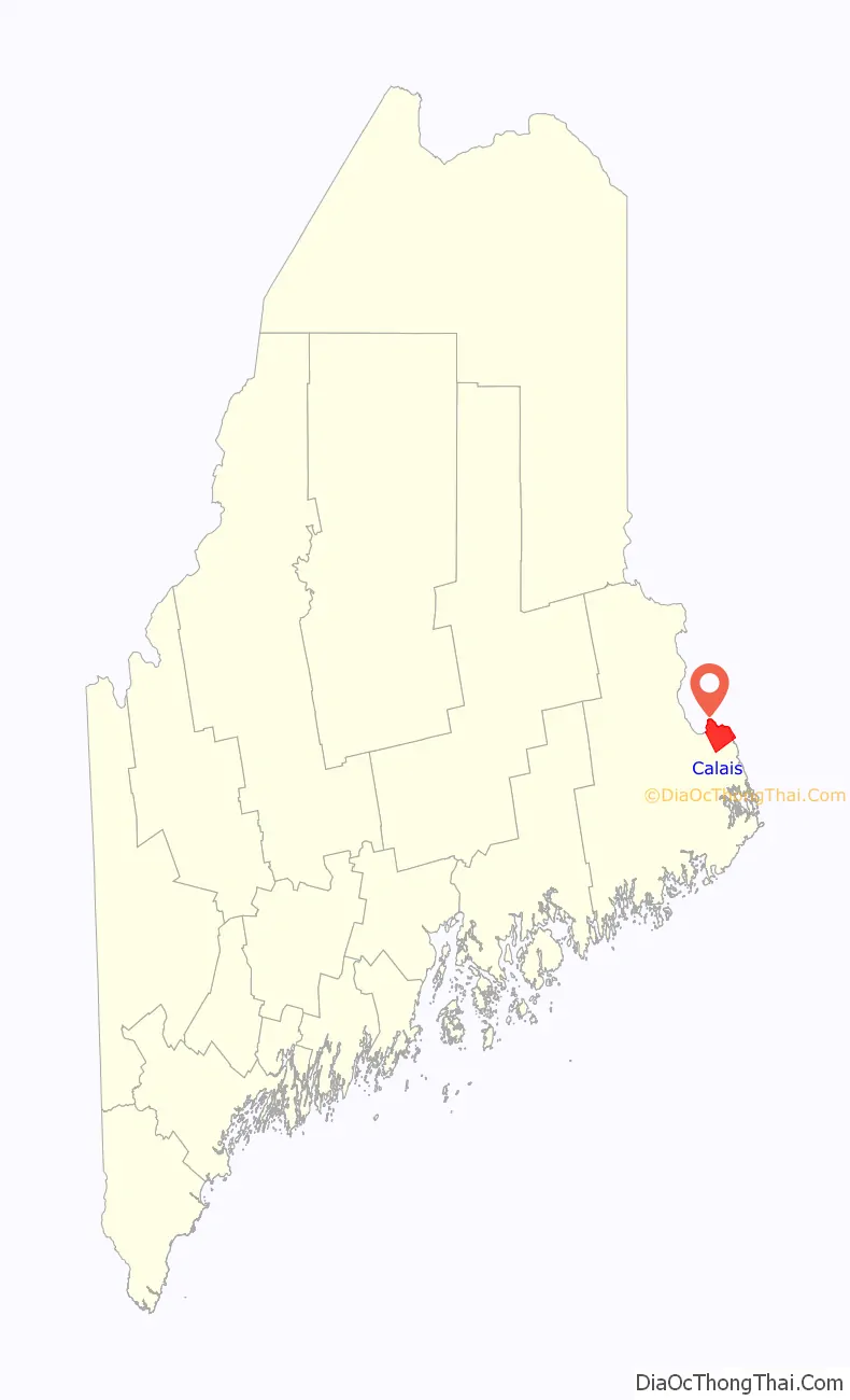
Calais location map. Where is Calais city?
History
This area was occupied for thousands of years by indigenous peoples. The historic Passamaquoddy, an Algonquian-speaking people of the Wabanaki Confederacy, was predominant in this area at the time of European encounter and settlement.
The St. Croix River and its area were first explored by the French Samuel de Champlain when he and his men spent a winter on St. Croix Island in 1604. The first permanent settler was Daniel Hill of Jonesboro, who arrived in 1779 during the American Revolutionary War, when this was still part of Massachusetts. With other settlers, he built the first sawmill in 1782. On June 27, 1789, the Massachusetts General Court sold the township to Waterman Thomas for 19¢ an acre (approx. $2.86 an acre in 2018 dollars). Early occupations in the settlement included farming, hunting and ship building.
On June 16, 1809, Plantation Number 5 PS was incorporated as Calais after Calais, France, in honor of French assistance during the American Revolution. The river provided the mill town with water power for industry, which included sawmills, clapboard and shingle mills, two planing mills, a saw factory, two axe factories and four grain mills. There were foundries, machine shops, granite works, shoe factories and a tannery. Other businesses produced bricks, bedsteads, brooms, carriages and plaster.
The relationship between Calais and the neighboring Canadian town of St. Stephen has been remarkably close, over a period of many years. As evidence of the longtime friendship between the towns, during the War of 1812, the British military provided St. Stephen with a large supply of gunpowder for protection against the enemy Americans in Calais, but St. Stephen’s town elders gave the gunpowder to Calais for its Fourth of July celebrations.
Calais is the home of the first railroad built in the state of Maine, the Calais Railroad, incorporated by the state legislature on February 17, 1832. It was built to transport lumber from a mill on the St. Croix River opposite Milltown, New Brunswick, 2 miles (3 km) to the tidewater at Calais in 1835. In 1849, the name was changed to the Calais & Baring Railroad, and the line was extended 4 miles (6 km) farther to Baring. In 1870, it became part of the St. Croix & Penobscot Railroad.
Calais was incorporated as a city on August 24, 1850. On July 18, 1864, Confederate agents crossed the border from New Brunswick and attempted to rob a bank in Calais.
The Calais Free Library was designed by noted Boston architect Arthur H. Vinal and opened on July 4, 1893. The Romanesque Revival building was listed on the National Register of Historic Places in 2001.
Other places in Calais listed on the National Register of Historic Places are the Calais Historic District, Calais Residential Historic District, Devils Head Site, Gilmore House, Thomas Hamilton House, Hinckley Hill Historic District, Holmes Cottage, Dr. Job Holmes House, Theodore Jellison House, Pike’s Mile Markers, St. Anne’s Episcopal Church, George Washburn House and Whitlocks Mill Light.
Main Street in 1913
Calais Avenue c. 1905
International Bridge in 1913
Looking east from bridge in 1908
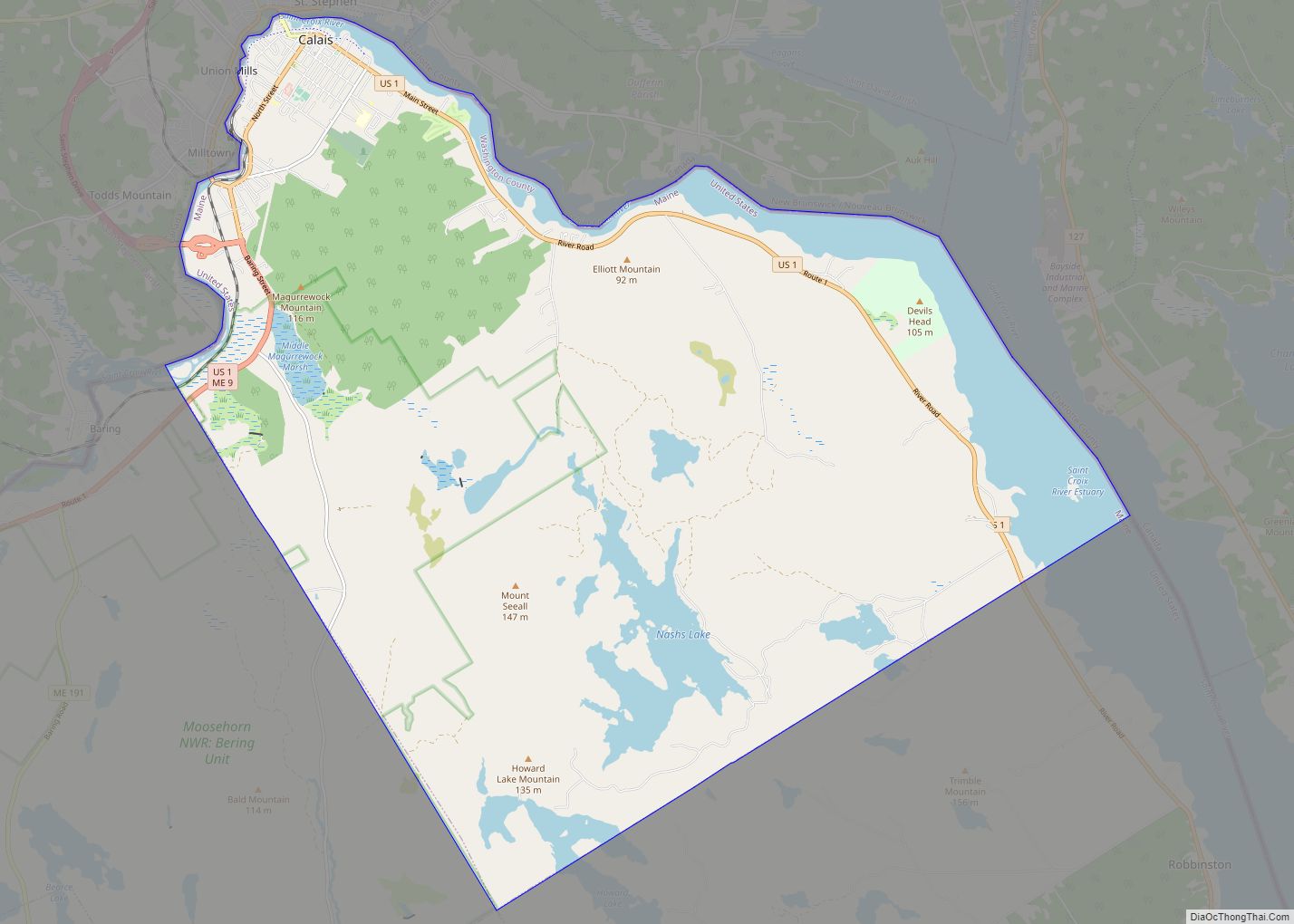
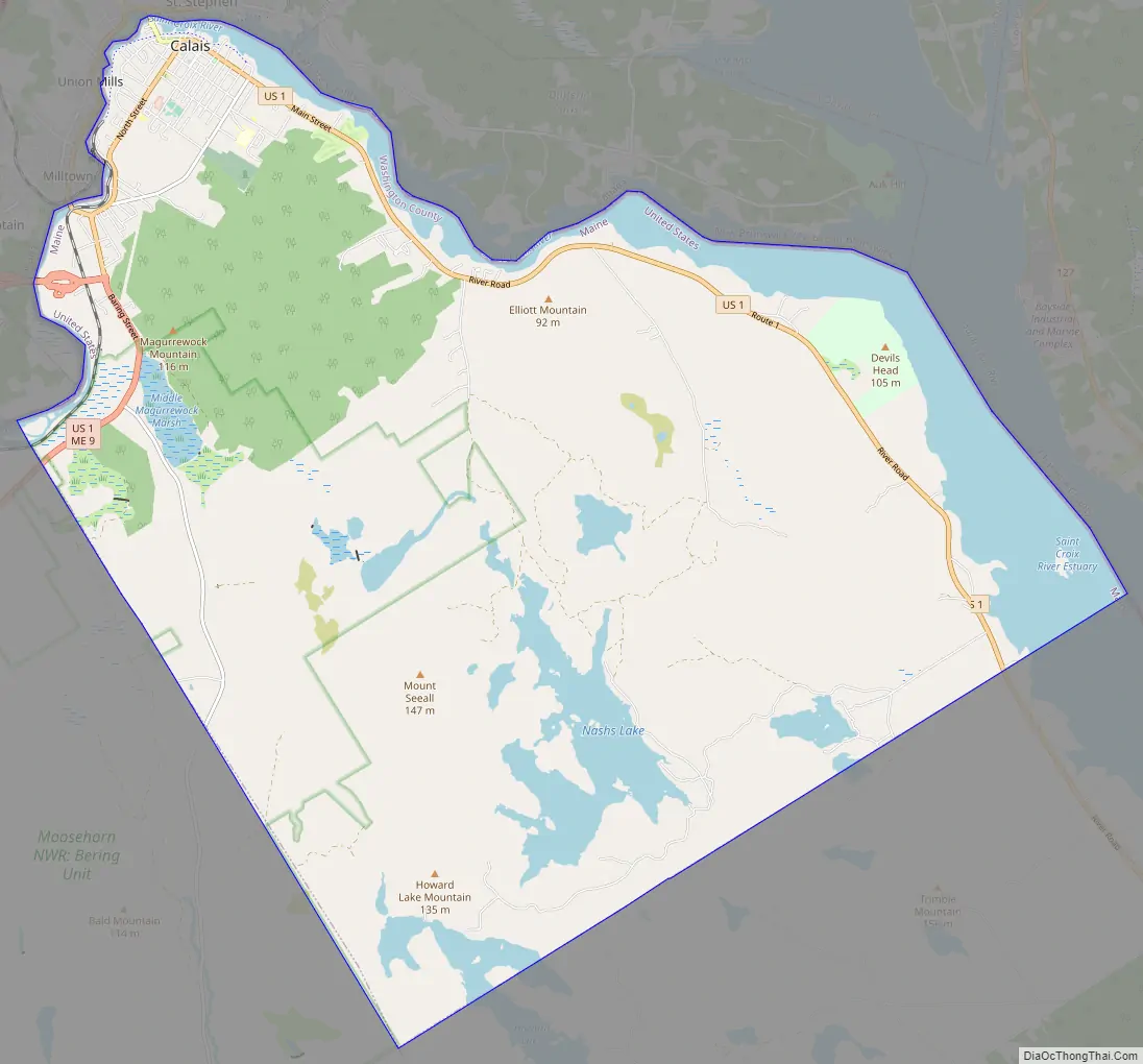
Calais Road Map
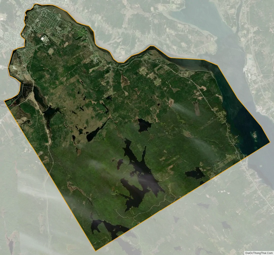
Calais city Satellite Map
Geography
Calais is located at 45°9′58″N 67°14′33″W / 45.16611°N 67.24250°W / 45.16611; -67.24250 (45.166045, −67.242434).
According to the United States Census Bureau, the city has a total area of 40.10 square miles (103.86 km), of which 34.32 square miles (88.89 km) is land and 5.78 square miles (14.97 km) is water. Calais is located at the head of tide on the St. Croix River.
Recently, the City of Calais acquired Devil’s Head. The site comprises 318 acres (1.29 km) of land, one mile (1.6 km) of frontage on the St. Croix River estuary, and 6/10 of a mile of frontage on U.S. Route 1. Significant features on the property include a 340-foot (100 m) high granite headland towering over the estuary, a low-tide sand and boulder beach, upland forest, and abundant wildlife. Trail construction was completed in 2003.
Calais is the northern terminus of the East Coast Greenway, which has its southern terminus in Key West, Florida.
See also
Map of Maine State and its subdivision: Map of other states:- Alabama
- Alaska
- Arizona
- Arkansas
- California
- Colorado
- Connecticut
- Delaware
- District of Columbia
- Florida
- Georgia
- Hawaii
- Idaho
- Illinois
- Indiana
- Iowa
- Kansas
- Kentucky
- Louisiana
- Maine
- Maryland
- Massachusetts
- Michigan
- Minnesota
- Mississippi
- Missouri
- Montana
- Nebraska
- Nevada
- New Hampshire
- New Jersey
- New Mexico
- New York
- North Carolina
- North Dakota
- Ohio
- Oklahoma
- Oregon
- Pennsylvania
- Rhode Island
- South Carolina
- South Dakota
- Tennessee
- Texas
- Utah
- Vermont
- Virginia
- Washington
- West Virginia
- Wisconsin
- Wyoming