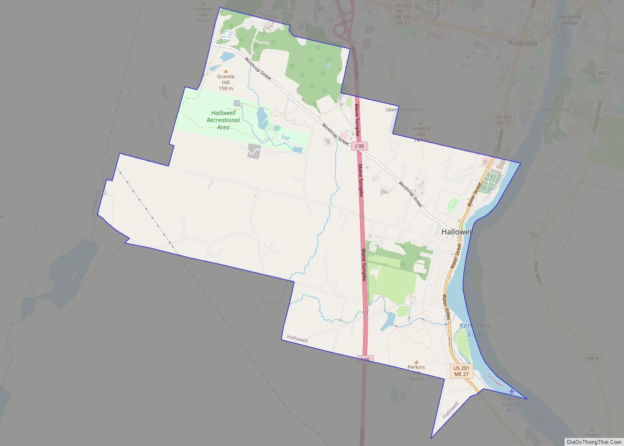
Hallowell is a city in Kennebec County, Maine, United States. The population was 2,570 at the 2020 census. Popular with tourists, Hallowell is noted for its culture and old architecture. Hallowell is included in the Augusta, Maine, micropolitan New England City and Town Area.
| Name: | Hallowell city |
|---|---|
| LSAD Code: | 25 |
| LSAD Description: | city (suffix) |
| State: | Maine |
| County: | Kennebec County |
| Incorporated: | 1771 |
| Elevation: | 39 ft (12 m) |
| Total Area: | 6.08 sq mi (15.76 km²) |
| Land Area: | 5.86 sq mi (15.19 km²) |
| Water Area: | 0.22 sq mi (0.57 km²) |
| Total Population: | 2,570 |
| Population Density: | 438.27/sq mi (169.22/km²) |
| ZIP code: | 04347 |
| Area code: | 207 |
| FIPS code: | 2330550 |
| GNISfeature ID: | 0567519 |
| Website: | www.hallowell.govoffice.com |
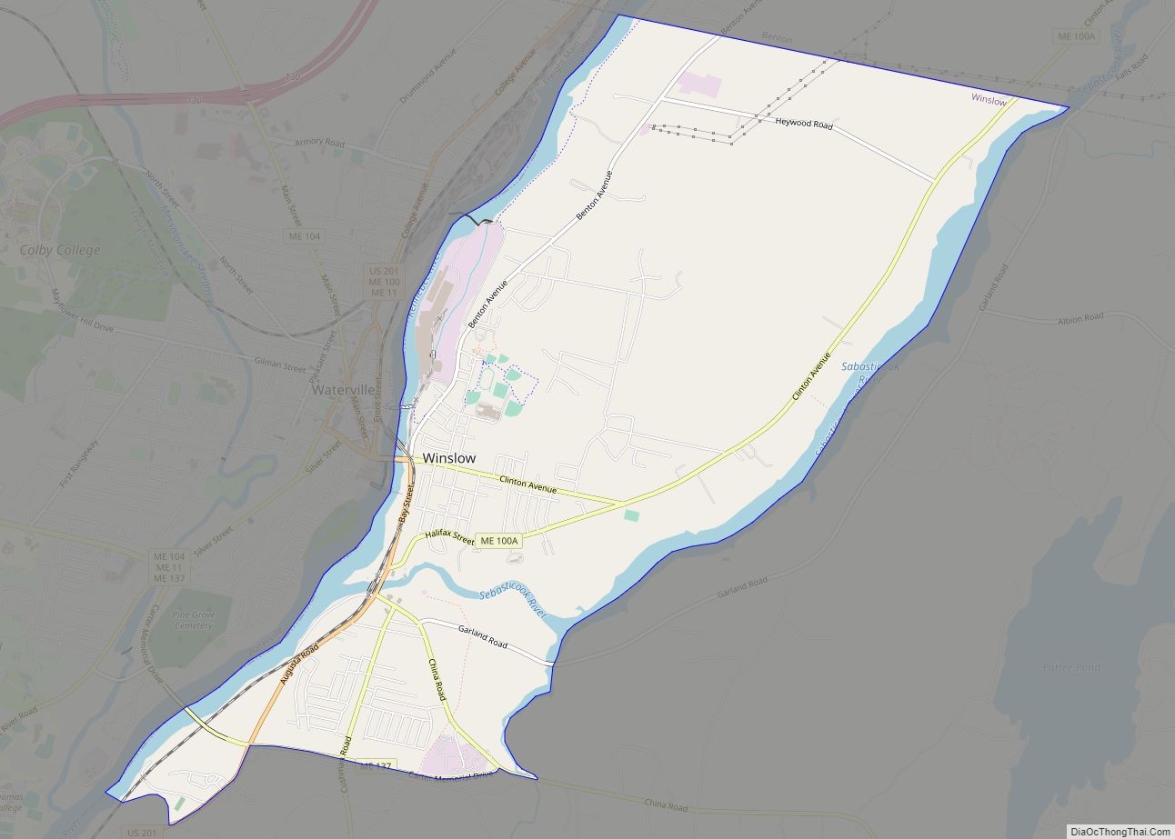
Online Interactive Map
Click on ![]() to view map in "full screen" mode.
to view map in "full screen" mode.
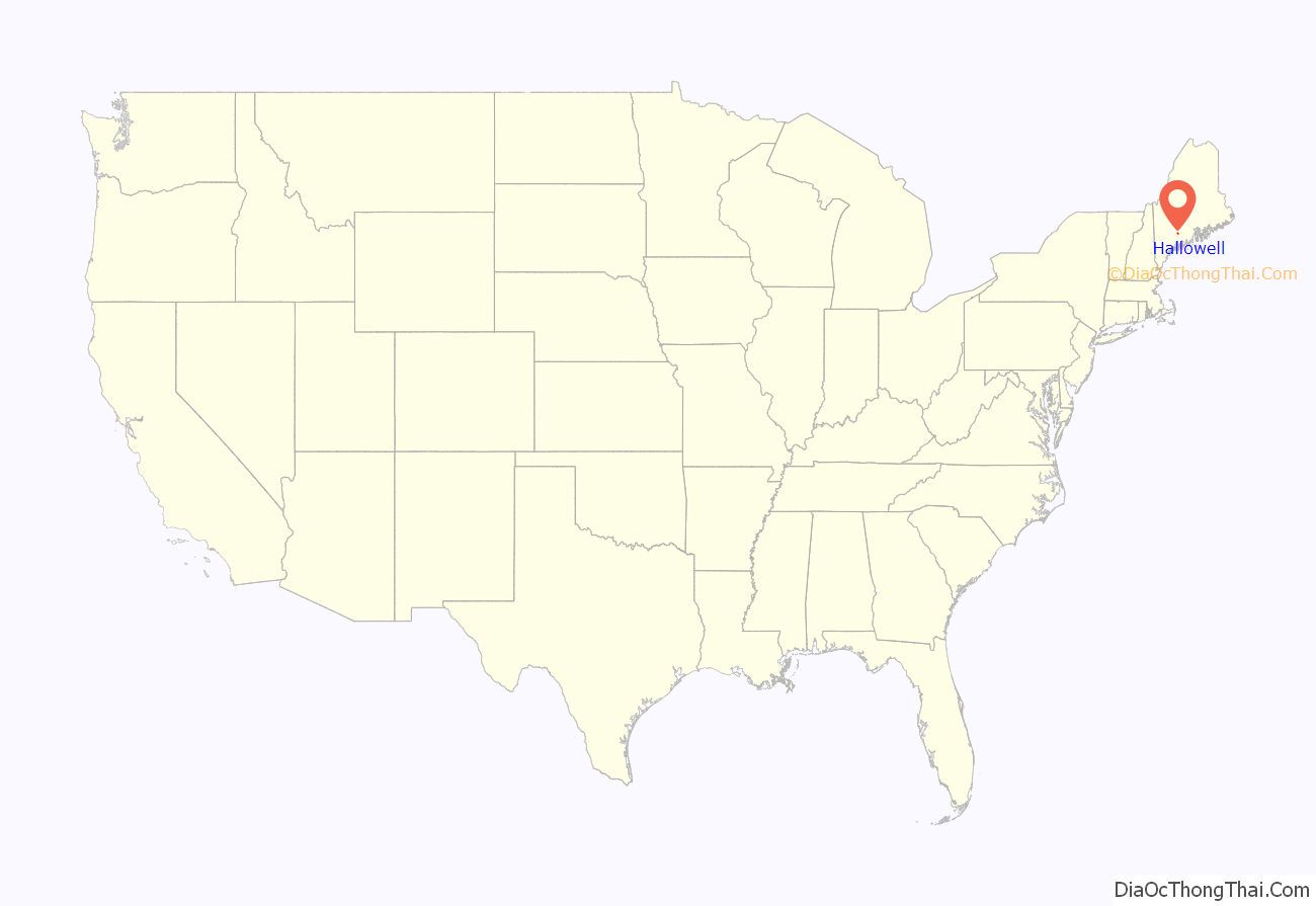
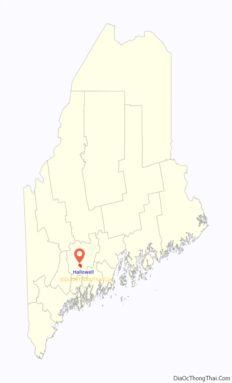
Hallowell location map. Where is Hallowell city?
History
The city is named for Benjamin Hallowell, a Boston merchant and one of the Kennebec Proprietors, holders of land originally granted to the Plymouth Company by the British monarchy in the 1620s.
First to settle here was Deacon Pease Clark, who emigrated with his wife and son Peter from Attleborough, Massachusetts, in the spring of 1762. Legend has it that after disembarking on the west side of the Kennebec, near present-day Water Street, the Clarks took shelter in their overturned cart. On a riverfront lot measuring 50 rods (275 yards, about 250 meters), the Clark family raised corn, rye and other crops. The first land they cleared was occupied by the fire department in 1859.
In 1797, Harrington (later the city of Augusta) split from Hallowell to be a separate town. The part of Hallowell that is the current city was then known as “The Hook”. Today, the city’s population (2,467) is only slightly smaller than it was in 1820, the year Maine seceded from Massachusetts and became a state. Yet 183 years ago, Hallowell’s inhabitants enjoyed the services of 71 stores along Water Street (by contrast, Augusta had a population of 1,000 and just 20 merchants). On February 20, 1799, Hallowell was reapportioned from Lincoln County to Kennebec County.
Thriving industries included logging, trading, publishing and shipbuilding. Location on the navigable Kennebec River estuary allowed 50 ships launched from Hallowell’s wharves to reach the Atlantic Ocean between 1783 and 1901. Two grist mills, five sawmills and two slaughterhouses served the needs of residents near and far.
In 1815, the first granite quarried near the Manchester town line signaled the birth of an industry that would support Hallowell until 1908, when cement displaced stone as the construction material of choice. In 1826, the ice industry began in earnest, employing thousands over the next 75 years. Frozen blocks loaded onto Hallowell’s schooners were delivered to Cuba and the West Indies. Other local products exported via the Kennebec (and, after 1857, by train) from Hallowell included sandpaper, textiles from cotton from the Deep South, rope, linseed oil, oilcloth, wire, books and shoes.
The Kennebec River sustained the city from its inception, but the mighty freeway also inspired fear. Spring floods regularly terrorized shopkeepers and sometimes brought commerce to a standstill. Worse still, citizens eager to cross the river in winter and unwary children skating and playing too far from the riverbank lost their lives when ice turned out to be thinner than it looked. On July 9, 1816, a freak frost during the Year Without a Summer destroyed crops and forced hungry families to sell their farms for half their worth.
In 1874, the state opened the Maine Industrial School for Girls in Hallowell. Operated until the 1970s, it was the state’s first reform school for girls.
Hallowell Road Map

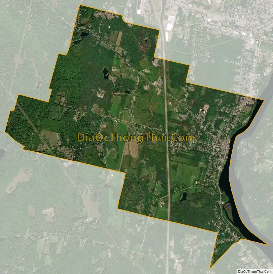
Hallowell city Satellite Map
Geography
Hallowell is located at 44°17′12″N 69°47′52″W / 44.28667°N 69.79778°W / 44.28667; -69.79778 (44.286802, −69.797884).
According to the United States Census Bureau, the city has a total area of 6.09 square miles (15.77 km), of which, 5.88 square miles (15.23 km) is land and 0.21 square miles (0.54 km) is water. Drained by Vaughn Brook, Hallowell is bounded by the Kennebec River.
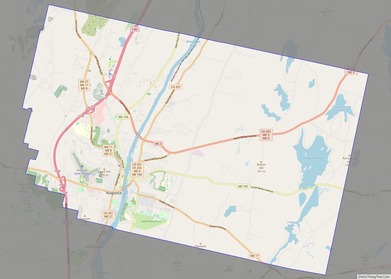
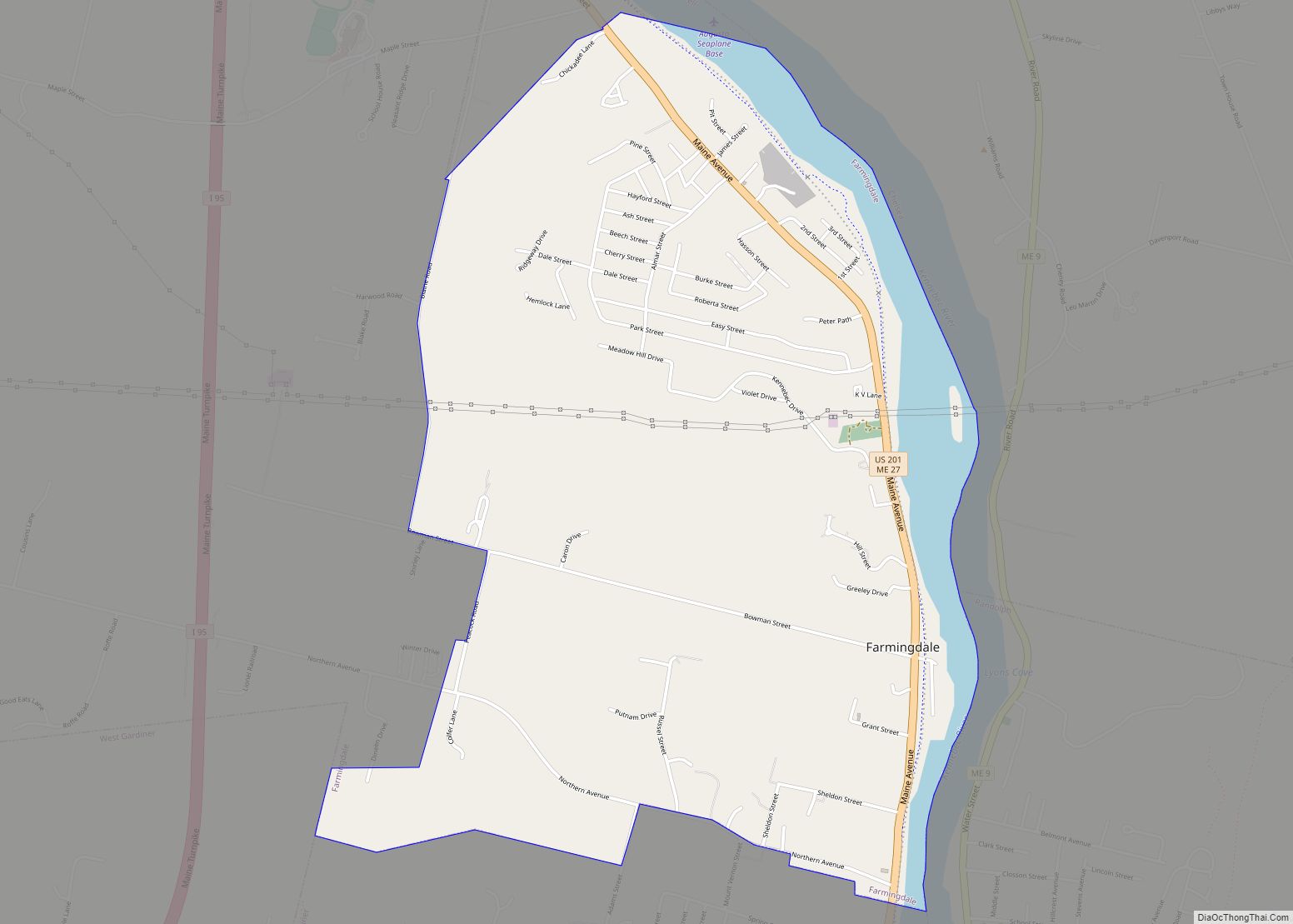
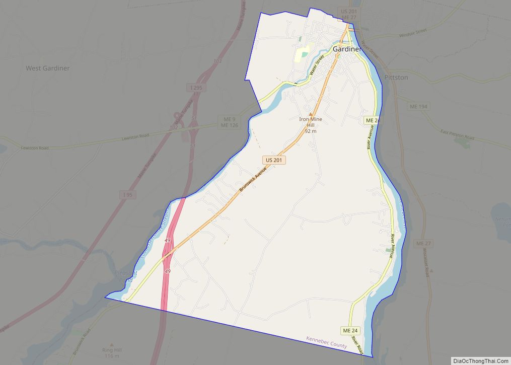
The city is crossed by Interstate 95, as well as state routes 27 and 201. It borders the towns of Farmingdale to the south, Manchester to the west, Augusta to the north, and Chelsea across the Kennebec River to the east.
Climate
This climatic region is typified by large seasonal temperature differences, with warm to hot (and often humid) summers and cold (sometimes severely cold) winters. According to the Köppen Climate Classification system, Hallowell has a humid continental climate, abbreviated “Dfb” on climate maps.
See also
Map of Maine State and its subdivision: Map of other states:- Alabama
- Alaska
- Arizona
- Arkansas
- California
- Colorado
- Connecticut
- Delaware
- District of Columbia
- Florida
- Georgia
- Hawaii
- Idaho
- Illinois
- Indiana
- Iowa
- Kansas
- Kentucky
- Louisiana
- Maine
- Maryland
- Massachusetts
- Michigan
- Minnesota
- Mississippi
- Missouri
- Montana
- Nebraska
- Nevada
- New Hampshire
- New Jersey
- New Mexico
- New York
- North Carolina
- North Dakota
- Ohio
- Oklahoma
- Oregon
- Pennsylvania
- Rhode Island
- South Carolina
- South Dakota
- Tennessee
- Texas
- Utah
- Vermont
- Virginia
- Washington
- West Virginia
- Wisconsin
- Wyoming