Sweden, a Nordic nation in Northern Europe, covers an area of 450,295 sq. km.
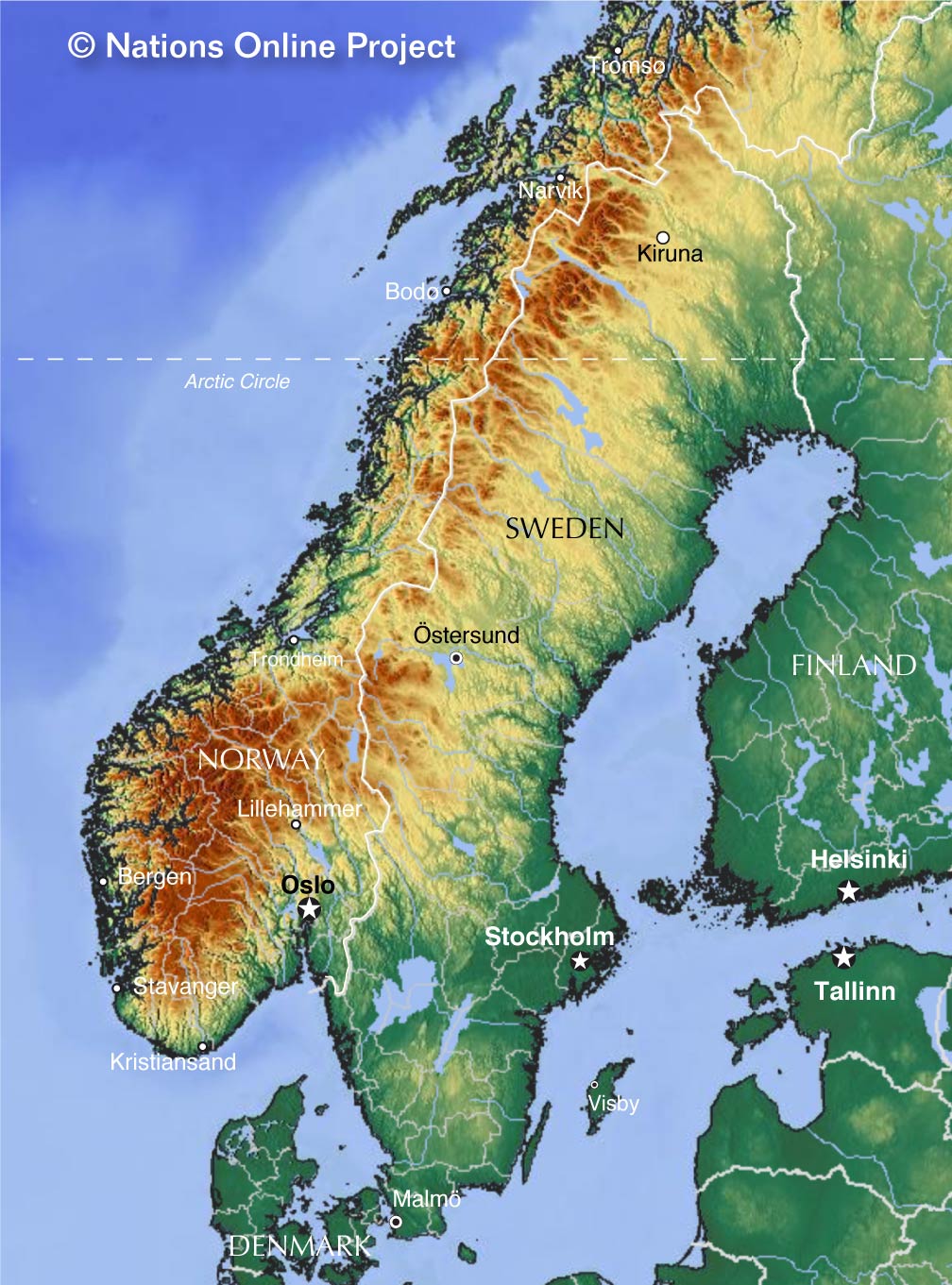
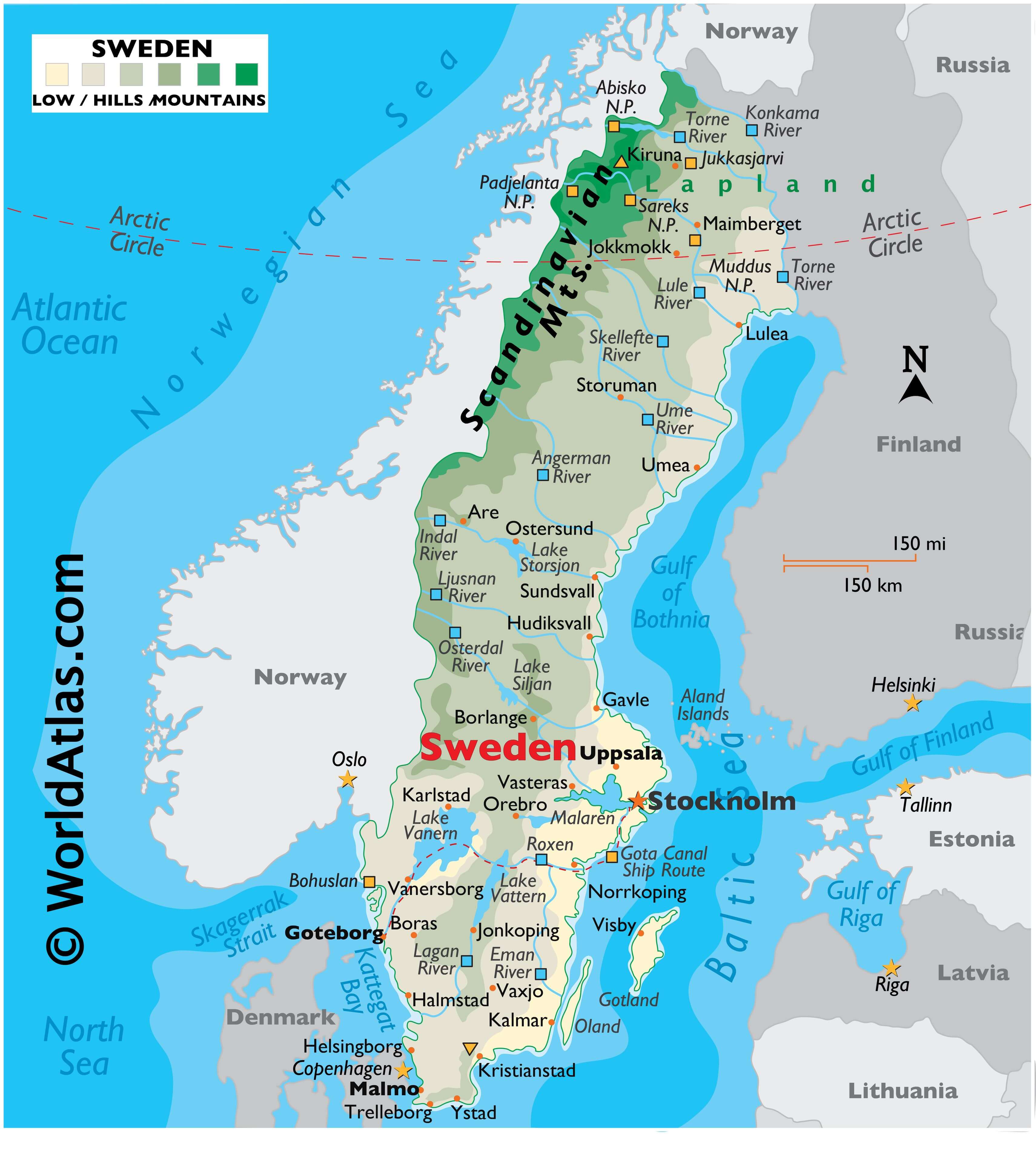
The topography of the country is largely shaped by ice. During the last Ice Age, much of Sweden was covered by a thick layer of ice. By 6,000 BC, when that ice finally retreated (or melted) it left in its wake a deeply-indented coastline (in the south) with many islands, and innumerable lakes, rivers and streams spread across the entire country.
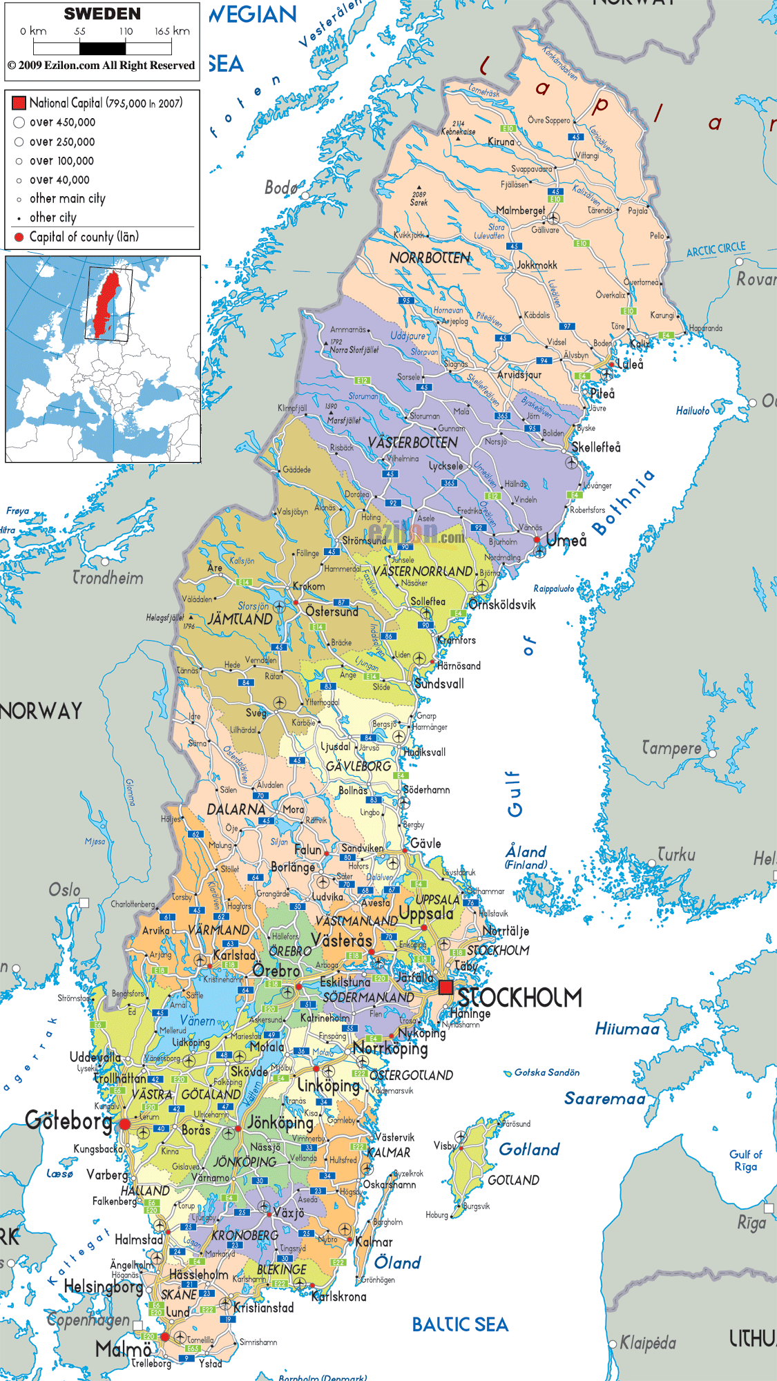
As observed on the physical map of Sweden, to the north (above the Arctic Circle) Sweden is rugged with snow-covered mountains and thick forests. Central Sweden is dominated by lower mountains in the west that give way to heavily forested hills and ridges, dozens and dozens of rivers and an estimated 101,000 lakes. In the south, large lakes (some linked by canals) and widely cultivated plains stretch across the land.
Sweden’s border with Norway is covered by the Scandinavian Mountains, or in Swedish, the Kolen (or Kjolen) Mountains. These are relatively low-level mountains, as Sweden’s highest point, Kebnekaise, stands at just 2,111 meters (about 7,000 ft.) It has been marked on the map by a yellow upright triangle.
The country has a 3,218 km (2,000 mi) long coastline to the east. Sweden’s coastal areas include several small islands and reefs, especially in the east and southwest. Directly south of Stockholm (a city of islands) are Gotland and Oland, Sweden’s largest islands. White sandy beaches are common along the southern coastline.
Significant lakes include Siljan, Storsjom, Varern and Vattern, and with few exceptions, the balance of Sweden’s lakes are on the small side.
Sweden’s largest rivers include the Angerman, Eman, Indal, Lagan, Ljusnan, Lule, Osterdal, Skellefte, Storuman, Torne and Ume.
The lowest point in the country is Kristianstad at −2.41 m (−7.9 ft). It has been marked on the map by an inverted triangle.
| Flag: |  |
|---|---|
| Legal Name: | Kingdom of Sweden |
| Capital Value: | Stockholm |
| Official languages: | Swedish |
| Demonym(s): |
|
| Government: | Unitary parliamentaryconstitutional monarchy |
| Legislature: | Riksdag |
| Total Area: | 450,295 km² |
| Land Area: | 410,335 km² |
| Water Area: | 39,960 km² |
| Population: | 10,285,453 |
| Density: | 25/km (64.7/sq mi) (198th) |
| GDP: | $530.83 Billion |
| GDP Per Capita: | $51,610.07 |
| Currency Value: | Swedish kronor (SEK) |
| Driving side: | right |
| Calling code: | +46 |
| Internet TLD: | .se |
Sweden is a country of captivating landscapes, with its diverse range of mountains, lakes, and rivers. The map of Sweden displays its impressive geography, ranging from the Scandinavian Mountains to its vast number of lakes, like Vänern, the largest in Sweden. The map also showcases the country’s highways, cities, and roads, giving visitors a comprehensive overview of the region’s spectacular geography.
Online Interactive Political Map
Click on ![]() to view map in "full screen" mode.
to view map in "full screen" mode.
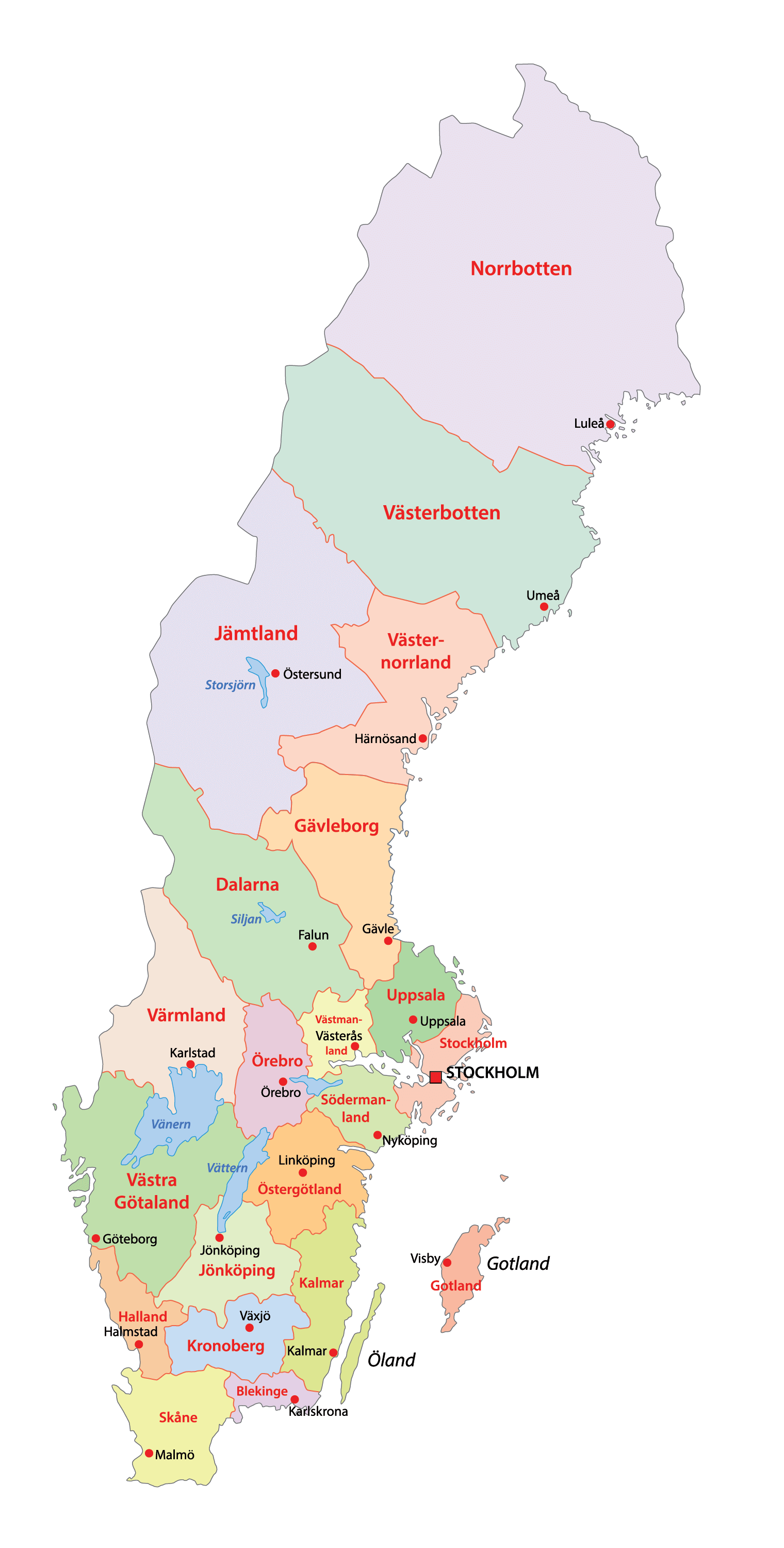
Sweden (officially, the Kingdom of Sweden) is divided into 21 counties (Ian) and 290 municipalities (kommuner). In alphabetical order, these counties are: Blekinge, Dalarna, Gavleborg, Gotland, Halland, Jamtland, Jonkoping, Kalmar, Kronoberg, Norrbotten, Orebro, Ostergotland, Skane, Sodermanland, Stockholm, Uppsala, Varmland, Vasterbotten, Vasternorrland, Vastmanland and Vastra Gotaland. The municipalities are further divided into 2512 parishes (forsamlinger).
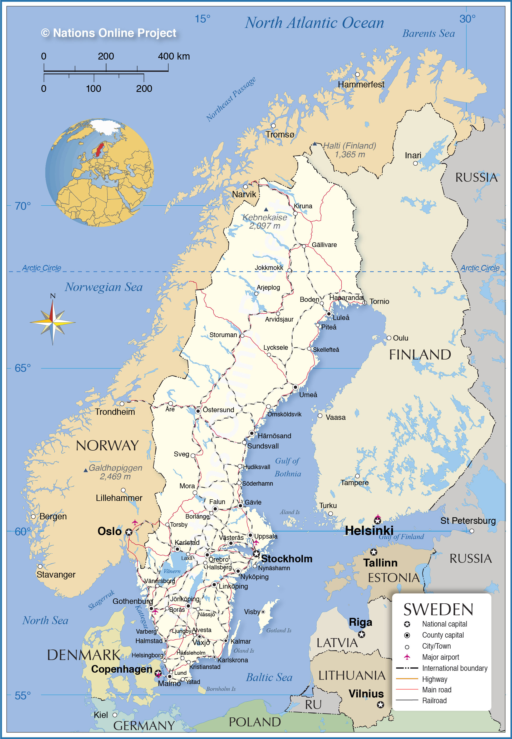
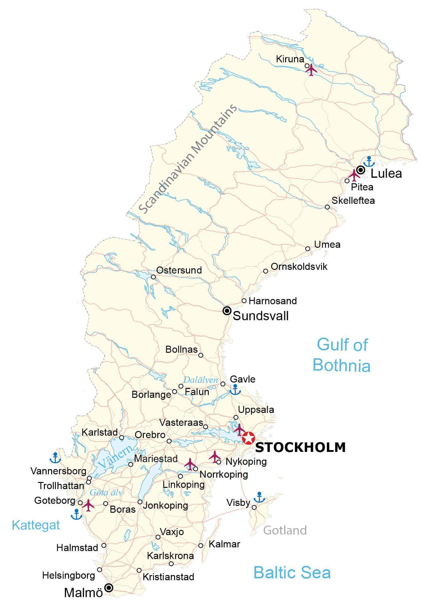
With an area of 450,295 sq. km, Sweden is the largest country in Northern Europe. It is also the 5th largest country in Europe and the 3rd largest country in EU. Located on the south-central east coast of Sweden is, Stockholm – the capital, the largest and the most populous city of Sweden. Stockholm is the cultural, administrative and economic center of Sweden. Stockholm is also Sweden’s financial capital. The city’s location establishes it as one of the world’s most beautiful and spectacular cities. On the west coast of Sweden is Gothenburg – the 2nd largest city in Sweden.
Location Maps
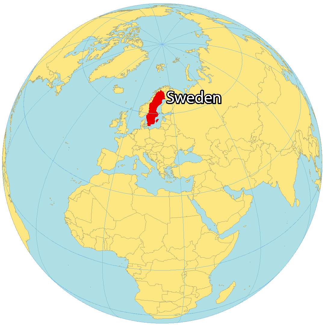
Where is Sweden?
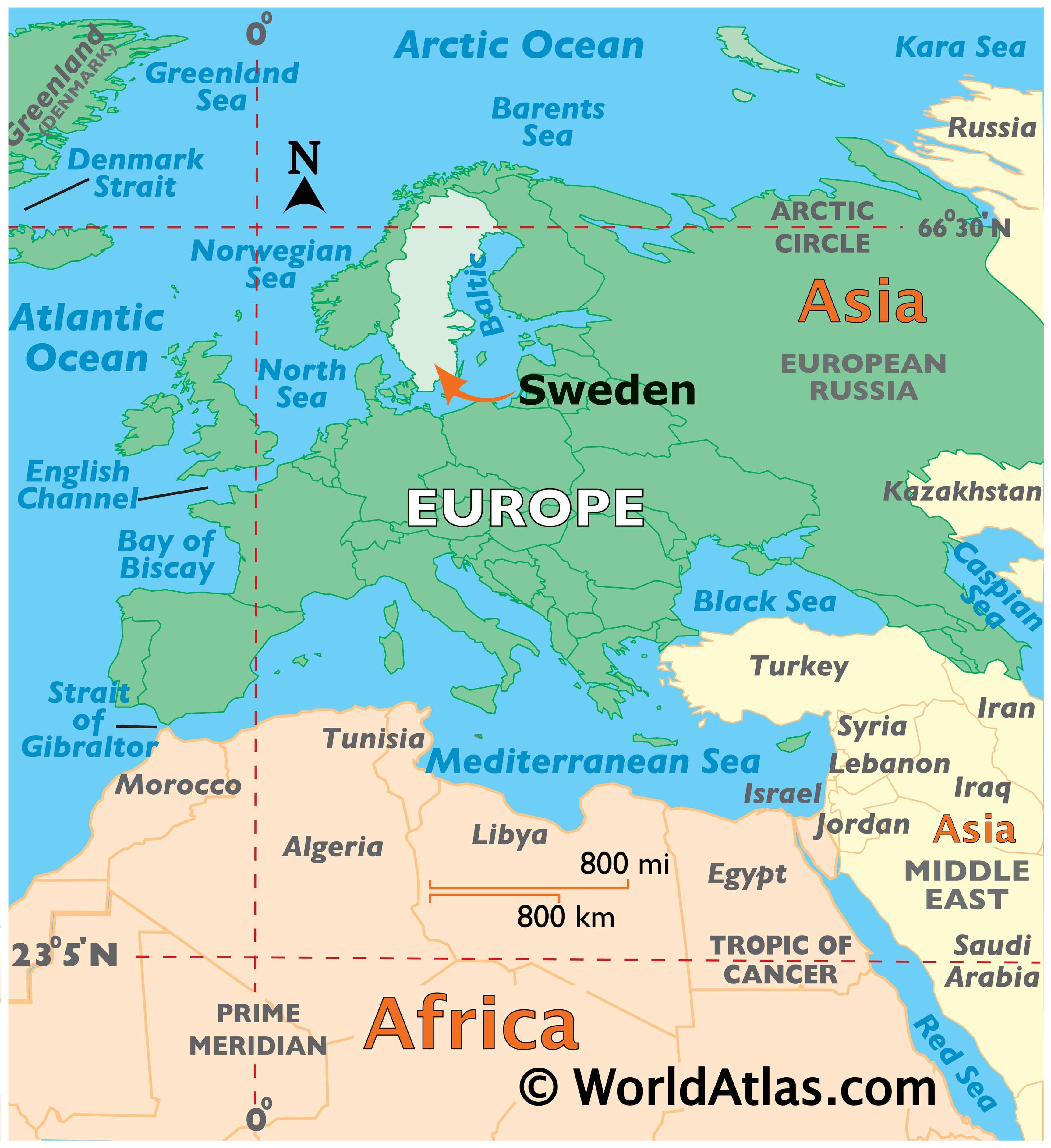
Sweden is a Northern European country situated between Finland to the east, and Norway to the west. It is connected to Denmark to the southwest by the Öresund bridge, and shares maritime borders with Germany, Poland, Russia, Lithuania, Latvia, and Estonia. Its east coast lies along the Gulf of Bothnia and the Baltic Sea, while its west coast is located along the Öresund Strait and Kattegat Sea. Stockholm is the capital and largest city in Sweden, located on the east coast and home to over 1.5 million people.

High Definition Political Map of Sweden
Physical Map of Sweden

Topo Map