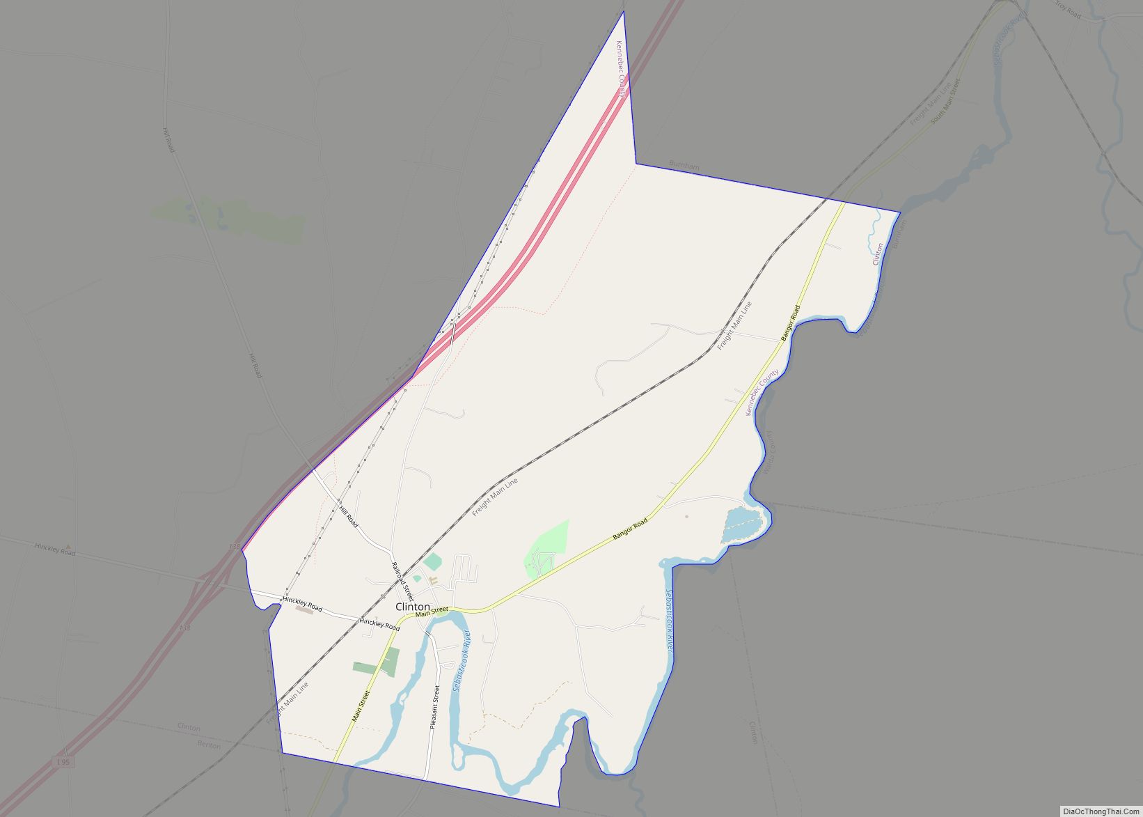
Clinton is a census-designated place (CDP) and the primary village in the town of Clinton in Kennebec County, Maine, United States. The population was 1,419 at the 2010 census, out of 3,486 in the entire town of Clinton.
| Name: | Clinton CDP |
|---|---|
| LSAD Code: | 57 |
| LSAD Description: | CDP (suffix) |
| State: | Maine |
| County: | Kennebec County |
| Elevation: | 131 ft (40 m) |
| Total Area: | 9.17 sq mi (23.74 km²) |
| Land Area: | 8.86 sq mi (22.94 km²) |
| Water Area: | 0.31 sq mi (0.80 km²) |
| Total Population: | 1,386 |
| Population Density: | 156.49/sq mi (60.42/km²) |
| ZIP code: | 04927 |
| Area code: | 207 |
| FIPS code: | 2313435 |
| GNISfeature ID: | 0564107 |
Online Interactive Map
Click on ![]() to view map in "full screen" mode.
to view map in "full screen" mode.
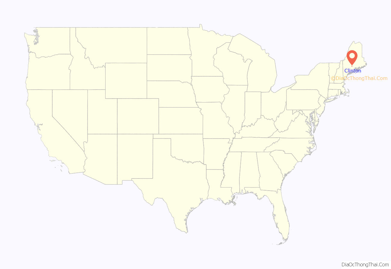
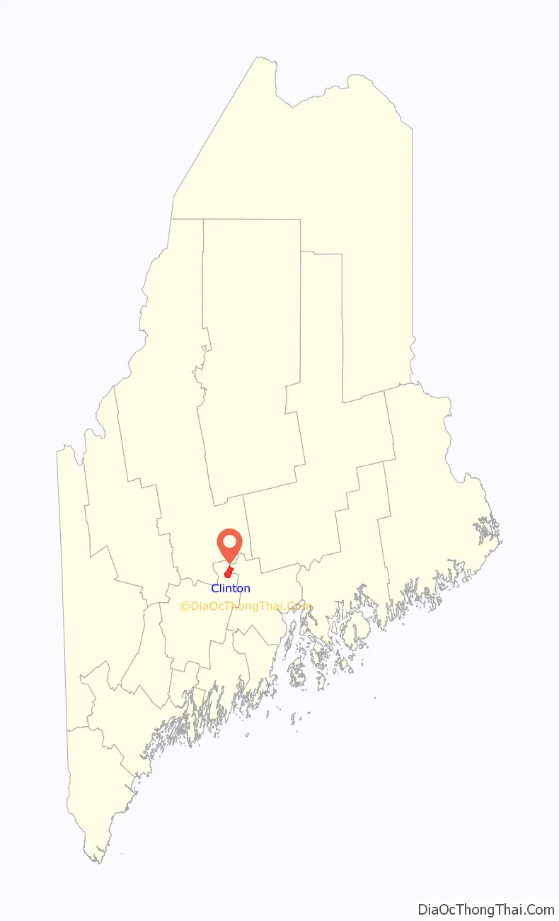
Clinton location map. Where is Clinton CDP?
Clinton Road Map
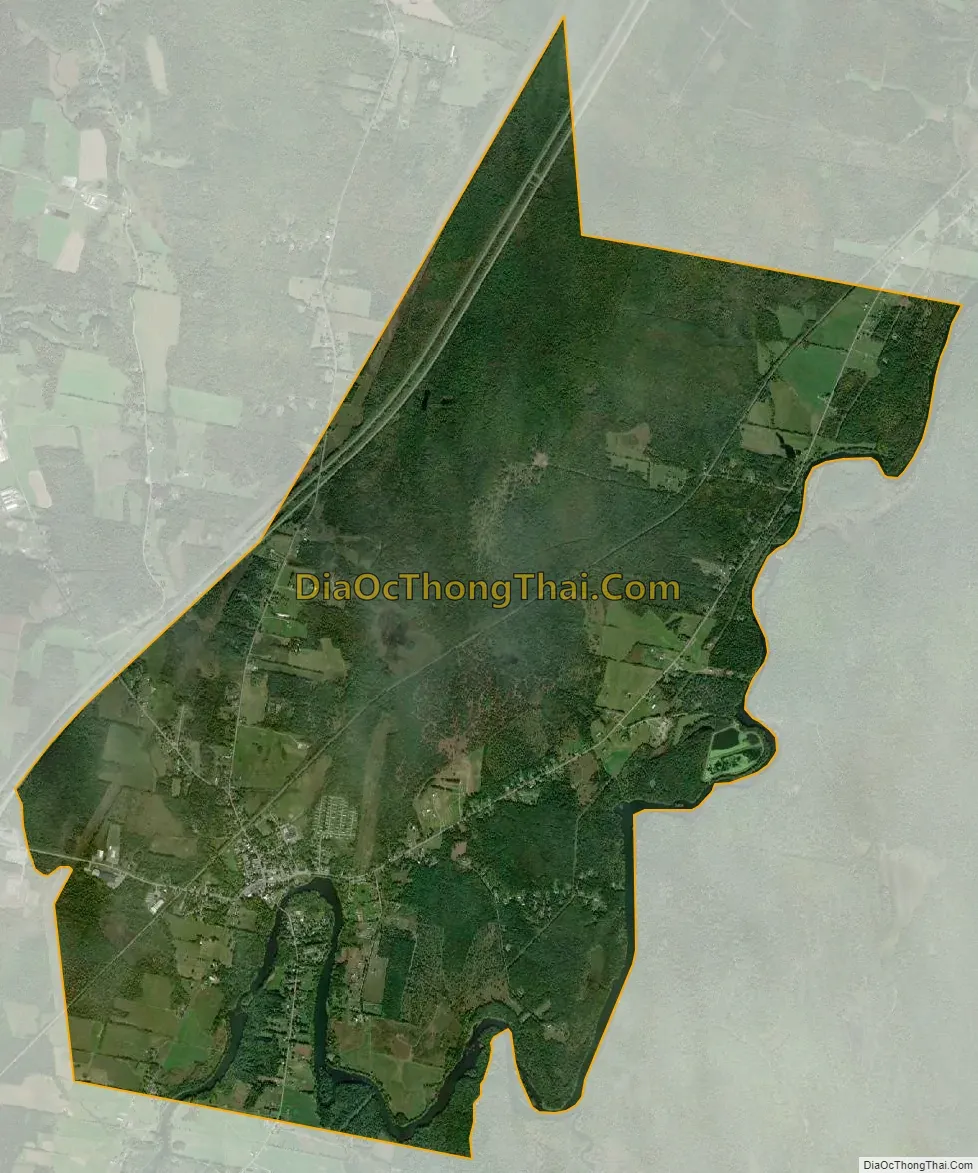
Clinton city Satellite Map
Geography
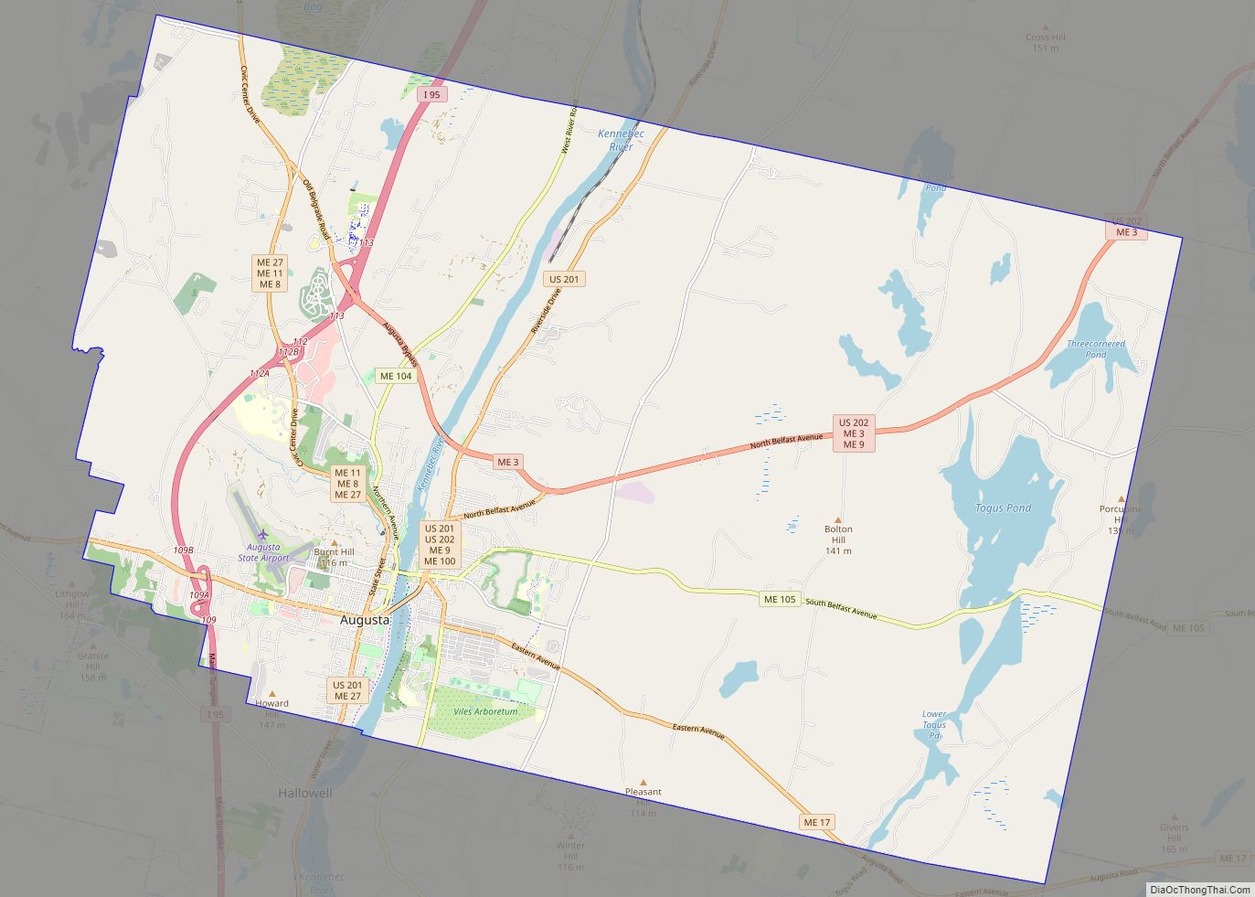
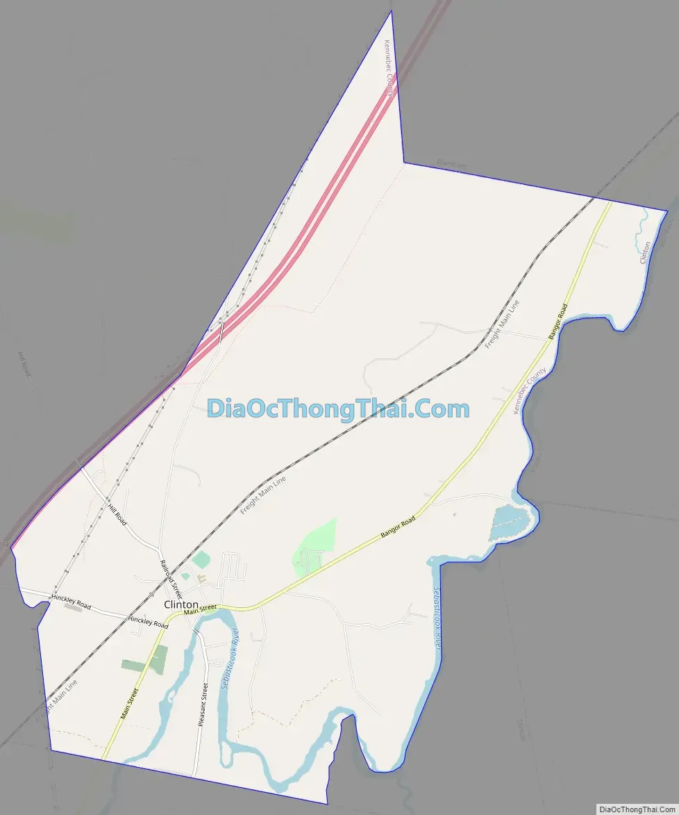
Clinton is located in northeastern Kennebec County at 44°38′25″N 69°29′52″W / 44.64028°N 69.49778°W / 44.64028; -69.49778 (44.640286, −69.497964). It is in the southeast part of the town of Clinton. The village sits on the north side of the Sebasticook River, a tributary of the Kennebec River. The Clinton CDP includes rural land surrounding the village; it is bordered to the south by the town of Benton, to the east by the Sebasticook River, to the northeast by the Waldo County line with the town of Burnham, and to the north and west by Interstate 95. Access to I-95 is from Exit 138 (Hinckley Road) west of the village. I-95 leads northeast 12 miles (19 km) to Pittsfield and 47 miles (76 km) to Bangor, and southwest 9 miles (14 km) to Waterville and 28 miles (45 km) to Augusta, the state capital. Maine State Routes 11 and 100 run through Clinton village as Main Street, leading northeast 5 miles (8 km) to Burnham village and southwest 7 miles (11 km) to Fairfield.
According to the United States Census Bureau, the Clinton CDP has a total area of 9.2 square miles (23.7 km), of which 8.8 square miles (22.9 km) are land and 0.3 square miles (0.9 km), or 3.39%, are water.
See also
Map of Maine State and its subdivision: Map of other states:- Alabama
- Alaska
- Arizona
- Arkansas
- California
- Colorado
- Connecticut
- Delaware
- District of Columbia
- Florida
- Georgia
- Hawaii
- Idaho
- Illinois
- Indiana
- Iowa
- Kansas
- Kentucky
- Louisiana
- Maine
- Maryland
- Massachusetts
- Michigan
- Minnesota
- Mississippi
- Missouri
- Montana
- Nebraska
- Nevada
- New Hampshire
- New Jersey
- New Mexico
- New York
- North Carolina
- North Dakota
- Ohio
- Oklahoma
- Oregon
- Pennsylvania
- Rhode Island
- South Carolina
- South Dakota
- Tennessee
- Texas
- Utah
- Vermont
- Virginia
- Washington
- West Virginia
- Wisconsin
- Wyoming