Covering a land area of 109,884 sq. km, Cuba is the largest country by land area in the Caribbean. With an area of 105,006 sq. km, the main island of Cuba is the 16th largest island in the world by land area. Several archipelagos (that include hound reds of island and cay’s) ring it’s coastline north and south. Isla de la Juventud (“Isle of Youth”) is the 2nd largest Cuban island and the 7th largest island in the West Indies.
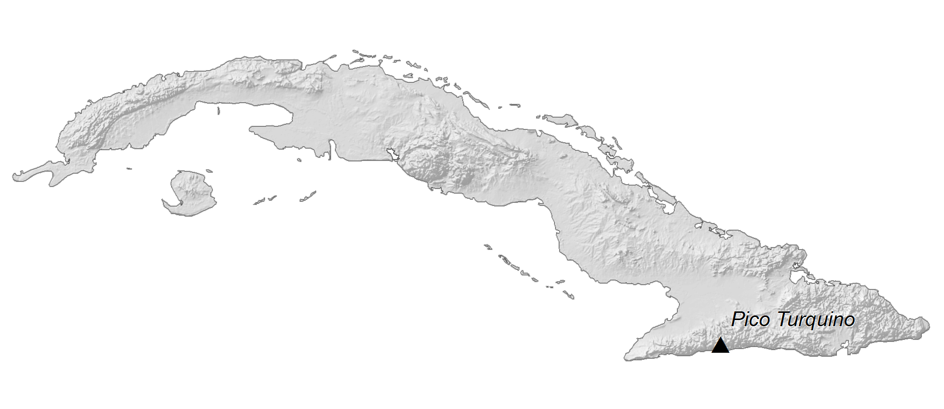
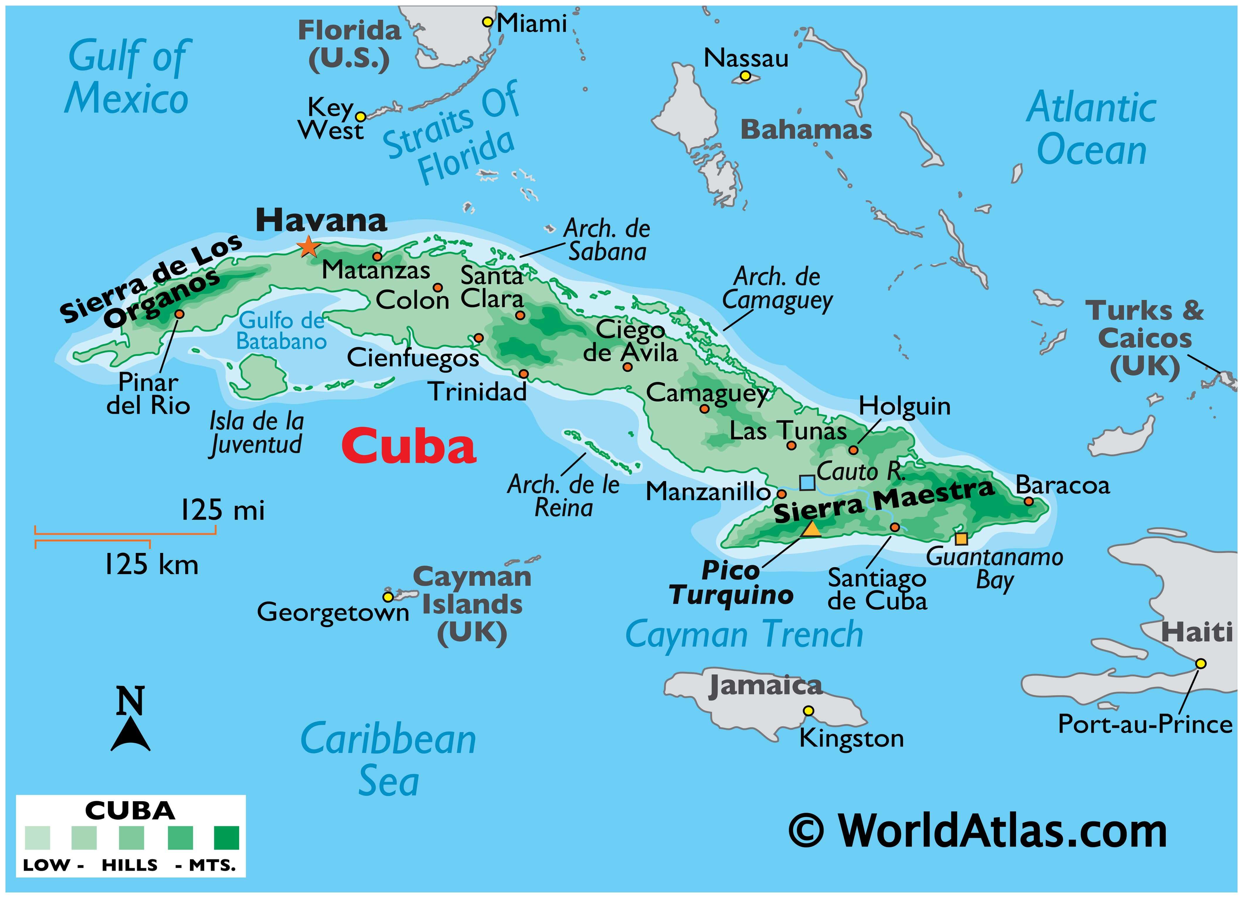
As observed on the physical map of Cuba, Cuba’s land is relatively flat, flowing gradually into hills, including a few hills of limestone shown to the right. Cuba’s coastal areas are the most mountainous. In the Sierra de los Organos of the far-northwest, the landscape is hilly with a few lower mountains. In the southwest, the Sierra Maestra is a mountain range that rises sharply from the coast. Located there and marked by a yellow triangle, Pico Turquino at 6,650ft (1,999m), is the highest point in Cuba. Other mountain ranges of note are the Sierra Cristal (southeast), the Escambray Mountains (central) and the Sierra del Rosario in the northwest.
Considering its overall size, Cuba has little inland water areas. Those of note include Laguna de Leche at 67.2 sq. km (25.9 sq. mi), and the man-made Zaza Reservoir, at 113.5 sq. km (43.8 sq. mi). Cuba has nearly 200 small rivers as well as many narrow streams that run dry in summer. The country’s longest river is the Cauto; it flows for 230 mi (370 km) from its source in the Sierra Maestra.
| Flag: |  |
|---|---|
| Legal Name: | Republic of Cuba |
| Capital Value: | Havana |
| Official languages: | Spanish |
| Demonym(s): | Cuban |
| Government: | Unitary Marxist–Leninist one-party socialist republic |
| Legislature: | National Assembly of People’s Power |
| Total Area: | 110,860 km² |
| Land Area: | 109,820 km² |
| Water Area: | 1,040 km² |
| Population: | 11,333,483 |
| Density: | 101.8/km (263.7/sq mi) (80th) |
| GDP: | $100.02 Billion |
| GDP Per Capita: | $8,821.82 |
| Currency Value: | Cuban pesos (CUP) |
| Driving side: | right |
| Calling code: | +53 |
| Internet TLD: | .cu |
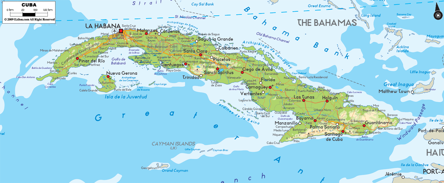
Discover Cuba with a Map
Explore Cuba with this detailed map. The Republic of Cuba is the largest island in the Caribbean and is known for its stunning beaches and vibrant culture. This map shows all the major cities, towns, and highways, as well as providing visual reference with elevation and satellite imagery so you can get to know the island better.
Online Interactive Political Map
Click on ![]() to view map in "full screen" mode.
to view map in "full screen" mode.
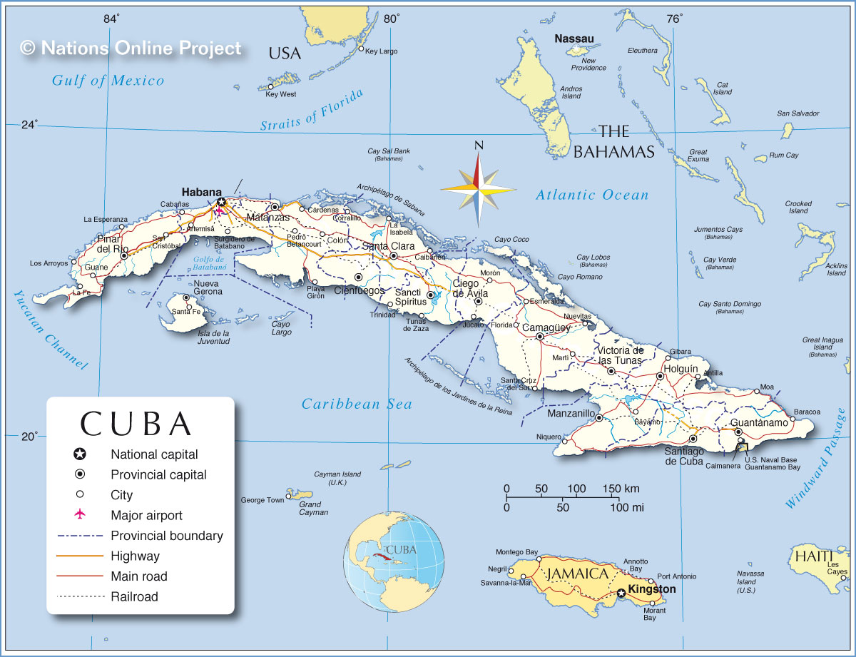
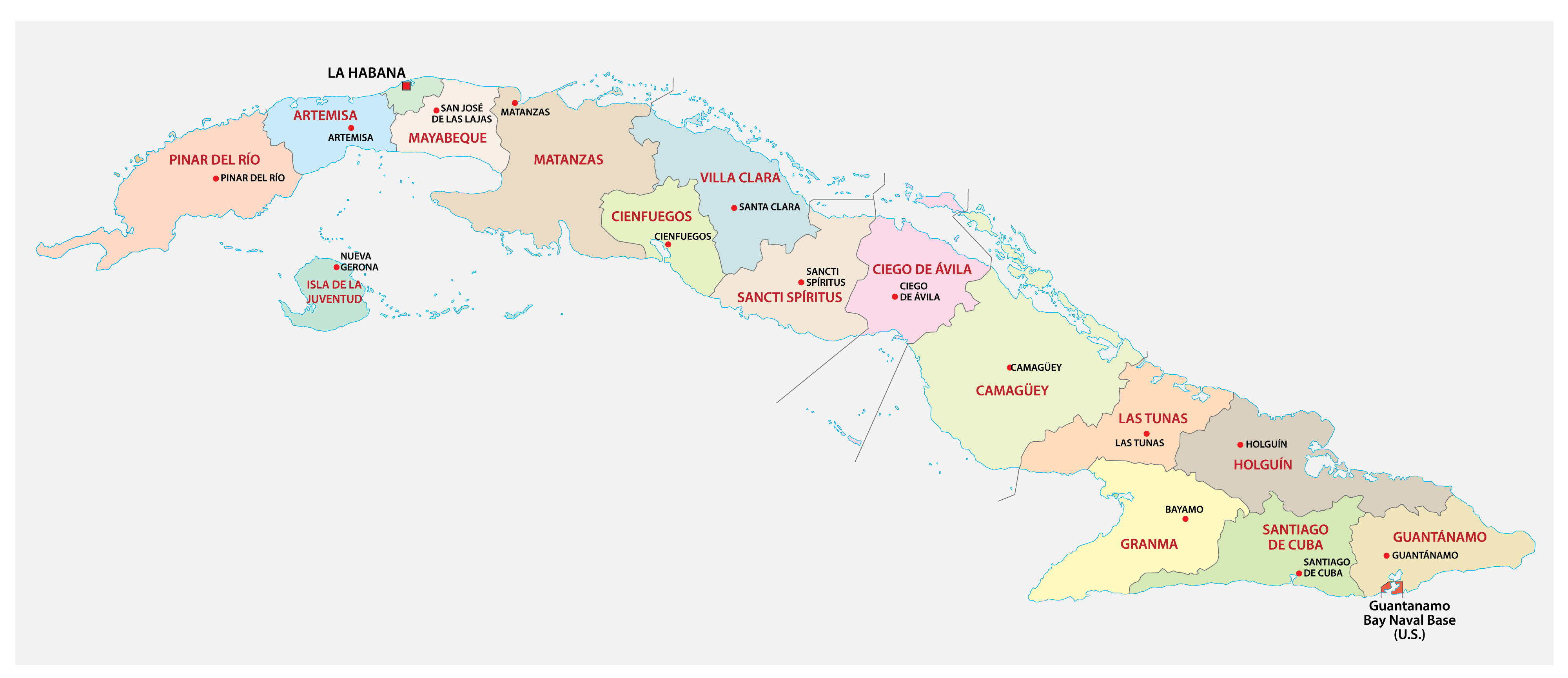
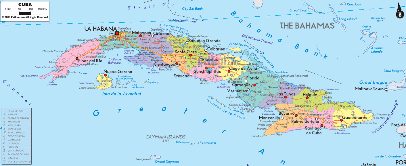
Cuba (officially, The Republic of Cuba) is divided into 15 provinces (provincias, sing. provincia) and 1 special municipality (municipio especial). In alphabetical order, the provinces are: Artemisa, Camaguey, Ciego de Avila, Cienfuegos, Granma, Guantanamo, Holguin, La Habana, Las Tunas, Matanzas, Mayabeque, Pinar del Rio, Sancti Spiritus, Santiago de Cuba and Villa Clara. Isla de la Juventud is a special municipality. The provinces are further subdivided into 168 municipalities (municipios).
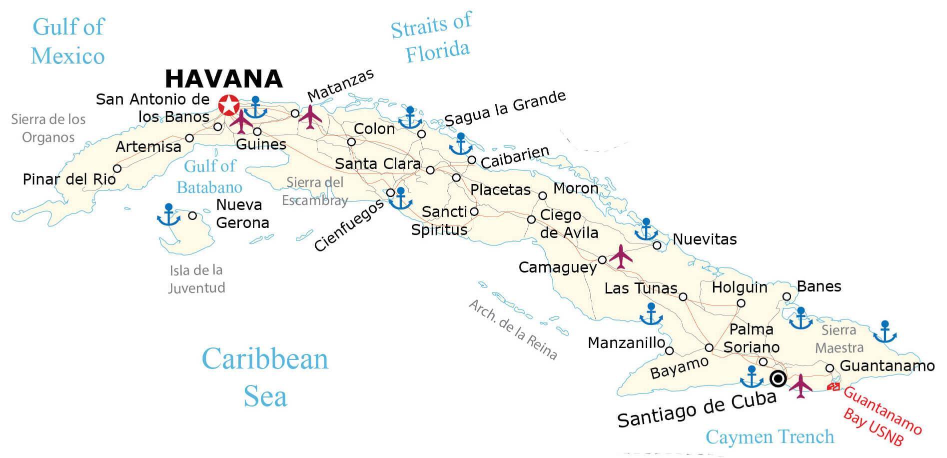
Located on Cuba’s northern coast on La Habana Bay and to the south of the Coral Cay archipelago of the Florida Keys is, Havana – the capital, the largest and the most populous city of Cuba. It is an administrative center, a major port and an important economic, commercial and industrial hub of Cuba.
Location Maps
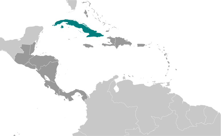
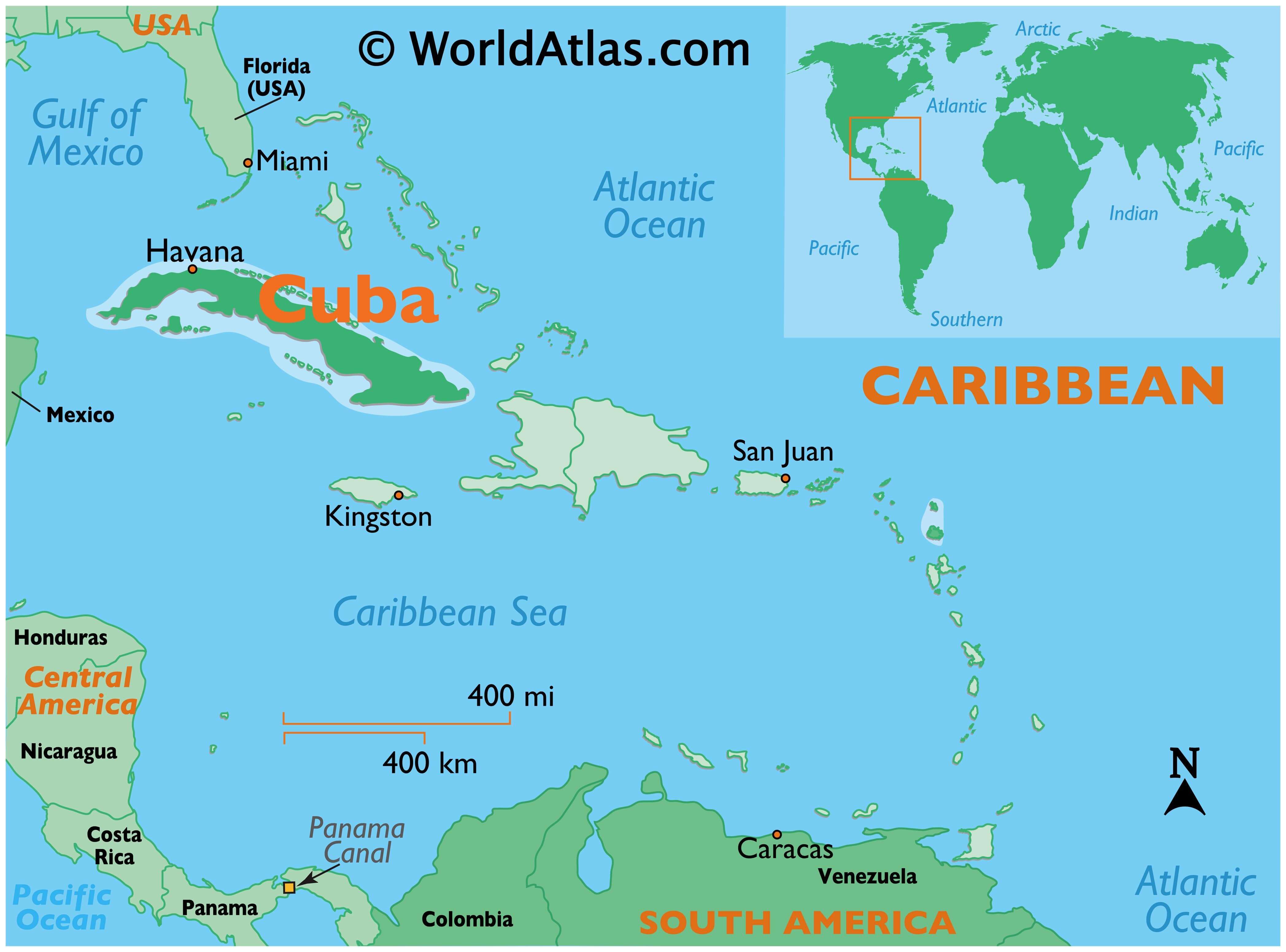
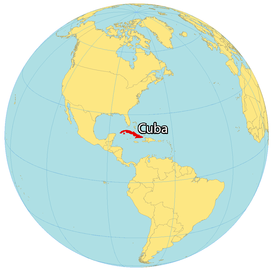
Where is Cuba?
Cuba is a country in Central America at the intersection of the Caribbean Sea, the Gulf of Mexico, and the Atlantic Ocean. It consists of the island of Cuba, Isla de la Juventud, and various smaller archipelagos. Cuba is situated near the Bahamas, Haiti, and the Cayman Islands.
The size of Cuba is 109,884 square kilometers (42,426 sq mi) which is almost identical in size to Guatemala. Also, this makes it the largest island in all of the Caribbean and the eighth-largest island country in the world. Havana is the capital and largest city in Cuba and is known for being a commercial hub and port city.
High Definition Political Map of Cuba
Physical Map of Cuba
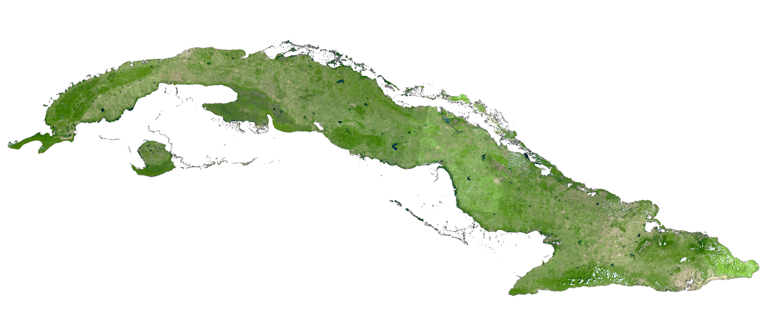
Cuba Satellite Map
Elevation Map