Newburyport is a coastal city in Essex County, Massachusetts, United States, 35 miles (56 km) northeast of Boston. The population was 18,289 at the 2020 census. A historic seaport with a vibrant tourism industry, Newburyport includes part of Plum Island. The mooring, winter storage, and maintenance of recreational boats, motor and sail, still contribute a large part of the city’s income. A Coast Guard station oversees boating activity, especially in the sometimes dangerous tidal currents of the Merrimack River.
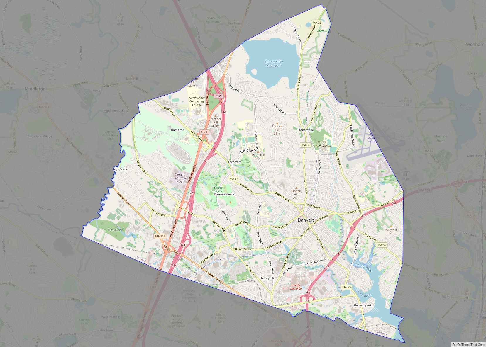
At the edge of the Newbury Marshes, delineating Newburyport to the south, an industrial park provides a wide range of jobs. Newburyport is on a major north-south highway, Interstate 95. The outer circumferential highway of Boston, Interstate 495, passes nearby in Amesbury. The Newburyport Turnpike (U.S. Route 1) still traverses Newburyport on its way north. The Newburyport/Rockport MBTA commuter rail from Boston’s North Station terminates in Newburyport. The earlier Boston and Maine Railroad leading farther north was discontinued, but a portion of it has been converted into a recreation trail.
| Name: | Newburyport city |
|---|---|
| LSAD Code: | 25 |
| LSAD Description: | city (suffix) |
| State: | Massachusetts |
| County: | Essex County |
| Elevation: | 37 ft (11 m) |
| Total Area: | 10.71 sq mi (27.74 km²) |
| Land Area: | 8.35 sq mi (21.63 km²) |
| Water Area: | 2.36 sq mi (6.11 km²) |
| Total Population: | 18,289 |
| Population Density: | 2,190.30/sq mi (845.66/km²) |
| ZIP code: | 01950 |
| Area code: | 351/978 |
| FIPS code: | 2545245 |
| GNISfeature ID: | 0614293 |
| Website: | www.cityofnewburyport.com |
Online Interactive Map
Click on ![]() to view map in "full screen" mode.
to view map in "full screen" mode.
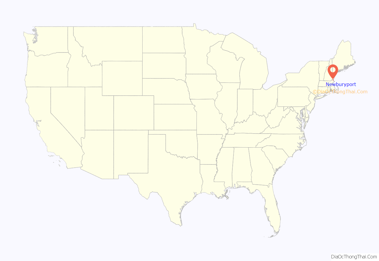
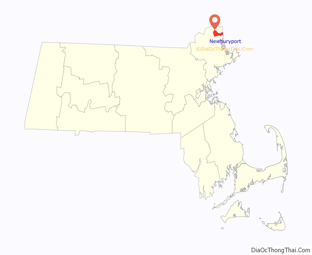
Newburyport location map. Where is Newburyport city?
History
On January 28, 1764, the General Court of Massachusetts passed “An act for erecting part of the town of Newbury into a new town by the name of Newburyport.” The act begins:
The act was approved by Governor Francis Bernard on February 4, 1764. The new town was the smallest in Massachusetts, covering an area of 647 acres (2.62 km), and had a population of 2,800 living in 357 homes. There were three shipyards, no bridges, and several ferries, one of which at the foot of Greenleaf Lane, now State Street, carried the Portsmouth Flying Stage Coach, running between Portsmouth, New Hampshire, and Boston.
The town prospered and became a city in 1851. Situated near the mouth of the Merrimack River, it was once a fishing, shipbuilding and shipping center, with an industry in silverware manufacture. In 1792, a bridge was built two miles above the town where the river contained an island. Merrimack Arms and Brown Manufacturing Company made Southerner Derringer pistols in their Newburyport factory from 1867 to 1873. The sea captains of old Newburyport (as elsewhere in Massachusetts) had participated vigorously in the triangular trade, importing West Indian molasses and exporting rum made from it. The distilleries were located around Market Square near the waterfront. Caldwell’s Old Newburyport rum was manufactured locally until 1961.
Newburyport once had a fishing fleet that operated from Georges Bank to the mouth of the Merrimack River. It was a center for privateering during the Revolutionary War and War of 1812. Beginning about 1832, it added numerous ships to the whaling fleet. Later, clipper ships were built there. Today, the city gives little hint of its former maritime importance. Notably missing are the docks, which are shown on earlier maps extending into the channel of the Merrimack River, and the shipyards, where the waterfront parking lot is currently located.
George Whitefield, the well-known and influential English preacher who helped inspire the First Great Awakening in America, arrived in Newburyport in September 1740. The revival that followed his labors, brought into existence Old South Church, where he was buried after his death in 1770.
The city’s historical highlights include:
Historic events:
- First of many clipper ships built here
- First “Tea Party” rebellion to oppose British Tea Tax
- First state mint and treasury building
- Newburyport Superior Courthouse, the oldest continuously active courthouse in Massachusetts
The Newburyport Five Cents Savings Bank on State Street was founded in 1854, and is one of the oldest banks in the United States still in operation.
Historic houses and museums:
- Cushing House Museum & Garden (c. 1808)
- Newburyport Custom House Museum (1835), designed by Robert Mills
Literary interests:
- Was referred to in the H. P. Lovecraft story, “The Shadow Over Innsmouth”, as being located near Innsmouth. Lovecraft in fact based his depiction of Innsmouth largely on Newburyport.
- Subject of the most ambitious community study ever undertaken, the Yankee City project conducted by anthropologist W. Lloyd Warner and his associates
Timeline
- 1635: Newbury incorporated.
- 1761: Belleville Congregational Church founded.
- 1764: Newburyport incorporated (formerly part of Newbury).
- 1772: Marine Society of Newburyport established.
- 1773
- Isaiah Thomas opens “a printing house in King Street.”
- Essex Journal newspaper begins publication.
- 1790: Population: 4,837.
- 1793: Impartial Herald newspaper begins publication.
- 1794
- Morning Star newspaper begins publication.
- Newburyport Woolen Manufacturing Co. established.
- 1795
- Political Gazette newspaper begins publication.
- Merrimack Bank incorporated.
- 1797: Newburyport Herald newspaper begins publication.
- 1799: Newburyport Marine Insurance Co. incorporated.
- 1801: American Intelligencer newspaper published.
- 1802: Merrimac Humane Society established.
- 1803
- Merrimack Gazette and New England Repertory newspapers begin publication.
- Newburyport Female Charitable Society organized.
- Merrimack Fire and Marine Insurance Co. incorporated.
- 1804: Political Calendar newspaper begins publication.
- 1805: Merrimack Magazine begins publication.
- 1807: Newburyport Gazette newspaper begins publication.
- 1808: Statesman newspaper begins publication.
- 1810
- Newburyport Mechanick Association and Newburyport Athenaeum incorporated.
- Independent Whig newspaper begins publication.
- Merrimack Bible Society organized.
- 1812: Washington Benevolent Society organized.
- 1818: Howard Benevolent Society instituted “for the relief of the sick and destitute.”
- 1825: Newburyport Hosiery Co. established.
- 1829: Newburyport Lyceum organized.
- 1835
- Society for the Relief of Aged Females founded.
- U.S. Custom House built.
- 1836
- Newburyport Linnean Society and Newburyport Steam Cotton Co. incorporated.
- Newburyport Silk Co. and Newburyport Ladies’ Bethel Society established.
- 1837: Bartlet Steam Mills incorporated.
- 1840: Pleasant Street Christian Church organized.
- 1841: Essex North District Medical Society organized.
- 1842: James Steam Mills incorporated.
- 1844: Essex Steam Mills incorporated.
- 1845: Globe Steam Mills and Ocean Steam Mills incorporated.
- 1850
- Ladies’ General Charitable Society instituted.
- Newburyport Gas Co. incorporated.
- 1851: June 18: Essex North Musical convention held.
- 1852: Merrimack Library Association organized.
- 1854
- Newburyport Public Library founded.
- Newburyport Five Cents Savings Bank incorporated.
- 1855: Newburyport Library Association organized.
- 1857: Mechanic Library Association incorporated.
- 1865: Washington Street Methodist Episcopal Church organized.
- 1869: Merrimack Marine Railway Co. incorporated.
- 1874: Newburyport Mutual Benefit Association organized.
- 1877: Antiquarian and Historical Society of Old Newbury established.
- 1878: Newburyport Athenaeum organized.
- 1884: Newburyport YMCA incorporated.
- 1886: Newburyport Society for the Relief of Aged Men incorporated.
- 1887: Newburyport Electric Light & Power Co. incorporated.
- 1888: Daily News established.
- 1890
- YWCA of Newburyport incorporated.
- City Improvement society organized.
- 1896: Newburyport Choral Union organized.
- 1904: South End Reading Room Association formed.
- 1906: Newburyport Homeoepathic Hospital opens.
- 1917: Annunciation Greek Orthodox Church of Newburyport founded.
- 1968: Newburyport Maritime Society established.
- 1971: Market Square Historic District added to National Register of Historic Places.
- 1971-1979: Downtown undergoes major renewal and historic preservation effort.
- 1991: Actors Studio of Newburyport founded.
- 1994: Sister city relationship established with Bura, Taita-Taveta District, Kenya.
Newburyport Road Map
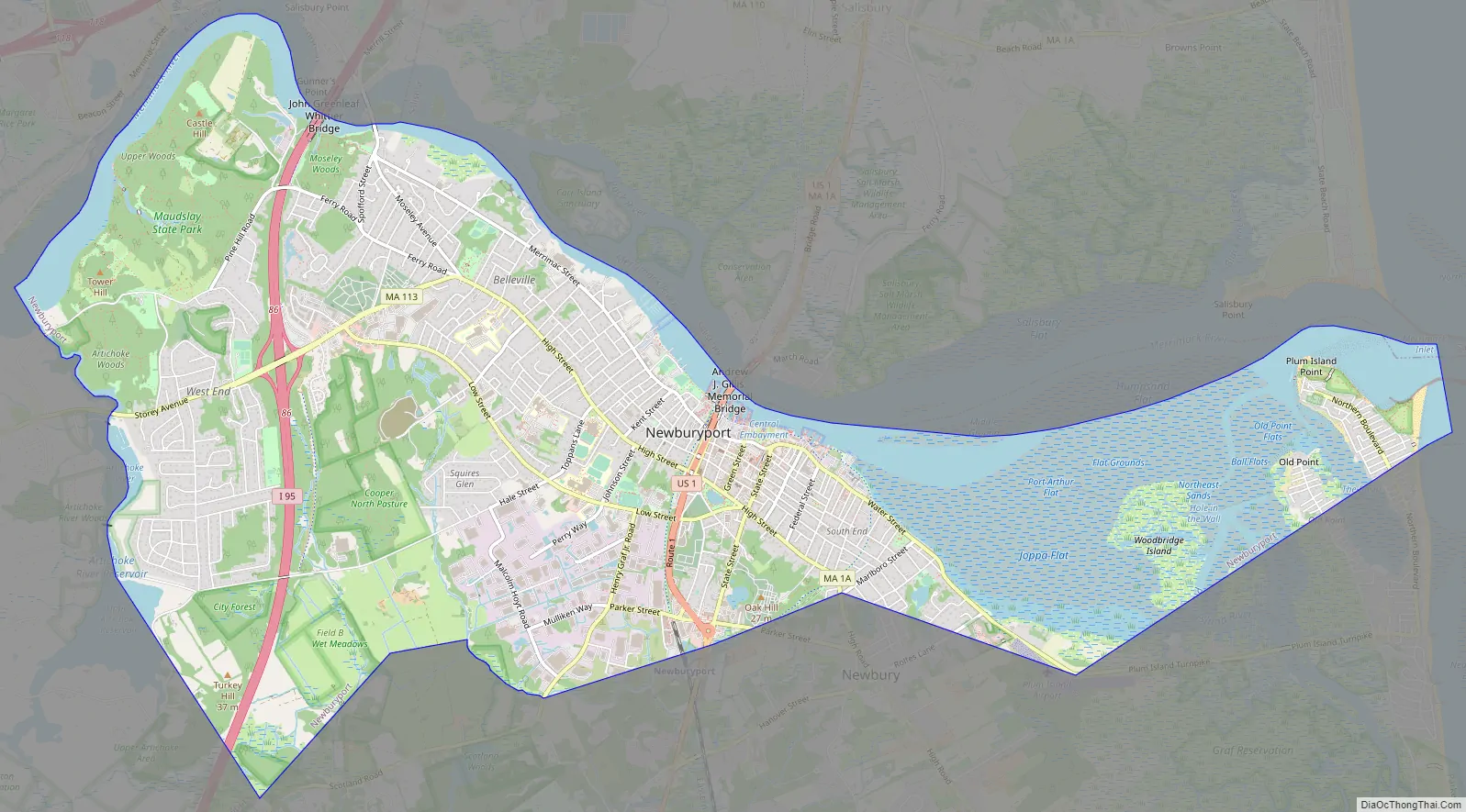
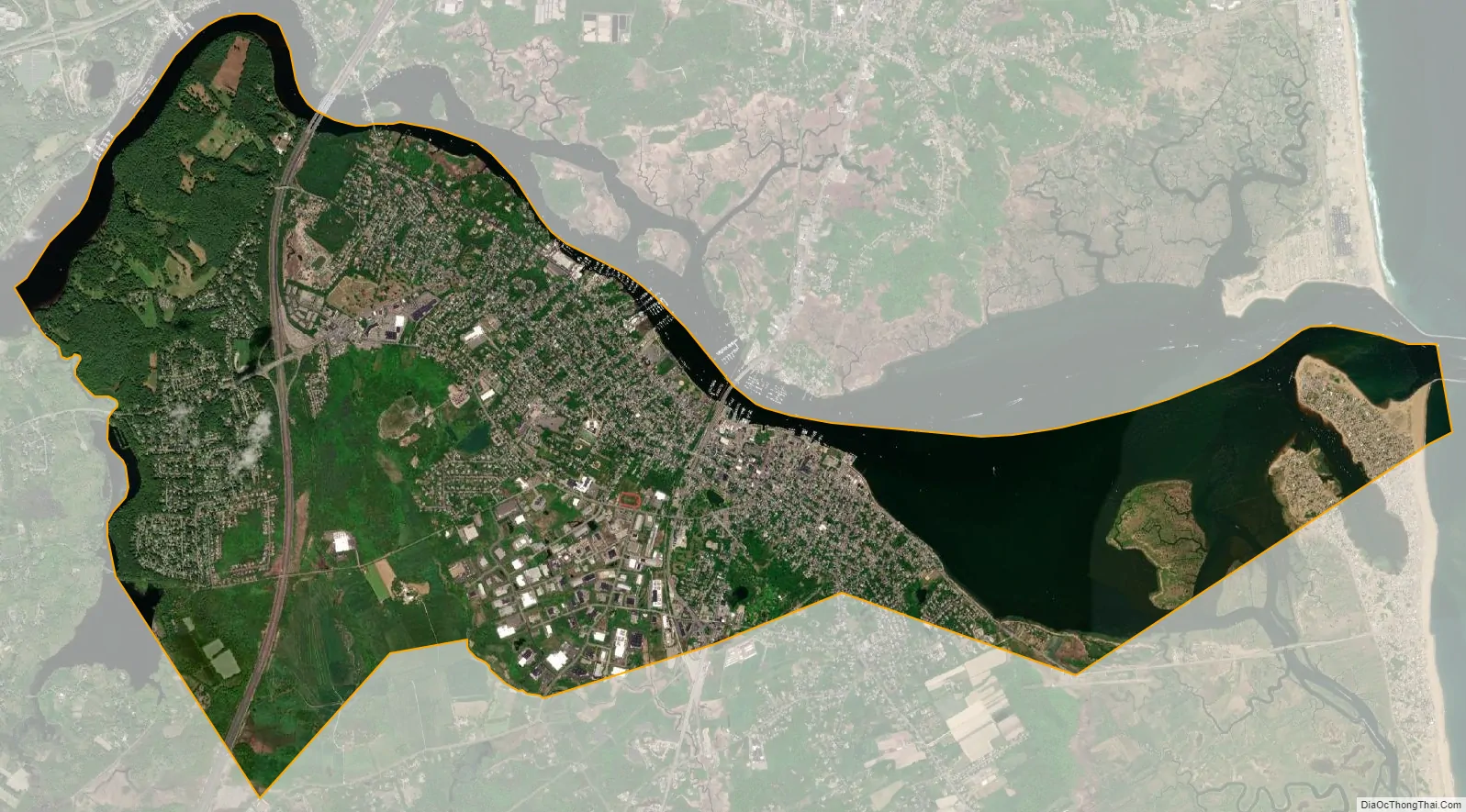
Newburyport city Satellite Map
Geography
Newburyport is located at 42°48′45″N 70°52′39″W / 42.81250°N 70.87750°W / 42.81250; -70.87750 (42.812391, −70.877440). According to the United States Census Bureau, the city has a total area of 10.6 square miles (27 km), of which 8.4 square miles (22 km) is land and 2.2 square miles (5.7 km) (20.77%) is water.
The city is part of Massachusetts’ North Shore; Newburyport was laid out on the elevated south bank of the Merrimack River between the river and Newbury marshes. The shipyards, now boatyards (and still vigorously active), extended along the bank at the edge of the river. They were connected by Merrimac Street, which ends upriver where the bank merges into bluffs covered with pine forest. Colonial residences extend up the bank from Merrimac Street to High Street running parallel to it near the top of the ridge. The homes of the seafaring entrepreneurs line High Street. Many feature widow’s walks, structures on the roof where the residents could watch for the return of sailing vessels. Nearly every home maintains a splendid flower garden, most dating to colonial times. Various cross streets, such as State Street, Green Street and Market Street, connect Merrimac Street and High Street. The top of the ridge proved an ideal location for later institutions, such as Newburyport High School and nearby Anna Jaques Hospital. The ridge drops more sharply to the marsh on the other side. Along its margin a third parallel street developed, Low Street.
The river bank gradually descends to marshes at Joppa Flats beyond downtown Newburyport. The Plum Island Turnpike was pushed out over the marsh on a causeway to a narrow part of the Plum Island River just to the south of where it connects to the mouth of the Merrimack. A drawbridge was built there, the only access to the island by road. On the Newburyport side a small airport, Plum Island Airport, was built at the edge of the marsh. The portion of Plum Island that is in the city has no direct access to the rest of the city; similarly, there is no access between the mainland and Woodbridge Island or Seal Island, west of Plum Island (the latter being shared between Newburyport and Newbury). Several parks and beaches dot the city, including Plum Island Point Beach, Simmons Beach, Joppa Park, Waterfront Park, Woodman Park, Cashman Park, Moseley Pines Park and Atkinson Common and March’s Hill Park. Newburyport Forest is located in the southwest corner of the city, and Maudslay State Park lies along the northwest part of the city, along the banks of the Merrimack.
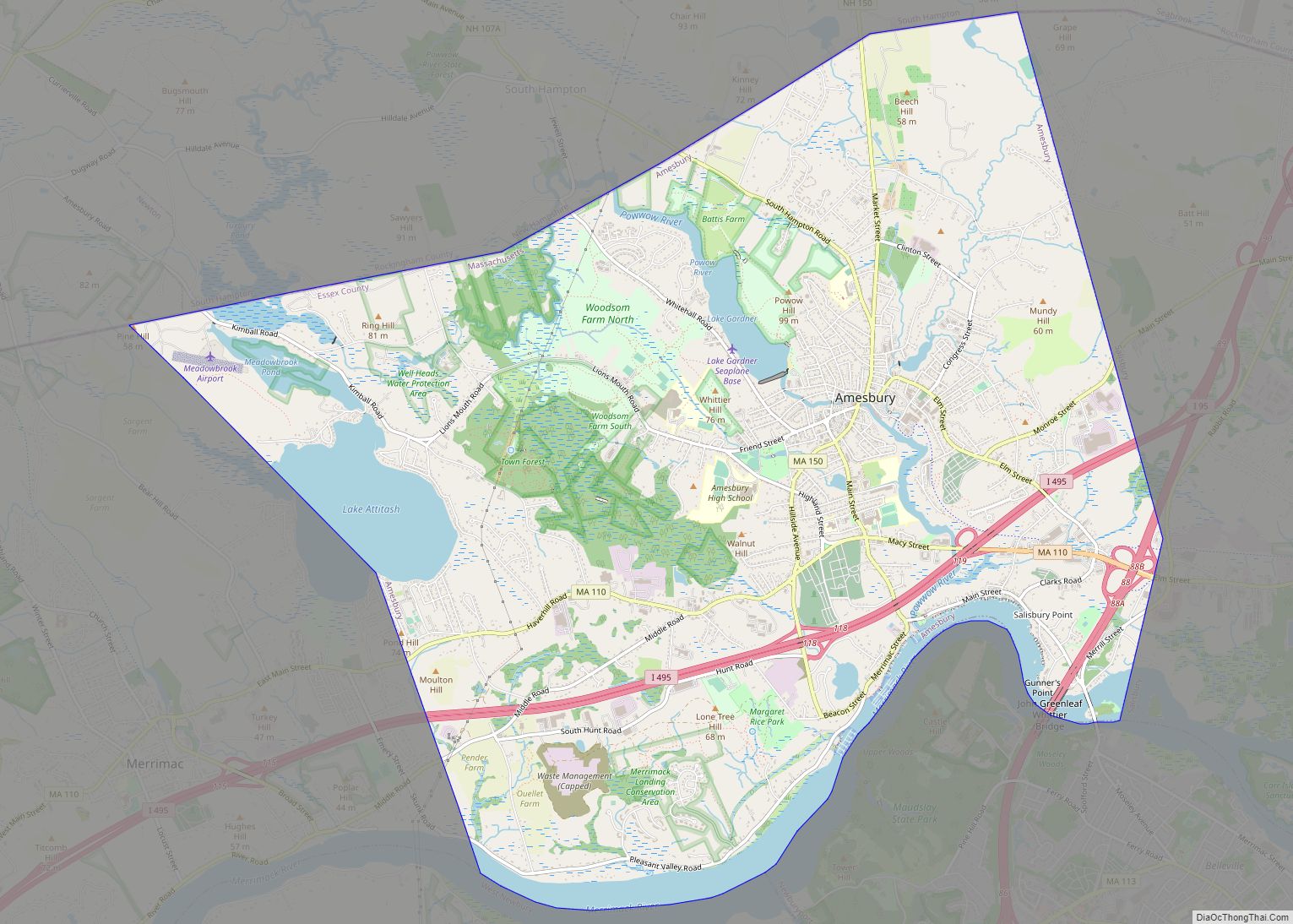
Newburyport is located 37 miles (60 km) north-northeast of Boston, 19 miles (31 km) east-northeast of Lawrence, and 21 miles (34 km) south-southeast of Portsmouth, New Hampshire. Situated 5 miles (8 km) south of the New Hampshire border, the city is bordered by the Gulf of Maine (Atlantic Ocean) to the east, Newbury to the south and southeast, West Newbury to the west and southwest, Amesbury to the north and northwest, and Salisbury to the northeast.
Neighborhoods
Joppa: Joppa is bordered by Newbury to the southeast, the South End to the southwest, and Downtown to the Northwest. This is the closest neighborhood to Plum Island Airport located in Newbury.
South End: The South End is bordered by Newbury to the south, Joppa to the northeast, and Downtown to the northwest. The border between the South End and Joppa is just behind Hancock Street, Chestnut Street, and, Part of Prospect Street.
Climate
See also
Map of Massachusetts State and its subdivision: Map of other states:- Alabama
- Alaska
- Arizona
- Arkansas
- California
- Colorado
- Connecticut
- Delaware
- District of Columbia
- Florida
- Georgia
- Hawaii
- Idaho
- Illinois
- Indiana
- Iowa
- Kansas
- Kentucky
- Louisiana
- Maine
- Maryland
- Massachusetts
- Michigan
- Minnesota
- Mississippi
- Missouri
- Montana
- Nebraska
- Nevada
- New Hampshire
- New Jersey
- New Mexico
- New York
- North Carolina
- North Dakota
- Ohio
- Oklahoma
- Oregon
- Pennsylvania
- Rhode Island
- South Carolina
- South Dakota
- Tennessee
- Texas
- Utah
- Vermont
- Virginia
- Washington
- West Virginia
- Wisconsin
- Wyoming