Loudon is a census-designated place (CDP) and the main village in the town of Loudon in Merrimack County, New Hampshire, United States. The population of the CDP was 711 at the 2020 census, out of 5,576 in the entire town.
| Name: | Loudon CDP |
|---|---|
| LSAD Code: | 57 |
| LSAD Description: | CDP (suffix) |
| State: | New Hampshire |
| County: | Merrimack County |
| Elevation: | 379 ft (116 m) |
| Total Area: | 1.81 sq mi (4.68 km²) |
| Land Area: | 1.81 sq mi (4.68 km²) |
| Water Area: | 0.00 sq mi (0.00 km²) |
| Total Population: | 711 |
| Population Density: | 393.25/sq mi (151.87/km²) |
| ZIP code: | 03307 |
| Area code: | 603 |
| FIPS code: | 3343300 |
| GNISfeature ID: | 2629726 |
Online Interactive Map
Click on ![]() to view map in "full screen" mode.
to view map in "full screen" mode.
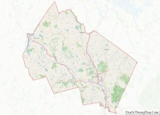
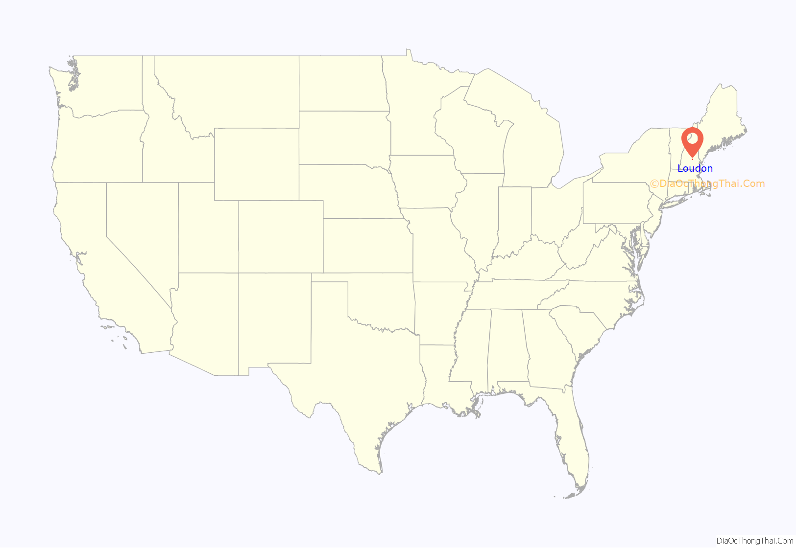
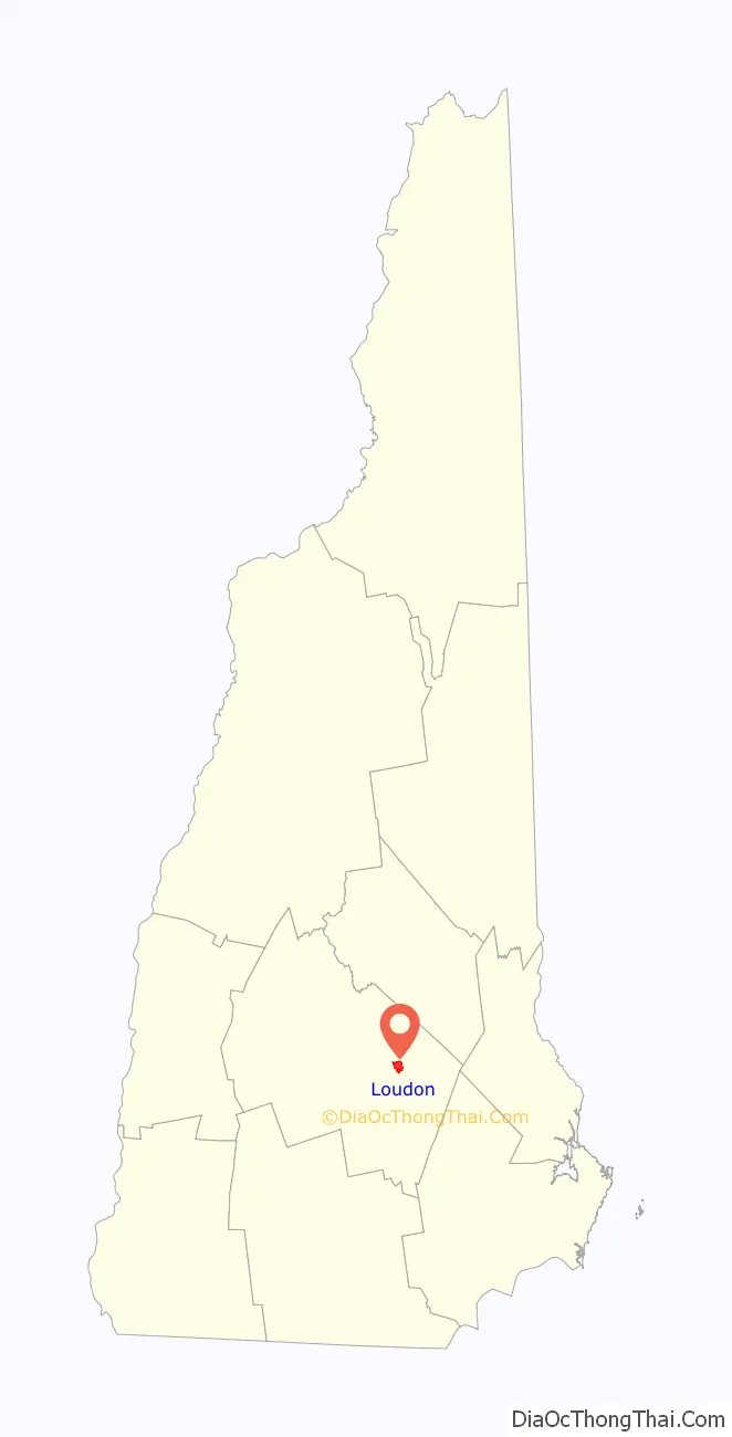
Loudon location map. Where is Loudon CDP?
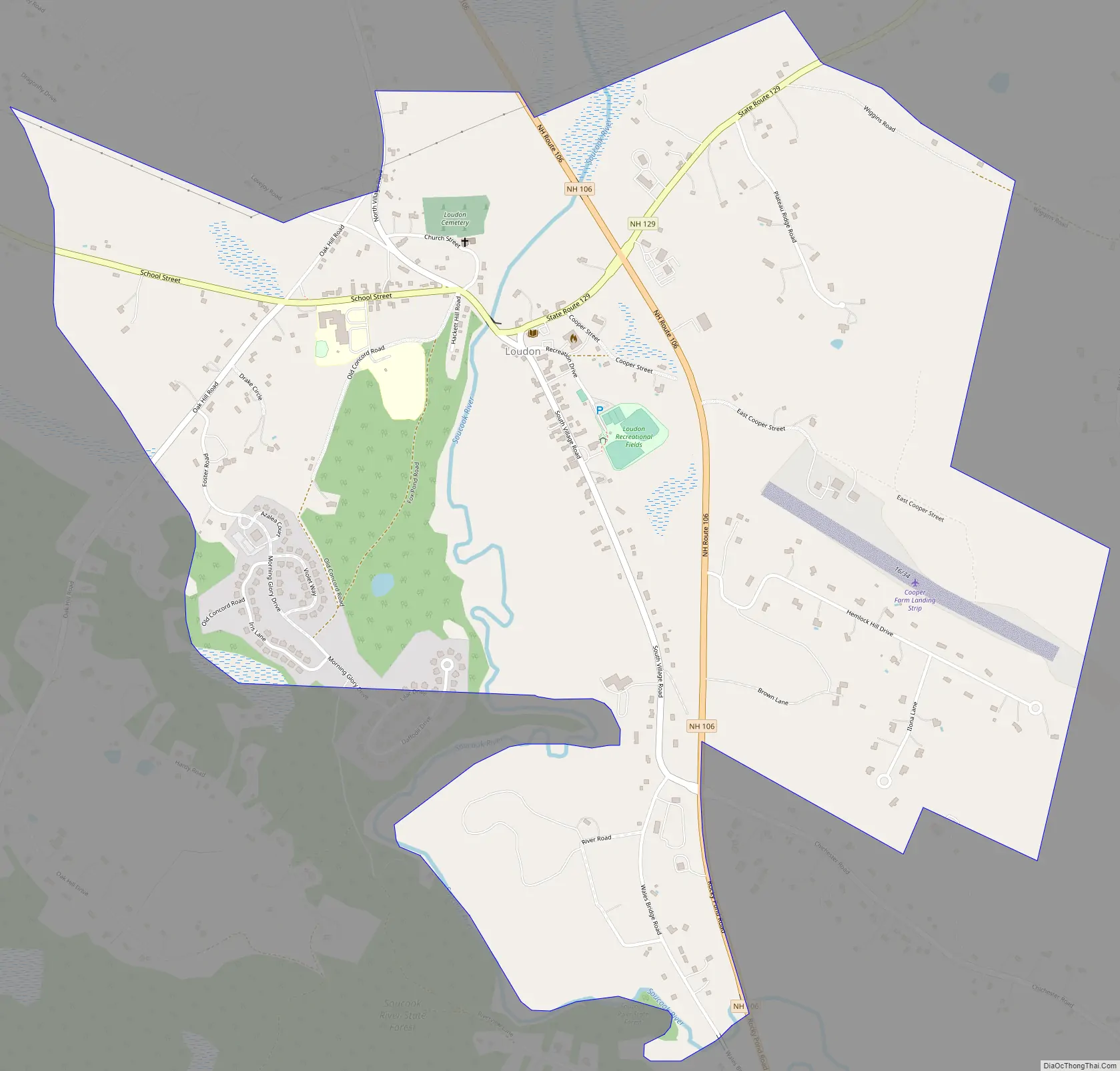
Loudon Road Map
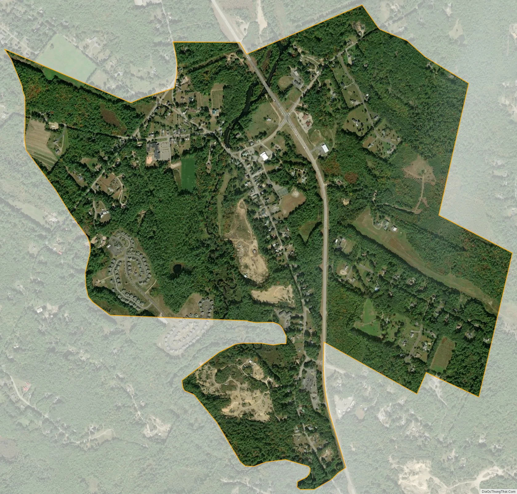
Loudon city Satellite Map
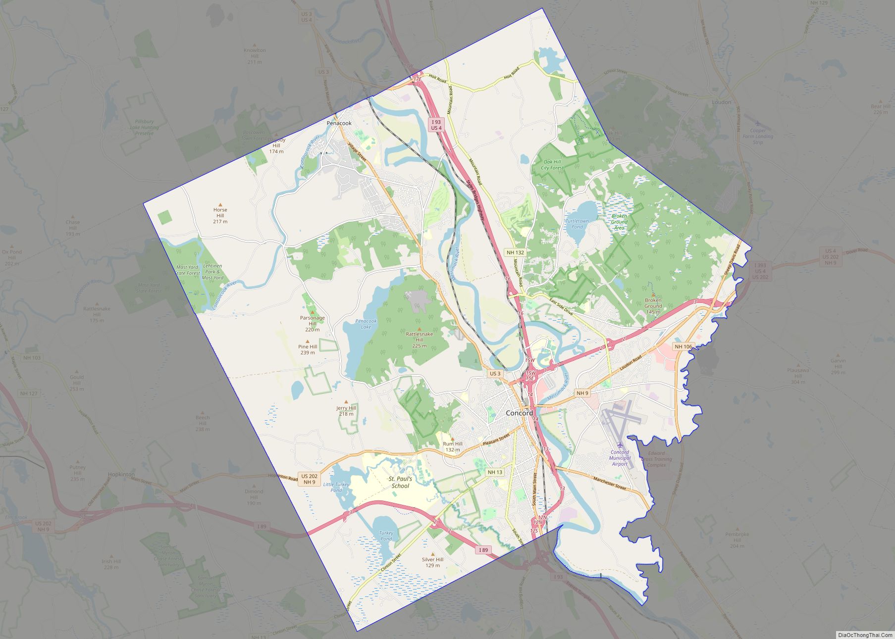
Geography
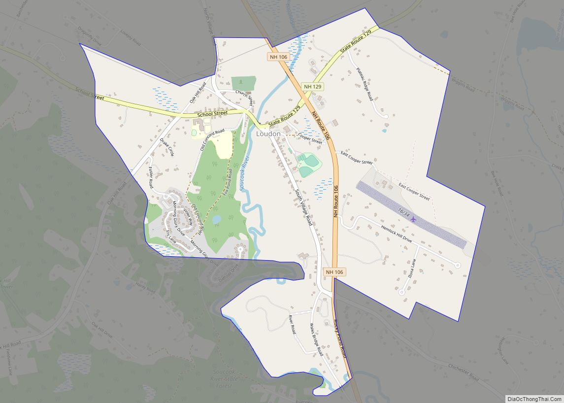
The CDP is in the southern part of the town of Loudon, on both sides of the Soucook River. The northern boundary of the CDP is north of School Street, Church Street, and New Hampshire Route 129, and follows Wiggins Road to the northeast corner of the CDP. To the east, all houses on East Cooper Street, Hemlock Hill Drive, Ilona Lane, and Brown Lane are within the CDP. The border extends south along New Hampshire Route 106 to Wales Bridge over the Soucook River, then turns northwest up Riverview Lane and Pine Island Brook until back to the northwest corner of the CDP.
Route 106 passes through the east side of the CDP, leading north 18 miles (29 km) to Laconia and south 8 miles (13 km) to U.S. Route 3 in Pembroke. Concord, the state capital, is eight miles to the southwest via Route 106 and Interstate 393. Route 129 leads northeast from Loudon 9 miles (14 km) to New Hampshire Route 107 in the southern part of Gilmanton.
According to the U.S. Census Bureau, the Loudon CDP has a total area of 1.8 square miles (4.7 km), all of it recorded as land. The Soucook River, which flows southward through the center of the community, is part of the Merrimack River watershed.
See also
Map of New Hampshire State and its subdivision: Map of other states:- Alabama
- Alaska
- Arizona
- Arkansas
- California
- Colorado
- Connecticut
- Delaware
- District of Columbia
- Florida
- Georgia
- Hawaii
- Idaho
- Illinois
- Indiana
- Iowa
- Kansas
- Kentucky
- Louisiana
- Maine
- Maryland
- Massachusetts
- Michigan
- Minnesota
- Mississippi
- Missouri
- Montana
- Nebraska
- Nevada
- New Hampshire
- New Jersey
- New Mexico
- New York
- North Carolina
- North Dakota
- Ohio
- Oklahoma
- Oregon
- Pennsylvania
- Rhode Island
- South Carolina
- South Dakota
- Tennessee
- Texas
- Utah
- Vermont
- Virginia
- Washington
- West Virginia
- Wisconsin
- Wyoming