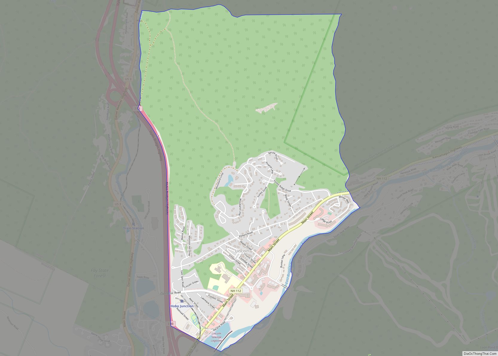
North Woodstock is a census-designated place (CDP) and the primary village in the town of Woodstock in Grafton County, New Hampshire, United States. It had a population of 739 at the 2020 census.
| Name: | North Woodstock CDP |
|---|---|
| LSAD Code: | 57 |
| LSAD Description: | CDP (suffix) |
| State: | New Hampshire |
| County: | Grafton County |
| Elevation: | 738 ft (225 m) |
| Total Area: | 1.65 sq mi (4.28 km²) |
| Land Area: | 1.62 sq mi (4.18 km²) |
| Water Area: | 0.04 sq mi (0.09 km²) |
| Total Population: | 739 |
| Population Density: | 457.30/sq mi (176.60/km²) |
| ZIP code: | 03262 |
| Area code: | 603 |
| FIPS code: | 3357220 |
| GNISfeature ID: | 0872411 |
Online Interactive Map
Click on ![]() to view map in "full screen" mode.
to view map in "full screen" mode.
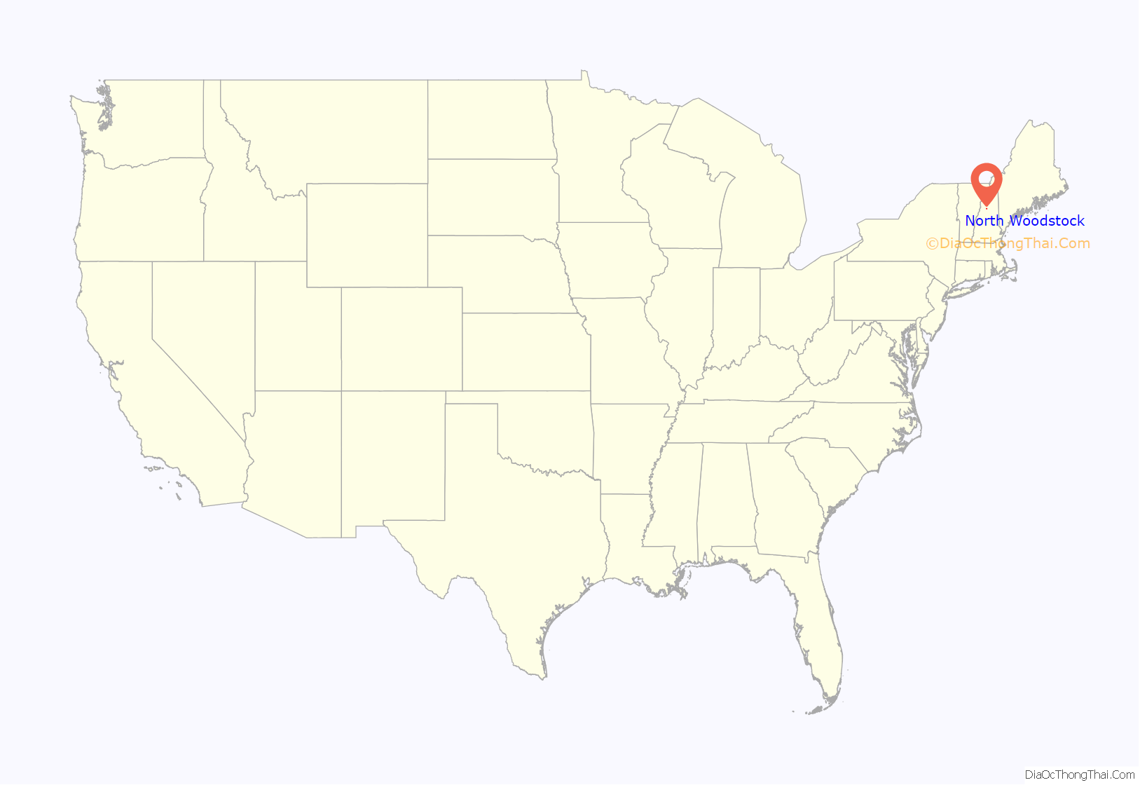
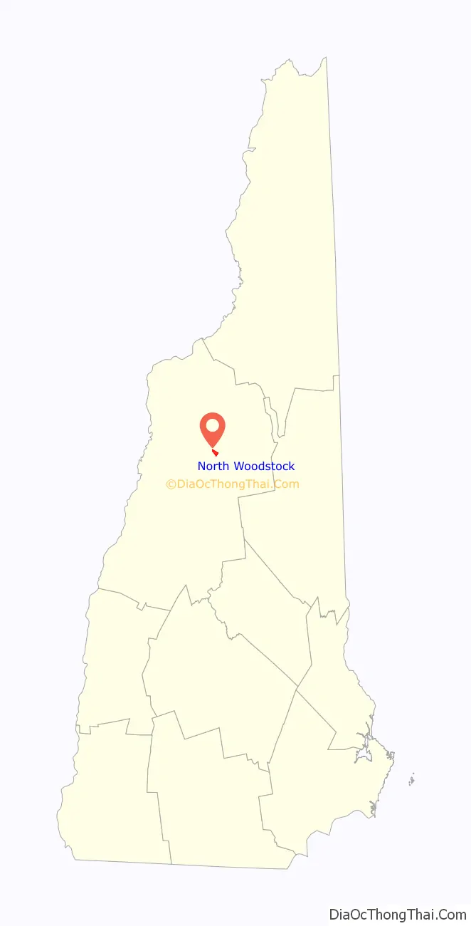
North Woodstock location map. Where is North Woodstock CDP?
North Woodstock Road Map
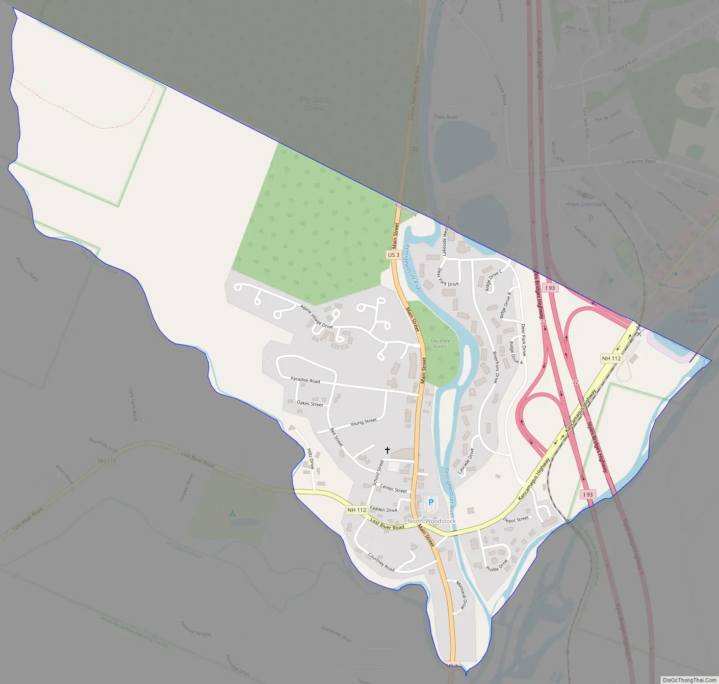
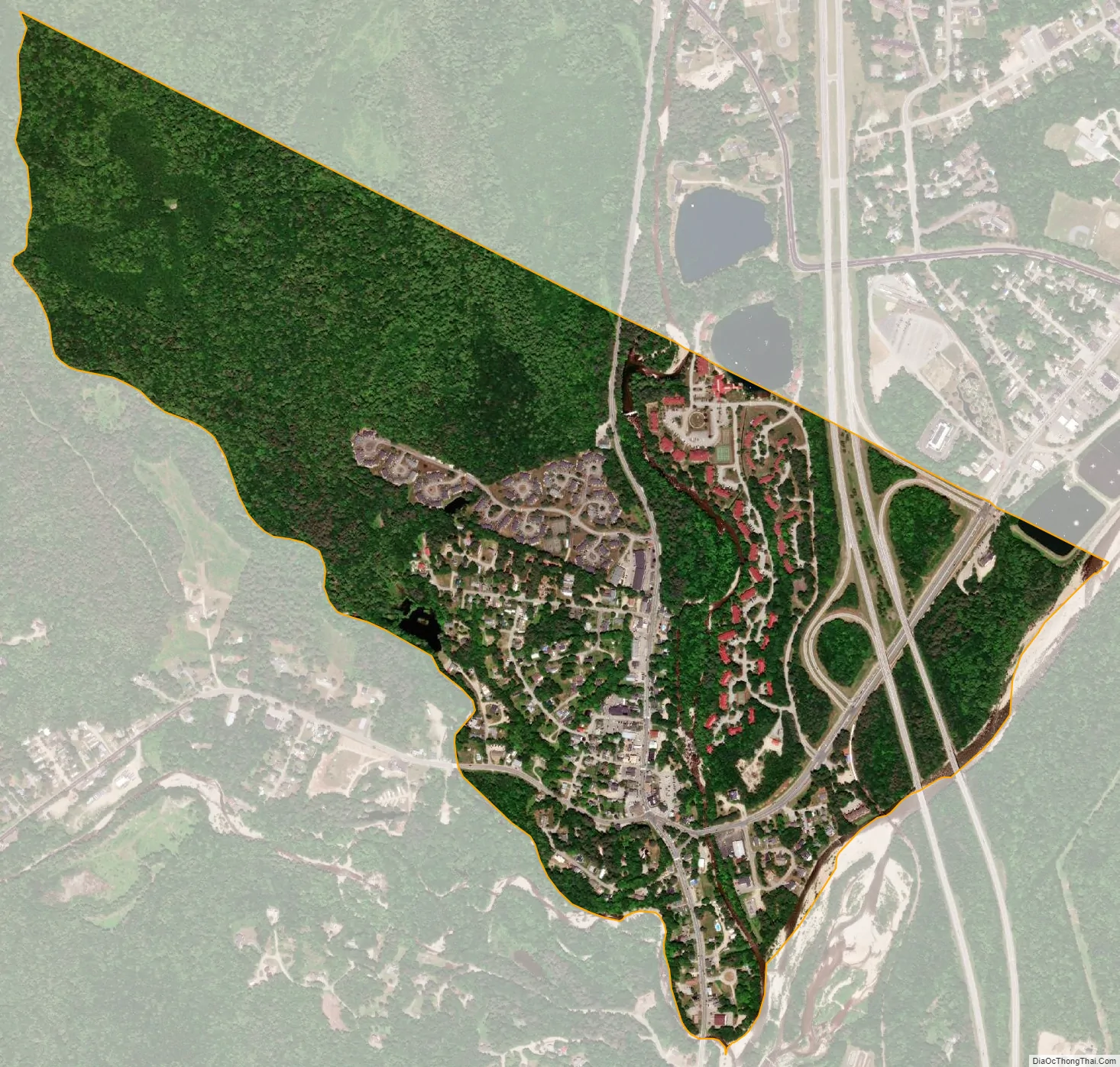
North Woodstock city Satellite Map
Geography
It is located along the northern boundary of the town of Woodstock, adjacent to the town of Lincoln. The village is centered on the intersection of U.S. Route 3 (Main Street) and New Hampshire Route 112 (Lost River Road/Kancamagus Highway). Interstate 93 passes through the east portion of the village, with access from Exit 32 (NH 112). I-93 leads south 21 miles (34 km) to Plymouth and north through Franconia Notch 23 miles (37 km) to Littleton. NH 112 leads east on the Kancamagus Highway 36 miles (58 km) to Conway and west through Kinsman Notch 24 miles (39 km) to Woodsville. US-3 is a local road that runs parallel to I-93.
The Pemigewasset River flows past the center of North Woodstock, joined by the East Branch of the Pemigewasset and Moosilauke Brook at the southern limits of the village. According to the U.S. Census Bureau, the North Woodstock CDP has a total area of 1.7 square miles (4.3 km), of which 0.04 square miles (0.1 km), or 2.17%, is water.
See also
Map of New Hampshire State and its subdivision: Map of other states:- Alabama
- Alaska
- Arizona
- Arkansas
- California
- Colorado
- Connecticut
- Delaware
- District of Columbia
- Florida
- Georgia
- Hawaii
- Idaho
- Illinois
- Indiana
- Iowa
- Kansas
- Kentucky
- Louisiana
- Maine
- Maryland
- Massachusetts
- Michigan
- Minnesota
- Mississippi
- Missouri
- Montana
- Nebraska
- Nevada
- New Hampshire
- New Jersey
- New Mexico
- New York
- North Carolina
- North Dakota
- Ohio
- Oklahoma
- Oregon
- Pennsylvania
- Rhode Island
- South Carolina
- South Dakota
- Tennessee
- Texas
- Utah
- Vermont
- Virginia
- Washington
- West Virginia
- Wisconsin
- Wyoming