Plymouth is a census-designated place (CDP) and the main village in the town of Plymouth in Grafton County, New Hampshire, United States. Its population was 4,730 at the 2020 census, out of 6,682 in the entire town. The CDP includes the campus of Plymouth State University.
| Name: | Plymouth CDP |
|---|---|
| LSAD Code: | 57 |
| LSAD Description: | CDP (suffix) |
| State: | New Hampshire |
| County: | Grafton County |
| Elevation: | 515 ft (157 m) |
| Total Area: | 5.95 sq mi (15.41 km²) |
| Land Area: | 5.88 sq mi (15.22 km²) |
| Water Area: | 0.07 sq mi (0.19 km²) |
| Total Population: | 4,730 |
| Population Density: | 805.11/sq mi (310.87/km²) |
| ZIP code: | 03264 |
| Area code: | 603 |
| FIPS code: | 3362580 |
| GNISfeature ID: | 2378089 |
Online Interactive Map
Click on ![]() to view map in "full screen" mode.
to view map in "full screen" mode.
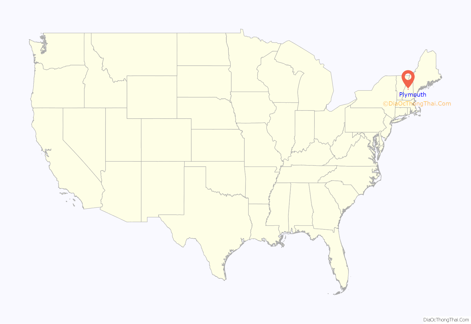
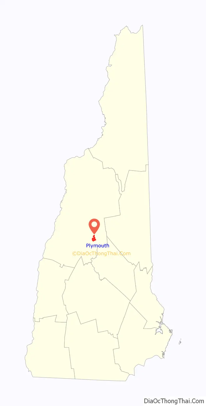
Plymouth location map. Where is Plymouth CDP?
Plymouth Road Map
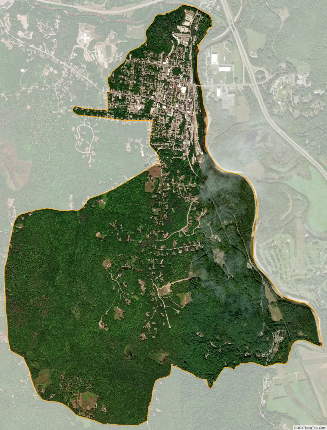
Plymouth city Satellite Map
Geography
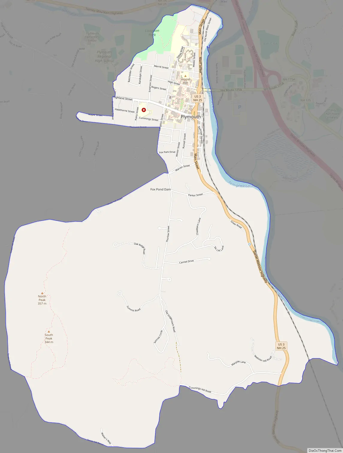
The CDP is in the eastern part of the town of Plymouth, on the west side of the Pemigewasset River. It includes the town center, the campus of Plymouth State University, and residential neighborhoods to the west and south of the town center. The CDP boundary is the Pemigewasset River on the east, Glove Hollow Brook to the south, Texas Hill Road to the south and west, Clay Brook to the west, and Route 25 and the Baker River to the north.
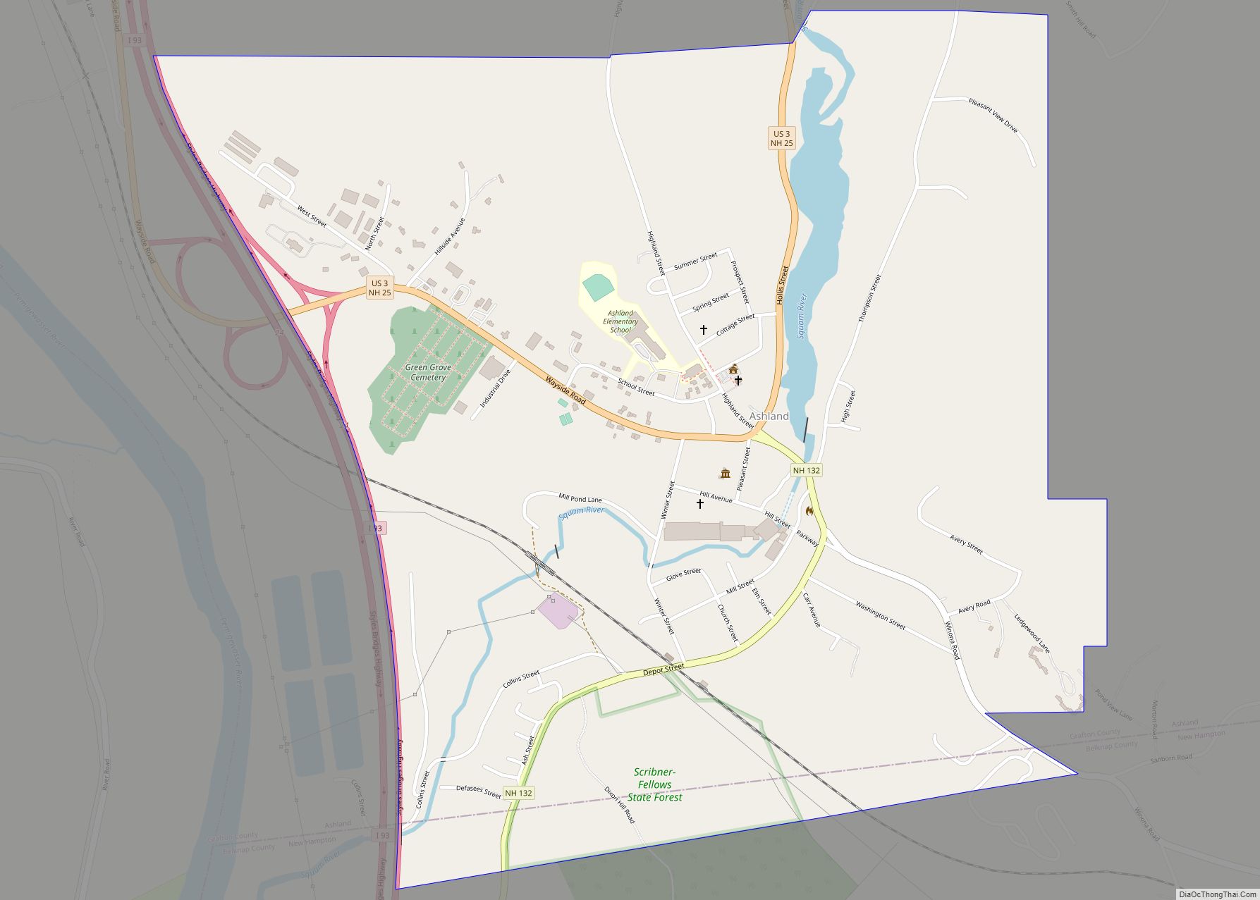
Interstate 93 runs just to the east of Plymouth, across the Pemigewasset River in the town of Holderness, with access from Exit 25 (New Hampshire Route 175A) and Exit 26 (New Hampshire Route 25). I-93 leads north 44 miles (71 km) to Littleton and south 43 miles (69 km) to Concord, the state capital. U.S. Route 3 passes through the center of the community, leading north 7 miles (11 km) to Campton and south 6 miles (10 km) to Ashland. NH 25 (Tenney Mountain Highway) passes just north of the CDP, leading northwest 35 miles (56 km) to Haverhill, New Hampshire.
According to the U.S. Census Bureau, the Plymouth CDP has a total area of 5.9 square miles (15.4 km), of which 5.9 square miles (15.2 km) are land and 0.1 square miles (0.2 km), or 1.25%, are water.
See also
Map of New Hampshire State and its subdivision: Map of other states:- Alabama
- Alaska
- Arizona
- Arkansas
- California
- Colorado
- Connecticut
- Delaware
- District of Columbia
- Florida
- Georgia
- Hawaii
- Idaho
- Illinois
- Indiana
- Iowa
- Kansas
- Kentucky
- Louisiana
- Maine
- Maryland
- Massachusetts
- Michigan
- Minnesota
- Mississippi
- Missouri
- Montana
- Nebraska
- Nevada
- New Hampshire
- New Jersey
- New Mexico
- New York
- North Carolina
- North Dakota
- Ohio
- Oklahoma
- Oregon
- Pennsylvania
- Rhode Island
- South Carolina
- South Dakota
- Tennessee
- Texas
- Utah
- Vermont
- Virginia
- Washington
- West Virginia
- Wisconsin
- Wyoming