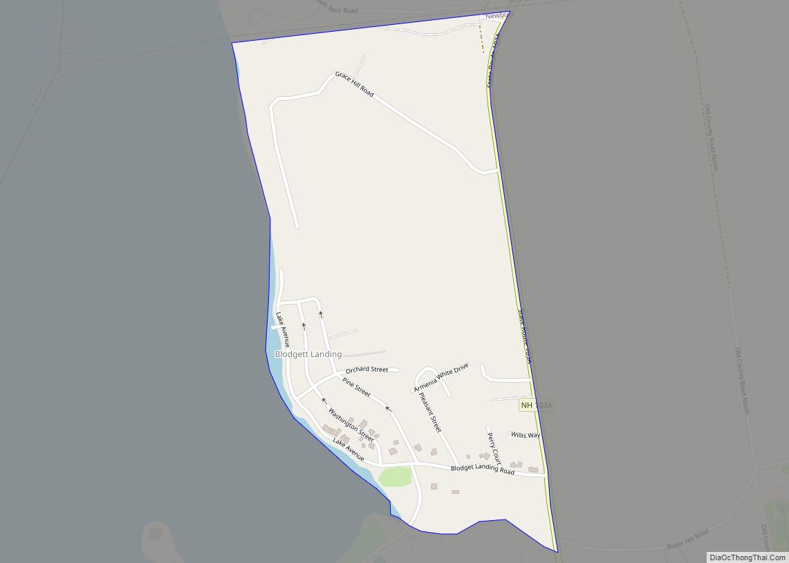
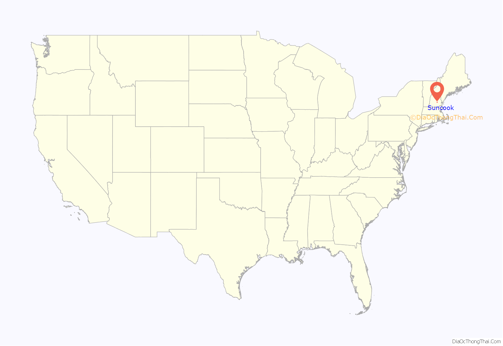
Suncook is a census-designated place (CDP) in Merrimack County, New Hampshire, United States. The population was 5,501 at the 2020 census. Approximately two-thirds of Suncook is located in the town of Pembroke, with the remainder in Allenstown.
The village of Suncook formed along the falls of the Suncook River, which drops 70 feet (21 m) in one-half mile (1 km) just before joining the Merrimack River. Much of the center of the village is occupied by 19th-century factory buildings which once used the river’s energy for hydropower. The buildings have now largely been converted to other uses. Much of Suncook’s late 19th-century commercial village center has been listed on the National Register of Historic Places.
Suncook was once home to the Suncook Valley Railroad, a shortline railroad company that operated northwest to Concord and northeast to Barnstead. The railroad operated on former Boston and Maine track that was sold to the company. The Suncook Valley Railroad went bankrupt in 1952 and all its track was torn up.
| Name: | Suncook CDP |
|---|---|
| LSAD Code: | 57 |
| LSAD Description: | CDP (suffix) |
| State: | New Hampshire |
| County: | Merrimack County |
| Elevation: | 269 ft (82 m) |
| Total Area: | 3.91 sq mi (10.12 km²) |
| Land Area: | 3.72 sq mi (9.64 km²) |
| Water Area: | 0.19 sq mi (0.48 km²) |
| Total Population: | 5,501 |
| Population Density: | 1,477.97/sq mi (570.66/km²) |
| ZIP code: | 03275 |
| Area code: | 603 |
| FIPS code: | 3375140 |
| GNISfeature ID: | 0870274 |
Online Interactive Map
Click on ![]() to view map in "full screen" mode.
to view map in "full screen" mode.
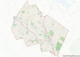
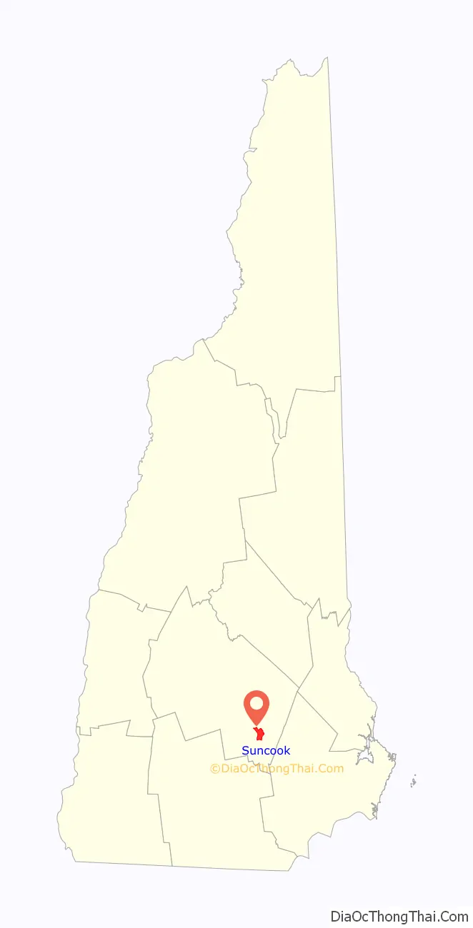
Suncook location map. Where is Suncook CDP?
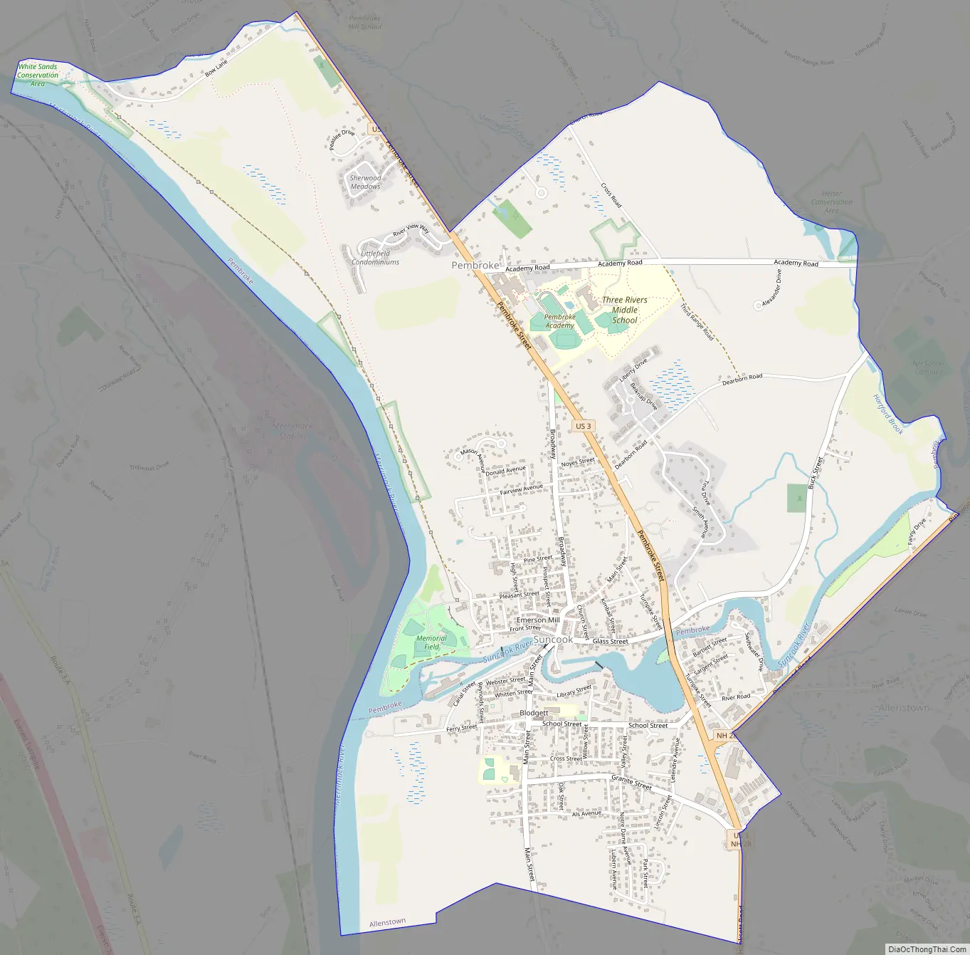
Suncook Road Map
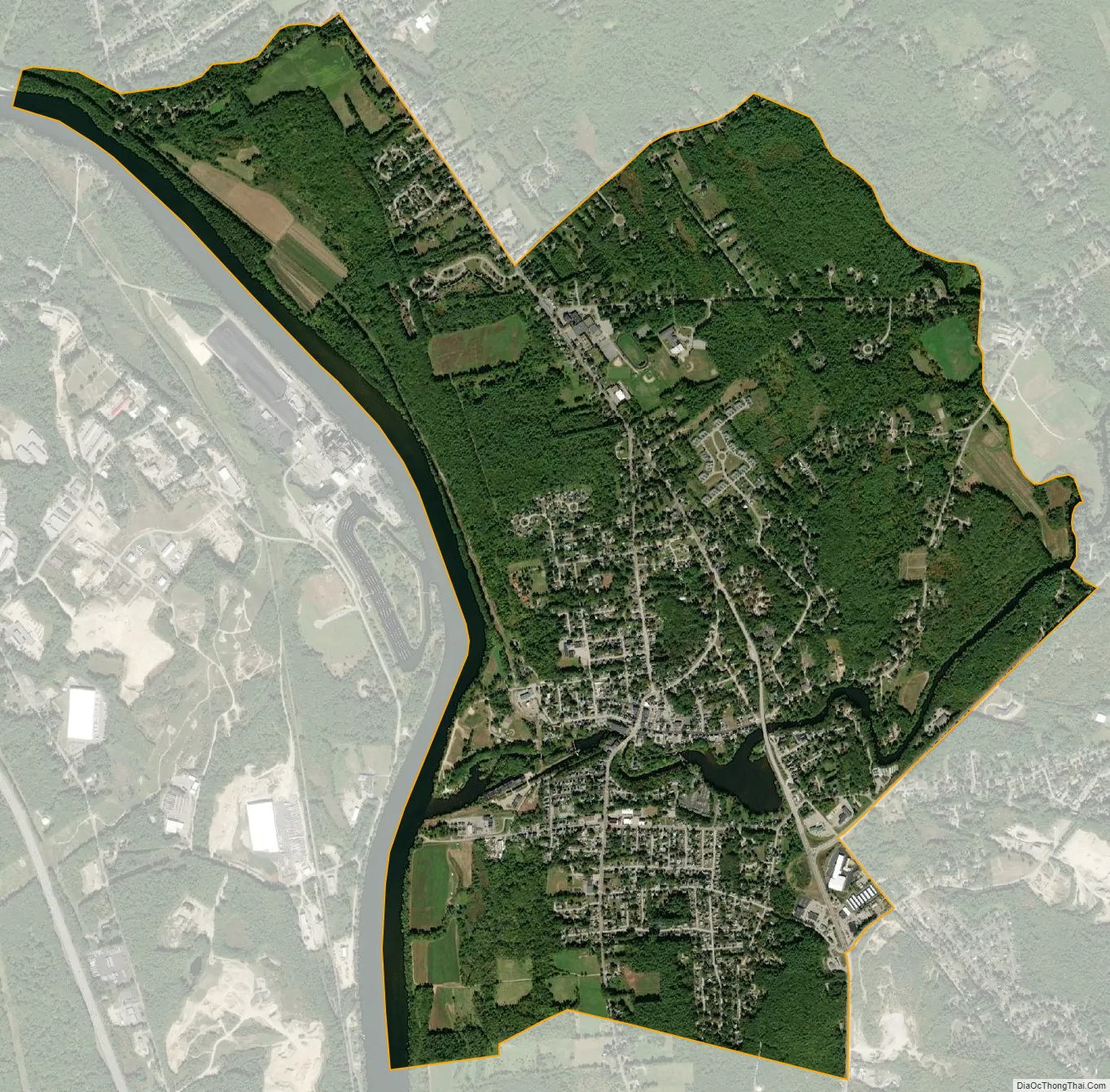
Suncook city Satellite Map
Geography
Suncook is located in the southern corner of the town of Pembroke and the western end of the town of Allenstown. The Suncook River runs through the center of the village and forms the boundary between the two towns. The CDP is bordered to the south by the town of Hooksett and to the west by the Merrimack River, which forms the Bow town line.
U.S. Route 3 runs through the east side of the CDP, leading northwest 7 miles (11 km) to Concord, the capital of New Hampshire, and south 10 miles (16 km) to Manchester, the state’s largest city. New Hampshire Route 28 leads south from Suncook with Route 3 but leads northeast up the Suncook River valley 15 miles (24 km) to Pittsfield.
According to the United States Census Bureau, the Suncook CDP has a total area of 3.9 square miles (10.1 km), of which 3.7 square miles (9.6 km) are land and 0.2 square miles (0.5 km), or 4.75%, are water.
See also
Map of New Hampshire State and its subdivision: Map of other states:- Alabama
- Alaska
- Arizona
- Arkansas
- California
- Colorado
- Connecticut
- Delaware
- District of Columbia
- Florida
- Georgia
- Hawaii
- Idaho
- Illinois
- Indiana
- Iowa
- Kansas
- Kentucky
- Louisiana
- Maine
- Maryland
- Massachusetts
- Michigan
- Minnesota
- Mississippi
- Missouri
- Montana
- Nebraska
- Nevada
- New Hampshire
- New Jersey
- New Mexico
- New York
- North Carolina
- North Dakota
- Ohio
- Oklahoma
- Oregon
- Pennsylvania
- Rhode Island
- South Carolina
- South Dakota
- Tennessee
- Texas
- Utah
- Vermont
- Virginia
- Washington
- West Virginia
- Wisconsin
- Wyoming