Barnegat Light is a borough in Ocean County, in the U.S. state of New Jersey. As of the 2020 United States census, the borough’s population was 640, an increase of 66 (+11.5%) from the 2010 census count of 574, which in turn reflected a decline of 190 (−24.9%) from the 764 counted at the 2000 census. The borough borders the Atlantic Ocean on Long Beach Island and is home to Barnegat Lighthouse.
Barnegat Light was formed as a borough by the New Jersey Legislature on November 2, 1948, to replace Barnegat City borough, which in turn had been created on March 29, 1904, from portions of Long Beach Township.
| Name: | Barnegat Light borough |
|---|---|
| LSAD Code: | 21 |
| LSAD Description: | borough (suffix) |
| State: | New Jersey |
| County: | Ocean County |
| Incorporated: | March 29, 1904 as Barnegat City |
| Elevation: | 3 ft (0.9 m) |
| Total Area: | 1.20 sq mi (3.10 km²) |
| Land Area: | 0.83 sq mi (2.15 km²) |
| Water Area: | 0.37 sq mi (0.95 km²) 30.50% |
| Total Population: | 640 |
| Population Density: | 770.3/sq mi (297.4/km²) |
| ZIP code: | 08006 |
| FIPS code: | 3403130 |
| GNISfeature ID: | 0885148 |
| Website: | www.barnegatlight.org |
Online Interactive Map
Click on ![]() to view map in "full screen" mode.
to view map in "full screen" mode.
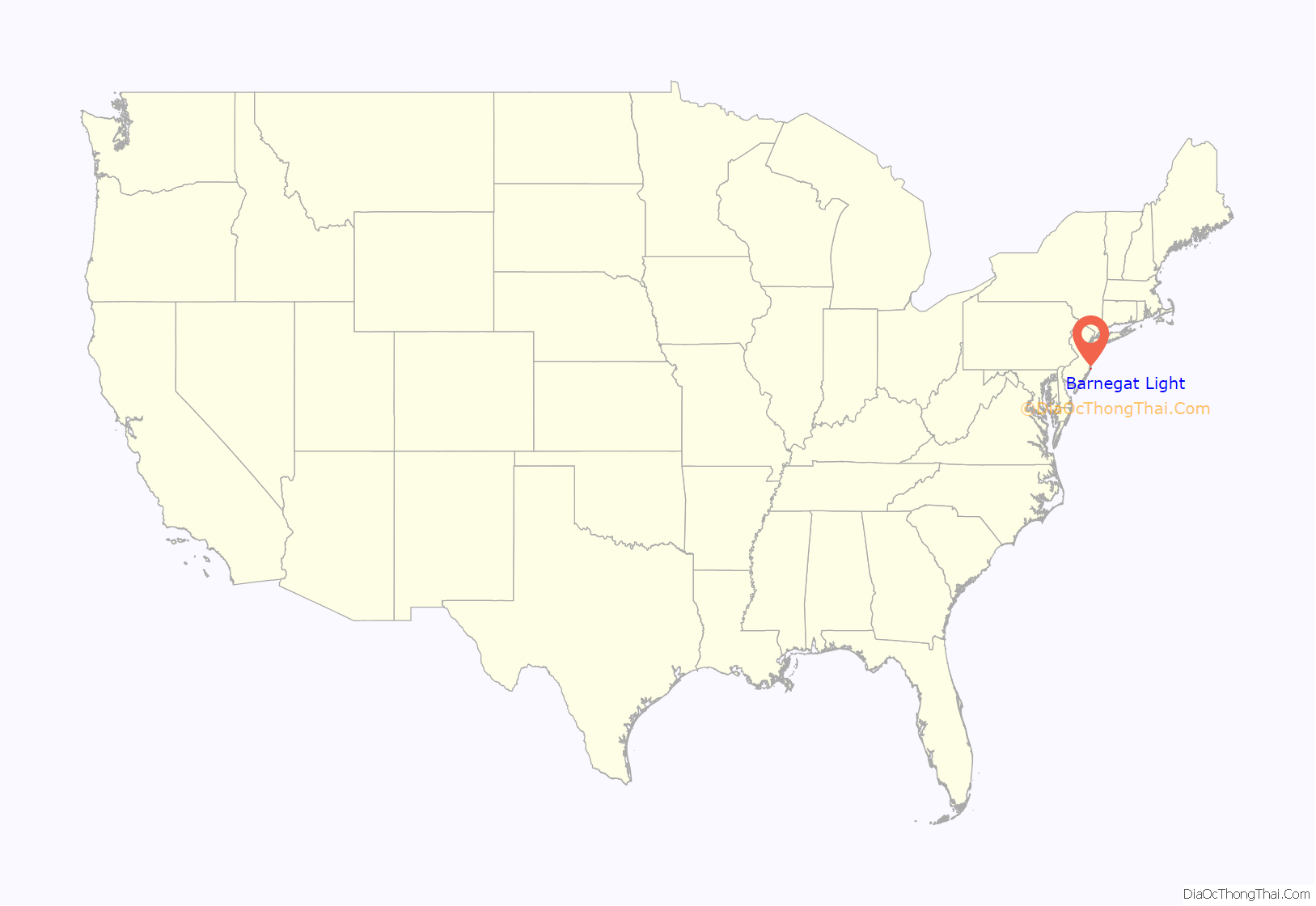
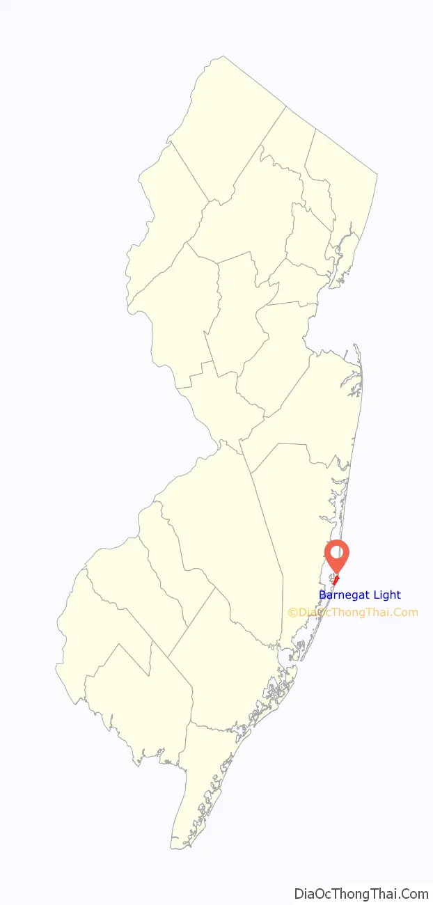
Barnegat Light location map. Where is Barnegat Light borough?
History
Early history
The area surrounding Barnegat Bay and Barnegat Inlet was described by Henry Hudson in 1609, as “…a great lake of water, as we could judge it to be … The mouth of the lake hath many shoals, and the sea breaketh on them as it is cast out of the mouth of it.” The name of the bay, mainland town, and island town were extensions of the inlet’s name, named so in the 1610s by later Dutch mariners as “barende-gat” which was a general Dutch lingual description of a powerful inlet, not a formal place name, and depending on its context meant “burning hole” or “inlet of breakers.” Subsequent transliteration as control of the land changed hands throughout the 17th century Anglo-Dutch wars resulted in barende-gat and its variations becoming Barnegat and a formal name for many locations and features in the area.
On October 26, 1782, a Belgian cutter traveling southward became stranded near the inlet. The ship was noticed by revolutionaries led by Captain Andrew Steelman, who recruited local men to unload the cargo. While at rest on the beach, the crews were attacked by Captain John Bacon, who ran a pinelands gang and was affiliated with the Loyalists. Almost all of Steelman’s men were murdered in what became known as the Barnegat Light Massacre, which led to a manhunt and battle at Cedar Bridge Tavern and one of the last of the Revolutionary War.
By the 19th century, Long Beach Island was known for its plentiful and various wildlife, fishing, favorable sailing conditions, and pleasant weather in summer. In 1801, most of the northern tip of what was then commonly referred to as Barnegat Beach, a neighbor to the established mainland town of Barnegat across the bay, was purchased by Bornt Slaght, a founder of Staten Island and a revolutionary veteran, who built a small house, the first structure on the north end of Long Beach Island, and later, in 1821, a hotel, one of the first seaside hotels in New Jersey. In the late 1820s, Slaght sold his hotel to Jacob Herring, thereafter known as the Herring House. The building lodged many of the visiting hunters and sport fishermen, who primarily came from New York City and Philadelphia.
The first lighthouse at Barnegat Inlet was built in 1834 in recognition of the increased economic dependence on the inlet. Barnegat Inlet held a unique position of strategic regional and national importance. Maritime traffic to New York City, the gateway to the new world, relied upon Barnegat Light to navigate into New York harbor. The sheltered Barnegat Bay was a safe harbor and access point to inner bay ports, such as the Mullica and Toms rivers, down which came numerous commodities manufactured in the pine barrens, such as bog iron, and exported to the cities through Barnegat Bay. Cranberry Inlet, located between Ortley Beach and Seaside Heights, naturally opened by storm and tidal forces in 1750, was naturally closed again in 1812, cutting off a well-used and less treacherous entryway to the bay, making Barnegat Inlet the primary access point thereafter. The 1834 lighthouse was painted white, stood 40 feet tall, and was powered by a reflector system patented by Winslow Lewis, who also constructed the tower.
Brownsville
In 1854, John Maxon Brown, a wrecker from Manasquan, bought much of the land that makes up present-day Barnegat Light. This purchase included the acquisition of Herring House, which he renamed the Ashley House for his wife’s family. The family owned so much of the tiny town that people in the area colloquially called it Brownsville during this time. The powerful inlet caused a southward drift that began to threaten the 1834 lighthouse, which was also in poor condition due to substandard construction and was the subject of voluminous complaints from mariners due to its weak light. The lighthouse collapsed into the inlet in 1857, but not before a temporary wooden tower had been put into service while a superior replacement lighthouse was erected from 1857 to 1859.
The Brown family left the island in the 1870s after John Ashley Brown, John M. Brown’s son, by then a ship captain, died in a storm at sea. In 1874, the Brown’s sold the Ashley House to “Uncle” Charlie Martin, the former manager and cook. The United States Life-Saving Service built Station No. 17 on East 5th street in 1872, replacing an 1840s house of refuge nearby. The new station was later expanded in the 1890s. In the late 1860s, a general store and post office was constructed near the intersection of West 4th Street and Central Avenue. The general store was originally run by Lloyd and Lucretia Butterworth and provided limited supplies—largely due to the difficulty in transporting goods to the remote Island location in then equally remote coastal New Jersey. In 1919, the general store was purchased by the Applegate family who ran it well into the 20th century.
Barnegat City
In 1881, the Barnegat City Improvement Company was formed by Benjamin Franklin Archer, William F. Bailey, and a group of Camden, New Jersey investors. They intended to capitalize on the success of Atlantic City, as well as the then-popular temperance and health resort movements. They laid out streets, housing lots, hotels, a port, and a railroad, calling their planned seaside resort Barnegat City, emulating its popular southern neighbor Atlantic City. Their vision enjoyed limited success, as the city increased its already established reputation as a small but popular destination for sailors, sport fishermen, and hunters from Philadelphia and New York City, who in the early 1880s arrived on regional rail lines for part of the way and a steamboat across the bay to waiting carriages on the Island. Or in the earliest days, by traditional horse-drawn carriage the entire way to the bay steamboats. The 1886 construction of a railroad from Whiting and Toms River to the Island made the trip faster and easier, but still not as direct or convenient as that built for Philadelphians to Atlantic City. Local concerns lobbied for years to have a direct rail route constructed, but those efforts failed to make the Island as convenient and affordable of a day-trip to those in Philadelphia as Atlantic City was. Those coming from New York City took a ferry to Long Branch, then railroad to Toms River, and finally a steamboat from Toms River down Barnegat Bay to Barnegat City. The SS Hesse, a ship chartered by the Pennsylvania Railroad, began providing transport into Barnegat City for passengers largely originating from New York City and Trenton. This ship was later replaced by the Connetquot. The Oceanic Hotel, Sunset Hotel (initially San Souci Hotel), and Social were built as part of the original BCIC plan. The Oceanic opened in 1882, the Sunset in 1883, and the Social in 1884. The large Oceanic Hotel, located on East 4th Street, would be moved 300 feet west barely a year after opening due to sudden erosion threatening the hotel, which was placed atop leveled dunes at the very edge of the beach.
The Ashley House was sold to John Warner Kinsey in 1882, who rebranded it the Kinsey Hotel. He sold the old hotel not long after, the Ashley being antiquated and badly in need of repairs to compete with its larger more modern new neighbors in town. The hotel stood empty until 1887 when it was torn down. Between 1884 and 1886, a direct railroad connection was completed to increase the Island’s tourism capabilities. The first train reached Barnegat City on June 28, 1886. The lighthouse keeper’s house was greatly expanded in 1889 by the Federal Lighthouse Bureau to house the head keeper, his two assistants, and their families. During the Spanish–American War, signal houses were hurriedly constructed up and down the east coast, one of which was built in Barnegat City whose staff were charged with watching the seas for signs of Spanish ships. The brief war ended, however, before the houses could be put into service.
Barnegat City became part of Long Beach Township after the township’s establishment in 1899. In 1904, the city declared itself an independent borough and Barnegat City became the first officially recognized name for the storied old northern point of Long Beach Island.
In 1914, an automobile bridge was built next to the railroad bridge at the midpoint of the Island at Ship Bottom, eventually attracting more to the Island when roads and automobiles were plentiful but also increasing the devastating near term decline in railroad passenger and freight traffic vital to the Island’s trade and tourist economy, as well as livelihoods of most residents. In 1919, the struggling Oceanic Hotel sold and the somewhat more successful Sunset Hotel, catering to seasonal water fowl hunters, was purchased by John Barber. In 1928, Kaetzel’s Hotel and Bar was opened on West 7th Street by Paul and Toni Kaetzel. The bar was later purchased by Philadelphia bar owners Adamas “Pop” Kubelczikas and his wife Helena “Mom” Kubelczikas. They renamed the then bar and grill Kubel’s Bar, which still operates today.
A severe winter storm in 1920 caused significant erosion of the shoreline from the lighthouse to East and West 8th streets on the bay and ocean side of Barnegat City, eroding the shore up to the base of the lighthouse and prompting the abandonment and removal of the keeper’s house by the United States Lighthouse Service. The Oceanic Hotel owner planned to open it in the spring of 1920, but limited prospects for turning a profit and the dangerously close tides caused him to sell the hotel for salvage. Locals stripped and demolished the hotel a section at the time from the east end. The 1920 winter caused some damage to the hotel as well. Life-Saving Station No. 17 also had to be moved from its site at the end of East 5th Street to the middle of the block on East 7th Street. It was later replaced by a modern station across the street which still stands today as the Borough Hall. On the bay side, the port at 6th Street, populated by docks, boats, and fisherman and their families living in small cottages, began to erode as the inlet current wrapped around the contour of Barnegat City and scoured away at it from both sides. The disappearing town, as newspapers morbidly began writing of Barnegat City, which included frequent claims of the lighthouse near toppling and, in some sensationalist cases, claims that the lighthouse had toppled in a most recent storm, saw the end of the developers dreams from 1881. The block upon block of cottages they envisioned would be built, but it would take the next 60 years to be completed. In 1923, train service was discontinued from Barnegat City Junction at Ship Bottom to the entire north end of the Island, including the towns of Surf City and Harvey Cedars, and the tracks taken up shortly after due to low ridership, increasing maintenance costs to keep the aging railways passable, dilapidated locomotives and cars, and the growth of automobile traffic. This fate would follow for the southern branch of the Island railroad in 1935 when the train bridge was washed out in a nor’easter, while the regional shore lines would shutter in the 1940s.
A series of disasters in the area occurred during the 1930s, beginning with the destruction of the Sunset Hotel by fire in June 1932. On April 4, 1933, the Airship USS Akron crashed in the sea off Barnegat Light, resulting in the deaths of 73 of the airship’s crew of 76, still the most deadly airship disaster on record. In the era of airships from the late 1910s to the 1940s, nearby Navy base Lakehurst operated as the east coast port for all lighter-than-air traffic, including international flights from legendary craft such as the Graf Zeppelin and the Hindenburg. The Barnegat lighthouse and the inlet acted as a navigational point for airships from Lakehurst, making them a common sight in the skies above Barnegat City and parts of the Island. During World War II, airships were often seen as part of merchant convoys, providing anti-submarine services.
Barnegat City’s commercial fishing economy improved with a pound boat fishery opened by Captain Dick Myers in 1920, who built a dock at West 6th Street replacing the old eroded port. Also by the 1920s, a wave of immigration since 1900 had changed Barnegat City’s makeup as fishermen from Norway, Sweden, and Finland came to local waters after hearing of its reputation and solicitations from Myers to work his pound nets. In 1927 these Scandinavian fisherman united to form the Independent Fish Company and bought land further south to build their own dock complex that spanned West 17th to West 20th streets and remains active today. During this period, gillnetting declined in popularity, but it would later gain a comeback in the 1950s. Also in the 1950s, dragger fishing was ended and tilefishing began, the latter taking into the early 1970s before it became a profitable fishery and backbone, along with scalloping, of the evolving Barnegat Light commercial fishing industry.
The Independent Fish Company docks are now known as Viking Village and today provide a combined shopping and industrial establishment with both handcrafted goods and fresh seafood. Catches typically consist of scallops, tuna, swordfish, tilefish, weakfish, monkfish, bluefish, shad, dogfish, and various other types of in-shore fish. In the 1960s and 1970s, foreign trawlers, many international, were permitted to fish in the area, coming within a few miles of shore and fishing out several key species. Nearly all of the cod have been fished out of the area along with blue fish. The scallop boat Lindsay L, docked at Viking Village, was used in the movie The Perfect Storm.
Barnegat Light
In 1948, Barnegat City was renamed as Barnegat Light after a referendum. The motivations for this renaming were both to honor the legacy of the lighthouse (which was decommissioned four years earlier) and to distinguish itself from nearby Barnegat Township. In 1950, the post office moved from the Applegate’s general store, which was falling into disrepair, to another general store on 18th Street. The building it replaced had itself been a general store and a gas station, both owned by Jens Jensen in 1920 who had given it to John Englesen in 1940 as a trade for a house on 19th Street. The post office remained at 18th Street until its current location on 10th Street was opened in the early 1960s when a borough hall and municipal complex was constructed. Town meetings had previously been held at the closed Barnegat City schoolhouse since 1951 and also the Barnegat Light Volunteer Firehouse hall. The site of the first post office, the general store on 4th Street, was saved and updated in the ensuing decades, operating today as the Inlet Deli.
The continued threat of storms such as the Great Atlantic Hurricane of 1944 and the Ash Wednesday Storm of 1962 reinforced concerns about Barnegat Light’s survival in the long term and the survival of the lighthouse and beachfront homes in the near term. The first attempt at stabilizing the shoreline came in 1939-40 when a combination of rock jetties and earthen dams were used to reroute the inlet current away from the shoreline. The massive effort succeeded and stopped the erosion that had doomed the eastern beach blocks, threatened the lighthouse, and erased the former port at 6th street. A diagonal jetty extending hundreds of yards NNE from East 8th Street forced the current far away from land before it entered the channel between the lighthouse and southern tip of Island Beach, while the damming of the existing current’s channel along the backside of the Island between West 20th Street and High Bar, plus the damming of a channel between High Bar and an island WNW of the inlet, rerouted the current a mile north and west of Barnegat Light, sending it farther into the bay away from the town. The construction of the existing jetty in the early 1990s further stabilized the earlier work, straightening the southern jetty of the inlet and reclaiming virtually all of the eastern shoreline from East 8th Street to the lighthouse that was lost over the last century, much of which was not redeveloped and instead designated as parkland, which in 2020 included the addition of a bird sanctuary. The jetties have provided stabilization to the shoreline and especially the previously unstable and occasionally shallow inlet. To maintain the channel, the inlet requires annual dredging by the United States Army Corps of Engineers. In addition to the lighthouse, Barnegat Light continues to host a United States Coast Guard station, now located on the bay at West 6th Street, reflecting the continued presence of the former United States Life-Saving Service and its vital duties on the still treacherous waters of Barnegat Inlet and out on the Barnegat shoals. In line with the borough’s history, its most prominent industries continue to be tourism and fishing.
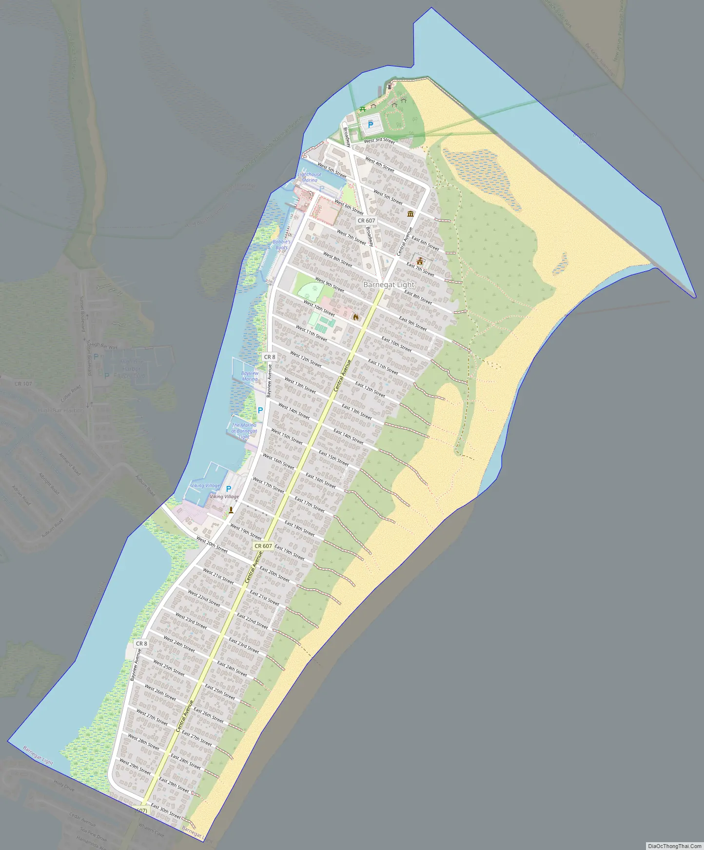
Barnegat Light Road Map
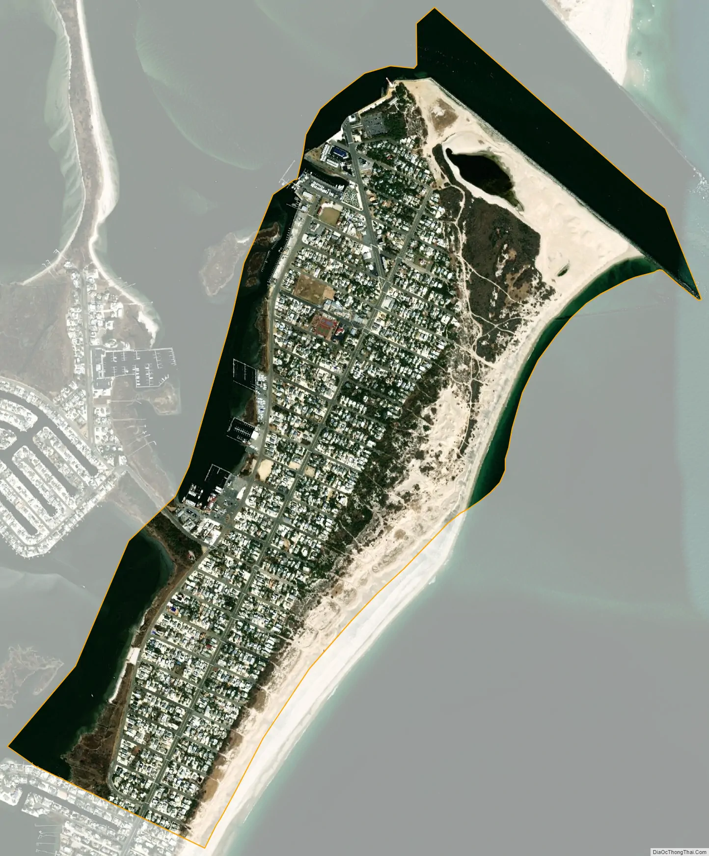
Barnegat Light city Satellite Map
Geography
According to the United States Census Bureau, the borough had a total area of 1.20 square miles (3.10 km), including 0.83 square mile (2.15 km) of land and 0.37 square mile (0.95 km) of water (30.50%).
The borough borders Berkeley Township, Long Beach Township and Ocean Township. It is located on the northern tip of Long Beach Island and is bounded by Barnegat Bay on the west, the Atlantic Ocean to the east, the Barnegat Inlet to the north and the Long Beach Township neighborhood of Loveladies to the south.
See also
Map of New Jersey State and its subdivision: Map of other states:- Alabama
- Alaska
- Arizona
- Arkansas
- California
- Colorado
- Connecticut
- Delaware
- District of Columbia
- Florida
- Georgia
- Hawaii
- Idaho
- Illinois
- Indiana
- Iowa
- Kansas
- Kentucky
- Louisiana
- Maine
- Maryland
- Massachusetts
- Michigan
- Minnesota
- Mississippi
- Missouri
- Montana
- Nebraska
- Nevada
- New Hampshire
- New Jersey
- New Mexico
- New York
- North Carolina
- North Dakota
- Ohio
- Oklahoma
- Oregon
- Pennsylvania
- Rhode Island
- South Carolina
- South Dakota
- Tennessee
- Texas
- Utah
- Vermont
- Virginia
- Washington
- West Virginia
- Wisconsin
- Wyoming


