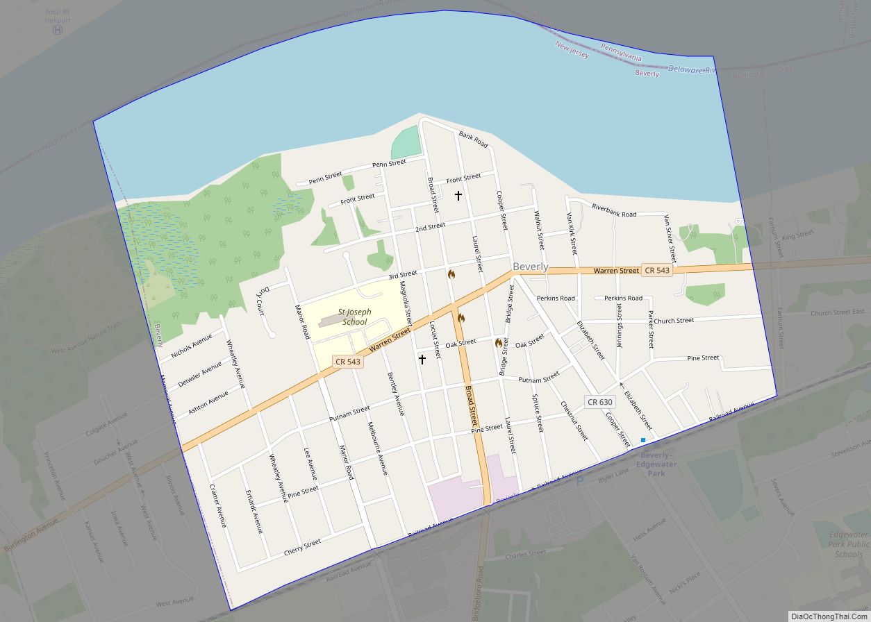
Beverly is a city in Burlington County in the U.S. state of New Jersey. As of the 2020 United States census, the city’s population was 2,499, a decrease of 78 (−3.0%) from the 2010 census count of 2,577, which in turn reflected a decline of 84 (−3.2%) from the 2,661 counted in the 2000 census. The city, and all of Burlington County, is a part of the Philadelphia–Reading–Camden combined statistical area and the Delaware Valley.
Beverly was originally incorporated as a borough on March 5, 1850, within Willingboro Township. Beverly was incorporated as a city by an act of the New Jersey Legislature on April 13, 1857, replacing Beverly borough, based on the results of a referendum held that day. Beverly Township, formed in 1859, co-existed alongside Beverly City and was renamed as Delanco Township in 1926. The borough was named for Beverley, England.
The city had the 15th-highest property tax rate in New Jersey, with an equalized rate of 4.550% in 2020, compared to 2.676% in the county as a whole and a statewide average of 2.279%.
| Name: | Beverly city |
|---|---|
| LSAD Code: | 25 |
| LSAD Description: | city (suffix) |
| State: | New Jersey |
| County: | Burlington County |
| Incorporated: | March 5, 1850 |
| Elevation: | 23 ft (7 m) |
| Total Area: | 0.76 sq mi (1.96 km²) |
| Land Area: | 0.54 sq mi (1.40 km²) |
| Water Area: | 0.21 sq mi (0.56 km²) 28.16% |
| Total Population: | 2,499 |
| Population Density: | 4,617.1/sq mi (1,782.7/km²) |
| ZIP code: | 08010 |
| Area code: | 609 |
| FIPS code: | 3405740 |
| GNISfeature ID: | 0885160 |
| Website: | www.thecityofbeverly.com |
Online Interactive Map
Click on ![]() to view map in "full screen" mode.
to view map in "full screen" mode.
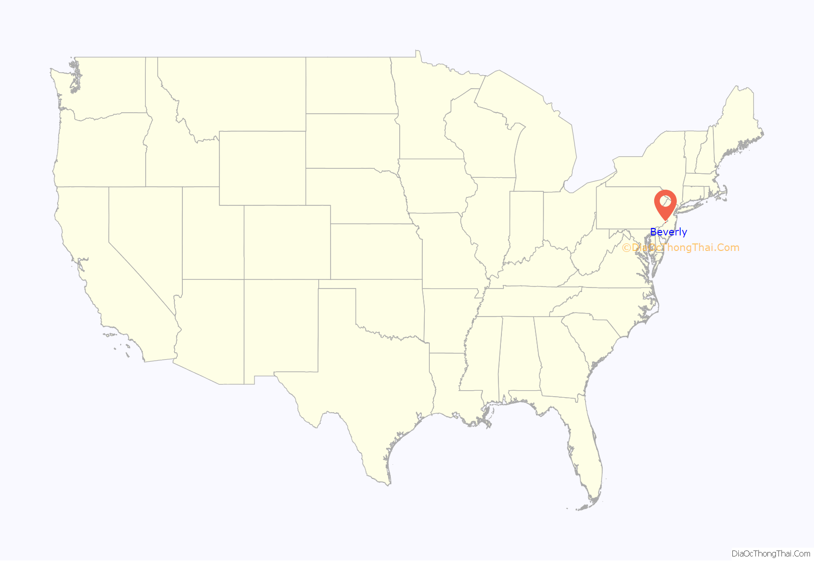
Beverly location map. Where is Beverly city?
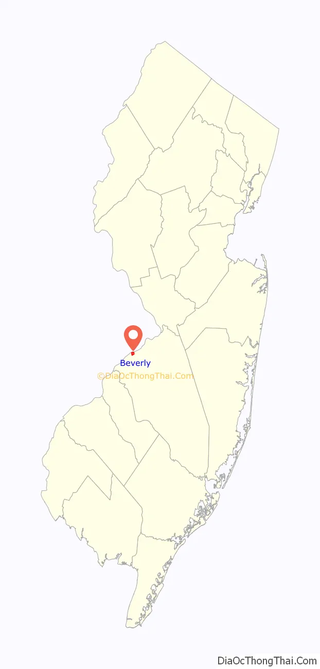
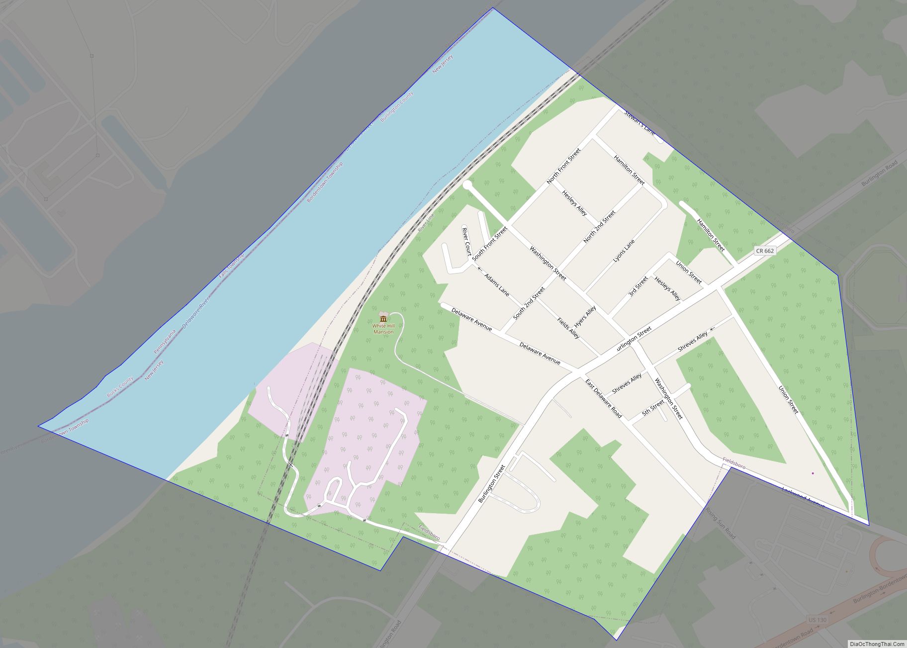
Beverly Road Map
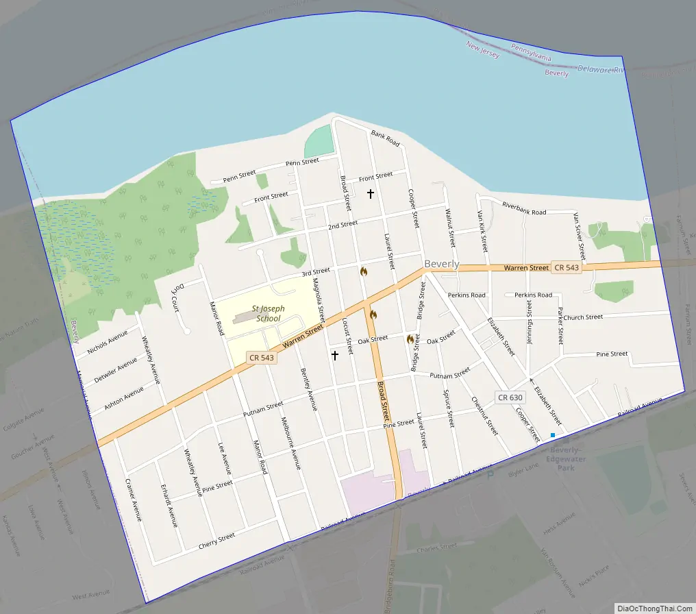
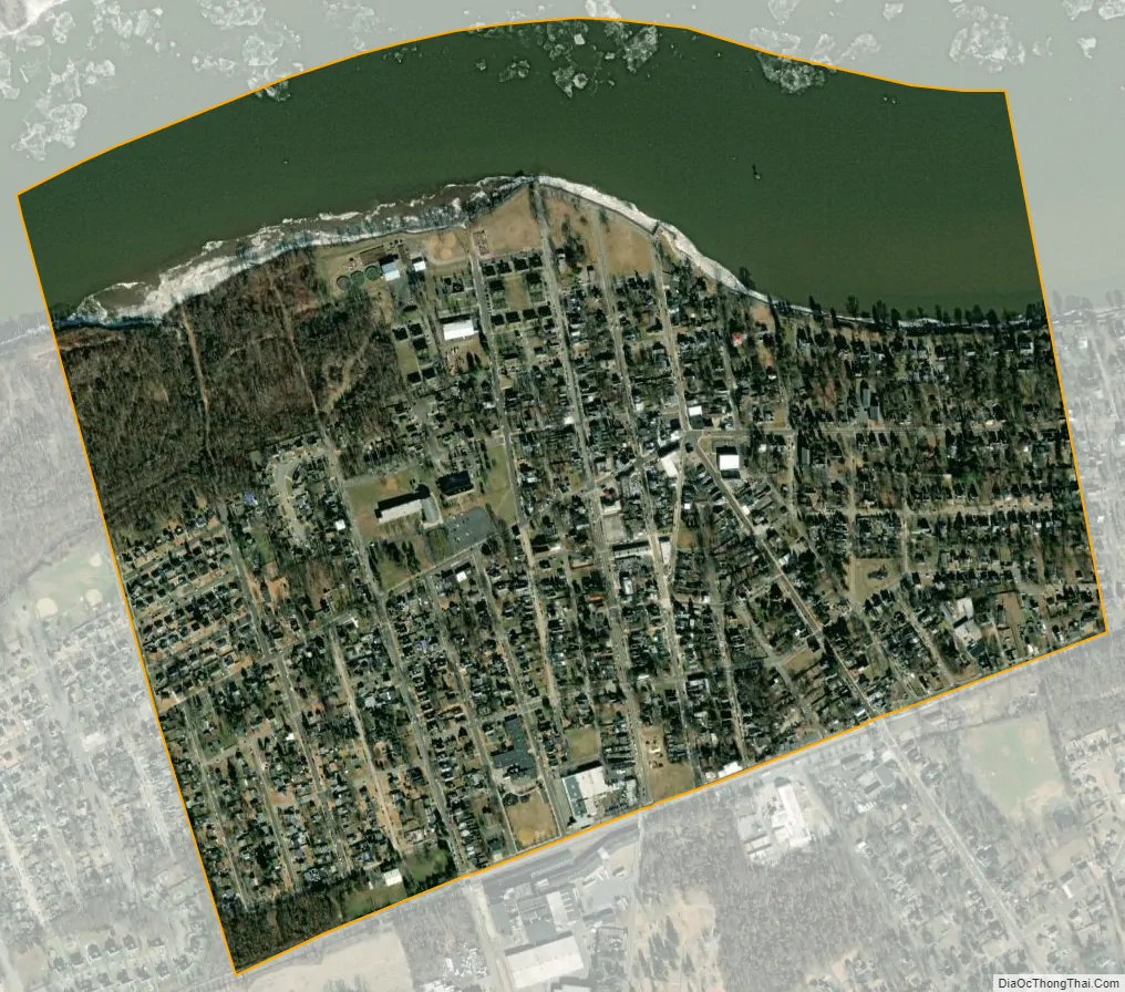
Beverly city Satellite Map
Geography
According to the United States Census Bureau, the city had a total area of 0.76 square miles (1.96 km), including 0.54 square miles (1.40 km) of land and 0.21 square miles (0.56 km) of water (28.16%).
Beverly borders Delanco Township and Edgewater Park in Burlington County; and Bensalem Township across the Delaware River in Bucks County, Pennsylvania.
See also
Map of New Jersey State and its subdivision: Map of other states:- Alabama
- Alaska
- Arizona
- Arkansas
- California
- Colorado
- Connecticut
- Delaware
- District of Columbia
- Florida
- Georgia
- Hawaii
- Idaho
- Illinois
- Indiana
- Iowa
- Kansas
- Kentucky
- Louisiana
- Maine
- Maryland
- Massachusetts
- Michigan
- Minnesota
- Mississippi
- Missouri
- Montana
- Nebraska
- Nevada
- New Hampshire
- New Jersey
- New Mexico
- New York
- North Carolina
- North Dakota
- Ohio
- Oklahoma
- Oregon
- Pennsylvania
- Rhode Island
- South Carolina
- South Dakota
- Tennessee
- Texas
- Utah
- Vermont
- Virginia
- Washington
- West Virginia
- Wisconsin
- Wyoming