Blackwood is an unincorporated community and census-designated place (CDP) located within Gloucester Township, in Camden County, in the U.S. state of New Jersey. As of the 2010 United States census, Blackwood’s population was 4,545. It is located 10 miles (16 km) from the city of Camden and 14.6 miles (23.5 km) away from Philadelphia in the South Jersey region of the state.
Blackwood is the home of the main campus of Camden County College. Blackwood is home to Camden County College’s radio station WDBK, which has been broadcasting on 91.5 FM since 1977.
| Name: | Blackwood CDP |
|---|---|
| LSAD Code: | 57 |
| LSAD Description: | CDP (suffix) |
| State: | New Jersey |
| County: | Camden County |
| Elevation: | 46 ft (14 m) |
| Total Area: | 1.23 sq mi (3.20 km²) |
| Land Area: | 1.22 sq mi (3.16 km²) |
| Water Area: | 0.01 sq mi (0.04 km²) 0.72% |
| Total Population: | 4,622 |
| Population Density: | 3,788.52/sq mi (1,462.76/km²) |
| ZIP code: | 08012 |
| Area code: | 856 |
| FIPS code: | 3406040 |
| GNISfeature ID: | 02389213 |
Online Interactive Map
Click on ![]() to view map in "full screen" mode.
to view map in "full screen" mode.
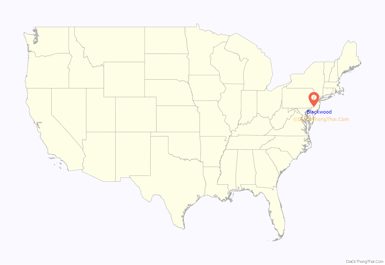
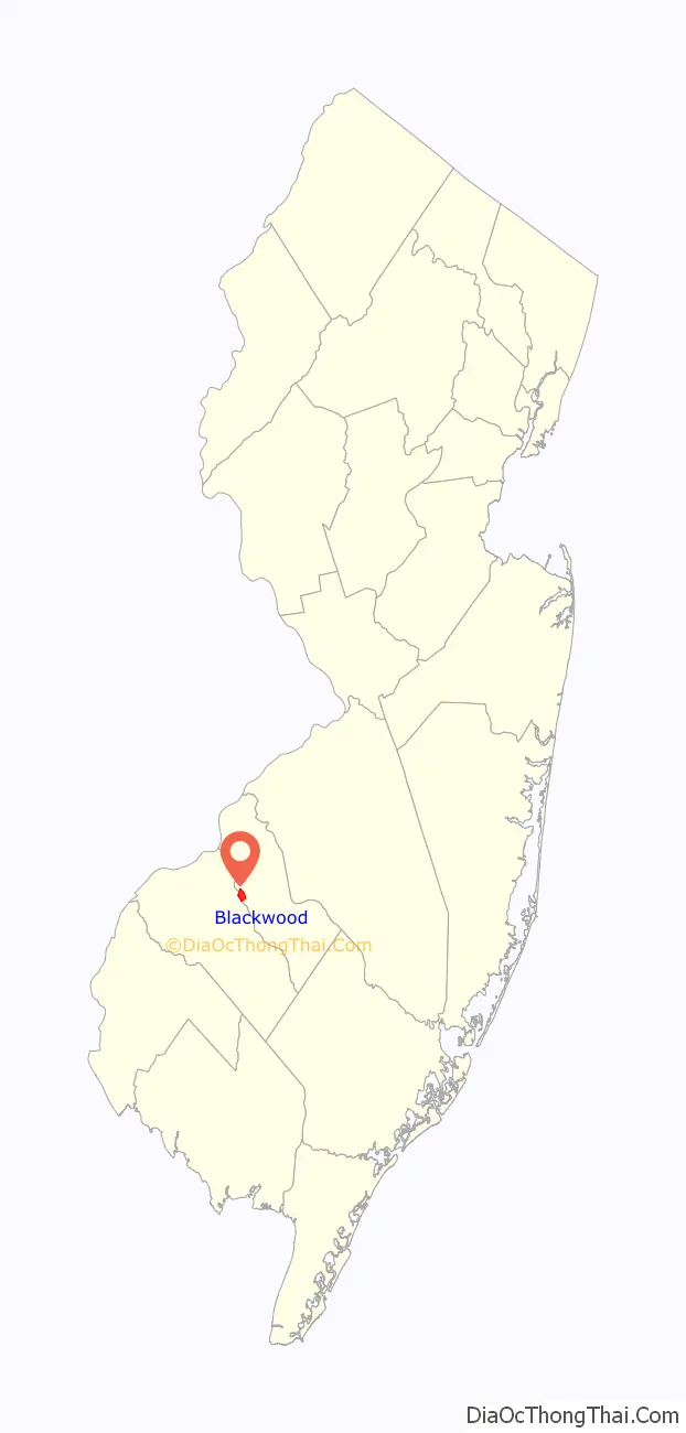
Blackwood location map. Where is Blackwood CDP?
History
Blackwood, originally known as Blackwoodtown, was settled about 1750 by John Blackwood in an area then known as “head of Timber Creek.” Blackwood was a fuller who immigrated from Scotland and established mills in Blackwoodtown. The area was a crossroads village along the Black Horse Pike well into the nineteenth century, that served as a local government and transportation center by the 1830s, when Uriah Norcross established a stage coach line between Camden and Woodbury with a stop at a tavern in Blackwoodtown. The arrival of the Camden County Railroad in 1891 led to further development.
Blackwood Lake operated as a summer resort from 1891 until 1932.
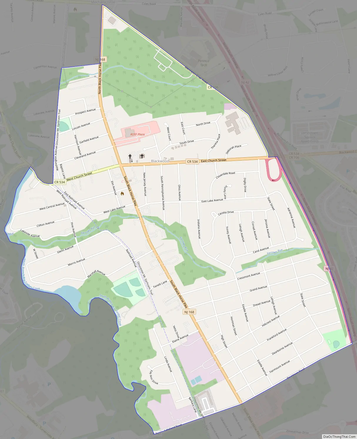
Blackwood Road Map
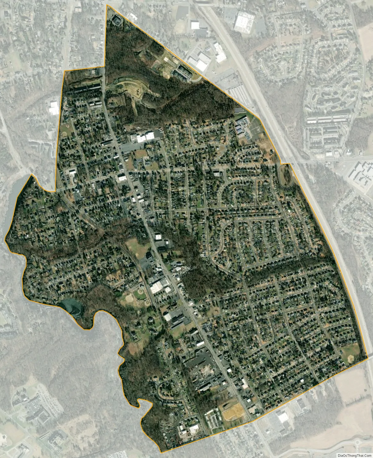
Blackwood city Satellite Map
Geography
According to the U.S. Census Bureau, Blackwood had a total area of 1.235 square miles (3.199 km), including 1.226 square miles (3.176 km) of land and 0.009 square miles (0.023 km) of water (0.72%). Bodies of water include Blackwood Lake and Farrows Run stream.
See also
Map of New Jersey State and its subdivision: Map of other states:- Alabama
- Alaska
- Arizona
- Arkansas
- California
- Colorado
- Connecticut
- Delaware
- District of Columbia
- Florida
- Georgia
- Hawaii
- Idaho
- Illinois
- Indiana
- Iowa
- Kansas
- Kentucky
- Louisiana
- Maine
- Maryland
- Massachusetts
- Michigan
- Minnesota
- Mississippi
- Missouri
- Montana
- Nebraska
- Nevada
- New Hampshire
- New Jersey
- New Mexico
- New York
- North Carolina
- North Dakota
- Ohio
- Oklahoma
- Oregon
- Pennsylvania
- Rhode Island
- South Carolina
- South Dakota
- Tennessee
- Texas
- Utah
- Vermont
- Virginia
- Washington
- West Virginia
- Wisconsin
- Wyoming


