Dunellen (/dʌ.nɛl.ən/) is a borough in Middlesex County, in the U.S. state of New Jersey. It is located within the Raritan Valley region. As of the 2020 United States census, the borough’s population was 7,637, an increase of 410 (+5.7%) from the 2010 census count of 7,227, which in turn reflected an increase of 404 (+5.9%) from the 6,823 counted in the 2000 census.
Dunellen was formed as a borough by an act of the New Jersey Legislature on October 28, 1887, when it broke away from Piscataway Township, based on the results of a referendum held on March 23, 1886. Dunellen’s incorporation was confirmed on April 15, 1914. The borough was named for the Dunellen station of the Central Railroad of New Jersey.
| Name: | Dunellen borough |
|---|---|
| LSAD Code: | 21 |
| LSAD Description: | borough (suffix) |
| State: | New Jersey |
| County: | Middlesex County |
| Incorporated: | October 28, 1887 |
| Elevation: | 52 ft (16 m) |
| Total Area: | 1.06 sq mi (2.75 km²) |
| Land Area: | 1.06 sq mi (2.75 km²) |
| Water Area: | 0.00 sq mi (0.00 km²) 0.00% |
| Total Population: | 7,637 |
| Population Density: | 7,191.1/sq mi (2,776.5/km²) |
| ZIP code: | 08812 |
| Area code: | 732 and 908 |
| FIPS code: | 3418490 |
| GNISfeature ID: | 0885198 |
| Website: | www.dunellen-nj.gov |
Online Interactive Map
Click on ![]() to view map in "full screen" mode.
to view map in "full screen" mode.
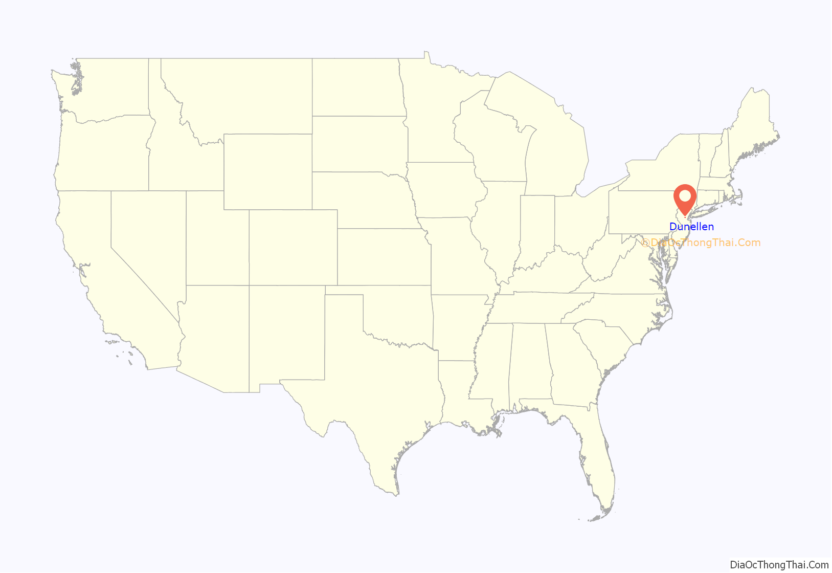
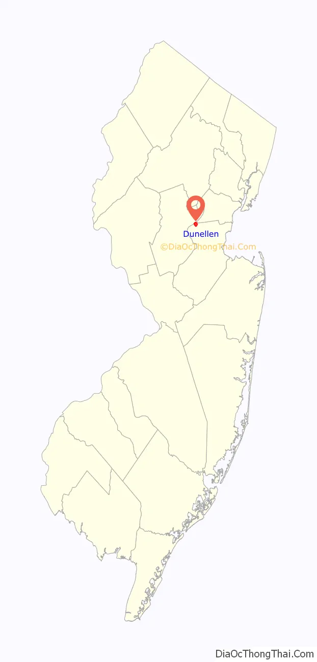
Dunellen location map. Where is Dunellen borough?
History
The earliest inhabitants of the area that would become Dunellen were the Lenape Native Americans; several Lenape sites in Dunellen were identified as part of a comprehensive survey in 1915. European settlers were drawn to the area as early as 1682, attracted by the productive agricultural land.
Railroad access from New York City to present-day Dunellen began in 1840. Dunellen grew from its start in 1867 with the construction of a railroad station, which was originally called New Market station, serving the nearby community of the same name in Piscataway. When it was originally constructed, the tracks were at grade level with North Avenue and the railroad was the Elizabethtown and Somerville Railroad, which later became part of the Central Railroad of New Jersey. The Central Railroad of New Jersey, created the residential development in the area which it owned surrounding its train station. The railroad brought industry to the area.
The Art Color factory built in 1925 was Dunellen’s principal industry and produced as many as 10 million magazines a month. The W. F. Hall Printing Company of Chicago bought Art Color in 1931, and ran it until 1968, when it closed the plant there.
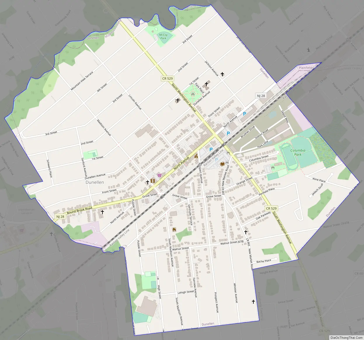
Dunellen Road Map
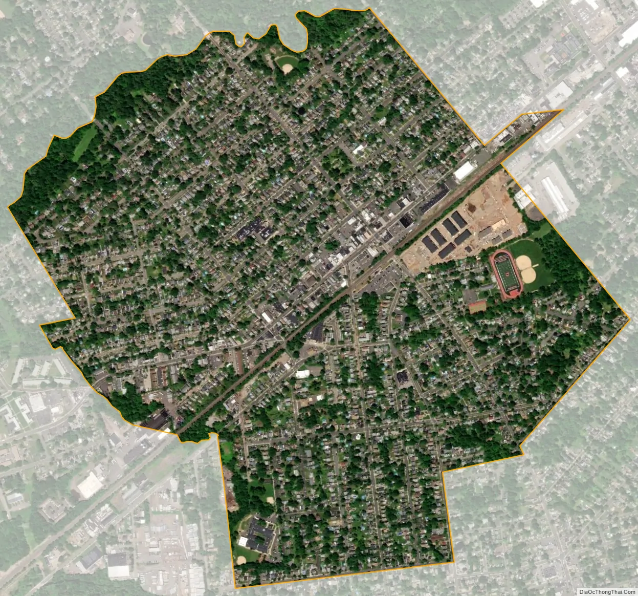
Dunellen city Satellite Map
Geography
According to the United States Census Bureau, the borough had a total area of 1.06 square miles (2.75 km), all of which was land. Dunellen is in the Raritan Valley, a line of communities in central New Jersey. Dunellen is in the central division along with Bound Brook, South Bound Brook and Middlesex.
The borough borders Middlesex and Piscataway Township in Middlesex County; Green Brook Township in Somerset County; and Plainfield in Union County.
See also
Map of New Jersey State and its subdivision: Map of other states:- Alabama
- Alaska
- Arizona
- Arkansas
- California
- Colorado
- Connecticut
- Delaware
- District of Columbia
- Florida
- Georgia
- Hawaii
- Idaho
- Illinois
- Indiana
- Iowa
- Kansas
- Kentucky
- Louisiana
- Maine
- Maryland
- Massachusetts
- Michigan
- Minnesota
- Mississippi
- Missouri
- Montana
- Nebraska
- Nevada
- New Hampshire
- New Jersey
- New Mexico
- New York
- North Carolina
- North Dakota
- Ohio
- Oklahoma
- Oregon
- Pennsylvania
- Rhode Island
- South Carolina
- South Dakota
- Tennessee
- Texas
- Utah
- Vermont
- Virginia
- Washington
- West Virginia
- Wisconsin
- Wyoming


