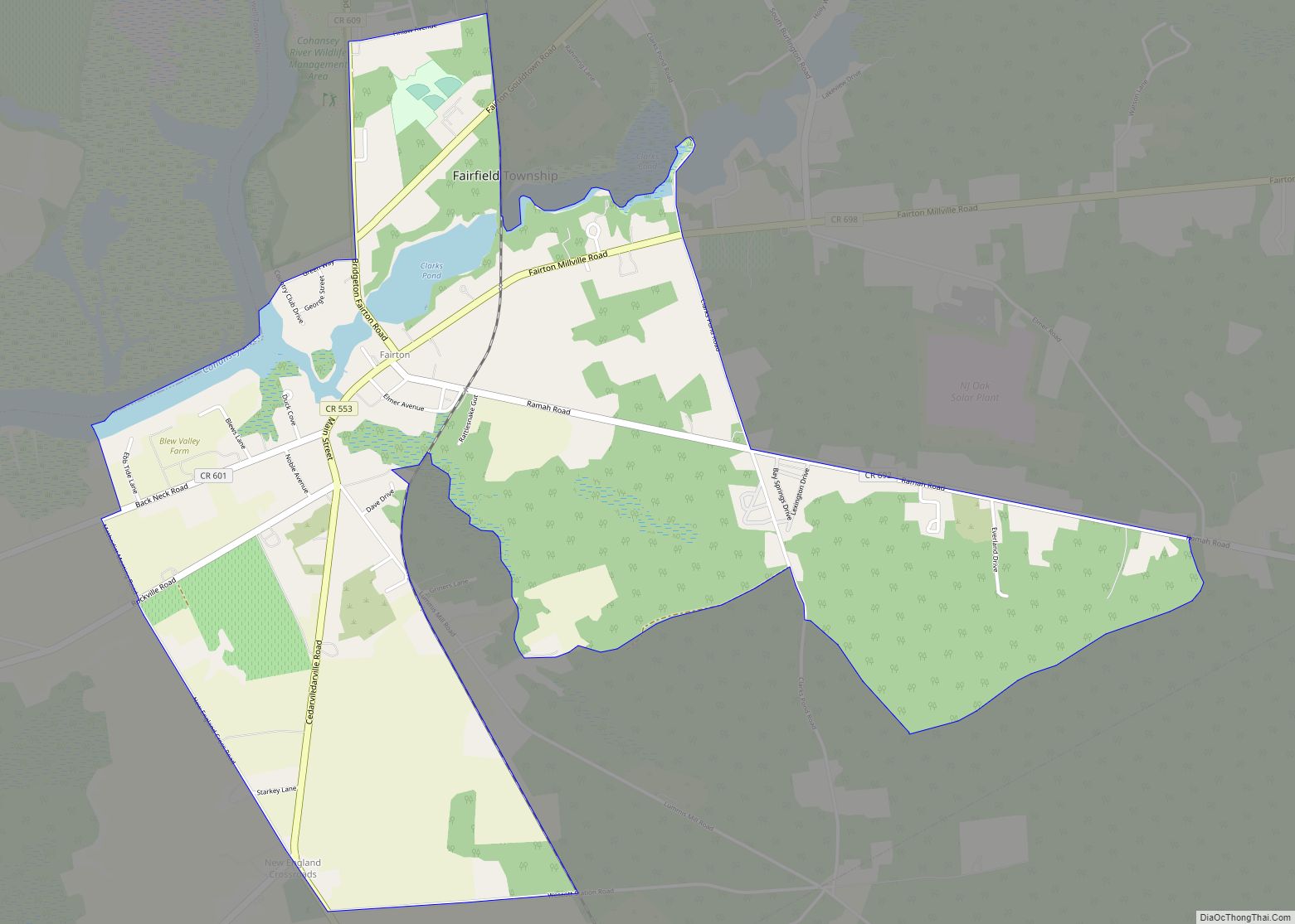
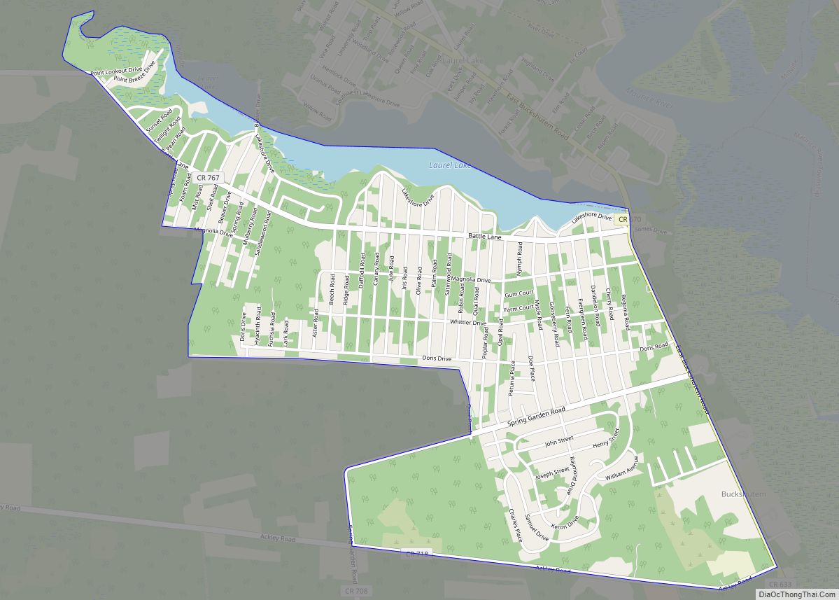
Fairton is an unincorporated community and census-designated place (CDP) located within Fairfield Township, in Cumberland County, in the U.S. state of New Jersey. It is part of the Vineland–Millville–Bridgeton Primary Metropolitan Statistical Area for statistical purposes. As of the 2010 United States Census, the CDP’s population was 1,264.
| Name: | Fairton CDP |
|---|---|
| LSAD Code: | 57 |
| LSAD Description: | CDP (suffix) |
| State: | New Jersey |
| County: | Cumberland County |
| Elevation: | 26 ft (8 m) |
| Total Area: | 2.99 sq mi (7.73 km²) |
| Land Area: | 2.87 sq mi (7.43 km²) |
| Water Area: | 0.12 sq mi (0.30 km²) 4.29% |
| Total Population: | 1,060 |
| Population Density: | 369.47/sq mi (142.65/km²) |
| ZIP code: | 08320 |
| Area code: | 856 |
| FIPS code: | 3422530 |
| GNISfeature ID: | 02389066 |
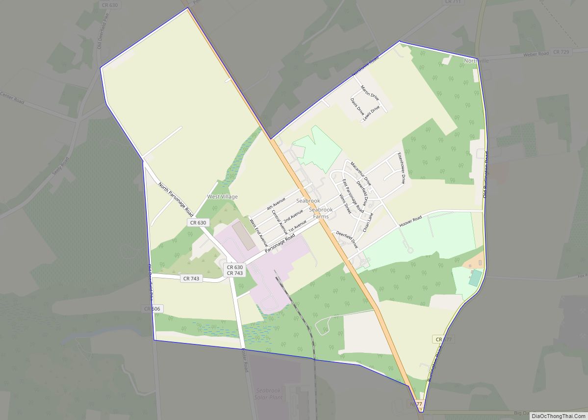
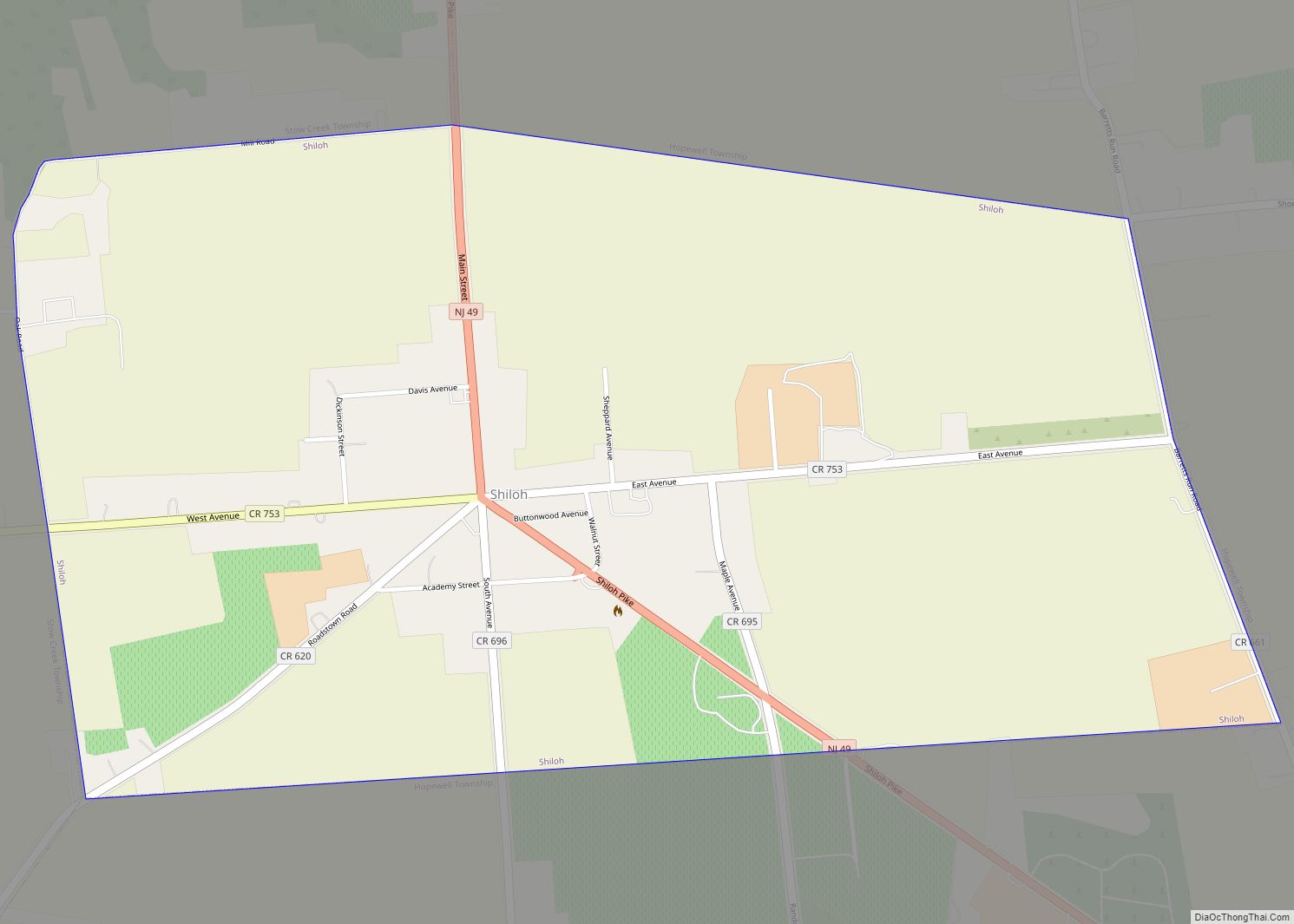
Online Interactive Map
Click on ![]() to view map in "full screen" mode.
to view map in "full screen" mode.
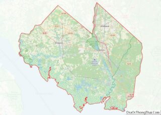
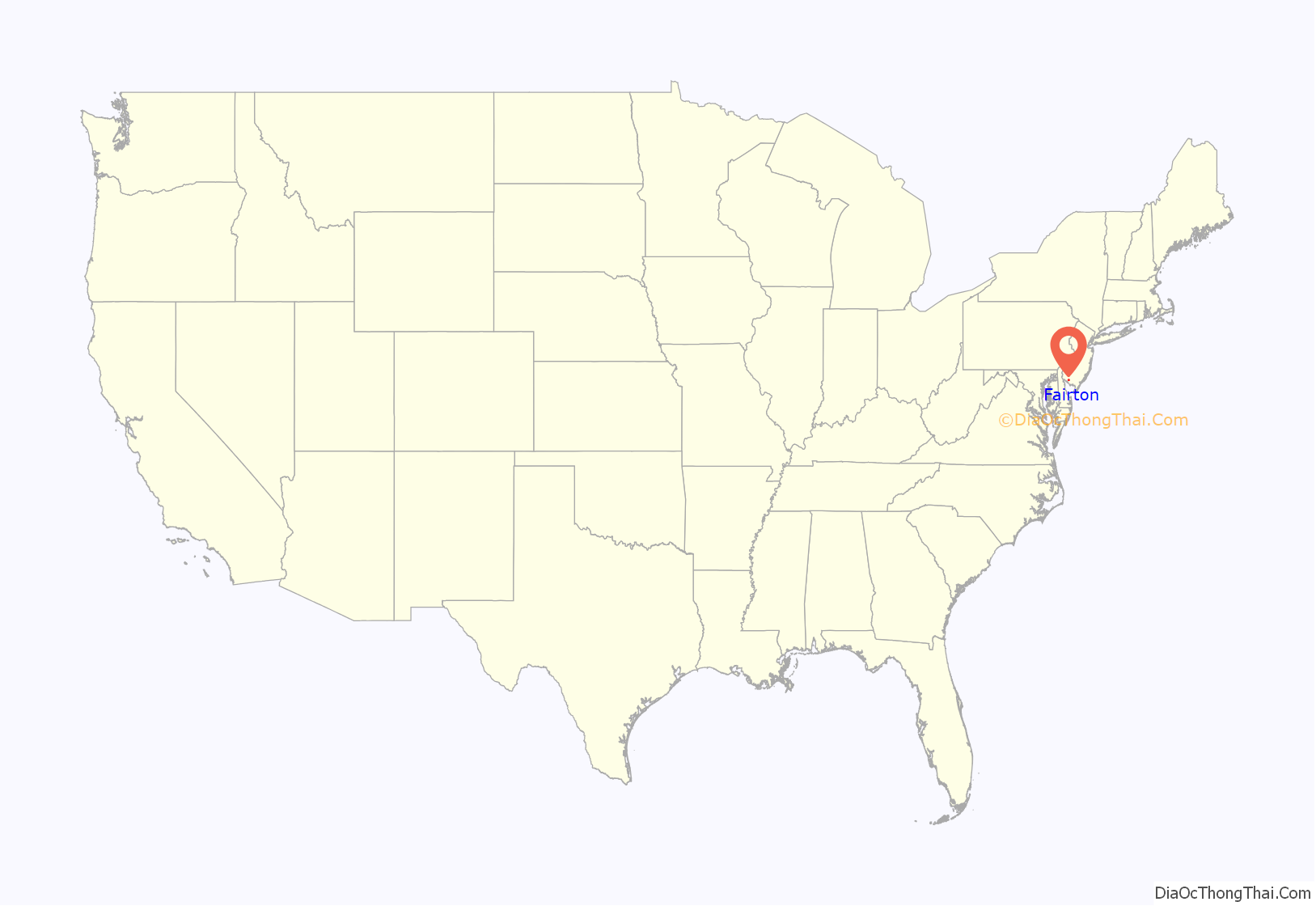
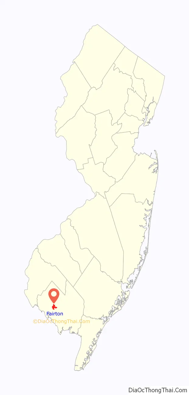
Fairton location map. Where is Fairton CDP?
History
This area was occupied historically by the Lenape and Nanticoke peoples, both part of the Algonquian languages family of the Atlantic coast. Their territory was encroached on by European-American settlers from colonial times.
The first industry in Fairfield was a mill, established by English settler Samuel Fithian. He owned part of the Grist Mill on Forke Creek before 1702. No information has been discovered on the other owners, but the shares were probably held in common. At some time before 1763, the owners moved the mill dam to near Clarks Pond Road. The mill was owned by David Clark from 1759 to 1843.
In the 1810s, a pork and beef business was the principal industry in this area. In the center of town was a busy public wharf, from which were shipped vegetables, fish and lumber to large city markets. Fairton was also active in the boat-building industry; between 1850 and 1897, its yards built three sloops.
In 1978, the indigenous peoples based in Cumberland County reorganized as the Nanticoke Lenni-Lenape Tribal Nation. Their cultural center is based in Fairton, and their tribal headquarters in Bridgeton. The tribe said that in 2016 they had 3,000 enrolled members, whose membership is based on documented descent from core families and blood quantum. The tribe has not obtained federal recognition. They contend that a state resolution recognized them, but in March 2016 a state court of New Jersey said that the state has not officially recognized any American Indian tribe in its territory and had no process to do so. Tribal members have lived for centuries in Cumberland and Salem counties in present-day New Jersey.
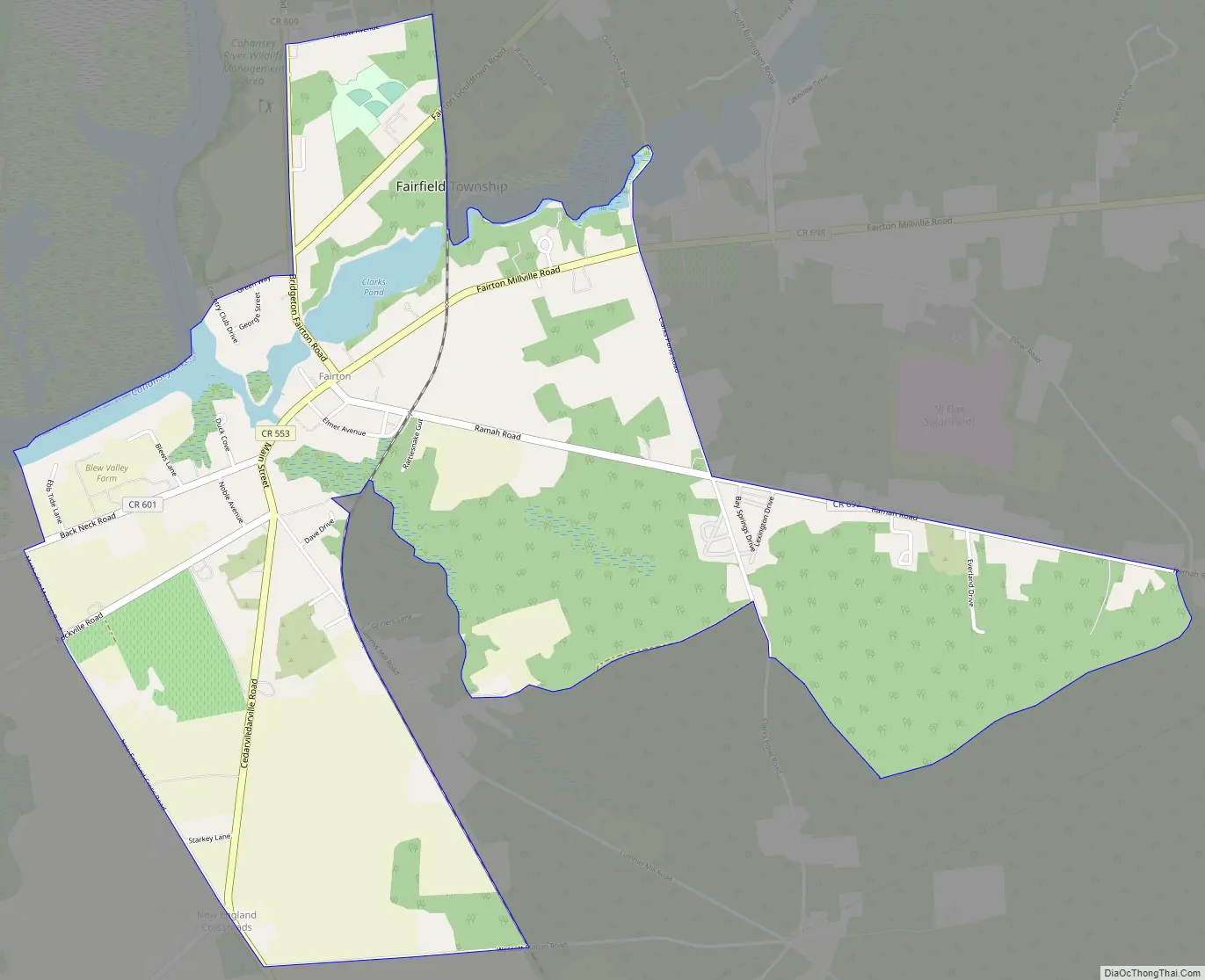
Fairton Road Map
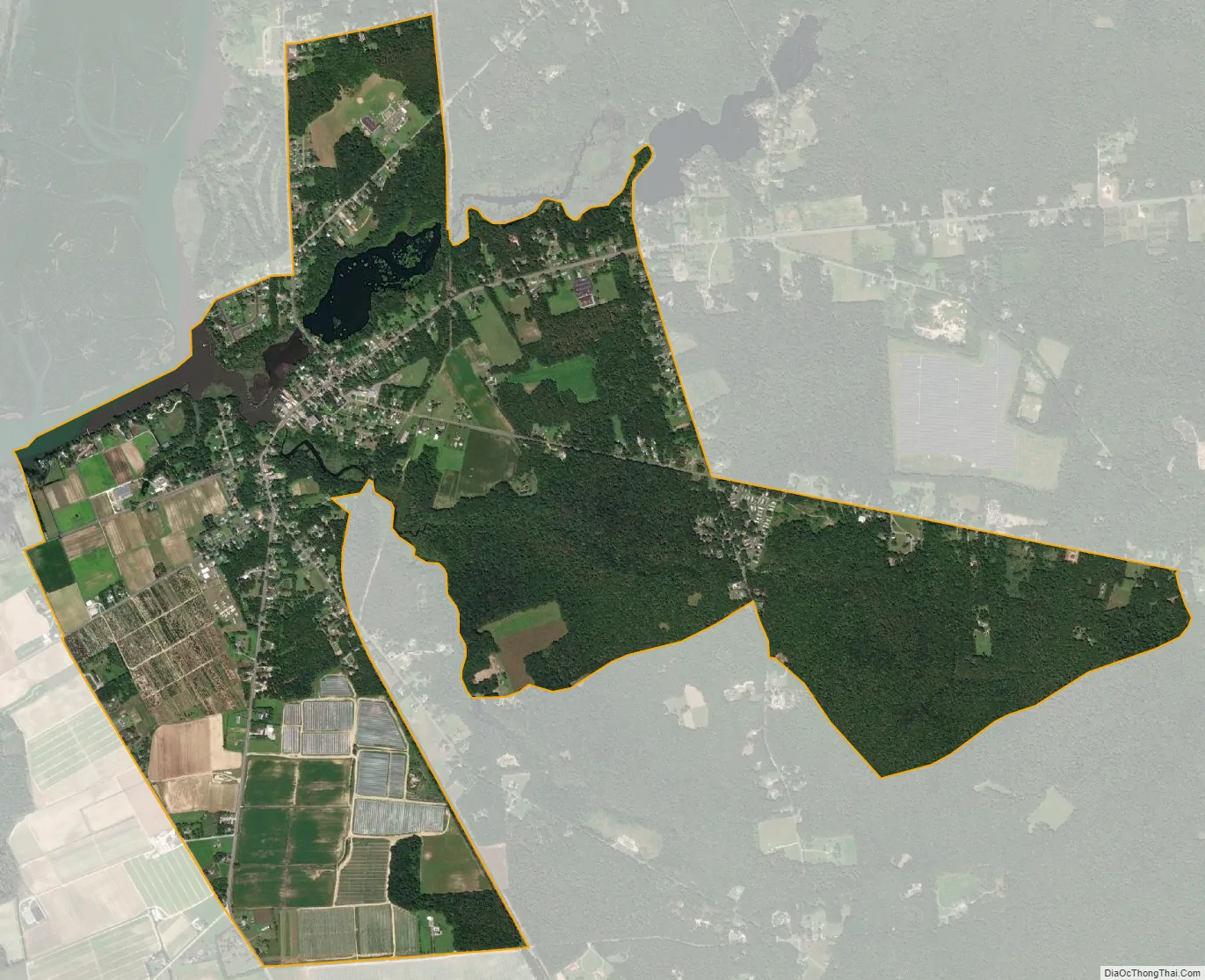
Fairton city Satellite Map
Geography
According to the United States Census Bureau, the CDP had a total area of 2.988 square miles (7.739 km), including 2.860 square miles (7.407 km) of land and 0.128 square mile (0.332 km) of water (4.29%).
See also
Map of New Jersey State and its subdivision: Map of other states:- Alabama
- Alaska
- Arizona
- Arkansas
- California
- Colorado
- Connecticut
- Delaware
- District of Columbia
- Florida
- Georgia
- Hawaii
- Idaho
- Illinois
- Indiana
- Iowa
- Kansas
- Kentucky
- Louisiana
- Maine
- Maryland
- Massachusetts
- Michigan
- Minnesota
- Mississippi
- Missouri
- Montana
- Nebraska
- Nevada
- New Hampshire
- New Jersey
- New Mexico
- New York
- North Carolina
- North Dakota
- Ohio
- Oklahoma
- Oregon
- Pennsylvania
- Rhode Island
- South Carolina
- South Dakota
- Tennessee
- Texas
- Utah
- Vermont
- Virginia
- Washington
- West Virginia
- Wisconsin
- Wyoming