Holiday City-Berkeley is an unincorporated community and census-designated place (CDP) located within Berkeley Township, in Ocean County, New Jersey, United States. As of the 2010 United States Census, the CDP’s population was 13,884.
Holiday City-Berkeley is a retirement community where residents must be over the age of 55 to own property and participate in community recreational activities.
| Name: | Holiday City-Berkeley CDP |
|---|---|
| LSAD Code: | 57 |
| LSAD Description: | CDP (suffix) |
| State: | New Jersey |
| County: | Ocean County |
| Elevation: | 42 ft (13 m) |
| Total Area: | 6.03 sq mi (15.62 km²) |
| Land Area: | 5.97 sq mi (15.45 km²) |
| Water Area: | 0.06 sq mi (0.16 km²) 1.09% |
| Total Population: | 12,943 |
| Population Density: | 2,169.46/sq mi (837.57/km²) |
| Area code: | 609, 732/848 |
| FIPS code: | 3432415 |
| GNISfeature ID: | 02389942 |
Online Interactive Map
Click on ![]() to view map in "full screen" mode.
to view map in "full screen" mode.
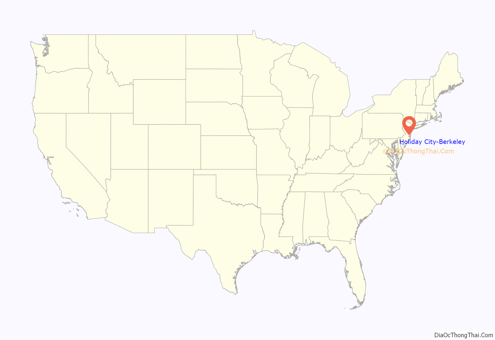
Holiday City-Berkeley location map. Where is Holiday City-Berkeley CDP?
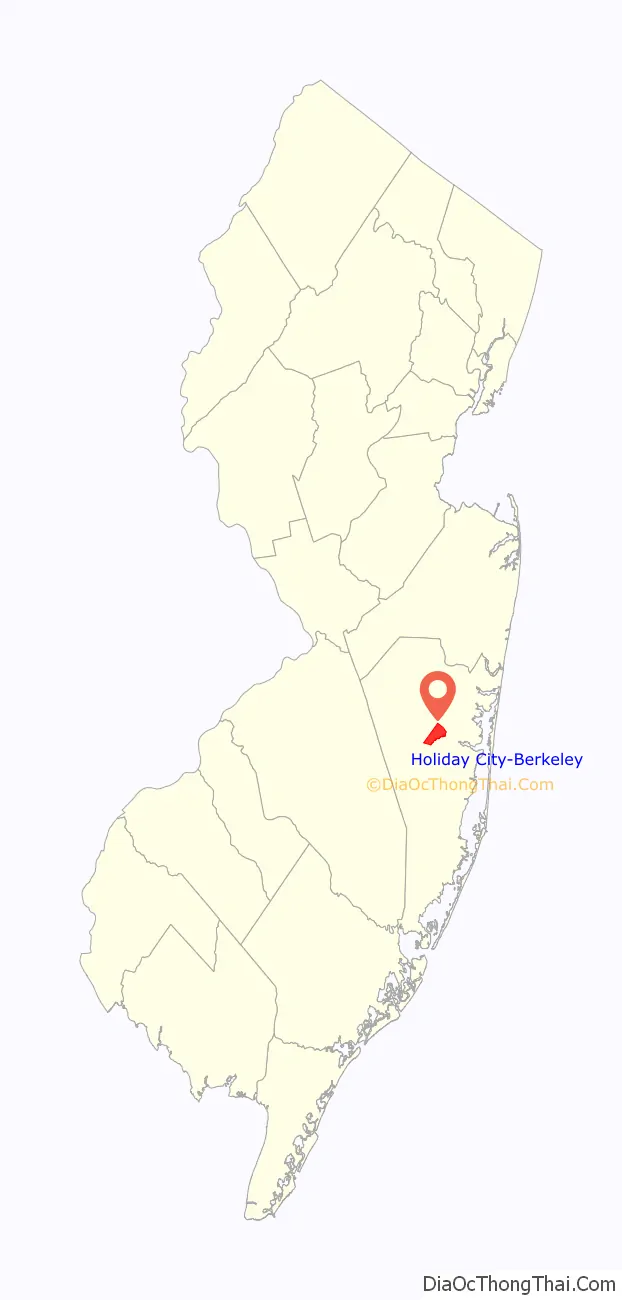
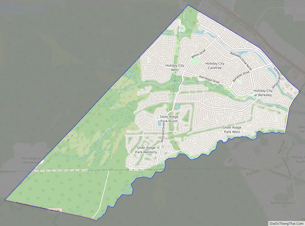
Holiday City-Berkeley Road Map
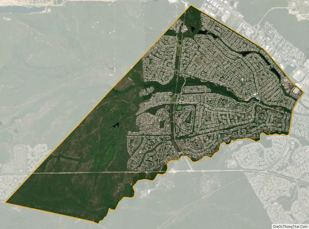
Holiday City-Berkeley city Satellite Map
Geography
According to the United States Census Bureau, the CDP had a total area of 5.816 square miles (15.063 km), including 5.752 square miles (14.898 km) of land and 0.064 square miles (0.165 km) of water (1.09%).
See also
Map of New Jersey State and its subdivision: Map of other states:- Alabama
- Alaska
- Arizona
- Arkansas
- California
- Colorado
- Connecticut
- Delaware
- District of Columbia
- Florida
- Georgia
- Hawaii
- Idaho
- Illinois
- Indiana
- Iowa
- Kansas
- Kentucky
- Louisiana
- Maine
- Maryland
- Massachusetts
- Michigan
- Minnesota
- Mississippi
- Missouri
- Montana
- Nebraska
- Nevada
- New Hampshire
- New Jersey
- New Mexico
- New York
- North Carolina
- North Dakota
- Ohio
- Oklahoma
- Oregon
- Pennsylvania
- Rhode Island
- South Carolina
- South Dakota
- Tennessee
- Texas
- Utah
- Vermont
- Virginia
- Washington
- West Virginia
- Wisconsin
- Wyoming


