Lakehurst is a borough in Ocean County, in the U.S. state of New Jersey. As of the 2020 United States census, the borough’s population was 2,636, a decrease of 18 (−0.7%) from the 2010 census count of 2,654, which in turn reflected an increase of 132 (+5.2%) from the 2,522 counted in the 2000 census.
Lakehurst was incorporated as a borough by an act of the New Jersey Legislature on April 7, 1921, from portions of Manchester Township, based on the results of a referendum held on May 24, 1921. The borough is named for its location near lakes and woods.
| Name: | Lakehurst borough |
|---|---|
| LSAD Code: | 21 |
| LSAD Description: | borough (suffix) |
| State: | New Jersey |
| County: | Ocean County |
| Incorporated: | April 7, 1921 |
| Elevation: | 66 ft (20 m) |
| Total Area: | 0.99 sq mi (2.56 km²) |
| Land Area: | 0.90 sq mi (2.32 km²) |
| Water Area: | 0.09 sq mi (0.24 km²) 9.39% |
| Total Population: | 2,636 |
| Population Density: | 2,944.8/sq mi (1,137.0/km²) |
| Area code: | 732 |
| FIPS code: | 3437770 |
| GNISfeature ID: | 0885270 |
| Website: | www.lakehurst-nj.gov |
Online Interactive Map
Click on ![]() to view map in "full screen" mode.
to view map in "full screen" mode.
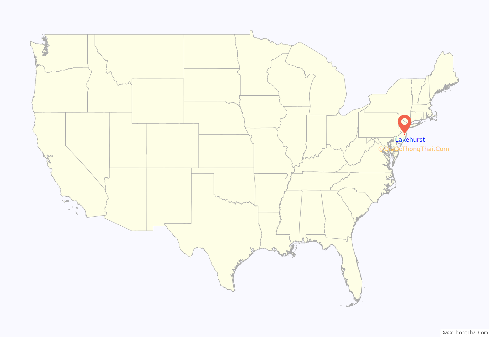
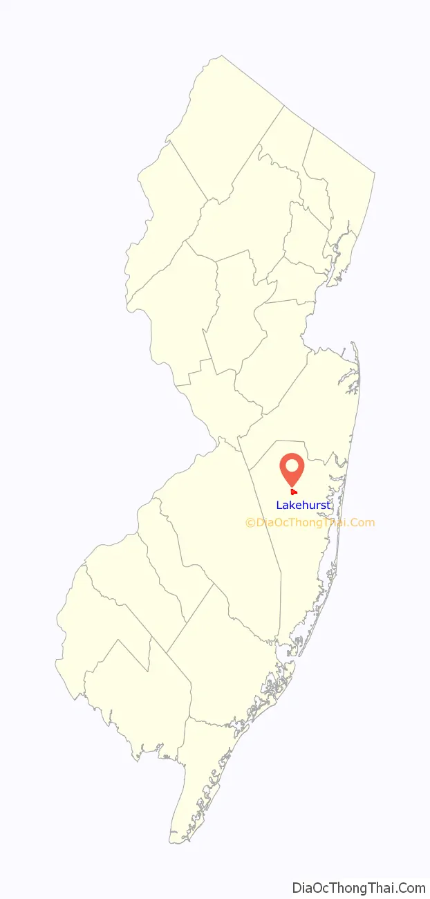
Lakehurst location map. Where is Lakehurst borough?
History
The community of Lakehurst first reached international recognition as a winter resort around the turn of the 20th century, following the opening of the Pine Tree Inn in 1898. In 1911, the rope factory in the town burned down, prompting the formation of a volunteer fire department.
The Hindenburg disaster, occurred on May 6, 1937; the German zeppelin Hindenburg arriving from Frankfurt am Main caught fire at the Lakehurst Naval Air Station, which is located in Manchester Township (not in the borough of Lakehurst).
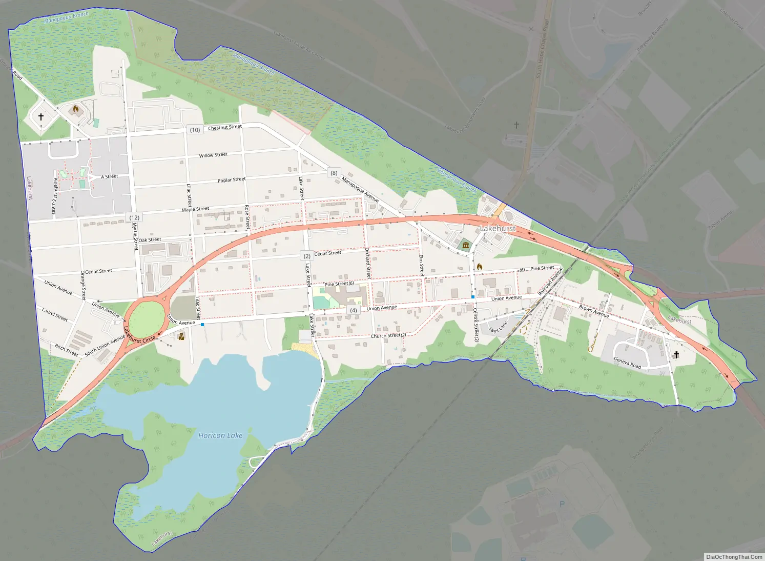
Lakehurst Road Map
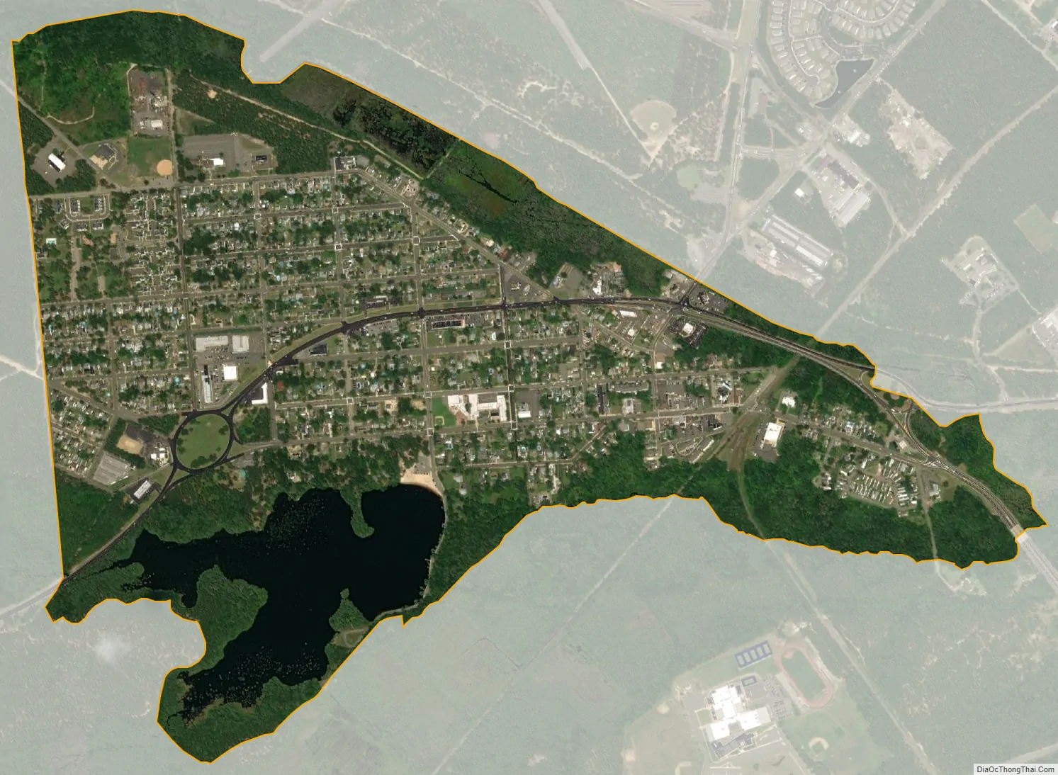
Lakehurst city Satellite Map
Geography
According to the United States Census Bureau, the borough had a total area of 0.99 square miles (2.56 km), including 0.90 square miles (2.32 km) of land and 0.09 square miles (0.24 km) of water (9.39%).
The borough’s lake, Lake Horicon, existed prior to 1942, as clearly shown in aerial photographs from 1940 and 1931 and topographical maps from 1912. The cedar water lake remains stream-fed.
Lakehurst is completely surrounded by Manchester Township, making it part of 21 pairs of “doughnut towns” in the state, where one municipality entirely surrounds another.
The borough is one of 11 municipalities in Ocean County that are part of the Toms River watershed.
Climate
The climate in this area is characterized by hot, humid summers and generally mild to cool winters. According to the Köppen Climate Classification system, Lakehurst has a humid subtropical climate, abbreviated “Cfa” on climate maps.
See also
Map of New Jersey State and its subdivision: Map of other states:- Alabama
- Alaska
- Arizona
- Arkansas
- California
- Colorado
- Connecticut
- Delaware
- District of Columbia
- Florida
- Georgia
- Hawaii
- Idaho
- Illinois
- Indiana
- Iowa
- Kansas
- Kentucky
- Louisiana
- Maine
- Maryland
- Massachusetts
- Michigan
- Minnesota
- Mississippi
- Missouri
- Montana
- Nebraska
- Nevada
- New Hampshire
- New Jersey
- New Mexico
- New York
- North Carolina
- North Dakota
- Ohio
- Oklahoma
- Oregon
- Pennsylvania
- Rhode Island
- South Carolina
- South Dakota
- Tennessee
- Texas
- Utah
- Vermont
- Virginia
- Washington
- West Virginia
- Wisconsin
- Wyoming


