Lambertville is a city in Hunterdon County in the U.S. state of New Jersey. As of the 2020 United States census, the city’s population was 4,139, an increase of 233 (+6.0%) from the 2010 census count of 3,906, which in turn reflected an increase of 38 (1.0%) from the 3,868 counted in the 2000 census.
Lambertville is on the Delaware River in southwestern Hunterdon County. In the 18th century, the area was named after various operators of ferries across the river to Pennsylvania, ultimately becoming known as Coryell’s Ferry, after its owner, Emanuel Coryell. Coryell’s Ferry was the western terminus of the New Jersey portion of York Road, which became U.S. Route 202, connecting New York City and Philadelphia. The community was named Lambertville in 1810, when the post office was established, in honor of John Lambert, a resident who had served as United States senator and acting governor of New Jersey, and who was responsible for the opening of the post office.
| Name: | Lambertville city |
|---|---|
| LSAD Code: | 25 |
| LSAD Description: | city (suffix) |
| State: | New Jersey |
| County: | Hunterdon County |
| Incorporated: | March 1, 1849 |
| Elevation: | 82 ft (25 m) |
| Total Area: | 1.23 sq mi (3.17 km²) |
| Land Area: | 1.08 sq mi (2.81 km²) |
| Water Area: | 0.14 sq mi (0.36 km²) 11.46% |
| Total Population: | 4,139 |
| Population Density: | 3,817.3/sq mi (1,473.9/km²) |
| ZIP code: | 08530 |
| Area code: | 609 exchanges: 397, 773 |
| FIPS code: | 3438610 |
| GNISfeature ID: | 0885271 |
| Website: | www.lambertvillenj.org |
Online Interactive Map
Click on ![]() to view map in "full screen" mode.
to view map in "full screen" mode.
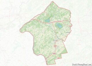
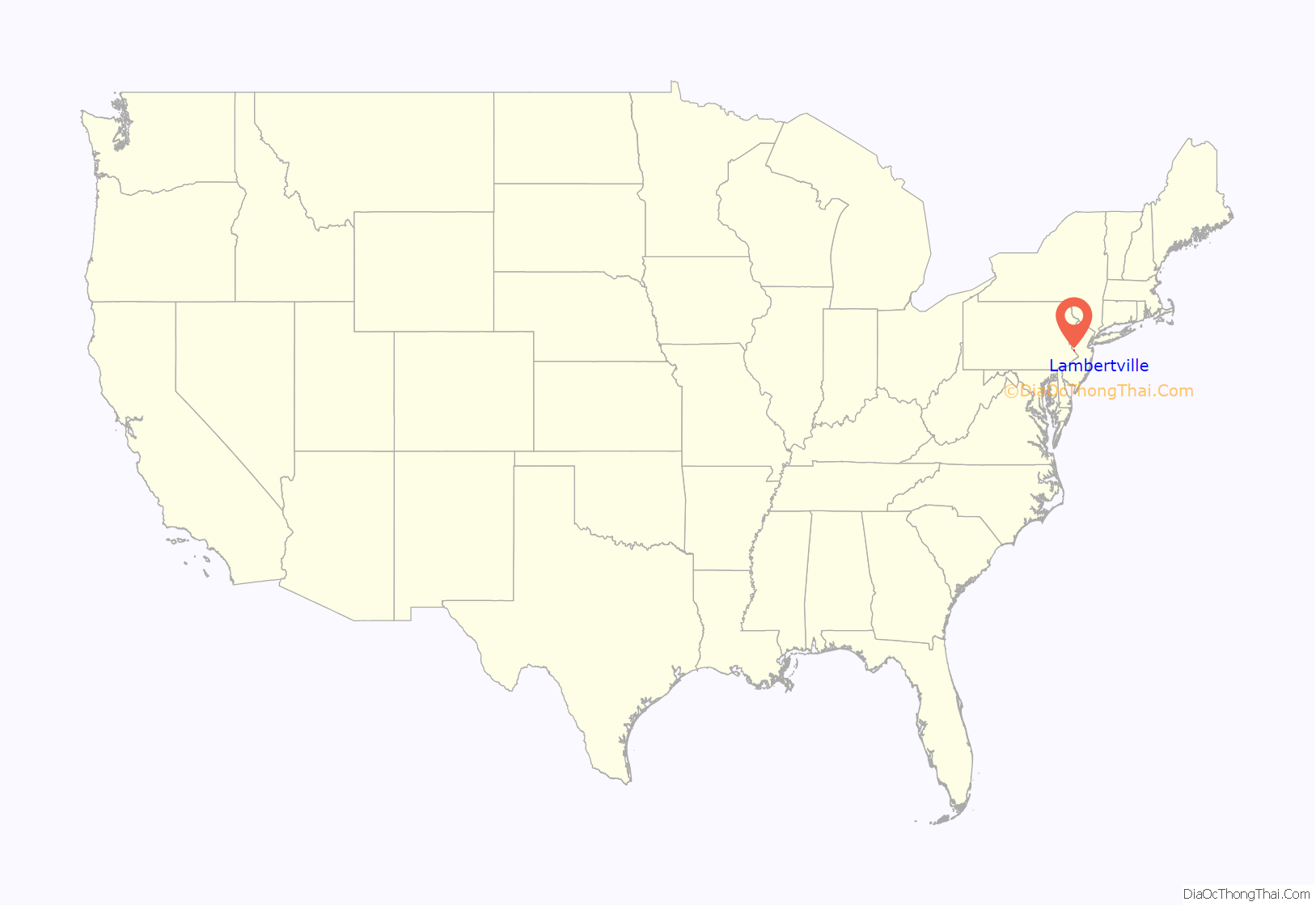
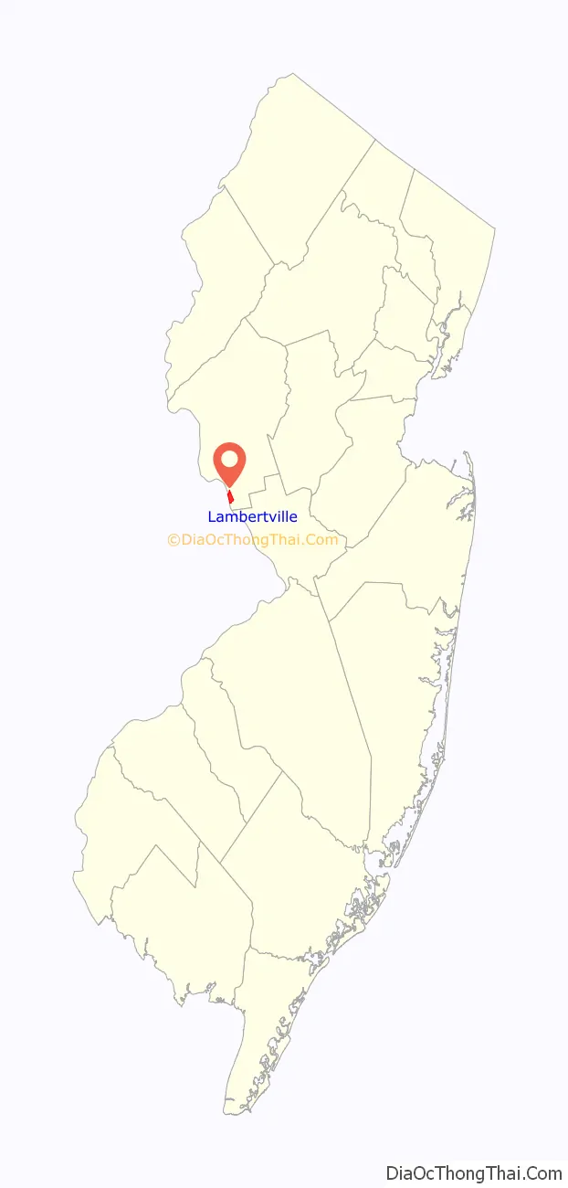
Lambertville location map. Where is Lambertville city?
History
Originally settled by the Lenape (Delaware) Native Americans, a 150,000-acre (230 sq mi; 610 km) area around Lambertville was acquired for 700 Pounds by the Council of West Jersey and divided into smaller plots. The earliest European settler in present-day Lambertville was John Holcombe, who purchased a lot and built a stone home in 1744.
Emanuel Coryell bought a property in the area in 1732, which was used for commercial purposes. He received a charter to operate a ferry connecting what is now Lambertville and New Hope, and opened a tavern and inn to host travelers stopping halfway along the route between New York City and Philadelphia. The settlements on either side of the Delaware River were each called Coryell’s Ferry. During the American Revolutionary War, George Washington and his colonial forces twice camped at the home John Holcombe built in 1744.
The Delaware River and the Delaware and Raritan Canal were instrumental in the early prosperity of Lambertville. In June 1834, the opening of the canal was celebrated with a barge ride from Trenton to Lambertville. The canal’s completion was not without hardship. 4,000 Irish immigrants were hired to dig the canal with pick and shovel. During the construction, an epidemic of cholera broke out in 1832 and dozens of men were buried along the banks of the canal and the Delaware.
Lambertville was originally incorporated as a town by an act of the New Jersey Legislature on March 1, 1849, from portions of West Amwell Township. It was reincorporated as a city on March 26, 1872.
In the 19th century, due to its proximity to the canal and the Belvidere Delaware Railroad, Lambertville became a factory town. The range of products extended from underwear to rubber bands. After the introduction of motorized vehicles made the canal obsolete, the factories began shutting down. Some lasted into the 1970s. The railroad continued to serve as a vital freight carrier until the mid-1970s. Later, the Black River and Western Railroad acquired the line into town and operated short-distance local freight trains and scenic tourist passenger excursion trains into the late 1990s.
Starting in the early 1980s, with pioneers including the Jonsdottir art gallery, Hamilton Grill and the Lambertville Station eatery (a hotel soon followed), the city began to attract artists and other creative types. These days, much of the town’s 18th- and 19th-century flavor remains, including many restored houses. The town has become a tourist destination, with many shops, galleries, restaurants, and B&Bs. The canal path offers cyclists, joggers and walkers a level place to exercise and enjoy views of the canal and Delaware River in all seasons.
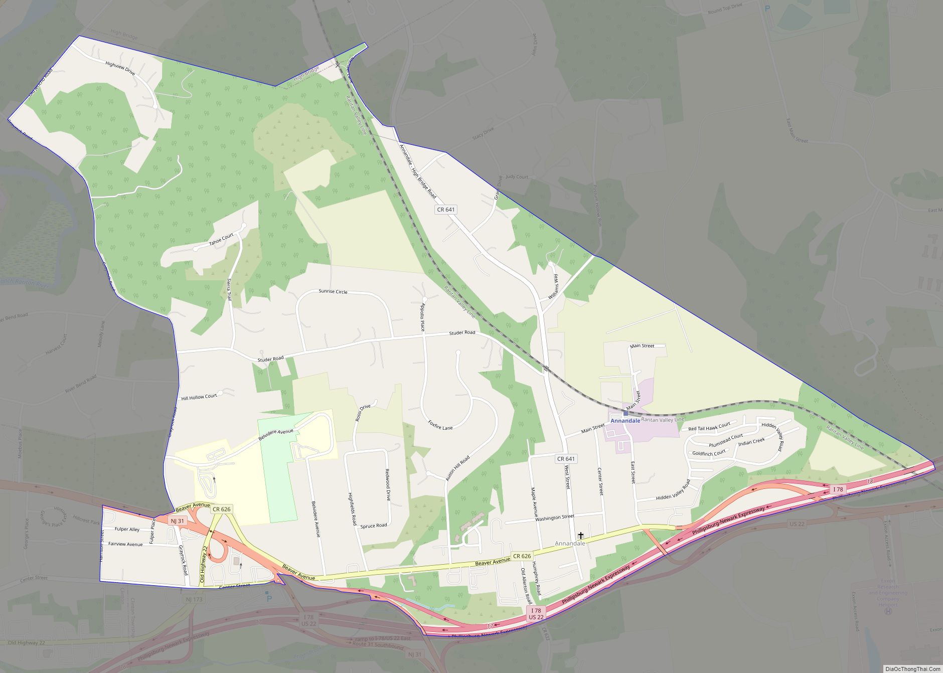
Lambertville Road Map
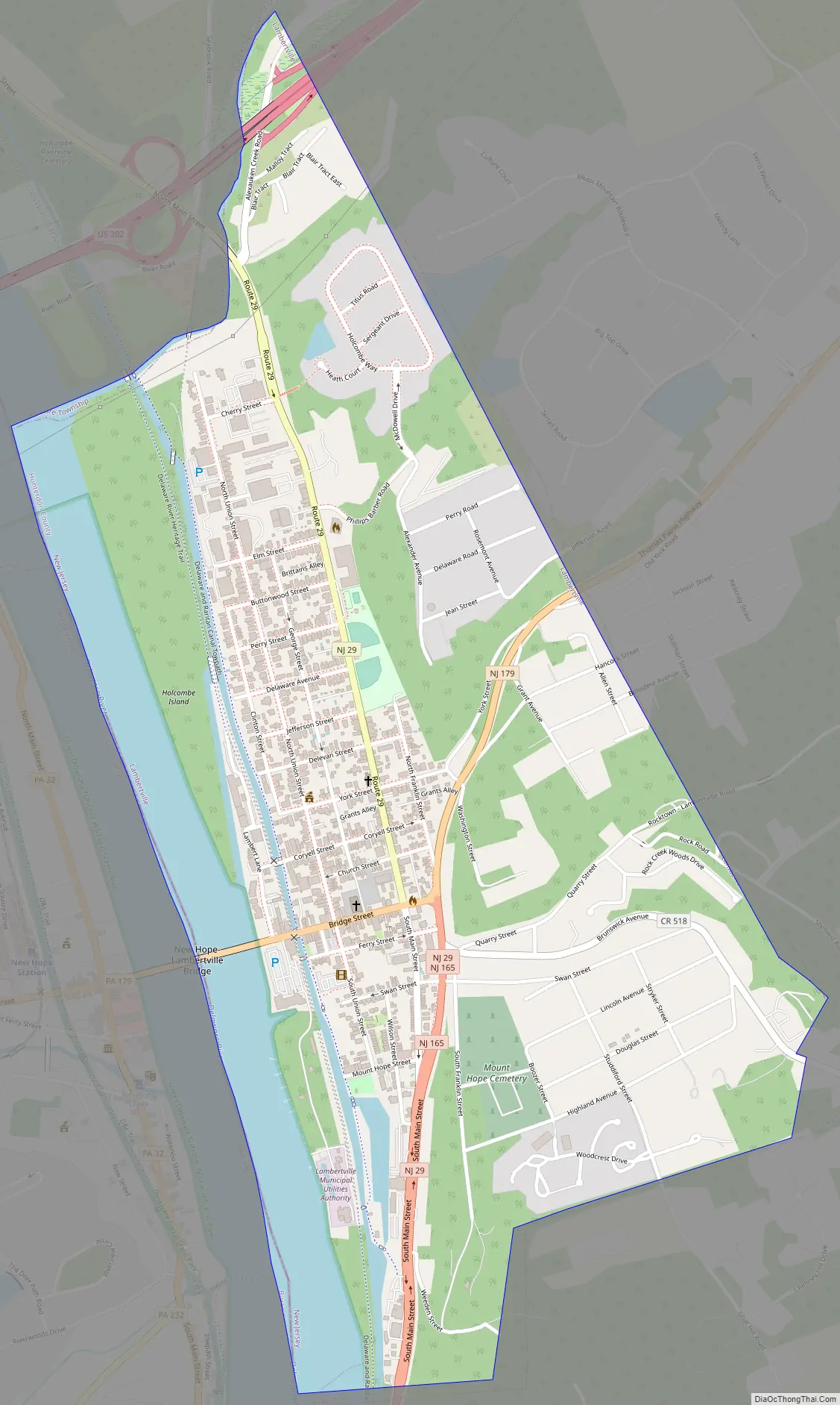
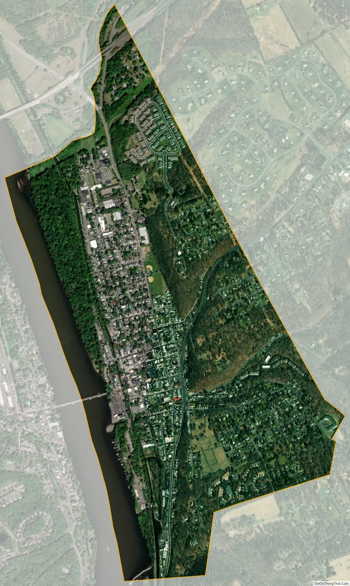
Lambertville city Satellite Map
Geography
According to the U.S. Census Bureau, the city had an area of 1.23 square miles (3.17 km), including 1.08 square miles (2.81 km) of land and 0.14 square miles (0.36 km) of water (11.46%). The city borders Delaware Township and West Amwell Township in Hunterdon County and New Hope and Solebury Township across the Delaware River in Bucks County, Pennsylvania.
The Delaware and Raritan Canal flows through the western half of Lambertville, parallel to the Delaware River. Sections of the Delaware and Raritan Canal State Park are in the city, including trails and bridges.
Climate
Lambertville’s climate is characterized by hot, humid summers and generally cold winters. According to the Köppen Climate Classification system, Lambertville has a humid continental climate, abbreviated “Dfa” on climate maps.
See also
Map of New Jersey State and its subdivision: Map of other states:- Alabama
- Alaska
- Arizona
- Arkansas
- California
- Colorado
- Connecticut
- Delaware
- District of Columbia
- Florida
- Georgia
- Hawaii
- Idaho
- Illinois
- Indiana
- Iowa
- Kansas
- Kentucky
- Louisiana
- Maine
- Maryland
- Massachusetts
- Michigan
- Minnesota
- Mississippi
- Missouri
- Montana
- Nebraska
- Nevada
- New Hampshire
- New Jersey
- New Mexico
- New York
- North Carolina
- North Dakota
- Ohio
- Oklahoma
- Oregon
- Pennsylvania
- Rhode Island
- South Carolina
- South Dakota
- Tennessee
- Texas
- Utah
- Vermont
- Virginia
- Washington
- West Virginia
- Wisconsin
- Wyoming