New Hope is a borough in Bucks County, Pennsylvania. The population was 2,612 at the 2020 census. New Hope is located approximately 30 mi (48 km) north of Philadelphia, and lies on the west bank of the Delaware River at its confluence with Aquetong Creek. The two-lane New Hope–Lambertville Bridge carries automobile and foot traffic across the Delaware to Lambertville, New Jersey, on the east bank.
New Hope’s primary industry is tourism.
| Name: | New Hope borough |
|---|---|
| LSAD Code: | 21 |
| LSAD Description: | borough (suffix) |
| State: | Pennsylvania |
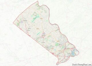
| County: | Bucks County |
| Elevation: | 69 ft (21 m) |
| Total Area: | 1.42 sq mi (3.67 km²) |
| Land Area: | 1.27 sq mi (3.29 km²) |
| Water Area: | 0.15 sq mi (0.38 km²) |
| Total Population: | 2,612 |
| Population Density: | 2,056.69/sq mi (794.08/km²) |
| ZIP code: | 18938 |
| FIPS code: | 4253712 |
| GNISfeature ID: | 1182332 |
| Website: | www.newhopeborough.org |
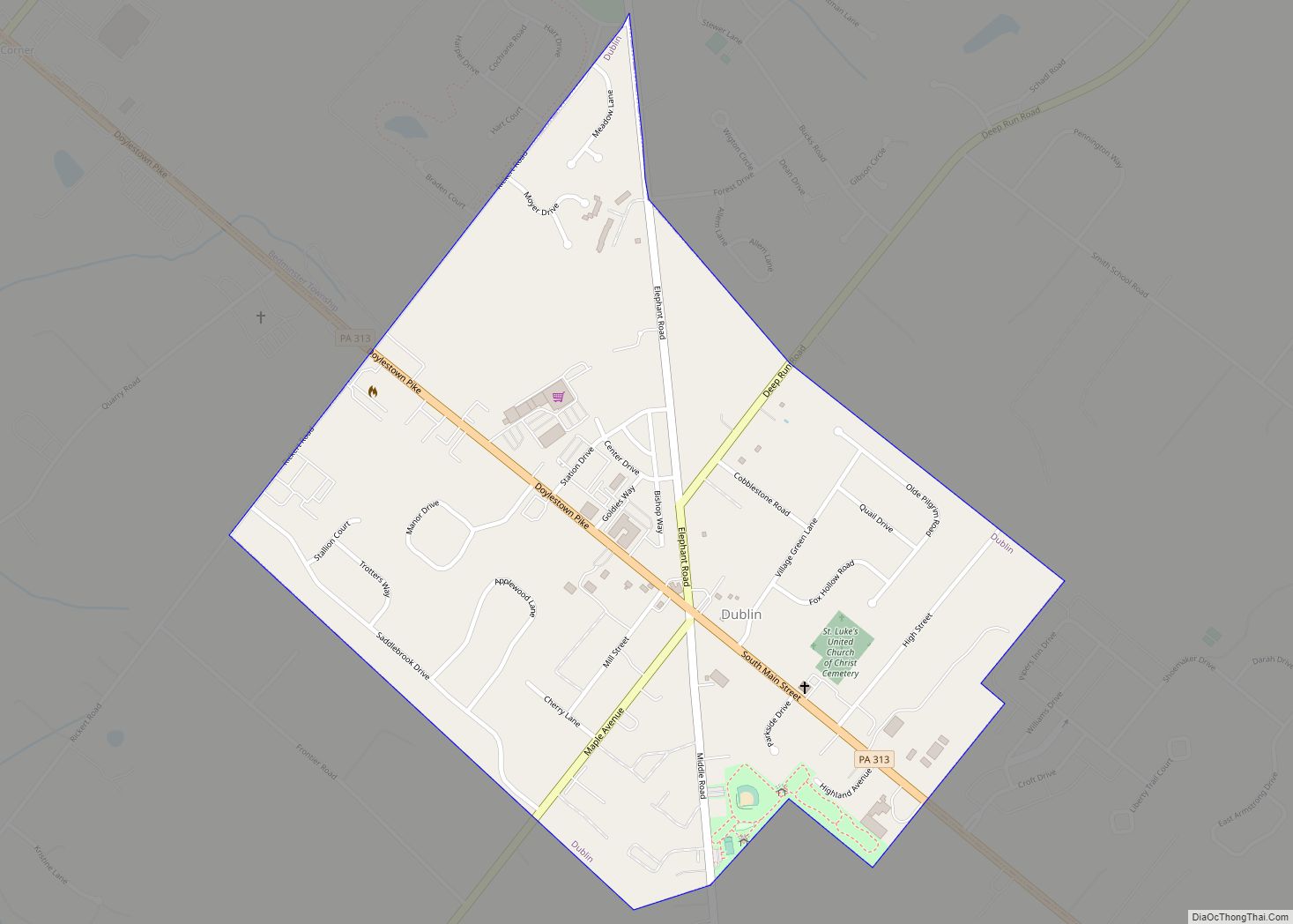
Online Interactive Map
Click on ![]() to view map in "full screen" mode.
to view map in "full screen" mode.
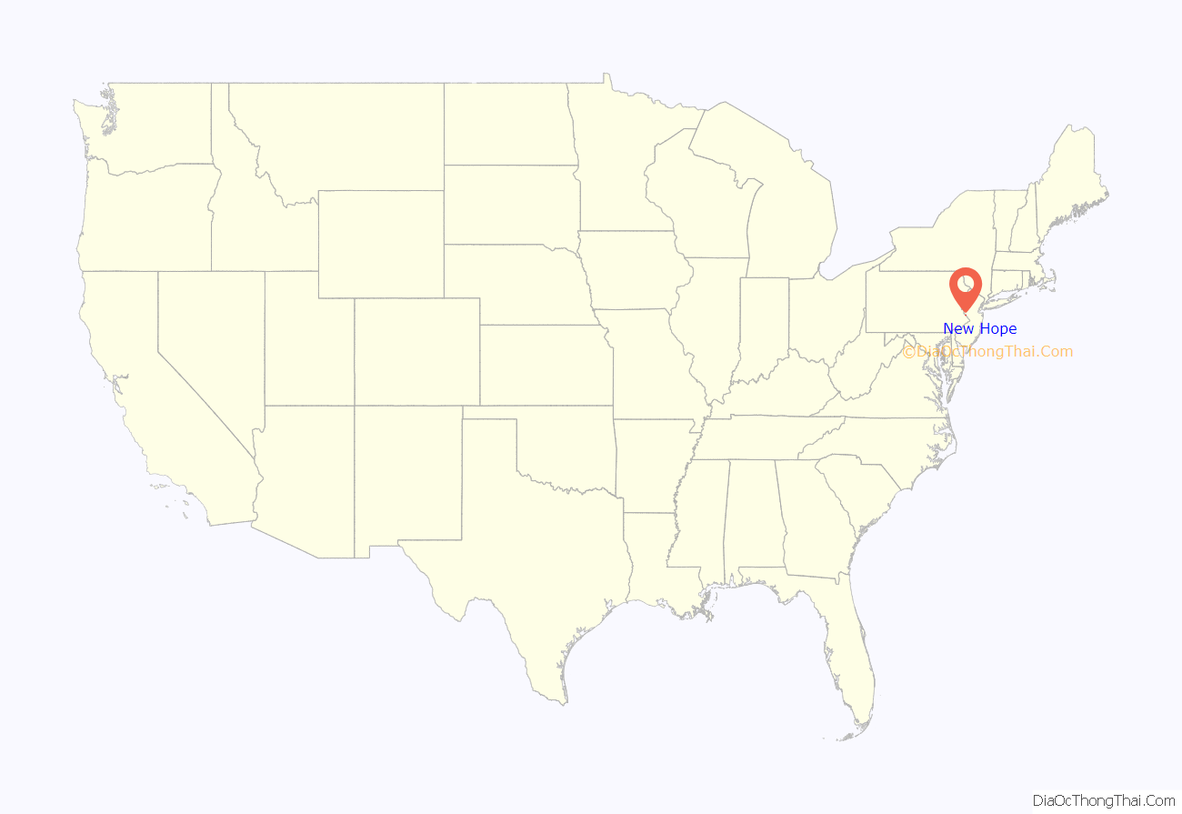
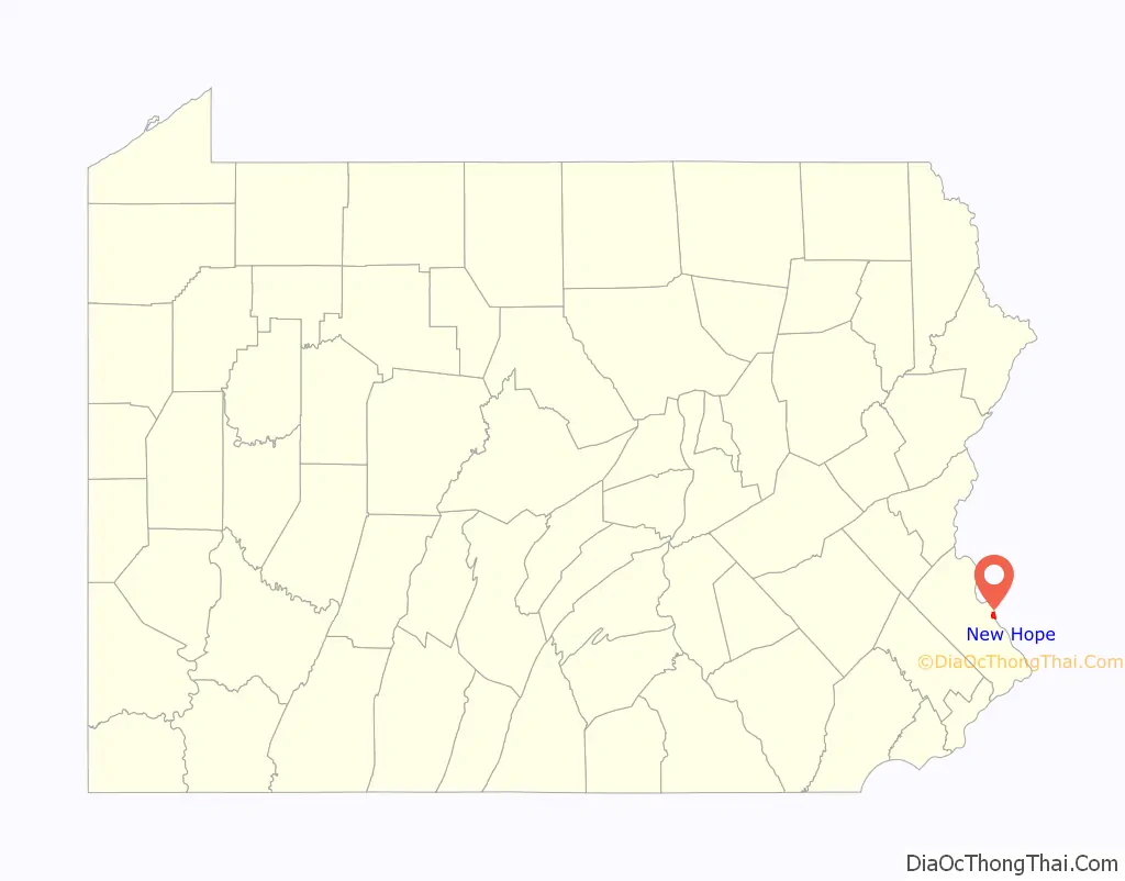
New Hope location map. Where is New Hope borough?
History
New Hope is located along the route of the Old York Road, the former main highway between Philadelphia and New York City. It was generally regarded as the halfway point, where travelers would stay overnight and be ferried across the Delaware River the next morning. The section of U.S. Route 202 that passes just north of New Hope is still named York Road, and the original route is now known as Bridge Street (PA 179).
New Hope was first called “Coryell’s Ferry,” after the owner of the ferry business. The current name came into use following a fire in 1790 that destroyed several mills in the area; their reconstruction was considered a “new hope.”
The night prior to George Washington’s crossing of the Delaware River, he is said to have lodged in New Hope. He destroyed the ferry so the British could not follow him, and after the battles of Trenton and Princeton, when British troops were sweeping the area for the American forces, there was no response when they rang for the ferry. The British assumed the town was sympathetic to the Colonial forces and shelled the town. Several of the older structures in the town still claim to have unexploded British ordnance lodged in their roofbeams.
Historic former residents include James A. Michener and Aaron Burr.
The North Pennsylvania Railroad finished construction of their New Hope Branch in 1891, later being taken over by the Reading Railroad. Passenger service to Philadelphia’s Reading Terminal as well as all other passenger activity was terminated in 1952 from Hatboro, also the end for electrified track, and New Hope. Between 1952 and 1966, only freight trains were seen entering and leaving New Hope, mostly to deliver paper pulp for the Union Camp Paper Corp. and to deliver sand and gravel to James D. Morrissey Materials Co., a cement company and a division of James D. Morrissey, Inc. In 1966, the New Hope and Ivyland Railroad was formed and bought 16 mi (26 km) of track from New Hope southwest to Ivyland. Scenic tourist excursions started the same year. Freight service to New Hope was then handled by the New Hope and Ivyland Railroad. In 1972, SEPTA, who by then took over Reading Railroad’s passenger operations, extended the electrified route to Warminster, where the current interchange for both SEPTA and NHRR is. Freight service to James D. Morrissey Materials Co. ceased sometime in the late 1970s and to Union Camp Paper Corp. in 1985. The New Hope and Ivyland Railroad continues to provide scenic tourist excursion passenger trains between New Hope and nearby Lahaska.
In 1983, NBC network anchorwoman Jessica Savitch and her boyfriend drowned after their car overturned into the Delaware Canal. The canal passes by Odette’s Restaurant, where the couple had dined on a rainy evening when visibility was poor and two warning signs were missed.
In 2004 and 2006, New Hope was flooded when the Delaware River overflowed its banks. On both occasions, the downtown businesses reopened within several days. Compared to the Great Flood of 1955, the 2004 and 2006 floods did not cause severe damage or fatalities.
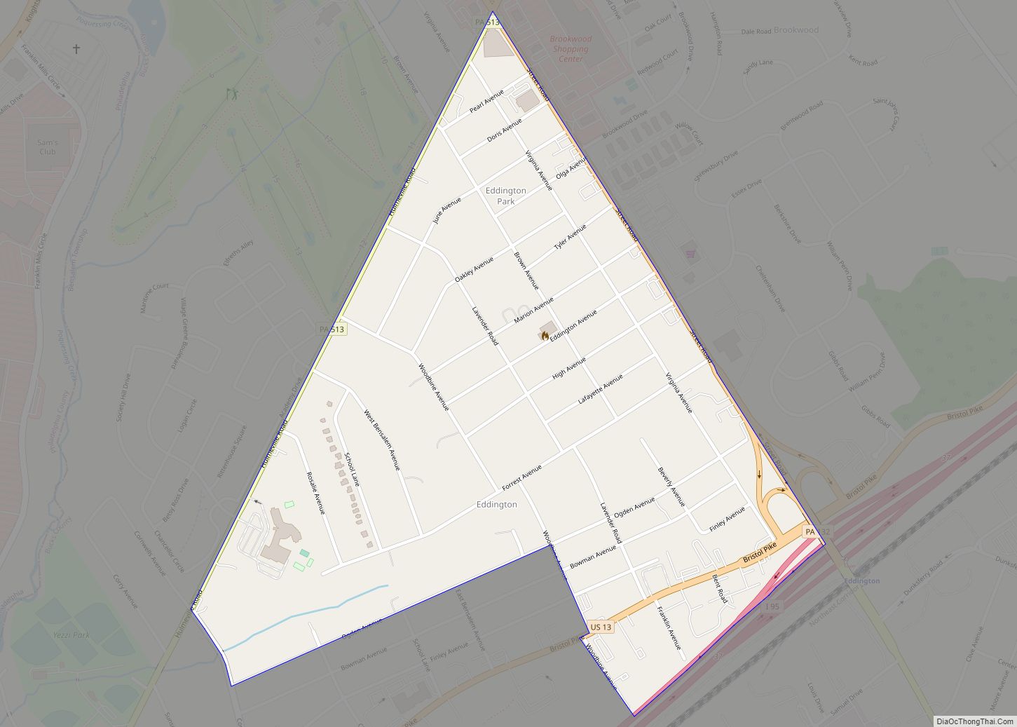
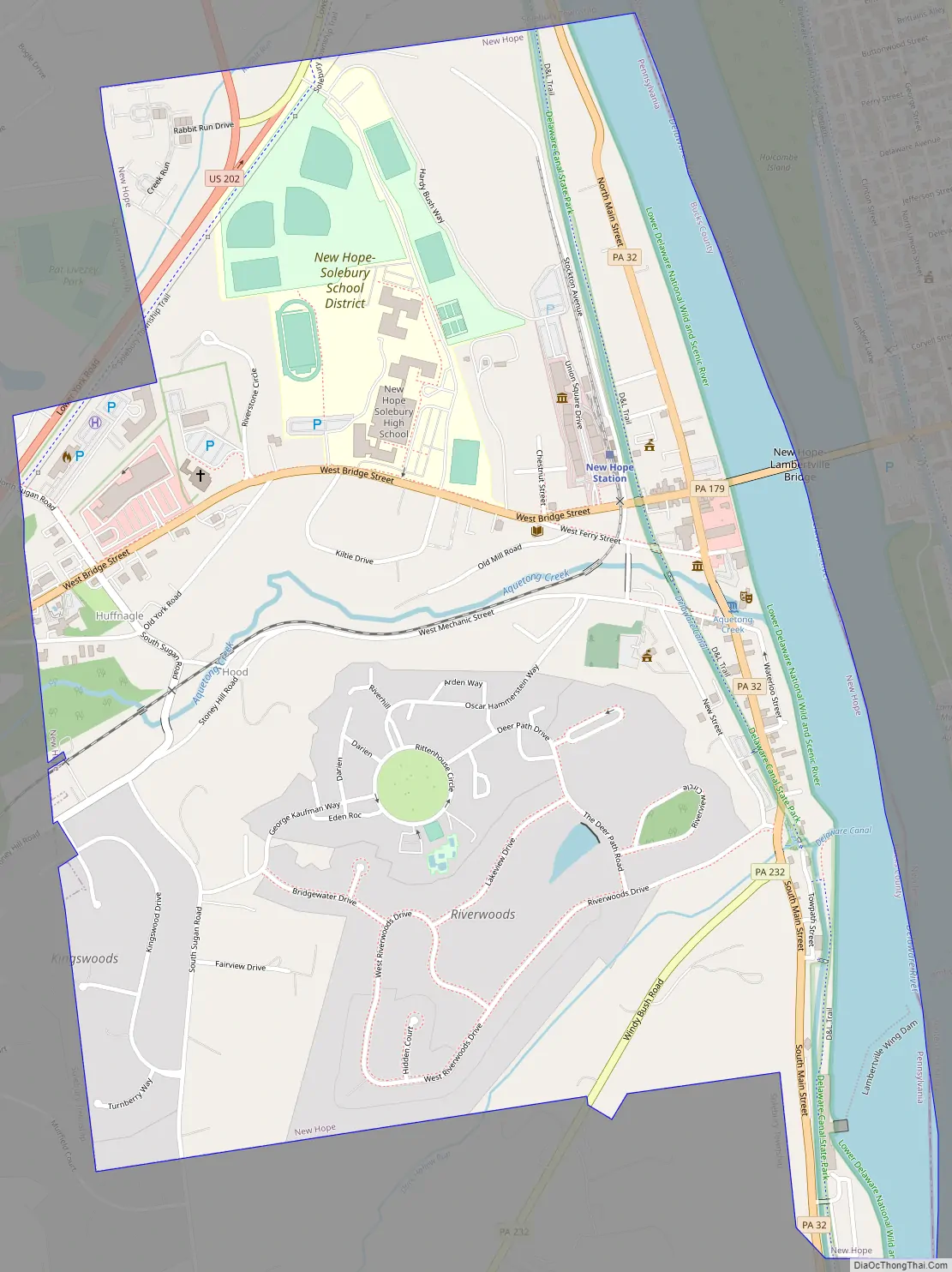
New Hope Road Map
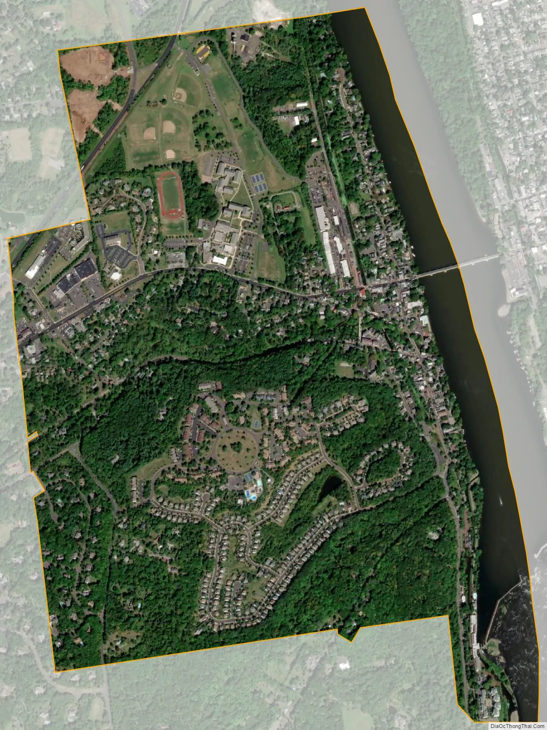
New Hope city Satellite Map
Geography
According to the U.S. Census Bureau, the borough has a total area of 1.4 square miles (3.6 km), of which 1.3 square miles (3.4 km) is land and 0.2 square miles (0.52 km) (11.19%) is water. Much of that water is the Delaware River.
The borough is located at the confluence of the Delaware River and Aquetong (Ingham) Creek, which begins its two-mile course in neighboring Solebury Township at Ingham Springs, the most productive spring in Southeastern Pennsylvania. The name Aquetong comes from a Lenape word meaning “spring in the bushes,” while Ingham refers to Samuel D. Ingham, an industrialist, congressman, and advocate of the canal that would run through the town. Near its end in New Hope, the creek forms a scenic millpond and waterfall near the Bucks County Playhouse, a former mill.
The former place names Hood and Hufnagel are now part of the borough.
Climate
According to the Köppen climate classification system, New Hope has a hot-summer, humid continental climate (Dfa). Dfa climates are characterized by at least one month having an average mean temperature ≤ 32.0 °F (0.0 °C), at least four months with an average mean temperature ≥ 50.0 °F (10.0 °C), at least one month with an average mean temperature ≥ 71.6 °F (22.0 °C) and no significant precipitation difference between seasons. Although most summer days are slightly humid in New Hope, episodes of heat and high humidity can occur with heat index values > 107 °F (42 °C). Since 1981, the highest air temperature was 103.3 °F (39.6 °C) on July 22, 2011, and the highest daily average mean dew point was 74.8 °F (23.8 °C) on August 13, 2016. The average wettest month is July which corresponds with the annual peak in thunderstorm activity. Since 1981, the wettest calendar day was 7.46 inches (189 mm) on August 27, 2011. During the winter months, the average annual extreme minimum air temperature is −0.3 °F (−17.9 °C). Since 1981, the coldest air temperature was −12.1 °F (−24.5 °C) on January 22, 1984. Episodes of extreme cold and wind can occur, featuring wind chill values below −11 °F (−24 °C). The average annual snowfall (Nov-Apr) is between 24 inches (61 cm) and 30 inches (76 cm). Ice storms and large snowstorms depositing ≥ 12 inches (30 cm) of snow occur once every few years, particularly during nor’easters from December through February.
See also
Map of Pennsylvania State and its subdivision:- Adams
- Allegheny
- Armstrong
- Beaver
- Bedford
- Berks
- Blair
- Bradford
- Bucks
- Butler
- Cambria
- Cameron
- Carbon
- Centre
- Chester
- Clarion
- Clearfield
- Clinton
- Columbia
- Crawford
- Cumberland
- Dauphin
- Delaware
- Elk
- Erie
- Fayette
- Forest
- Franklin
- Fulton
- Greene
- Huntingdon
- Indiana
- Jefferson
- Juniata
- Lackawanna
- Lancaster
- Lawrence
- Lebanon
- Lehigh
- Luzerne
- Lycoming
- Mc Kean
- Mercer
- Mifflin
- Monroe
- Montgomery
- Montour
- Northampton
- Northumberland
- Perry
- Philadelphia
- Pike
- Potter
- Schuylkill
- Snyder
- Somerset
- Sullivan
- Susquehanna
- Tioga
- Union
- Venango
- Warren
- Washington
- Wayne
- Westmoreland
- Wyoming
- York
- Alabama
- Alaska
- Arizona
- Arkansas
- California
- Colorado
- Connecticut
- Delaware
- District of Columbia
- Florida
- Georgia
- Hawaii
- Idaho
- Illinois
- Indiana
- Iowa
- Kansas
- Kentucky
- Louisiana
- Maine
- Maryland
- Massachusetts
- Michigan
- Minnesota
- Mississippi
- Missouri
- Montana
- Nebraska
- Nevada
- New Hampshire
- New Jersey
- New Mexico
- New York
- North Carolina
- North Dakota
- Ohio
- Oklahoma
- Oregon
- Pennsylvania
- Rhode Island
- South Carolina
- South Dakota
- Tennessee
- Texas
- Utah
- Vermont
- Virginia
- Washington
- West Virginia
- Wisconsin
- Wyoming