Medford Lakes is a borough in Burlington County, in the U.S. state of New Jersey. As of the 2020 United States census, the borough’s population was 4,264, an increase of 118 (+2.8%) from the 2010 census count of 4,146, which in turn reflected a decline of 27 (−0.6%) from the 4,173 counted in the 2000 census. The township, and all of Burlington County, is a part of the Philadelphia–Reading–Camden combined statistical area and the Delaware Valley.
Medford Lakes was incorporated as a borough by an act of the New Jersey Legislature on May 17, 1939, from portions of Medford Township. The borough was named for Medford Township, which was named by a developer for Medford, Massachusetts.
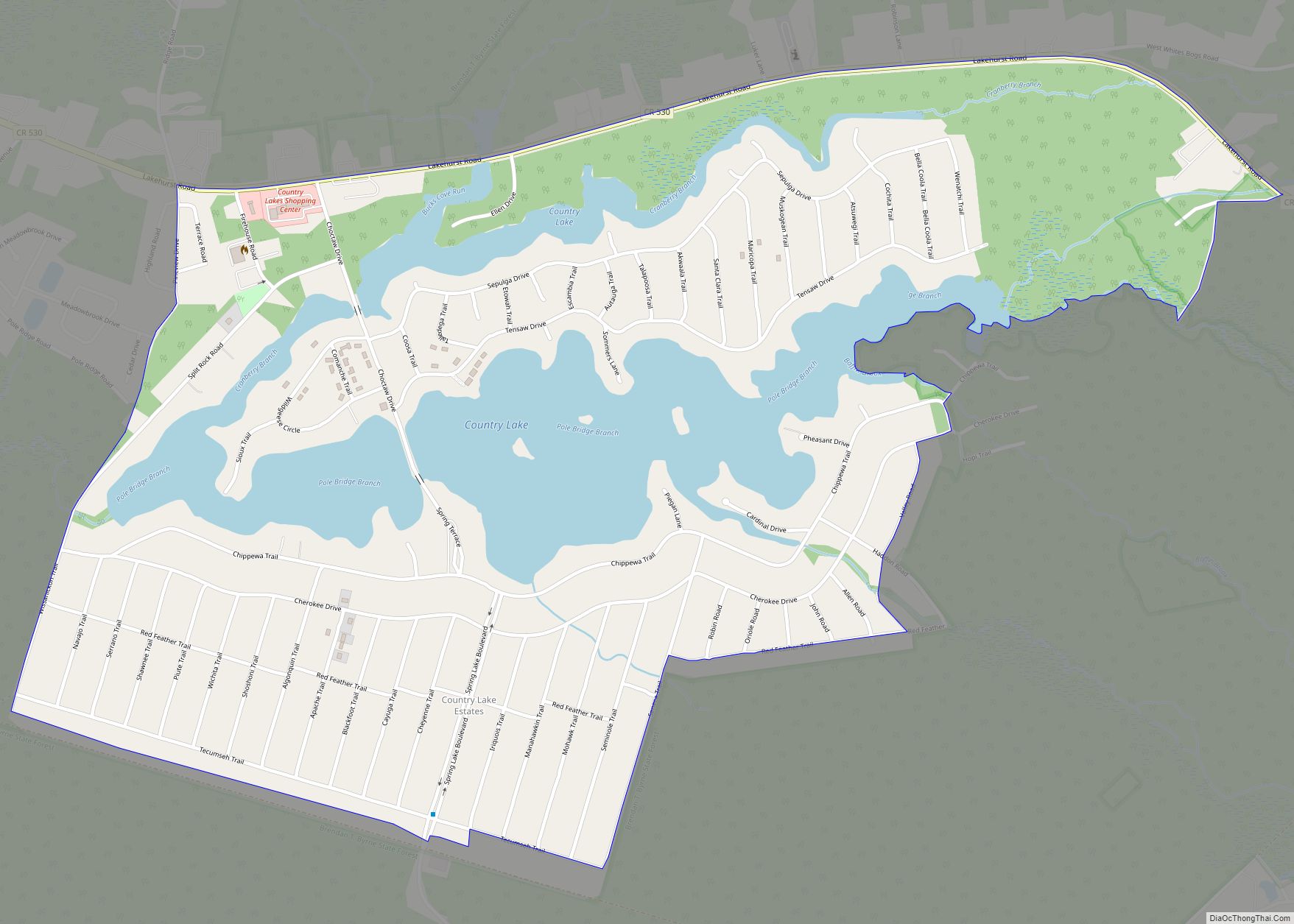
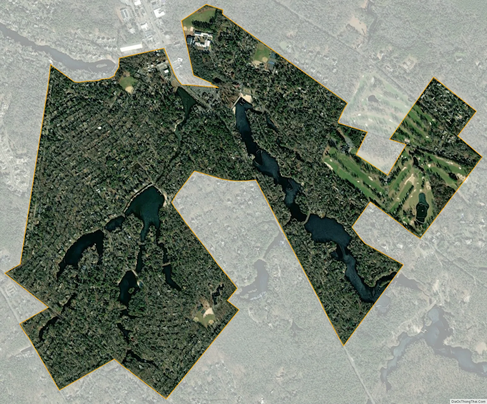
The borough’s 22 lakes and surrounding lake communities are within the boundaries of the New Jersey Pinelands Commission. The Medford Lakes Colony, a homeowner association, manages the lakes and other recreational facilities. More than 10% of the borough’s homes are log cabins.
| Name: | Medford Lakes borough |
|---|---|
| LSAD Code: | 21 |
| LSAD Description: | borough (suffix) |
| State: | New Jersey |
| County: | Burlington County |
| Incorporated: | May 17, 1939 |
| Elevation: | 62 ft (19 m) |
| Total Area: | 1.27 sq mi (3.29 km²) |
| Land Area: | 1.14 sq mi (2.95 km²) |
| Water Area: | 0.13 sq mi (0.34 km²) 10.24% |
| Total Population: | 4,264 |
| Population Density: | 3,741.2/sq mi (1,444.5/km²) |
| ZIP code: | 08055 |
| Area code: | 609 exchanges: 654, 714, 953 |
| FIPS code: | 3445210 |
| GNISfeature ID: | 0885295 |
| Website: | www.medfordlakes.com |
Online Interactive Map
Click on ![]() to view map in "full screen" mode.
to view map in "full screen" mode.
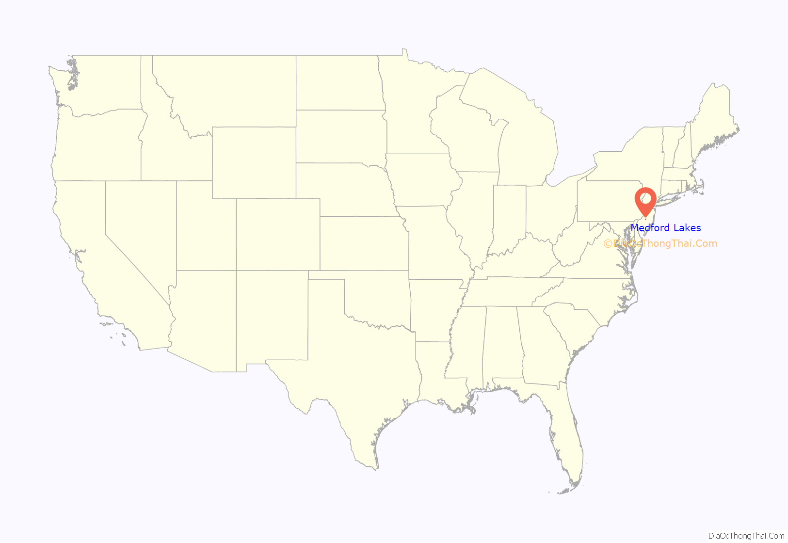
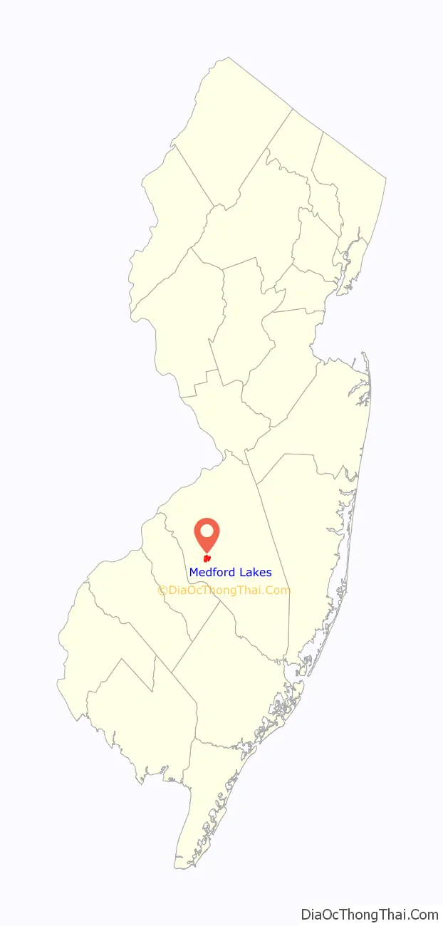
Medford Lakes location map. Where is Medford Lakes borough?
History
Charles Read’s Aetna Furnace contributed to the Continental Army’s efforts during the American Revolutionary War, using local bog iron to manufacture cannonballs. A part of the industrial life of what is now Medford Lakes was the saw and grist mill erected by John Haines.
Medford Lakes was originally founded as resort community with a distinct architectural style, utilizing cedar logs as the primary building material. The logs were imported in large quantities and crafted into log cabins, with both the interior and exterior walls being made entirely of solid logs. Some of the logs were stripped of their bark while others were left in their natural state. The use of cedar as a building material was chosen due to its porous nature, which serves as an excellent insulator, thus allowing the cabins to remain cool in the summer and warm in the winter. The community also had an extended season, as the large stone fireplaces in the cabins could effectively heat the cabins during the colder months. The Medford Lakes Development Company was established in 1927 and in 1928, the Colony Club Pavilion was constructed on land donated by the Development Company.
St. Mary of the Lakes Catholic Church, a single-story log cabin structure built in 1931, was added to the National Register of Historic Places in 2007.
Medford Lakes was established as an independent municipality in 1939.
The borough experienced heavy damage on July 12, 2004, during a day that saw 7.26 inches (18.4 cm) of rainfall over a span of 14 hours. The heavy rain caused a series of dam breaks and breaches in the surrounding areas of Southern New Jersey, which have since been replaced. Quogue Dam, as well as both Lower and Upper Aetna Lake Dams failed, with high water levels on portions of Ballinger Run exceeding 500-year flood elevations.
Since 1931, a Canoe Carnival has been held during the first week of every August on Lower Aetna Lake. Elaborate floats, built with a maximum of two canoes, are paddled by crowds gathered along the lake. A winner is then named, along with a king, queen, and court.
Medford Lakes Road Map
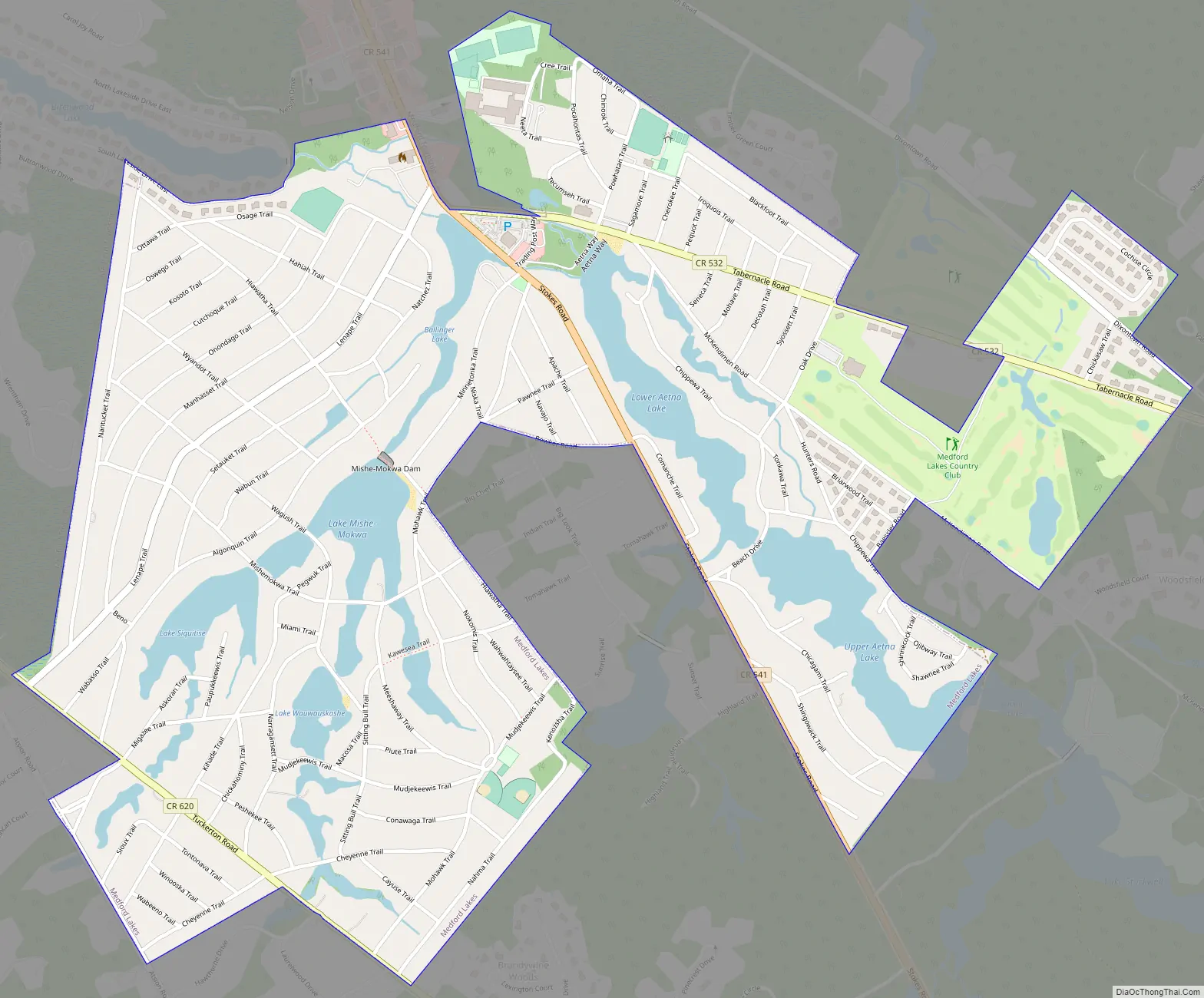
Medford Lakes city Satellite Map
Geography
According to the U.S. Census Bureau, the borough had a total area of 1.293 square miles (3.348 km), including 1.162 square miles (3.008 km) of which is land and 0.131 square miles (0.340 km) of which is water (10.15%). The borough is an independent municipality surrounded entirely by Medford Township, making it part one of 21 pairs of “doughnut towns” in the state, where one municipality entirely surrounds another.
Medford Lakes is one of 56 South Jersey municipalities that are included within the New Jersey Pinelands National Reserve, a protected natural area of unique ecology covering 1,100,000 acres (450,000 ha), that has been classified as a United States Biosphere Reserve and established by Congress in 1978 as the nation’s first National Reserve. All of the borough is included in the state-designated Pinelands Area, which includes portions of Burlington County, along with areas in Atlantic, Camden, Cape May, Cumberland, Gloucester and Ocean counties.
Climate
See also
Map of New Jersey State and its subdivision: Map of other states:- Alabama
- Alaska
- Arizona
- Arkansas
- California
- Colorado
- Connecticut
- Delaware
- District of Columbia
- Florida
- Georgia
- Hawaii
- Idaho
- Illinois
- Indiana
- Iowa
- Kansas
- Kentucky
- Louisiana
- Maine
- Maryland
- Massachusetts
- Michigan
- Minnesota
- Mississippi
- Missouri
- Montana
- Nebraska
- Nevada
- New Hampshire
- New Jersey
- New Mexico
- New York
- North Carolina
- North Dakota
- Ohio
- Oklahoma
- Oregon
- Pennsylvania
- Rhode Island
- South Carolina
- South Dakota
- Tennessee
- Texas
- Utah
- Vermont
- Virginia
- Washington
- West Virginia
- Wisconsin
- Wyoming