| Name: | New Brunswick city |
|---|---|
| LSAD Code: | 25 |
| LSAD Description: | city (suffix) |
| State: | New Jersey |
| County: | Middlesex County |
| Incorporated: | September 1, 1784 |
| Elevation: | 62 ft (19 m) |
| Total Area: | 5.75 sq mi (14.90 km²) |
| Land Area: | 5.23 sq mi (13.55 km²) |
| Water Area: | 0.52 sq mi (1.35 km²) 9.06% |
| Total Population: | 55,266 |
| Population Density: | 10,561.1/sq mi (4,077.7/km²) |
| Area code: | 732/848 and 908 |
| FIPS code: | 3451210 |
| GNISfeature ID: | 0885318 |
| Website: | www.cityofnewbrunswick.org |
Online Interactive Map
Click on ![]() to view map in "full screen" mode.
to view map in "full screen" mode.
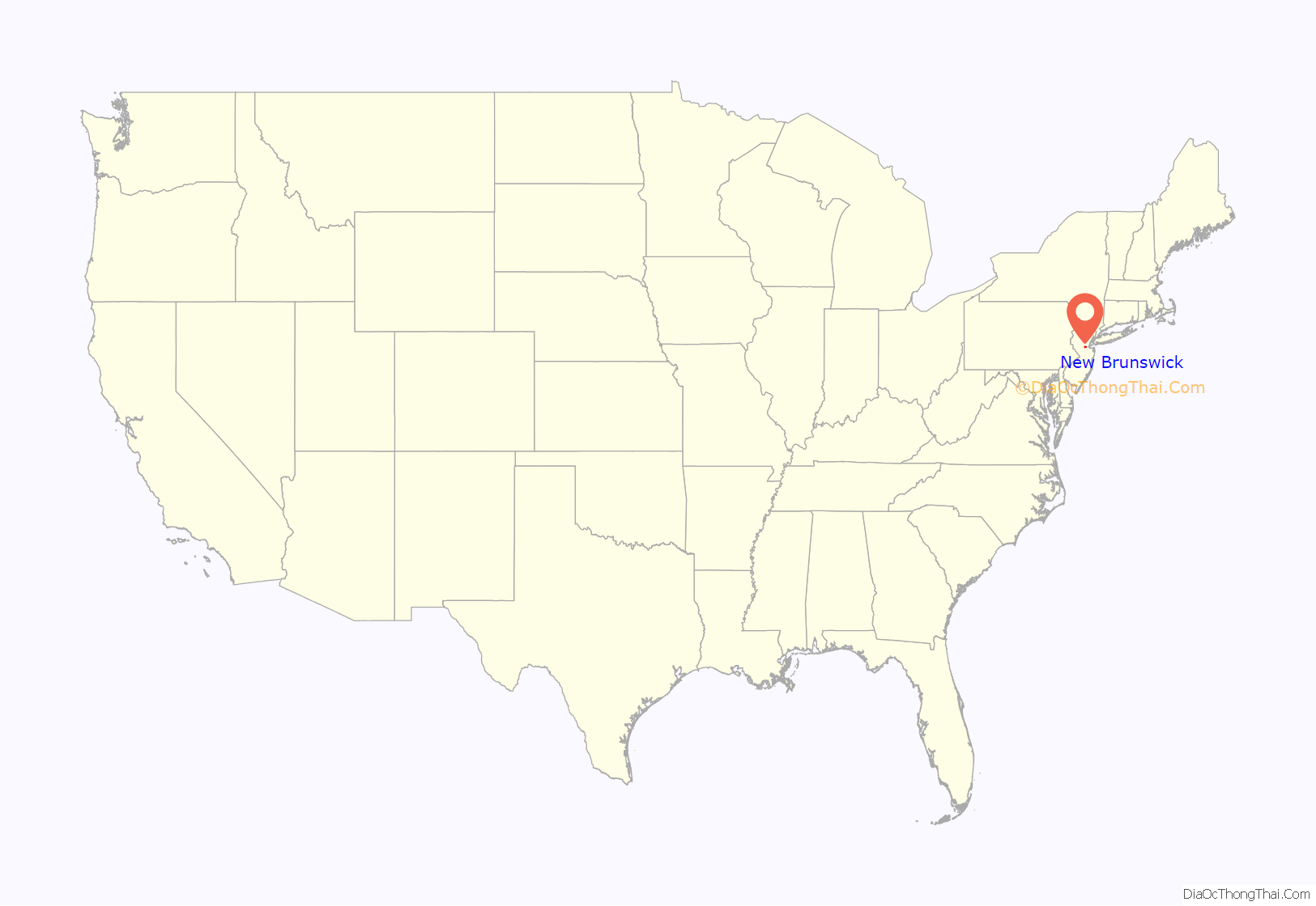
New Brunswick location map. Where is New Brunswick city?
History
Etymology
The area around present-day New Brunswick was first inhabited by the Lenape Native Americans, whose Minisink Trail intersected the Raritan River and followed a route that would be taken by later colonial roads. The first European settlement at the site of New Brunswick was made in 1681. The settlement here was called Prigmore’s Swamp (1681–1697), then known as Inian’s Ferry (1691–1714). In 1714, the settlement was given the name New Brunswick, after the city of Braunschweig (Brunswick in Low German), in the state of Lower Saxony, now located in Germany. Braunschweig was an influential and powerful city in the Hanseatic League and was an administrative seat for the Duchy of Hanover. Shortly after the first settlement of New Brunswick in colonial New Jersey, George, Duke of Brunswick-Lüneburg and Elector of Hanover, became King George I of Great Britain. Alternatively, the city gets its name from King George II of Great Britain, the Duke of Brunswick-Lüneburg.
Colonial and Early American periods
Centrally located between New York City and Philadelphia along an early thoroughfare known as the King’s Highway and situated along the Raritan River, New Brunswick became an important hub for Colonial travelers and traders. New Brunswick was incorporated as a town in 1736 and chartered as a city in 1784. It was incorporated into a town in 1798 as part of the Township Act of 1798. It was occupied by the British in the winter of 1776–1777 during the Revolutionary War.
The Declaration of Independence received one of its first public readings, by Colonel John Neilson in New Brunswick on July 9, 1776, in days following its promulgation by the Continental Congress. A bronze statue marking the event was dedicated on July 9, 2017, in Monument Square, in front of the Heldrich Hotel.
The Trustees of Queen’s College (now Rutgers University), founded in 1766, voted by a margin of ten to seven in 1771 to locate the young college in New Brunswick, selecting the city over Hackensack, in Bergen County, New Jersey. Classes began in 1771 with one instructor, one sophomore, Matthew Leydt, and several freshmen at a tavern called the ‘Sign of the Red Lion’ on the corner of Albany and Neilson Streets (now the grounds of the Johnson & Johnson corporate headquarters); Leydt would become the university’s first graduate in 1774 when he was the only member of the graduating class. The Sign of the Red Lion was purchased on behalf of Queens College in 1771, and later sold to the estate of Jacob Rutsen Hardenbergh in 1791. Classes were held through the American Revolution in various taverns and boarding houses, and at a building known as College Hall on George Street, until Old Queens was completed and opened in 1811. It remains the oldest building on the Rutgers University campus. The Queen’s College Grammar School (now Rutgers Preparatory School) was established also in 1766, and shared facilities with the college until 1830, when it located in a building (now known as Alexander Johnston Hall) across College Avenue from Old Queens. After Rutgers University became the state university of New Jersey in 1945, the Trustees of Rutgers divested itself of Rutgers Preparatory School, which relocated in 1957 to an estate purchased from the Colgate-Palmolive Company in Franklin Township in neighboring Somerset County.
The New Brunswick Theological Seminary, founded in 1784 in New York, moved to New Brunswick in 1810, sharing its quarters with the fledgling Queen’s College. (Queen’s closed from 1810 to 1825 due to financial problems, and reopened in 1825 as Rutgers College.) The Seminary, due to overcrowding and differences over the mission of Rutgers College as a secular institution, moved to a tract of land covering 7 acres (2.8 ha) located less than 1⁄2 mile (0.80 km) to the west, which it still occupies, although the land is now in the middle of Rutgers University’s College Avenue Campus.
New Brunswick was formed by royal charter on December 30, 1730, within other townships in Middlesex and Somerset counties and was reformed by royal charter with the same boundaries on February 12, 1763, at which time it was divided into north and south wards. New Brunswick was incorporated as a city by an act of the New Jersey Legislature on September 1, 1784.
Old Queens, the oldest building at Rutgers University
Building the Streetcar line, c. 1885
Albany Street Bridge, 1903
Aerial view of New Brunswick, 1910
African-American community
The existence of an African American community in New Brunswick dates back to the 18th century, when racial slavery was a part of life in the city and the surrounding area. Local slaveholders routinely bought and sold African American children, women, and men in New Brunswick in the late-eighteenth and early-nineteenth century. In this period, the Market-House was the center of commercial life in the city. It was located at the corner of Hiram Street and Queen Street (now Neilson Street) adjacent to the Raritan Wharf. The site was a place where residents of New Brunswick sold and traded their goods which made it an integral part of the city’s economy. The Market-House also served as a site for regular slave auctions and sales.
By the late-eighteenth century, New Brunswick became a hub for newspaper production and distribution. The Fredonian, a popular newspaper, was located less than a block away from the aforementioned Market-House and helped facilitate commercial transactions. A prominent part of the local newspapers were sections dedicated to private owners who would advertise their slaves for sale. The trend of advertising slave sales in newspapers shows that the New Brunswick residents typically preferred selling and buying slaves privately and individually rather than in large groups. The majority of individual advertisements were for female slaves, and their average age at the time of the sale was 20 years old, which was considered the prime age for childbearing. Slave owners would get the most profit from the women who fit into this category because these women had the potential to reproduce another generation of enslaved workers. Additionally, in the urban environment of New Brunswick, there was a high demand for domestic labor, and female workers were preferred for cooking and housework tasks.
The New Jersey Legislature passed An Act for the Gradual Abolition of Slavery in 1804. Under the provisions of this law, children born to enslaved women after July 4, 1804, would serve their master for a term of 21 years (for girls) or a term of 25 years (for boys), and after this term, they would gain their freedom. However, all individuals who were enslaved before July 4, 1804, would continue to be slaves for life and would never attain freedom under this law. New Brunswick continued to be home to enslaved African Americans alongside a growing community of free people of color. The 1810 United States Census listed 53 free Blacks and 164 slaves in New Brunswick.
By the 1810s, some free African Americans lived in a section of the city called Halfpenny Town, which was located along the Raritan River by the east side of the city, near Queen (now Neilson) Street. Halfpenny Town was a place populated by free blacks as well as poorer whites who did not own slaves. This place was known as a social gathering for free blacks that was not completely influenced by white scrutiny and allowed free blacks to socialize among themselves. This does not mean that it was free from white eyes and was still under the negative effects of the slavery era. In the early decades of the nineteenth century, White and either free or enslaved African Americans shared many of the same spaces in New Brunswick, particularly places of worship. The First Presbyterian Church, Christ Church, and First Reformed Church were popular among both Whites and Blacks, and New Brunswick was notable for its lack of spaces where African Americans could congregate exclusively. Most of the time Black congregants of these churches were under the surveillance of Whites. That was the case until the creation of the African Association of New Brunswick in 1817.
Both free and enslaved African Americans were active in the establishment of the African Association of New Brunswick, whose meetings were first held in 1817. The African Association of New Brunswick held a meeting every month, mostly in the homes of free blacks. Sometimes these meetings were held at the First Presbyterian Church. Originally intended to provide financial support for the African School of New Brunswick, the African Association grew into a space where blacks could congregate and share ideas on a variety of topics such as religion, abolition and colonization. Slaves were required to obtain a pass from their owner in order to attend these meetings. The African Association worked closely with Whites and was generally favored amongst White residents who believed it would bring more racial peace and harmony to New Brunswick.
The African Association of New Brunswick established the African School in 1822. The African School was first hosted in the home of Caesar Rappleyea in 1823. The school was located on the upper end of Church Street in the downtown area of New Brunswick about two blocks away from the jail that held escaped slaves. Both free and enslaved Blacks were welcome to be members of the School. Reverend Huntington (pastor of the First Presbyterian Church) and several other prominent Whites were trustees of the African Association of New Brunswick. These trustees supported the Association which made some slave owners feel safe sending their slaves there by using a permission slip process. The main belief of these White supporters was that Blacks were still unfit for American citizenship and residence, and some trustees were connected with the American Colonization Society that advocated for the migration of free African Americans to Africa. The White trustees only attended some of the meetings of the African Association, and the Association was still unprecedented as a space for both enslaved and free Blacks to get together while under minimal supervision by Whites.
The African Association appears to have disbanded after 1824. By 1827, free and enslaved Black people in the city, including Joseph and Jane Hoagland, came together to establish the Mount Zion African Methodist Episcopal Church and purchased a plot of land on Division Street for the purpose of erecting a church building. This was the first African American church in Middlesex County. The church had approximately 30 members in its early years. The church is still in operation and is currently located at 39 Hildebrand Way. The street Hildebrand Way is named after the late Rev. Henry Alphonso Hildebrand, who was pastor of Mount Zion AME for 37 years, which is the longest appointment received by a pastor at Mount Zion AME.
Records from the April 1828 census, conducted by the New Brunswick Common Council, state that New Brunswick was populated with 4,435 white residents and 374 free African Americans. The enslaved population of New Brunswick in 1828 consisted of 57 slaves who must serve for life and 127 slaves eligible for emancipation at age 21 or 25 due to the 1804 Act for the Gradual Abolition of Slavery. Free and enslaved African Americans accounted for 11% of New Brunswick’s population in 1828, a relatively high percentage for New Jersey. By comparison, as of the 1830 United States Census, African Americans made up approximately 6.4% of the total population of New Jersey.
In 1824, the New Brunswick Common Council adopted a curfew for free people of color. Free African Americans were not allowed to be out after 10 PM on Saturday night. The Common Council also appointed a committee of white residents who were charged with rounding up and detaining free African Americans who appeared to be out of place according to white authorities.
New Brunswick became a notorious city for slave hunters, who sought to enforce the Fugitive Slave Act of 1850. Strategically located on the Raritan River, the city was also a vital hub for New Jersey’s Underground Railroad. For runaway slaves in New Jersey, it served as a favorable route for those heading to New York and Canada. When African Americans tried to escape either to or from New Brunswick, they had a high likelihood of getting discovered and captured and sent to New Brunswick’s jail, which was located on Prince Street, which by now is renamed Bayard Street.
Hungarian community
New Brunswick has been described as the nation’s “most Hungarian city”, with Hungarian immigrants arriving in the city as early as 1888 and accounting for almost 20% of the city’s population in 1915. Hungarians were primarily attracted to the city by employment at Johnson & Johnson factories located in the city. Hungarians settled mainly in what today is the Fifth Ward and businesses were established to serve the needs of the Hungarian community that weren’t being met by mainstream businesses. The immigrant population grew until the end of the immigration boom in the early 20th century.
During the Cold War, the community was revitalized by the decision to process the tens of thousands refugees who came to the United States from the failed 1956 Hungarian Revolution at Camp Kilmer, in nearby Edison. Even though the Hungarian population has been largely supplanted by newer immigrants, there continues to be a Hungarian Festival in the city held on Somerset Street on the first Saturday of June each year; the 44th annual event was held in 2019. Many Hungarian institutions set up by the community remain and are active in the neighborhood, including: Magyar Reformed Church, Ascension Lutheran Church, St. Ladislaus Roman Catholic Church, St. Joseph Byzantine Catholic Church, Hungarian American Athletic Club, Aprokfalva Montessori Preschool, Széchenyi Hungarian Community School & Kindergarten, Teleki Pál Scout Home, Hungarian American Foundation, Vers Hangja, Hungarian Poetry Group, Bolyai Lecture Series on Arts and Sciences, Hungarian Alumni Association, Hungarian Radio Program, Hungarian Civic Association, Committee of Hungarian Churches and Organizations of New Brunswick, and Csűrdöngölő Folk Dance Ensemble.
Several landmarks in the city also testify to its Hungarian heritage. There is a street and a park named after Lajos Kossuth, one of the leaders of the Hungarian Revolution of 1848. The corner of Somerset Street and Plum Street is named Mindszenty Square where the first ever statue of Cardinal József Mindszenty was erected. A stone memorial to the victims of the 1956 Hungarian Revolution stands nearby.
Latino community
In the 2010 Census, about 50% of New Brunswick’s population is self-identified as Hispanic, the 14th highest percentage among municipalities in New Jersey. Since the 1960s, many of the new residents of New Brunswick have come from Latin America. Many citizens moved from Puerto Rico in the 1970s. In the 1980s, many immigrated from the Dominican Republic, and still later from Guatemala, Honduras, Ecuador and Mexico.
Demolition, revitalization, and redevelopment
New Brunswick is one of nine cities in New Jersey designated as eligible for Urban Transit Hub Tax Credits by the state’s Economic Development Authority. Developers who invest a minimum of $50 million within a half-mile of a train station are eligible for pro-rated tax credit.
New Brunswick contains a number of examples of urban renewal in the United States. In the 1960s–1970s, the downtown area became blighted as middle class residents moved to newer suburbs surrounding the city, an example of the phenomenon known as “white flight.” Beginning in 1975, Rutgers University, Johnson & Johnson and the city’s government collaborated through the New Jersey Economic Development Authority to form the New Brunswick Development Company (DevCo), with the goal of revitalizing the city center and redeveloping neighborhoods considered to be blighted and dangerous (via demolition of existing buildings and construction of new ones). Johnson & Johnson announced in 1978 that they would remain in New Brunswick and invest $50 million to build a new world headquarters building in the area between Albany Street, Amtrak’s Northeast Corridor, Route 18, and George Street, requiring many old buildings and historic roads to be removed. The Hiram Market area, a historic district that by the 1970s had become a mostly Puerto Rican and Dominican-American neighborhood, was demolished to build a Hyatt hotel and conference center, and upscale housing. Johnson & Johnson guaranteed the investment made by Hyatt Hotels, as they were wary of building an upscale hotel in a run-down area.
Devco, the hospitals, and the city government have drawn ire from both historic preservationists, those opposing gentrification and those concerned with eminent domain abuses and tax abatements for developers.
New Brunswick is home to the main campus of Rutgers University and Johnson & Johnson, which in 1983 constructed its new headquarters in the city. Both work with Devco in a public–private partnership to redevelop downtown, particularly regarding transit-oriented development. Boraie Development, a real estate development firm based in New Brunswick, has developed projects using the incentives provided by Devco and the state.
Christ Church, originally built in 1742, was the tallest building at the time of construction. A steeple was added in 1773 and replaced in 1803.
The six-story First Reformed Church, built in 1812 was long the city’s tallest structure. One of the earliest tall commercial buildings in the city was the eight-story 112.5 ft (34.29 m) National Bank of New Jersey built in 1908. The 4 nine-story 125 ft (38 m) buildings of the New Brunswick Homes housing project, originally built in 1958, were demolished by implosion in 2000 and largely replaced by low-rise housing.
While there no buildings over 330 feet (100 meters) in the city, since the beginning of the new millennium, a number of high-rise residential buildings clustered around the New Brunswick station have joined those built in the 1960s on the city’s skyline.
Since the advent of the 21st century, New Brunswick has rapidly developed high-rise skyline. In 2008, there was a proposal to construct a 34-story 466-foot (142 m) New Brunswick Cultural Center Tower, which would have been the city’s tallest building. In 2017 it was announced that the New Brunswick Performing Arts Center would be built on the site of the George Street Playhouse and Crossroads Theatre and would include 25 stories of residential and office space. A new complex, The Hub, will contain the city’s tallest buildings upon completion.
New Brunswick station and The Gateway, a transit-oriented development
First Reformed Church, built in 1812, long the tallest building in the city
National Bank of New Jersey, 1908
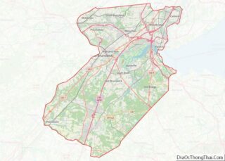
New Brunswick Road Map
New Brunswick city Satellite Map
Geography
According to the United States Census Bureau, the city had a total area of 5.75 square miles (14.9 km), including 5.23 square miles (13.5 km) of land and 0.52 square miles (1.3 km) of water (9.06%). New Brunswick is on the south side of Raritan Valley along with Piscataway, Highland Park, Edison, and Franklin Township. New Brunswick lies southwest of Newark and New York City and northeast of Trenton and Philadelphia.
New Brunswick is bordered by the municipalities of Piscataway, Highland Park and Edison across the Raritan River to the north by way of the Donald and Morris Goodkind Bridges, and also by North Brunswick to the southwest, East Brunswick to the southeast, all in Middlesex County; and by Franklin Township in Somerset County.
While the city does not hold elections based on a ward system it has been so divided. There are several neighborhoods in the city, which include the Fifth Ward, Feaster Park, Lincoln Park, Raritan Gardens, and Edgebrook-Westons Mills.
Climate
Under the Köppen climate classification, New Brunswick falls within either a hot-summer humid continental climate (Dfa) if the 0 °C (32 °F) isotherm is used or a humid subtropical climate (Cfa) if the −3 °C (27 °F) isotherm is used. New Brunswick has humid, hot summers and moderately cold winters with moderate to considerable rainfall throughout the year. There is no marked wet or dry season.
See also
Map of New Jersey State and its subdivision: Map of other states:- Alabama
- Alaska
- Arizona
- Arkansas
- California
- Colorado
- Connecticut
- Delaware
- District of Columbia
- Florida
- Georgia
- Hawaii
- Idaho
- Illinois
- Indiana
- Iowa
- Kansas
- Kentucky
- Louisiana
- Maine
- Maryland
- Massachusetts
- Michigan
- Minnesota
- Mississippi
- Missouri
- Montana
- Nebraska
- Nevada
- New Hampshire
- New Jersey
- New Mexico
- New York
- North Carolina
- North Dakota
- Ohio
- Oklahoma
- Oregon
- Pennsylvania
- Rhode Island
- South Carolina
- South Dakota
- Tennessee
- Texas
- Utah
- Vermont
- Virginia
- Washington
- West Virginia
- Wisconsin
- Wyoming
