Ocean Acres is an unincorporated community and census-designated place (CDP) split between Barnegat Township and Stafford Township, in Ocean County, New Jersey, United States. As of the 2010 United States Census, the CDP’s population was 16,142, of which 925 were in Barnegat Township and 15,217 were in Stafford Township. Ocean Acres is located in the northwestern end of Stafford Township and part of Barnegat Township, and is the newest and biggest part of both communities, with approximately 5,500 lots in an area of 6 square miles (16 km).
| Name: | Ocean Acres CDP |
|---|---|
| LSAD Code: | 57 |
| LSAD Description: | CDP (suffix) |
| State: | New Jersey |
| County: | Ocean County |
| Elevation: | 121 ft (37 m) |
| Total Area: | 5.96 sq mi (15.44 km²) |
| Land Area: | 5.83 sq mi (15.09 km²) |
| Water Area: | 0.14 sq mi (0.35 km²) 1.81% |
| Total Population: | 18,185 |
| Population Density: | 3,121.35/sq mi (1,205.09/km²) |
| FIPS code: | 3454315 |
| GNISfeature ID: | 02389608 |
Online Interactive Map
Click on ![]() to view map in "full screen" mode.
to view map in "full screen" mode.
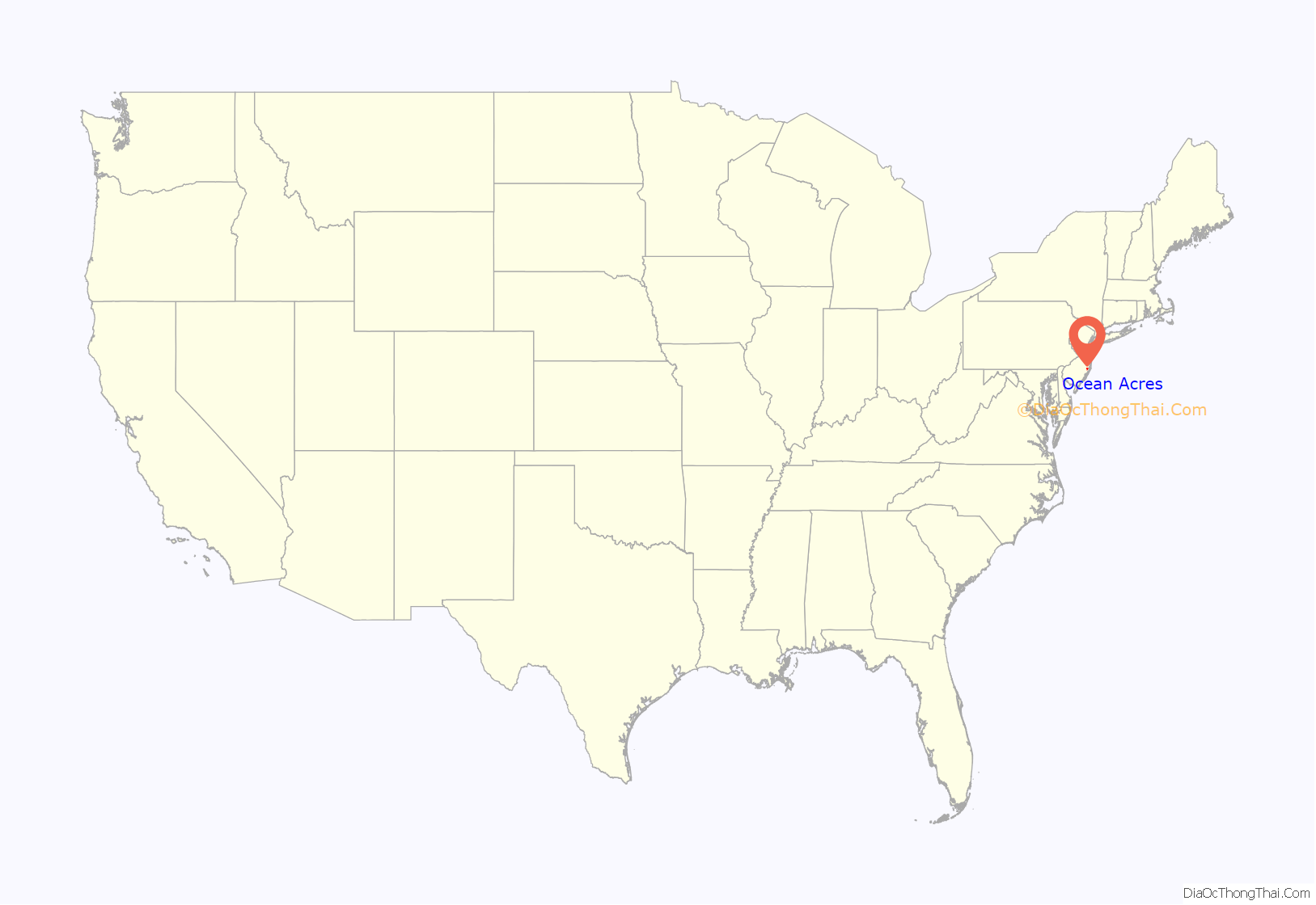
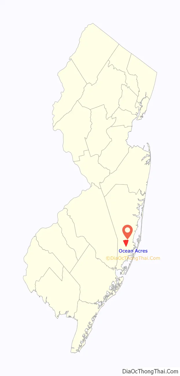
Ocean Acres location map. Where is Ocean Acres CDP?
History
Ocean Acres was started in the early 1960s, on a large tract west of the Garden State Parkway sprawling between Stafford Township and Barnegat Townships. Potential buyers were bused to the site and in its first year, 2,000 lots were sold. The original Ocean Acres development offered three home designs, two ranch styles and a bi-level design. The original models were located on New Jersey Route 72, west of the present site of the Southern Ocean Medical Center, all three are currently used as businesses.
Throughout the 1970s and 1980s, growth on the community was slow. Only a handful of the streets were paved, and most homes were used as summer homes. The community offered several recreation centers, such as a lakefront park near the Nautilus Drive entrance (it was eventually leveled to make way for an expanded lake), a second lakefront park with tennis and basketball courts off of Forecastle and Canal Drive which doesn’t exist anymore, a bathing beach and pool, and an 18-hole golf course. The pool has since been removed, but the bathing beach is still open to swimmers after being closed for several years throughout the 1990s. While many original recreational centers original to Ocean Acres, many new parks and recreation centers owned by Stafford Township were built since the 1990s.
For years, a state-mandated moratorium on construction west of the Garden State Parkway had limited the 5,500-lot community to fewer than 800 homes. In the 1990s, when the moratorium was lifted and sewer lines were installed; development skyrocketed. Several area developers built nearly thousands of homes in the 1990s. Large areas of vacant land in Ocean Acres were even set aside for other individual subdivisions, such as The Oaks at Stafford development. The Ocean Acres Elementary School opened to grades K-2 in 1999.
Development in the Barnegat side of the development was restricted for years due to environmental concerns, development was jump-started in the 2000s starting with the completion of Nautilus Boulevard, which was formerly a “missing link”. The Walters Group became the first developer to build in the Barnegat section, an early sales promotion for the Ocean Acres Barnegat homes included a free Toyota Yaris hatchback to be included with the homes.
In 2010, the Garden State Parkway exit 67 in Barnegat was redesigned to redirect the southbound exit ramp onto the Lighthouse Drive entrance to Ocean Acres. The opening of the exit and redesign of the interchange fueled growth of the Barnegat section starting in the 2010s, with the opening of a CVS Pharmacy and Wawa, as well as a major shopping center under construction at the intersection.
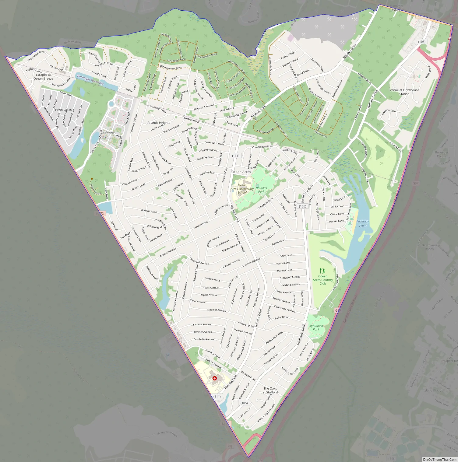
Ocean Acres Road Map
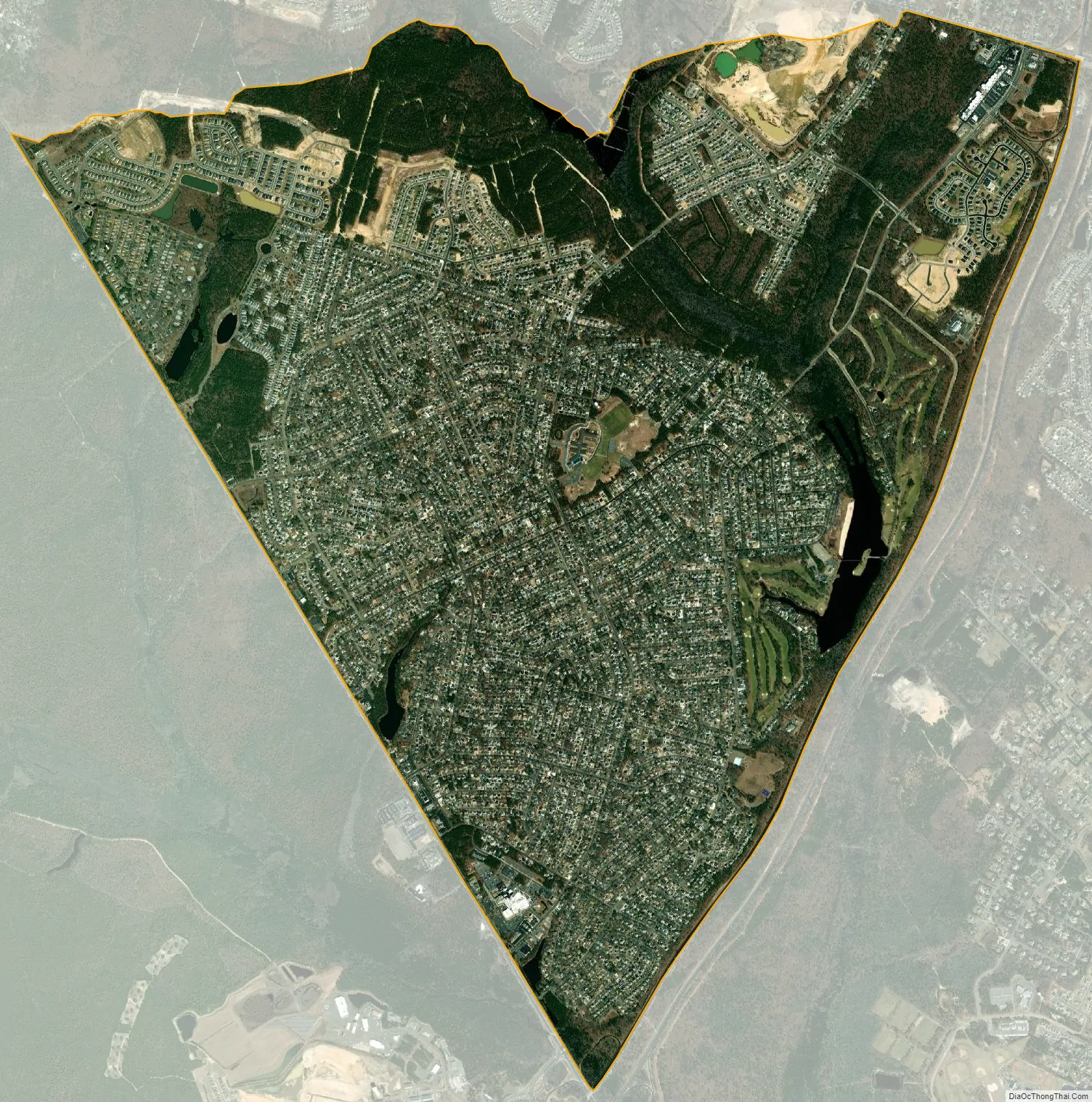
Ocean Acres city Satellite Map
Geography
According to the United States Census Bureau, the CDP had a total area of 5.956 square miles (15.427 km), including 5.848 square miles (15.147 km) of land and 0.108 square miles (0.280 km) of water (1.81%).
See also
Map of New Jersey State and its subdivision: Map of other states:- Alabama
- Alaska
- Arizona
- Arkansas
- California
- Colorado
- Connecticut
- Delaware
- District of Columbia
- Florida
- Georgia
- Hawaii
- Idaho
- Illinois
- Indiana
- Iowa
- Kansas
- Kentucky
- Louisiana
- Maine
- Maryland
- Massachusetts
- Michigan
- Minnesota
- Mississippi
- Missouri
- Montana
- Nebraska
- Nevada
- New Hampshire
- New Jersey
- New Mexico
- New York
- North Carolina
- North Dakota
- Ohio
- Oklahoma
- Oregon
- Pennsylvania
- Rhode Island
- South Carolina
- South Dakota
- Tennessee
- Texas
- Utah
- Vermont
- Virginia
- Washington
- West Virginia
- Wisconsin
- Wyoming


