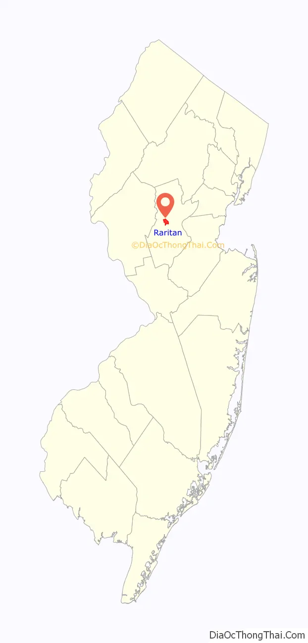
Raritan is a borough in Somerset County, in the U.S. state of New Jersey. As of the 2010 United States Census, the borough’s population was 6,881, reflecting an increase of 543 (+8.6%) from the 6,338 counted in the 2000 census.
The borough’s name is derived from the Raritans, a Native American group of Lenape. The name of the tribe is said to mean “forked river”, “stream overflows” or “point on a tidal river”.
| Name: | Raritan borough |
|---|---|
| LSAD Code: | 21 |
| LSAD Description: | borough (suffix) |
| State: | New Jersey |
| County: | Somerset County |
| Incorporated: | April 3, 1868 (as town) |
| Elevation: | 125 ft (38 m) |
| Total Area: | 2.03 sq mi (5.27 km²) |
| Land Area: | 1.99 sq mi (5.16 km²) |
| Water Area: | 0.04 sq mi (0.11 km²) 2.02% |
| Total Population: | 7,835 |
| Population Density: | 3,933.2/sq mi (1,518.6/km²) |
| Area code: | 908 |
| FIPS code: | 3461980 |
| GNISfeature ID: | 0885365 |
| Website: | www.raritanboro.org |
Online Interactive Map
Click on ![]() to view map in "full screen" mode.
to view map in "full screen" mode.
Raritan location map. Where is Raritan borough?

History
Raritan town was originally established as a subdivision within Bridgewater Township by act of the New Jersey Legislature on April 3, 1868. After a series of bitter lawsuits between Raritan and Bridgewater in the 1930s and 1940s, the Legislature allowed Raritan to become a fully independent borough by an Act on May 12, 1948, based on the results of a referendum passed on June 12, 1948. The new borough incorporated the old town and an additional portion of Bridgewater Township.
The Knox–Porter Resolution ending United States involvement in World War I was signed by President Harding at the estate of New Jersey Senator Joseph S. Frelinghuysen Sr. on July 2, 1921.
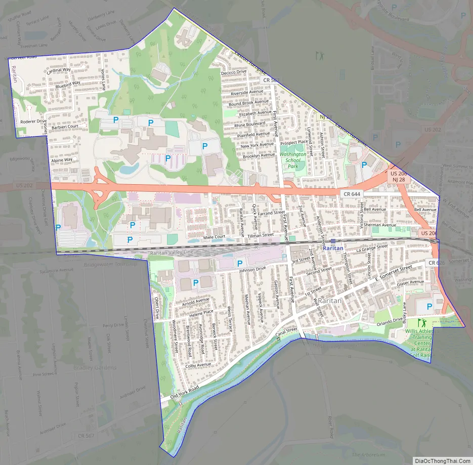
Raritan Road Map
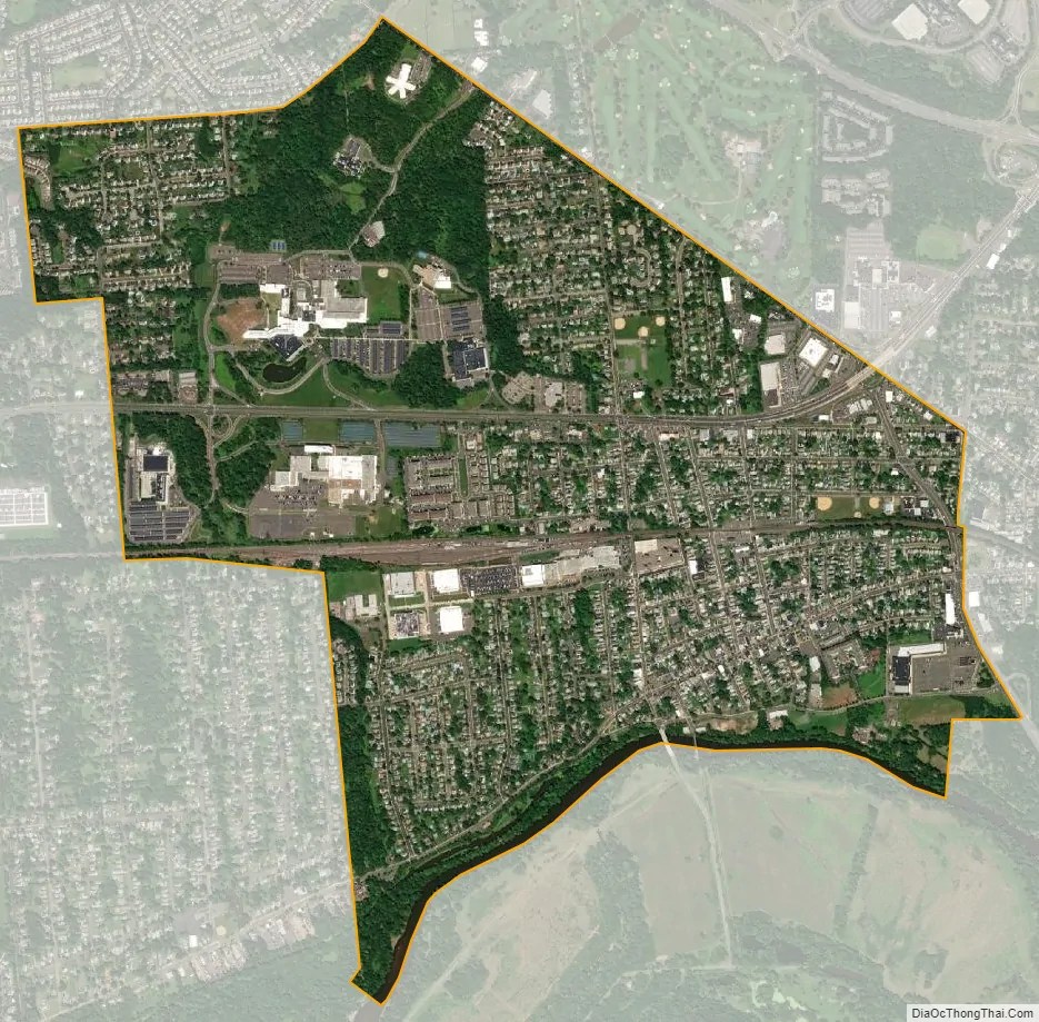
Raritan city Satellite Map
Geography
According to the United States Census Bureau, the borough had a total area of 2.03 square miles (5.27 km), including 1.99 square miles (5.16 km) of land and 0.04 square miles (0.11 km) of water (2.02%).
The borough borders the Somerset County municipalities of Bridgewater Township, Hillsborough Township and Somerville.
Raritan is in the western division of the Raritan Valley (a line of cities in central New Jersey), along with Branchburg and Bridgewater.
See also
Map of New Jersey State and its subdivision: Map of other states:- Alabama
- Alaska
- Arizona
- Arkansas
- California
- Colorado
- Connecticut
- Delaware
- District of Columbia
- Florida
- Georgia
- Hawaii
- Idaho
- Illinois
- Indiana
- Iowa
- Kansas
- Kentucky
- Louisiana
- Maine
- Maryland
- Massachusetts
- Michigan
- Minnesota
- Mississippi
- Missouri
- Montana
- Nebraska
- Nevada
- New Hampshire
- New Jersey
- New Mexico
- New York
- North Carolina
- North Dakota
- Ohio
- Oklahoma
- Oregon
- Pennsylvania
- Rhode Island
- South Carolina
- South Dakota
- Tennessee
- Texas
- Utah
- Vermont
- Virginia
- Washington
- West Virginia
- Wisconsin
- Wyoming


