Somerville is a borough and the county seat of Somerset County, in the U.S. state of New Jersey. The borough is located in the heart of the Raritan Valley region within the New York Metropolitan Area, located about 33 miles (53 km) from Manhattan and 20 miles (32 km) from Staten Island. The borough has grown to become a commercial hub for central New Jersey and commuter town of New York City.
As of the 2020 United States census, the borough’s population was 12,346, an increase of 248 (+2.0%) from the 2010 census count of 12,098, which in turn reflected a decline of 325 (-2.6%) from the 12,423 counted in the 2000 census.
Somerville was originally formed as a town on March 25, 1863, within a portion of Bridgewater Township. Somerville was incorporated as a borough by an act of the New Jersey Legislature on April 16, 1909, based on the results of a referendum held on May 4, 1909, at which point it was fully set off from Bridgewater Township. It is home of the oldest competitive bicycle race in the United States.
The borough is named for Somerset in England.
| Name: | Somerville borough |
|---|---|
| LSAD Code: | 21 |
| LSAD Description: | borough (suffix) |
| State: | New Jersey |
| County: | Somerset County |
| Incorporated: | March 25, 1863 (as town) |
| Elevation: | 62 ft (19 m) |
| Total Area: | 2.37 sq mi (6.13 km²) |
| Land Area: | 2.34 sq mi (6.05 km²) |
| Water Area: | 0.03 sq mi (0.07 km²) 1.18% |
| Total Population: | 12,346 |
| Population Density: | 5,280.6/sq mi (2,038.9/km²) |
| Area code: | 908 |
| FIPS code: | 3468460 |
| GNISfeature ID: | 0885398 |
| Website: | www.somervillenj.org |
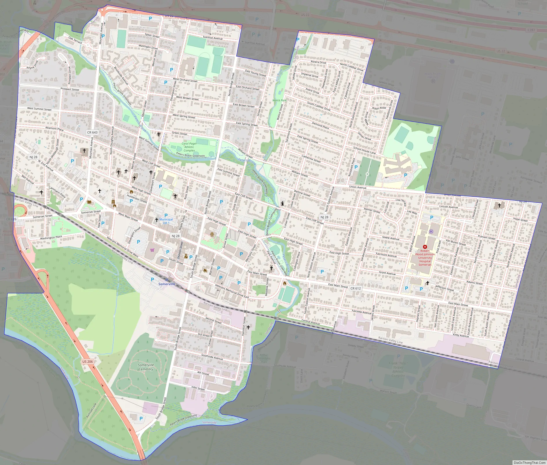
Online Interactive Map
Click on ![]() to view map in "full screen" mode.
to view map in "full screen" mode.
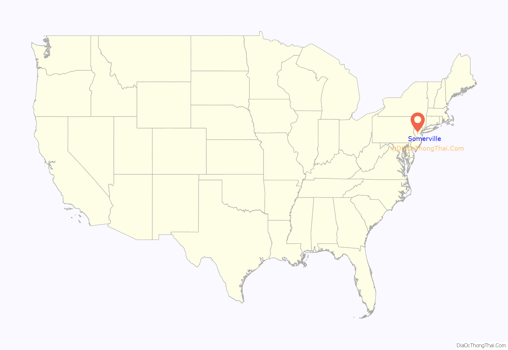
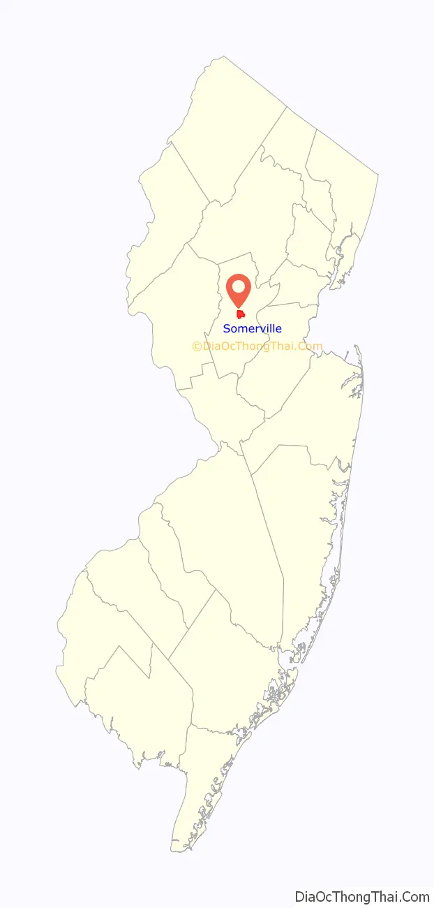
Somerville location map. Where is Somerville borough?
History
Early development
Somerville was settled in colonial times primarily by the Dutch who purchased land from the English proprietors of the colony. The Dutch established their church near what is today Somerville and a Dutch Reformed minister or Domine lived at the Old Dutch Parsonage from about 1754. The early village grew up around a church, courthouse and a tavern built at a crossroads shortly after the American Revolution. The name “Somerville” was taken from four brothers of the Somerville family, Edward, John and James from Drishane and Castlehaven, County Cork, Ireland, who first founded the town in the 1750s. Somerville was originally a sparsely populated farming community, but rapidly grew after the completion of the railroad in the 1840s and development of water power along the Raritan River in the 1850s. Early industry included brick making from the plentiful red clay and shale on which Somerville is built. While much of the borough features distinctive Victorian architecture in several neighborhoods and along its Main Street, other periods are represented. National Register sites in Somerville include the white marble 1909 Somerville Court House and the wooden and stone colonial Wallace House (today a museum) where George Washington spent a winter during the American Revolutionary War. Near the Wallace House is the Old Dutch Parsonage, where Reverend Jacob Rutsen Hardenbergh, a founder and first president of Rutgers University, then called Queens College, lived. Register listed Victorian structures include the James Harper Smith Estate (privately owned), St. John’s Episcopal Church and rectory, and the Fire Museum (a vintage fire house). Other notable, register eligible structures are the Victorian train station (privately owned) and the municipal building, the former Robert Mansion.
Originally the center of local commerce, the borough has evolved into a destination for boutique retail and dining. Modern highways today surround and traverse Somerville, including U.S. Route 22, U.S. Route 202, U.S. Route 206 and Route 28 and is within 5 miles (8.0 km) of Interstate 287 and Interstate 78, making it an important hub in central New Jersey.
Tour of Somerville
In 1940, the first competitive bicycle race, called the Tour of Somerville was established by bicycle shop owner, Fred Kugler, to showcase his son, Furman, who was a national cycling champion, and who won the initial men’s competition. His daughter, Mildred won the women’s. The 50-mile race is held annually and has since become the oldest competitive bicycle race in the U.S. It carries a purse of $10,000 for each winner of the women’s and men’s races.
Downtown today
Main Street Somerville maintains most of its historical buildings, although many are now boutique specialty shops and second-hand shops. Somerville has quite a diverse and large selection of restaurants that draw people from the surrounding area. In many ways, Somerville remains Somerset County’s downtown, and is the heart of its designated Regional Center. Several of the factories in Somerville were abandoned and replaced with modern office buildings or remodeled as apartments. Somerville today and historically has had an important African American community, a distinguished member of which was Paul Robeson. Another famous Somerville native was famed character actor Lee Van Cleef. One of the founders of modern American Dance, Ruth St. Denis, made her professional debut at Somerset Hall, once a vaudeville theatre and today a local restaurant. The mix of modern amenities and an interesting and diverse past make Main Street, Somerville a unique destination for dining, strolling and visiting.
Future redevelopment
The shopping center on the west side of the downtown area was demolished and a new shopping center, town homes and other amenities will be built on the shopping center land and on adjacent land in the former borough landfill to the south. Ground was broken for a new “world class” ShopRite supermarket in March 2011 and opened in November 2011. Borough planners envision a transit village style redevelopment centered around the Somerville train station.
Hurricane Floyd
Somerville was hit hard by Hurricane Floyd in September 1999, despite its having been downgraded to a tropical storm by the time it impacted the vicinity. The borough received a record 13.34 inches (339 mm) of rain over three days during the slow moving storm, causing significant flooding and considerable damage.
Regulation concerns
Numerous local and national media publications reported on how the state of New Jersey had eased regulations allowing for home baked goods to be made and sold from a home, but how Somerville in particular still suffers from, “…[a] draconian ordinance that creates a contradiction between Somerville’s zoning policies and New Jersey’s home baking law…” making it difficult for a small business owner or entrepreneur to try and earn a living in this fashion in Somerville. In order to be able to make her cookies and sell them from her home kitchen was required “… to pay a $1,000 application fee and put $4,000 into a borough escrow account”, in addition to notifying neighbors, placing a public notice advertisement and having a public hearing on the application.
Somerville Road Map
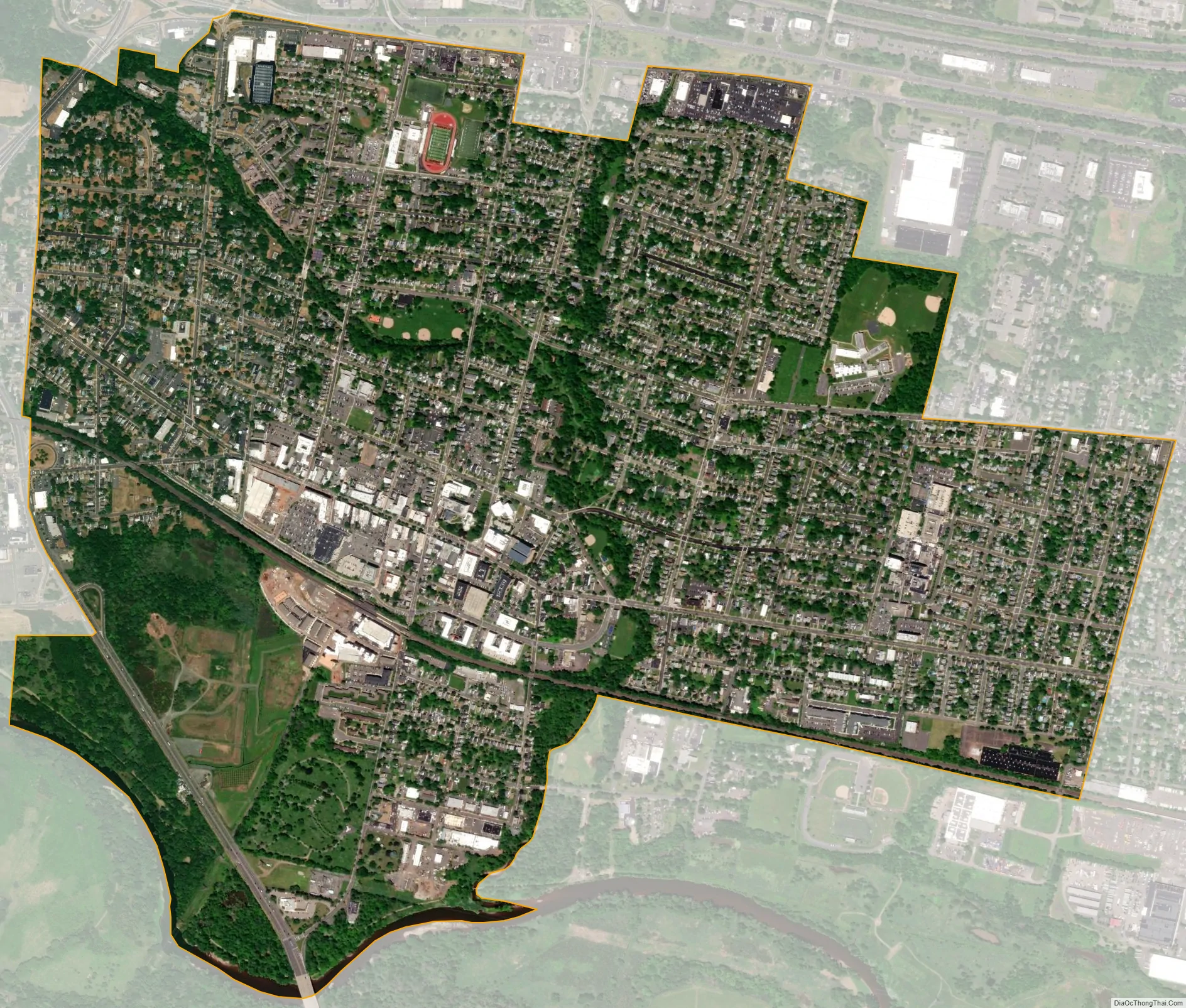
Somerville city Satellite Map
Geography
According to the United States Census Bureau, the borough had a total area of 2.37 square miles (6.13 km), including 2.34 square miles (6.06 km) of land and 0.03 square miles (0.07 km) of water (1.18%). The borough’s territory is flat land. Somerville borders the Raritan River to the south and is crossed by Peters Brook, a tributary.
The borough borders Bridgewater Township, Hillsborough Township and Raritan.
Climate
Somerville’s climate is warm during summer when temperatures tend to be in the 80s, and 90s and cold during winter when temperatures tend to be in the 20s and 30s.
The warmest month of the year is July with an average maximum temperature of 84.40 degrees Fahrenheit, while the coldest month of the year is January with an average minimum temperature of 19.10 degrees Fahrenheit.
Temperature variations between night and day tend to be moderate during summer with a difference that can reach 22 degrees Fahrenheit, and fairly limited during winter with an average difference of 19 degrees Fahrenheit.
The annual average precipitation at Somerville is 45.93 inches (1,167 mm). Rainfall in is fairly evenly distributed throughout the year. The wettest month of the year is July with an average rainfall of 4.81 inches (122 mm).
See also
Map of New Jersey State and its subdivision: Map of other states:- Alabama
- Alaska
- Arizona
- Arkansas
- California
- Colorado
- Connecticut
- Delaware
- District of Columbia
- Florida
- Georgia
- Hawaii
- Idaho
- Illinois
- Indiana
- Iowa
- Kansas
- Kentucky
- Louisiana
- Maine
- Maryland
- Massachusetts
- Michigan
- Minnesota
- Mississippi
- Missouri
- Montana
- Nebraska
- Nevada
- New Hampshire
- New Jersey
- New Mexico
- New York
- North Carolina
- North Dakota
- Ohio
- Oklahoma
- Oregon
- Pennsylvania
- Rhode Island
- South Carolina
- South Dakota
- Tennessee
- Texas
- Utah
- Vermont
- Virginia
- Washington
- West Virginia
- Wisconsin
- Wyoming


