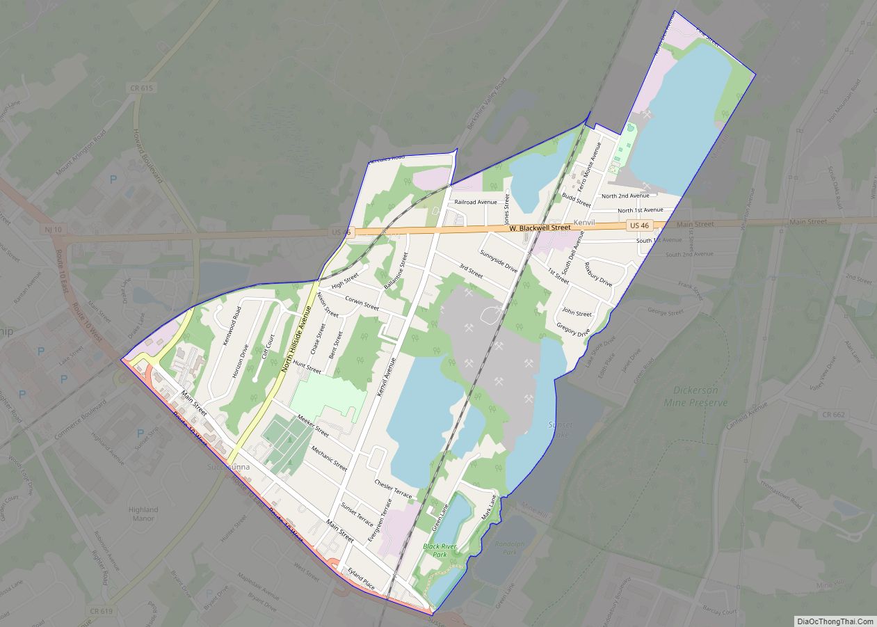
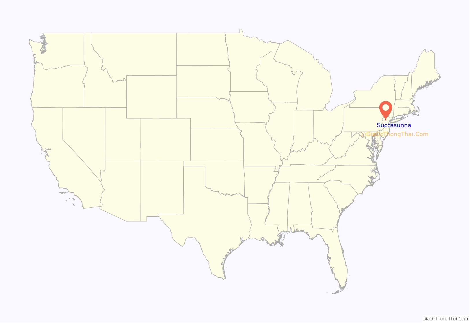
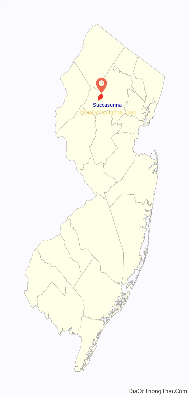
Succasunna is an unincorporated community and census-designated place (CDP) located within Roxbury Township, in Morris County, in the U.S. state of New Jersey, serving as its downtown and population center, having a population of 9,152 people as of the 2010 United States Census.
| Name: | Succasunna CDP |
|---|---|
| LSAD Code: | 57 |
| LSAD Description: | CDP (suffix) |
| State: | New Jersey |
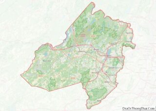
| County: | Morris County |
| Elevation: | 751 ft (229 m) |
| Total Area: | 6.04 sq mi (15.64 km²) |
| Land Area: | 5.87 sq mi (15.20 km²) |
| Water Area: | 0.17 sq mi (0.43 km²) 1.14% |
| Total Population: | 10,338 |
| Population Density: | 1,761.46/sq mi (680.05/km²) |
| FIPS code: | 3471370 |
| GNISfeature ID: | 02584032 |
Online Interactive Map
Click on ![]() to view map in "full screen" mode.
to view map in "full screen" mode.
Succasunna location map. Where is Succasunna CDP?
History
The name of Succasunna comes from the Lenni-Lenape Native American word for “land of black stones”, most likely due to the rich iron-ore deposits in the area. The community was established circa 1740.
The Morris Canal was an important transportation link in the iron industry around Succasunna, carrying coal to iron-ore producing areas all over northern New Jersey. The canal was abandoned in 1924 and largely dismantled.
Succasunna was the site of the world’s first electronic switching public telephone exchange. The Western Electric model 1ESS system was cut over for service on the New Jersey Bell 584 central office on May 30, 1965. A commemorative plaque on the wall of the central office building notes this historic event. Instead of electro-mechanical relays, the 1ESS was the first commercial computerized electronic switching system. This innovation allowed for features of modern telephone service, like call forwarding, call waiting, and three-way calling.
U.S. Route 46 and Route 10 pass through the area. The Morristown and Erie Railway runs rail freight service through the area 2-5 times per week on its High Bridge Branch.
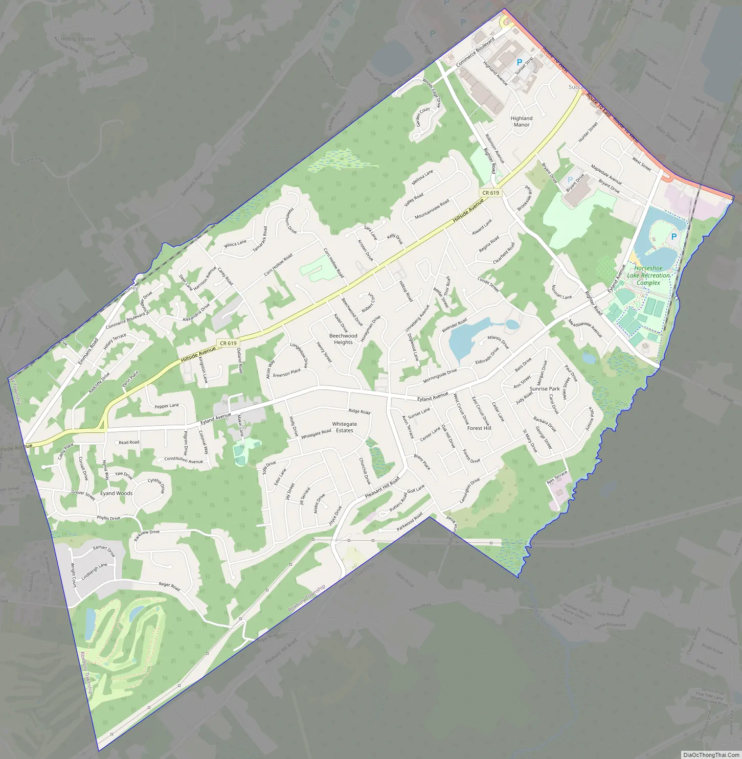
Succasunna Road Map
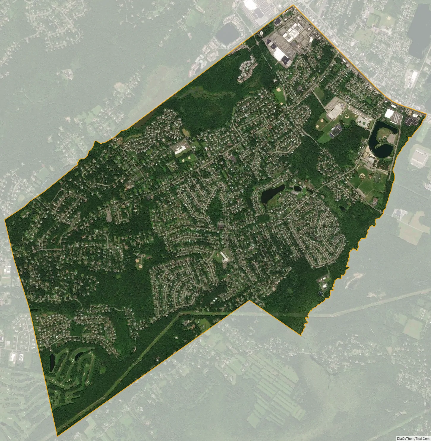
Succasunna city Satellite Map
Geography
According to the United States Census Bureau, the CDP had a total area of 5.187 square miles (13.435 km), including 5.128 square miles (13.282 km) of land and 0.059 square miles (0.153 km) of water (1.14%).
See also
Map of New Jersey State and its subdivision: Map of other states:- Alabama
- Alaska
- Arizona
- Arkansas
- California
- Colorado
- Connecticut
- Delaware
- District of Columbia
- Florida
- Georgia
- Hawaii
- Idaho
- Illinois
- Indiana
- Iowa
- Kansas
- Kentucky
- Louisiana
- Maine
- Maryland
- Massachusetts
- Michigan
- Minnesota
- Mississippi
- Missouri
- Montana
- Nebraska
- Nevada
- New Hampshire
- New Jersey
- New Mexico
- New York
- North Carolina
- North Dakota
- Ohio
- Oklahoma
- Oregon
- Pennsylvania
- Rhode Island
- South Carolina
- South Dakota
- Tennessee
- Texas
- Utah
- Vermont
- Virginia
- Washington
- West Virginia
- Wisconsin
- Wyoming