Woodbury Heights is a borough in Gloucester County, in the U.S. state of New Jersey. As of the 2020 United States census, the borough’s population was 3,098, an increase of 43 (+1.4%) from the 2010 census count of 3,055, which in turn reflected an increase of 67 (+2.2%) from the 2,988 counted in the 2000 census.
Woodbury Heights was formed as a borough by an act of the New Jersey Legislature on April 6, 1915, from portions of Deptford Township, based on the results of a referendum held on April 27, 1915. Portions were exchanged with Woodbury in 1925, and portions of the city were annexed on March 22, 1938. Portions were exchanged with Deptford Township in 1956 and other portions were annexed from the township in 1965. The borough was named for the city of Woodbury, which in turn was named for its founder Henry Wood, who settled in the area in 1683 after arriving from Bury, England, at the age of 80 to escape religious persecution.
As of 2020, the borough had the 19th-highest property tax rate in New Jersey with an equalized rate of 4.442% compared to 3.212% in the county as a whole and a statewide average of 2.279%.
| Name: | Woodbury Heights borough |
|---|---|
| LSAD Code: | 21 |
| LSAD Description: | borough (suffix) |
| State: | New Jersey |
| County: | Gloucester County |
| Incorporated: | April 27, 1915 |
| Elevation: | 46 ft (14 m) |
| Total Area: | 1.25 sq mi (3.24 km²) |
| Land Area: | 1.25 sq mi (3.23 km²) |
| Water Area: | 0.01 sq mi (0.02 km²) 0.48% |
| Total Population: | 3,098 |
| Population Density: | 2,486.0/sq mi (959.8/km²) |
| ZIP code: | 08097 |
| Area code: | 856 |
| FIPS code: | 3482180 |
| GNISfeature ID: | 0885448 |
| Website: | bwhnj.com |
Online Interactive Map
Click on ![]() to view map in "full screen" mode.
to view map in "full screen" mode.
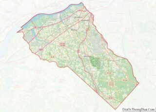
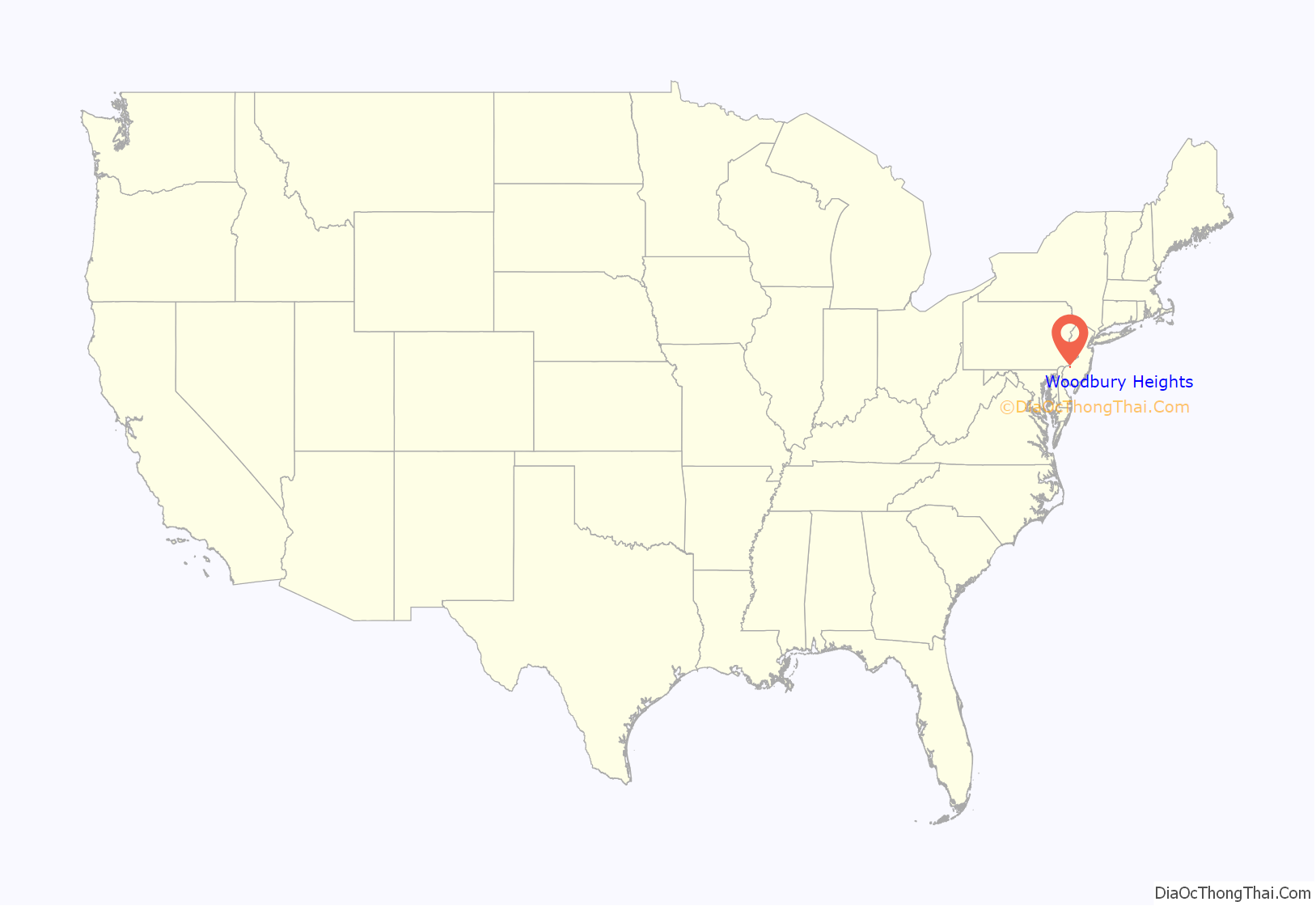
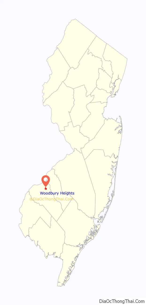
Woodbury Heights location map. Where is Woodbury Heights borough?
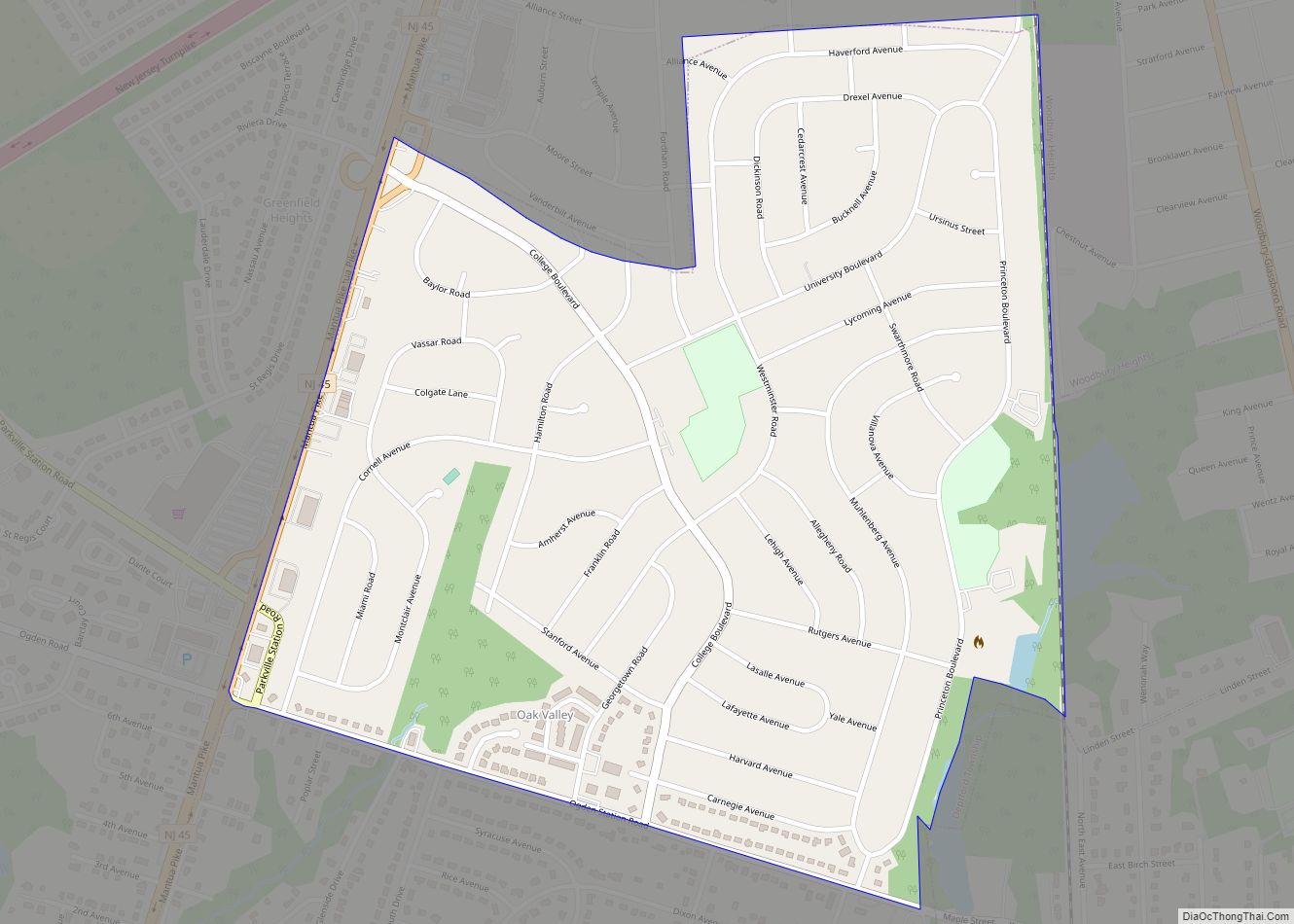
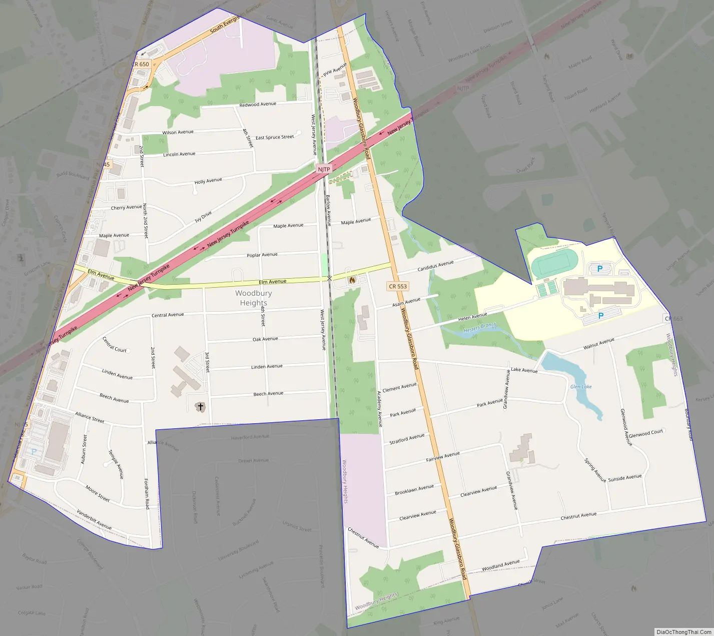
Woodbury Heights Road Map
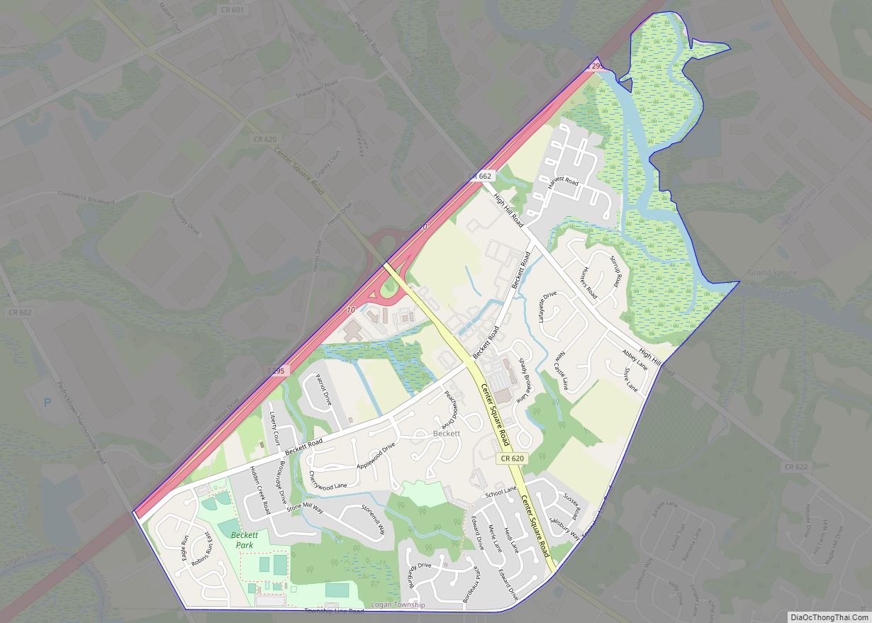
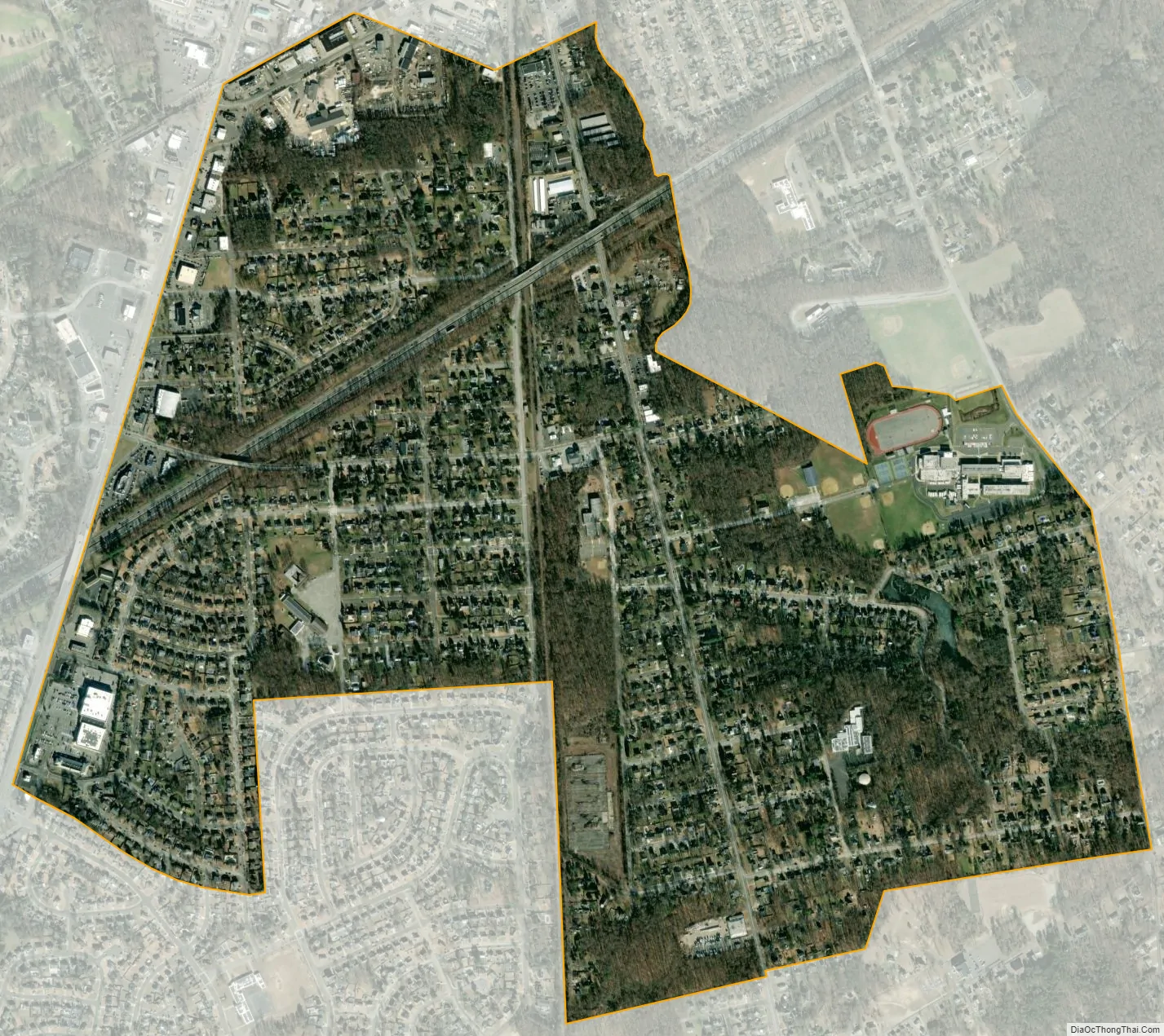
Woodbury Heights city Satellite Map
Geography
According to the U.S. Census Bureau, the borough had a total area of 1.25 square miles (3.24 km), including 1.25 square miles (3.23 km) of land and 0.01 square miles (0.02 km) of water (0.48%). Glen Lake, although no longer open for swimming, is available for fishing and non-motorized boating.
The borough borders the Gloucester County municipalities of Deptford Township, West Deptford Township, and Woodbury.
See also
Map of New Jersey State and its subdivision: Map of other states:- Alabama
- Alaska
- Arizona
- Arkansas
- California
- Colorado
- Connecticut
- Delaware
- District of Columbia
- Florida
- Georgia
- Hawaii
- Idaho
- Illinois
- Indiana
- Iowa
- Kansas
- Kentucky
- Louisiana
- Maine
- Maryland
- Massachusetts
- Michigan
- Minnesota
- Mississippi
- Missouri
- Montana
- Nebraska
- Nevada
- New Hampshire
- New Jersey
- New Mexico
- New York
- North Carolina
- North Dakota
- Ohio
- Oklahoma
- Oregon
- Pennsylvania
- Rhode Island
- South Carolina
- South Dakota
- Tennessee
- Texas
- Utah
- Vermont
- Virginia
- Washington
- West Virginia
- Wisconsin
- Wyoming