Las Cruces (/lɑːsˈkrusɪs/; Spanish: [las ‘kruses] “the crosses”) is the second-largest city in the U.S. state of New Mexico and the seat of Doña Ana County. As of the 2020 census the population was 111,385. Las Cruces is the largest city in both Doña Ana County and southern New Mexico. The Las Cruces metropolitan area had an estimated population of 213,849 in 2017. It is the principal city of a metropolitan statistical area which encompasses all of Doña Ana County and is part of the larger El Paso–Las Cruces combined statistical area.
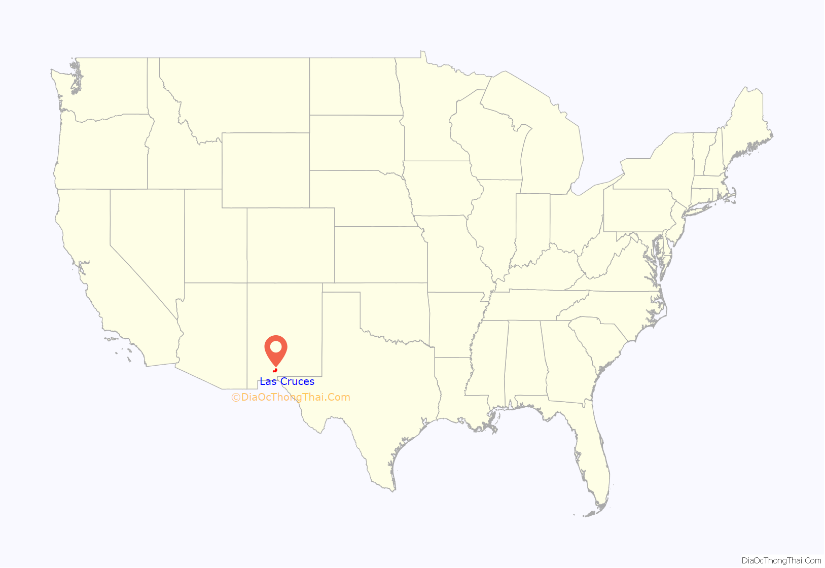
Las Cruces is the economic and geographic center of the Mesilla Valley, the agricultural region on the floodplain of the Rio Grande which extends from Hatch to the west side of El Paso, Texas. Las Cruces is the home of New Mexico State University (NMSU), New Mexico’s only land-grant university. The city’s major employer is the federal government on nearby White Sands Test Facility and White Sands Missile Range. The Organ Mountains, 10 miles (16 km) to the east, are dominant in the city’s landscape, along with the Doña Ana Mountains, Robledo Mountains, and Picacho Peak. Las Cruces lies 225 miles (362 km) south of Albuquerque, 42 miles (68 km) northwest of El Paso, Texas and 41 miles (66 km) north of the Mexican border at Sunland Park.
Spaceport America, which has corporate offices in Las Cruces, operates from 55 miles (89 km) to the north; it has completed several successful crewed, sub-orbital flights. The city is also the headquarters for Virgin Galactic, the world’s first company to offer sub-orbital spaceflights.
| Name: | Las Cruces city |
|---|---|
| LSAD Code: | 25 |
| LSAD Description: | city (suffix) |
| State: | New Mexico |
| County: | Doña Ana County |
| Founded: | 1849 |
| Incorporated: | 1907 |
| Elevation: | 3,900 ft (1,200 m) |
| Land Area: | 76.93 sq mi (199.26 km²) |
| Water Area: | 0.10 sq mi (0.25 km²) |
| Population Density: | 1,447.82/sq mi (559.00/km²) |
| Area code: | 575 |
| FIPS code: | 3539380 |
| GNISfeature ID: | 0899715 |
| Website: | www.las-cruces.org |
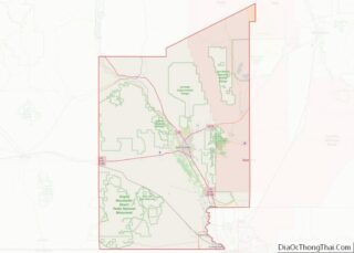
Online Interactive Map
Click on ![]() to view map in "full screen" mode.
to view map in "full screen" mode.
Las Cruces location map. Where is Las Cruces city?
History
During the Mexican–American War, the Battle of El Bracito was fought nearby on Christmas Day, 1846. The settlement of Las Cruces was founded in 1849 when the US Army first surveyed the town, thus opening up the area for American settlement. The town was first surveyed as the result of the American acquisition of the land surrounding Las Cruces, which later became the New Mexico Territory. This land had been ceded to the United States as a result of the Treaty of Guadalupe Hidalgo of 1848, which ended the Mexican-American War. The town was named “Las Cruces” after three crosses which were once located just north of the town.
Initially, Mesilla became the leading settlement of the area, with more than 2,000 residents in 1860, more than twice what Las Cruces had; at that time, Mesilla had a population primarily of Mexican descent. When the Atchison, Topeka, and Santa Fe Railway reached the area, the landowners of Mesilla refused to sell it the rights-of-way, and instead residents of Las Cruces donated the rights-of-way and land for a depot in Las Cruces. The first train reached Las Cruces in 1881. Las Cruces was not affected as strongly by the train as some other villages, as it was not a terminus or a crossroads, but the population did grow to 2,300 in the 1880s. Las Cruces was incorporated as a town in 1907.
Pat Garrett is best known for his involvement in the Lincoln County War, but he also worked in Las Cruces on a famous case, the disappearance of Albert Jennings Fountain in 1896.
New Mexico State University was founded in 1888, and it has grown as Las Cruces has grown. The growth of Las Cruces has been attributed to the university, government jobs, and recent retirees.
The establishment of White Sands Missile Range in 1944 and White Sands Test Facility in 1963 has been integral to population growth. Las Cruces is the nearest city to each, and they provide Las Cruces’ workforce with many high-paying, stable, government jobs. In recent years, the influx of retirees from out of state has also increased Las Cruces’ population.
In the 1960s Las Cruces undertook a large urban renewal project, intended to convert the old downtown into a modern city center. As part of this, St. Genevieve’s Catholic Church, built in 1859, was razed to make way for a downtown pedestrian mall. The original covered walkways have been removed in favor of a more traditional main street thoroughfare.
On February 10, 1990, seven people were shot, four fatally, in the Las Cruces bowling alley massacre. The incident remains unsolved.
Las Cruces Road Map
Las Cruces city Satellite Map
Geography
The approximate elevation of Las Cruces is 3,908 feet (1,191 m) above sea level.
According to the United States Census Bureau, the city has a total area of 76.6 square miles (198.5 km), of which 76.5 square miles (198.1 km) is land and 0.2 square miles (0.4 km), or 0.18%, is water.
Las Cruces is the center of the Organ Caldera; the Doña Ana Mountains to the north and the Organ Mountains to the east are its margins. Its major eruption was 32 Ma.
Doña Ana County lies within the Chihuahuan Desert ecoregion, and the vegetation surrounding the built portions of the city are typical of this setting; it includes creosote bush (Larrea tridentata), soaptree (Yucca elata), tarbush (Flourensia cernua), broom dalea (Psorothamnus scoparius), and various desert grasses such as tobosa (Hilaria mutica or Pleuraphis mutica) and black grama (Bouteloua eriopoda).
The Rio Grande bisects the Mesilla Valley and passes west of Las Cruces proper, supplying irrigation water for the intensive agriculture surrounding the city. However, since the institution of water rights, the Rio Grande fills its banks only when water is released from upstream dams, which before 2020 usually occurred at least from March to September. Drought conditions, exacerbated by climate change, mean that the Rio Grande experiences increasingly short or small flows.
Prior to farming and ranching, desert shrub vegetation extended into the valley from the adjacent deserts, including extensive stands of tornillo (Prosopis pubescens) and catclaw acacia (Acacia greggii). Desert grasslands extend in large part between the edges of Las Cruces and the lower slopes of the nearby Organ and Robledo Mountains, where grasses and assorted shrubs and cacti dominate large areas of this mostly rangeland as well as the occasional large-lot subdivision housing.
The desert and desert grassland uplands surrounding both sides of the Mesilla Valley are often dissected with arroyos, dry streams that often carry water following heavy thunderstorms. These arroyos often contain scattered small trees, and they serve as wildlife corridors between Las Cruces’ urban areas and adjacent deserts or mountains.
Cityscape
Unlike many cities its size, Las Cruces lacks a true central business district. This is because in the 1960s an urban-renewal project tore down a large part of the original downtown. Many chain stores and national restaurants are located in the rapidly developing east side. Las Cruces’ shopping mall and a variety of retail stores and restaurants are located in this area.
However, the historic downtown of the city is the area around Main Street, a six-block stretch of which was closed off in 1973 to form a pedestrianized shopping area. The downtown mall has an extensive farmers market each Wednesday and Saturday morning, where a variety of foods and cultural items can be purchased from numerous small stands that are set up by local farmers, artists and craftspeople. This area also contains museums, businesses, restaurants, churches, art galleries and theaters, which add a great deal to the changing character of Las Cruces’ historic downtown.
In August 2005, a master plan was adopted, the centerpiece of which was the restoration of narrow lanes of two-way traffic on this model portion of Main Street. Main Street was reopened to vehicular traffic in 2012.
In February 2013, Las Cruces Mayor Ken Miyagishima announced during his “State of the City” address that a 700-acre (280 ha) park in the area behind the Las Cruces Dam was under construction, in cooperation with the Army Corps of Engineers. The area features trails through restored wetlands and serves as a major refuge for migratory birds and a key recreational area for the city.
Climate
Las Cruces has a desert climate (Köppen BWk). Winters alternate between colder and windier weather following trough and frontal passages, and warmer, sunnier periods; light freezes occur 69 nights on average. Spring months can be windy, particularly in the afternoons, sometimes causing periods of blowing dust and short-lived dust storms. Summers begin with the hottest weather of the year, with some extended periods of over 100 °F or 37.8 °C temperatures not uncommon, while the latter half of the summer sees increased humidity and frequent afternoon thunderstorms, with slightly lower daytime temperatures. Autumns feature decreasing temperatures and decreasing precipitation.
Precipitation is very light from October to June, with only occasional winter storm systems bringing any precipitation to the Las Cruces area. Most winter moisture is in the form of rain, though some light snowfalls happen most winters, usually enough to accumulate and stay on the ground for a few hours. Summer precipitation is often from heavy thunderstorms, especially from the late summer monsoon weather pattern.
Since records began in 1892, the lowest temperature recorded at New Mexico State University has been −10 °F or −23.3 °C on January 11, 1962 – though only ten nights have ever fallen to or below 0 °F or −17.8 °C – and the highest 110 °F or 43.3 °C on June 28, 1994. The lowest maximum on record is 16 °F or −8.9 °C on January 28, 1948, and the highest minimum 80 °F or 26.7 °C on July 5, 1920. The wettest calendar year has been 1941 with 19.60 inches or 497.8 millimetres, although 1905 with 17.09 inches or 434.1 millimetres is the only other year to exceed 15 inches (380 mm). The only months to exceed 6 inches (150 mm) have been September 1941 with 7.53 inches or 191.3 millimetres and August 1935 with 7.41 inches or 188.2 millimetres. The wettest single day has been August 30, 1935 with 6.49 inches or 164.8 millimetres and the driest calendar year 1970 with 3.44 inches or 87.4 millimetres.
See also
Map of New Mexico State and its subdivision: Map of other states:- Alabama
- Alaska
- Arizona
- Arkansas
- California
- Colorado
- Connecticut
- Delaware
- District of Columbia
- Florida
- Georgia
- Hawaii
- Idaho
- Illinois
- Indiana
- Iowa
- Kansas
- Kentucky
- Louisiana
- Maine
- Maryland
- Massachusetts
- Michigan
- Minnesota
- Mississippi
- Missouri
- Montana
- Nebraska
- Nevada
- New Hampshire
- New Jersey
- New Mexico
- New York
- North Carolina
- North Dakota
- Ohio
- Oklahoma
- Oregon
- Pennsylvania
- Rhode Island
- South Carolina
- South Dakota
- Tennessee
- Texas
- Utah
- Vermont
- Virginia
- Washington
- West Virginia
- Wisconsin
- Wyoming
