Sunland Park is a city in southern Doña Ana County, New Mexico, United States, on the borders of Texas and the Mexican state of Chihuahua, with Ciudad Juárez adjoining it on the south and El Paso, Texas on the east. The community of Santa Teresa adjoins it on the northwest. The population of Sunland Park was 14,106 at the 2010 census and was estimated at 17,978 by the United States Census Bureau in 2019. Though it lies adjacent to El Paso, being in Doña Ana County makes it a part of the Las Cruces metropolitan statistical area. Las Cruces is 42 miles (68 km) to the north.
The city is at the foot of Mount Cristo Rey, next to the Rio Grande, and is named for Sunland Park Racetrack & Casino, which lies within the city limits. The location was formerly called “Anapra”, a name shared by an adjacent area of Ciudad Juárez.
| Name: | Sunland Park city |
|---|---|
| LSAD Code: | 25 |
| LSAD Description: | city (suffix) |
| State: | New Mexico |
| County: | Doña Ana County |
| Elevation: | 3,789 ft (1,155 m) |
| Total Area: | 15.01 sq mi (38.88 km²) |
| Land Area: | 14.74 sq mi (38.17 km²) |
| Water Area: | 0.27 sq mi (0.71 km²) |
| Total Population: | 16,702 |
| Population Density: | 1,133.26/sq mi (437.55/km²) |
| ZIP code: | 88063,88008 |
| Area code: | 575 |
| FIPS code: | 3575640 |
| GNISfeature ID: | 0920024 |
| Website: | www.sunlandpark-nm.gov |
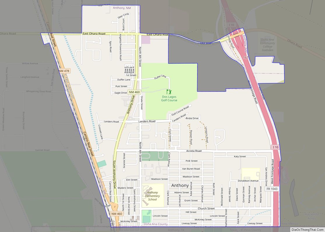
Online Interactive Map
Click on ![]() to view map in "full screen" mode.
to view map in "full screen" mode.
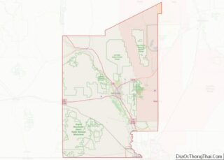
Sunland Park location map. Where is Sunland Park city?


History
Sunland Park was formed when the unincorporated communities of Anapra, Sunland Park, and Meadow Vista voted to incorporate as Sunland Park on July 13, 1983.
2012 extortion scandal
In February 2012, then-Mayor Pro Tem Daniel Salinas and City Manager Jaime Aguilera were arrested and charged with extortion of mayoral candidate Gerardo Hernandez. Salinas and Aguilera allegedly tried to blackmail Hernandez into withdrawing from the race with a videotape of Hernandez receiving a lap dance in his campaign office.
An election for mayor was held in March 2012, with Daniel Salinas winning the mayor’s office, but he was denied taking office due to extortion, bribery, and election fraud charges filed against him, which disqualified him from taking an oath of office.
Border barrier
A private organization, named We Build The Wall built a 1/2 mile wall on at the border of Sunland Park and Mexico in 2019. Privately financed using a GoFundMe campaign, the wall was built on private property but the gate they constructed blocked access needed to maintain a federal dam. The barrier also blocked access to Monument One, an official marker of the International Boundary and Water Commission that was set where New Mexico, Texas and the Mexican state of Chihuahua converge.
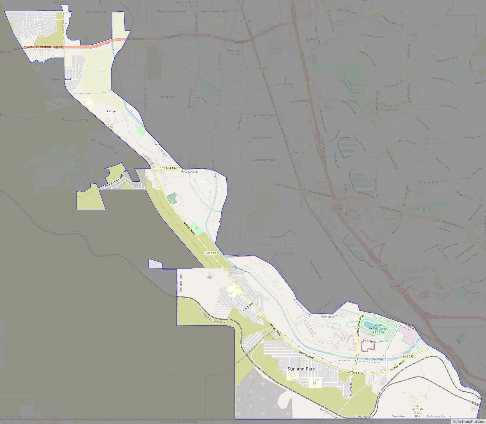
Sunland Park Road Map
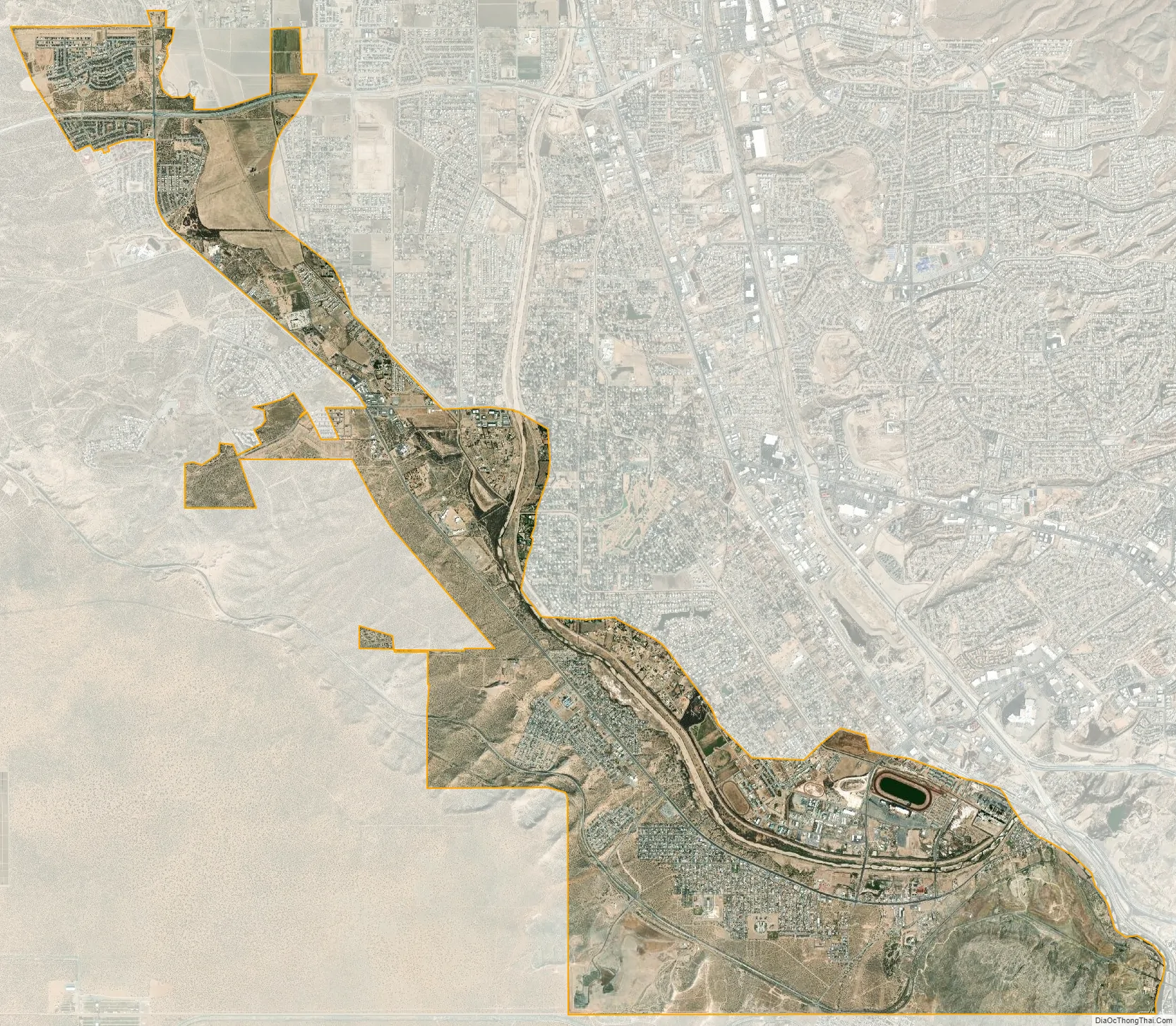
Sunland Park city Satellite Map
Geography
According to the United States Census Bureau, Sunland Park has a total area of 11.6 square miles (30.1 km), of which 11.4 square miles (29.5 km) is land and 0.2 square miles (0.6 km), or 2.02%, is covered by water.
See also
Map of New Mexico State and its subdivision: Map of other states:- Alabama
- Alaska
- Arizona
- Arkansas
- California
- Colorado
- Connecticut
- Delaware
- District of Columbia
- Florida
- Georgia
- Hawaii
- Idaho
- Illinois
- Indiana
- Iowa
- Kansas
- Kentucky
- Louisiana
- Maine
- Maryland
- Massachusetts
- Michigan
- Minnesota
- Mississippi
- Missouri
- Montana
- Nebraska
- Nevada
- New Hampshire
- New Jersey
- New Mexico
- New York
- North Carolina
- North Dakota
- Ohio
- Oklahoma
- Oregon
- Pennsylvania
- Rhode Island
- South Carolina
- South Dakota
- Tennessee
- Texas
- Utah
- Vermont
- Virginia
- Washington
- West Virginia
- Wisconsin
- Wyoming